

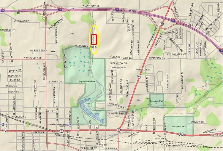
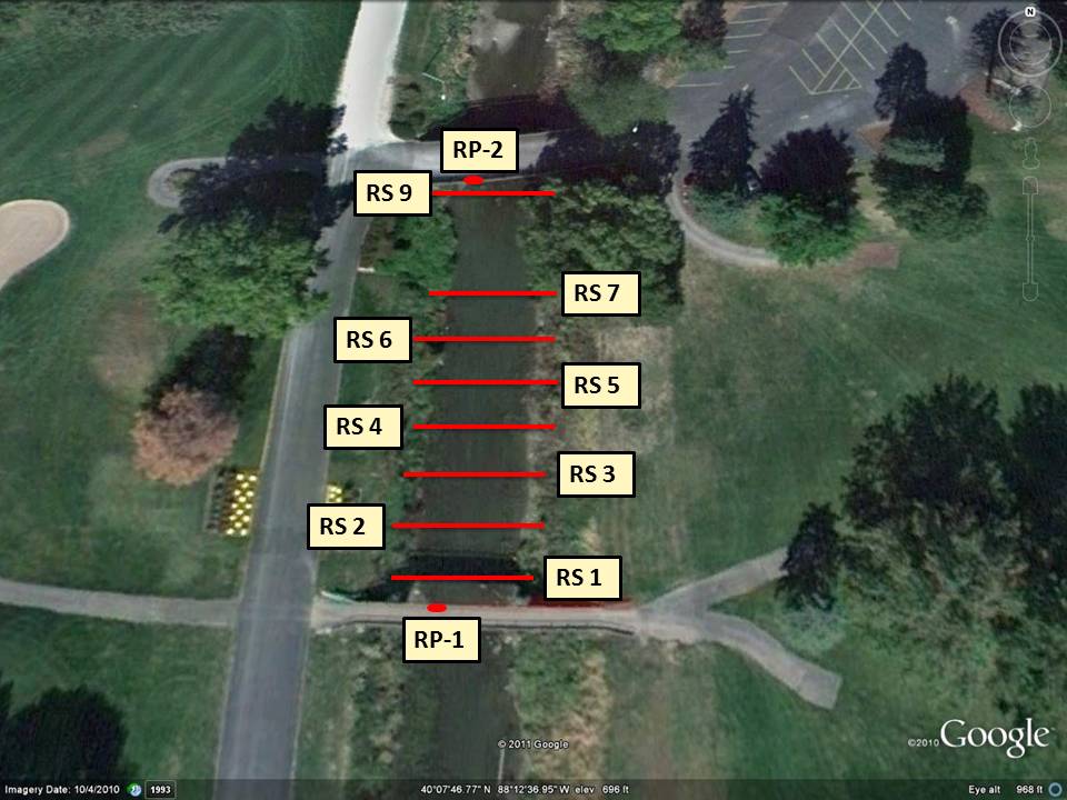

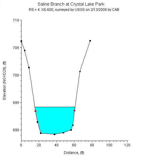
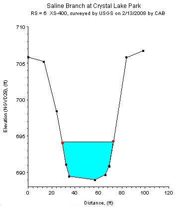
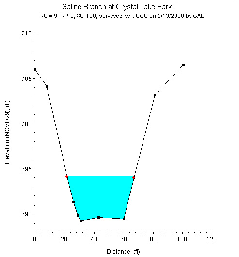
Study Reach.--The channel reach is straight, channelized, and located in a suburb setting, as shown in quadrangle map on the top left. The study reach is 171 ft long, running between a vehicle bridge upstream and a pedestrian bridge downstream on the property of the Urbana Country Club. The USGS surveyed eight cross sections in March, 2008, between the two bridges. The channel alignment, approximate variations of channel width and bank conditions, and location of the cross section are shown in the aerial photograph on the top right. Cross sectional geometry represented by four selected cross sections are shown in plots above.
Gage Location.-- Lat 40°07’46”, long 88°12’37”, in NE1/4SE1/4SW1/4 sec.05, T.19N., R.09E., Champaign County, Hydrologic Unit 05120109, located at mid-section of the study reach between two bridges at the entrance to Urbana Country Club; approximately 0.7 miles on East Country Club Rd. The USGS streamgage station number is 03336980.
Drainage Area.-- 59.05 sq mi.
Gage Datum and Elevations of Reference Points.-- Datum of the gage is 713.38 ft. NAVD88. Two reference points (RPs) were established in the spring of 2008. Tape-downs are made at the RPs. RP-1 is two file marks on an iron pipe support, located on the upstream side of the downstream bridge. Elevation of RP-1 is 704.50 ft. RP- 2 is two file marks on the iron I-beam, supporting the handrail, located on the downstream side of the upstream bridge. Elevation of RP-2 is 709.76 ft.
Stage, Discharge Measurements, and Computed n-Values.--Water-surface elevations were measured from the two reference points. Discharge measurements were made using both an Acoustic Doppler Velocimeter and an Acoustic Doppler Channel Profiler
| Date of Observation | Discharge (ft3/s) | Average Cross Section Area (ft2) | Hydraulic Radius (ft) | Mean Velocity (ft/s) | Slope (ft/ft) | Coefficient of Roughness n |
|---|---|---|---|---|---|---|
| 4/10/2008 | 53.8 | 59.6 | 1.57 | 0.91 | 0.001300 | 0.023 |
| 5/19/2008 | 82.1 | 70.7 | 1.82 | 1.17 | 0.000100 | 0.020 |
| 7/9/2008 | 627.0 | 188.7 | 3.95 | 3.32 | 0.000400 | 0.019 |
| 7/9/2008 | 629.0 | 189.9 | 3.96 | 3.31 | 0.000400 | 0.019 |
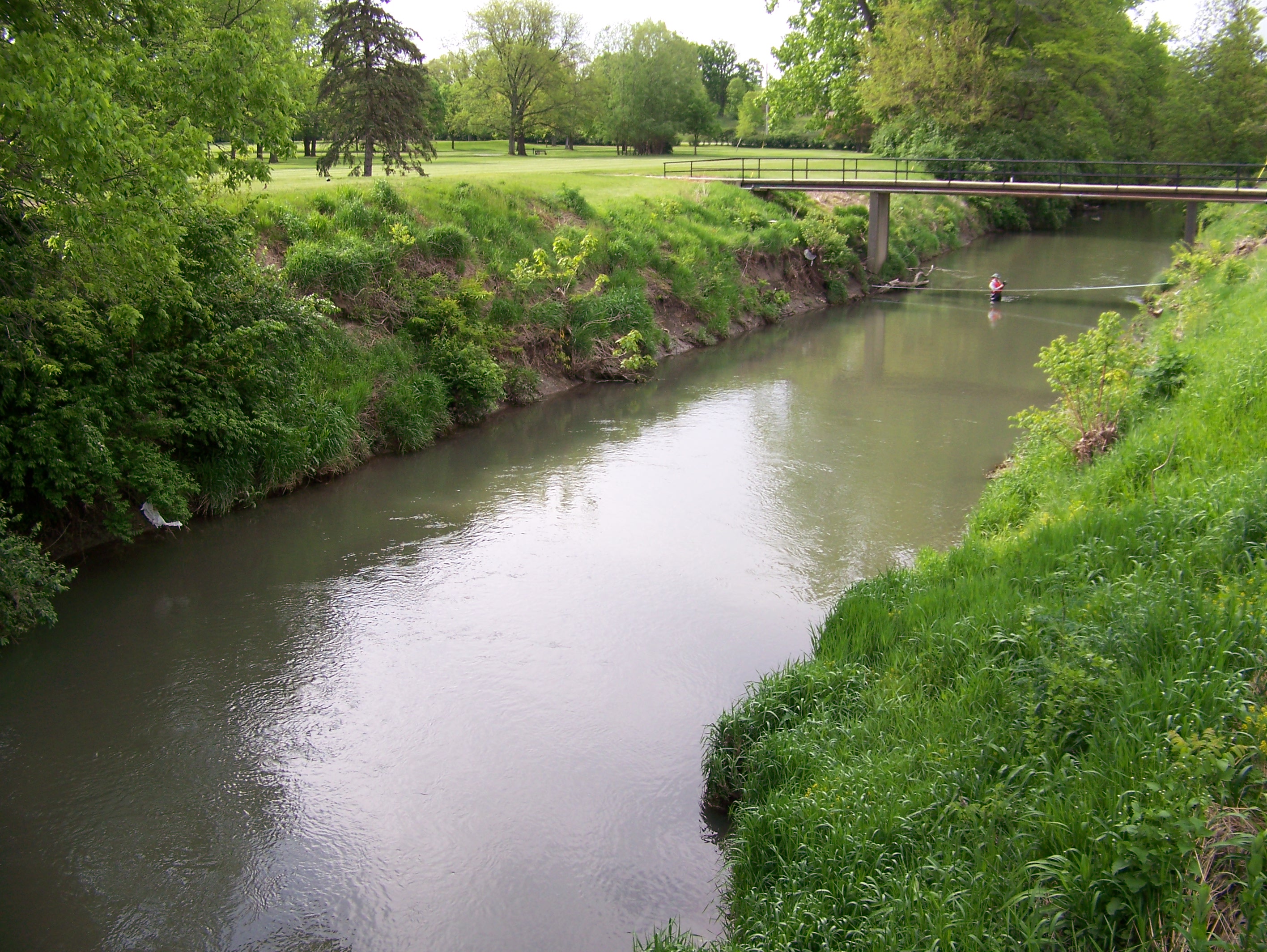

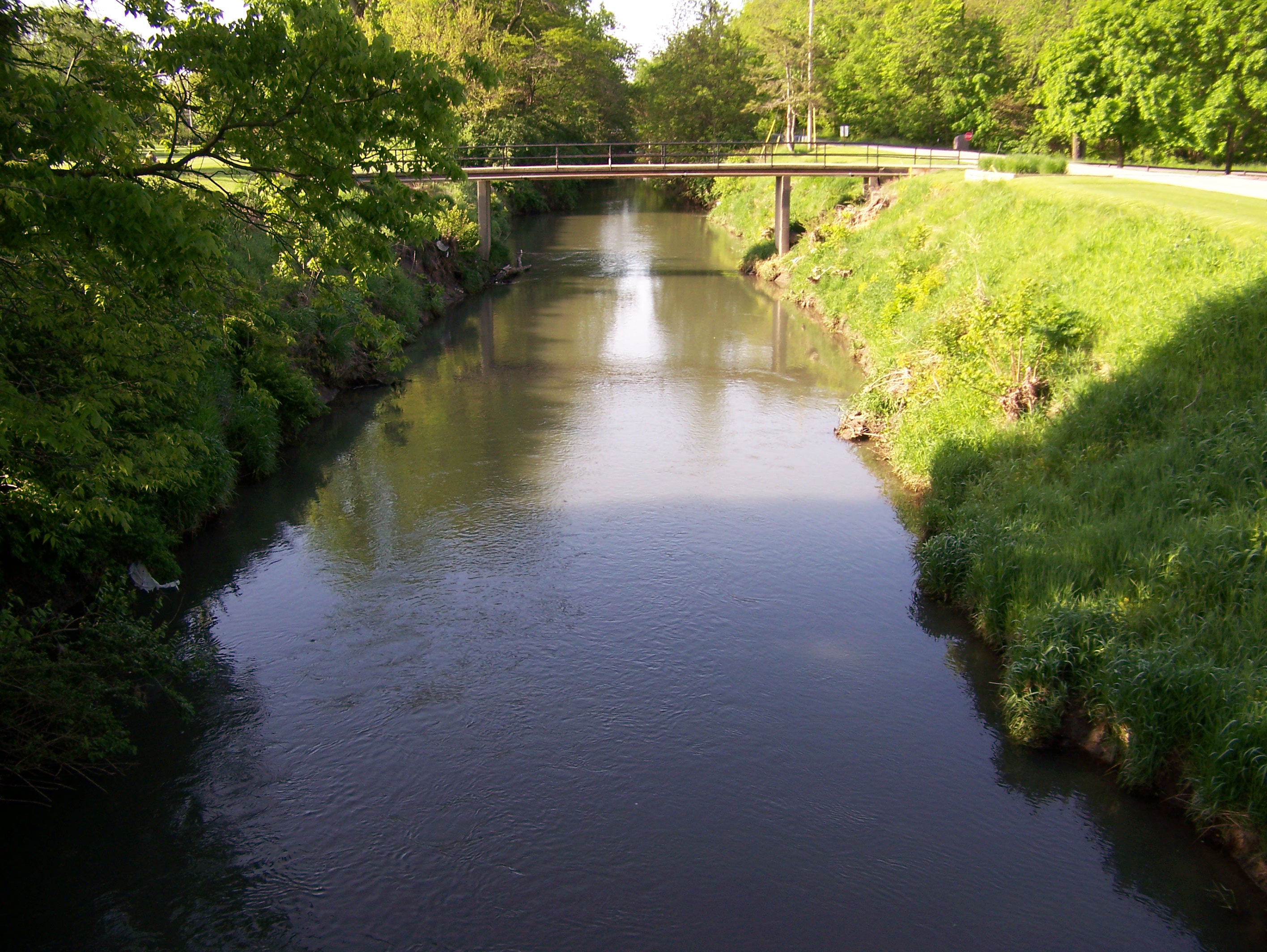
Description of Channel.--The channel is a straightened reach of a natural channel. The streambed consists of silt, sand and gravel mixtures and is subject to the growth of aquatic vegetation during the spring, summer and fall months. The width of the streambed is approximately 30 ft. Bank materials consist of bare earth below the normal depth line, with shrubs and turf grass above. The bank slope is fairly steep, approximately 35 ş to 40ş. Cross sectional geometry is trapezoidal in shape. Average top width of the cross sections is approximately 70 ft.
Floods.--The maximum discharge measured during the study was 629 ft3/s, on July 9, 2008. The maximum water surface elevation at the downstream bridge tape-down point was 694.23 feet, and at the upstream bridge tape-down point it was 694.31 feet.

![]() U.S. Department of the Interior |
U.S. Geological Survey
U.S. Department of the Interior |
U.S. Geological Survey
URL: http://il.water.usgs.gov/proj/nvalues/db/sites/03336980.shtml[an error occurred while processing this directive]?
Page Contact Information: David Soong
Page Last Modified: February 4, 2013
