

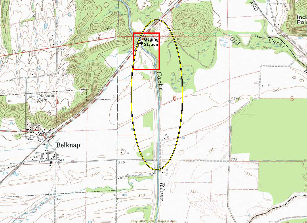
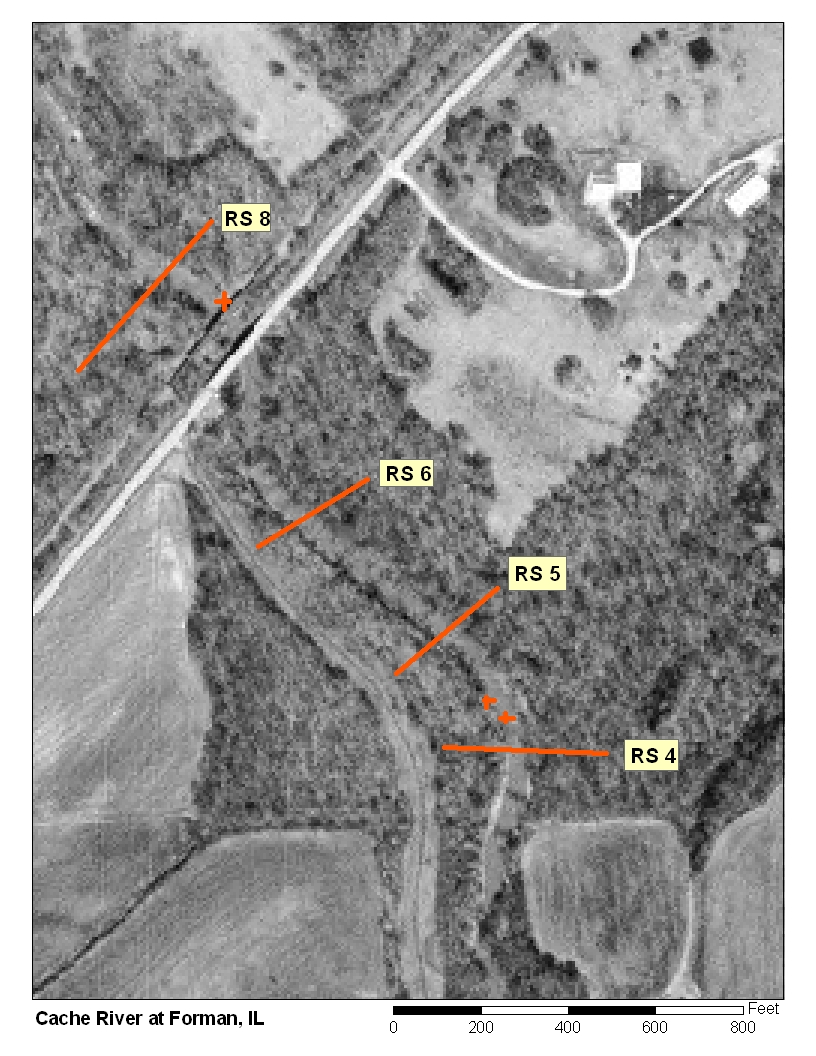
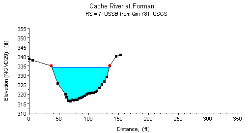
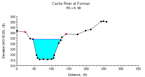
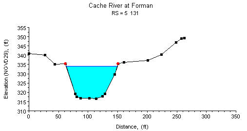
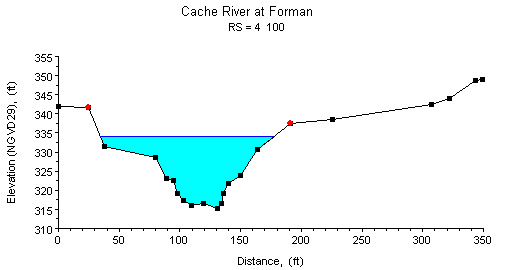
Study Reach.--The channel reach is a straightened, dredged ditch located at the downstream side of an abandoned railroad bridge and extending to the County Road 200N bridge, as shown in the quadrangle map on the top left. The study reach, 1300 ft long, extends from a point 300 ft upstream from the Belknap Road bridge to 1000 ft downstream. The study reach represents a transition from a natural meandering reach to a straightened, dredged reach. Four surveyed cross sections (surveyed by the Illinois Department of Natural Resources, in May 2003) are available for describing channel geometries in the study reach (see plots above). The channel alignment, approximate variations in channel width and bank conditions, and locations of cross sections are shown in the aerial photograph on the top right.
Gage Location.--Lat 37°20'11", long 88°55'26" in NE1/4 NW1/4 sec.6, T.14S., R.3E., Johnson County, on the downstream side of the Belknap-Forman county highway bridge, 1.2 mi southwest of Forman and at river mi 8.1. The USGS streamgage station number is 03612000.
Drainage Area.--244 sq mi.
Gage Datum and Elevations of Reference Points.--Datum of the gage is 308.47 ft. Two reference points were created for the n-value study. RP-N1 is two file marks located on the vertical I-beam on the upstream side of the bridge located about 1 mi downstream of the gage on County Road 200N, elevation = 347.930 ft. RP-N2 is two file marks on the steel plate at the 31st upright post from the right on the guardrail on the downstream side of the bike path trestle, elevation = 345.422 ft. A wire-weight gage (WWG) is attached to the handrail of the highway bridge at the downstream end. An upper staff gage is located 1000 ft downstream of gage on the right bank, elevation of the brass screw on the staff = 328.247 ft. A lower staff gage is located 1,000 ft downstream of the gage on the right bank, elevation of the brass screw on the staff = 324.594 ft. All elevations are referenced to NGVD29.
Stage, Discharge Measurements, and Computed n-Values.--Water-surface elevations at RP-N2, the WWG, the staff gages and RP-N1 were measured before and after each discharge measurement. Discharge measurements were made using the conventional current-meter method. The computed n-values are listed in the following table. Whenever possible, the computed n-values are associated with a photograph taken at the time of the measurement. The photographs are arranged from low to high discharge in order to illustrate the contributing factors of n-values at a particular discharge.
| Date of Observation | Discharge (ft3/s) | Average Cross Section Area (ft2) | Hydraulic Radius (ft) | Mean Velocity (ft/s) | Slope (ft/ft) | Coefficient of Roughness n |
|---|---|---|---|---|---|---|
| 1/13/2005 | 2640.0 | 1070.5 | 10.27 | 2.47 | 0.000225 | 0.046 |
| 5/5/2003 | 2740.0 | 1251.1 | 11.13 | 2.20 | 0.000314 | 0.066 |
| 1/26/1999 | 2790.0 | 1205.0 | 10.91 | 2.32 | 0.000386 | 0.066 |
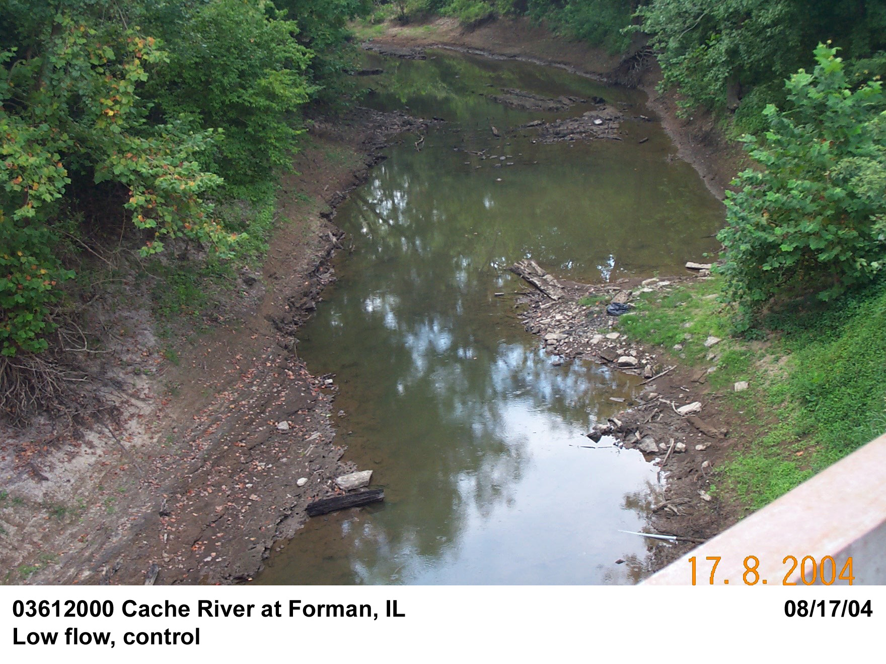
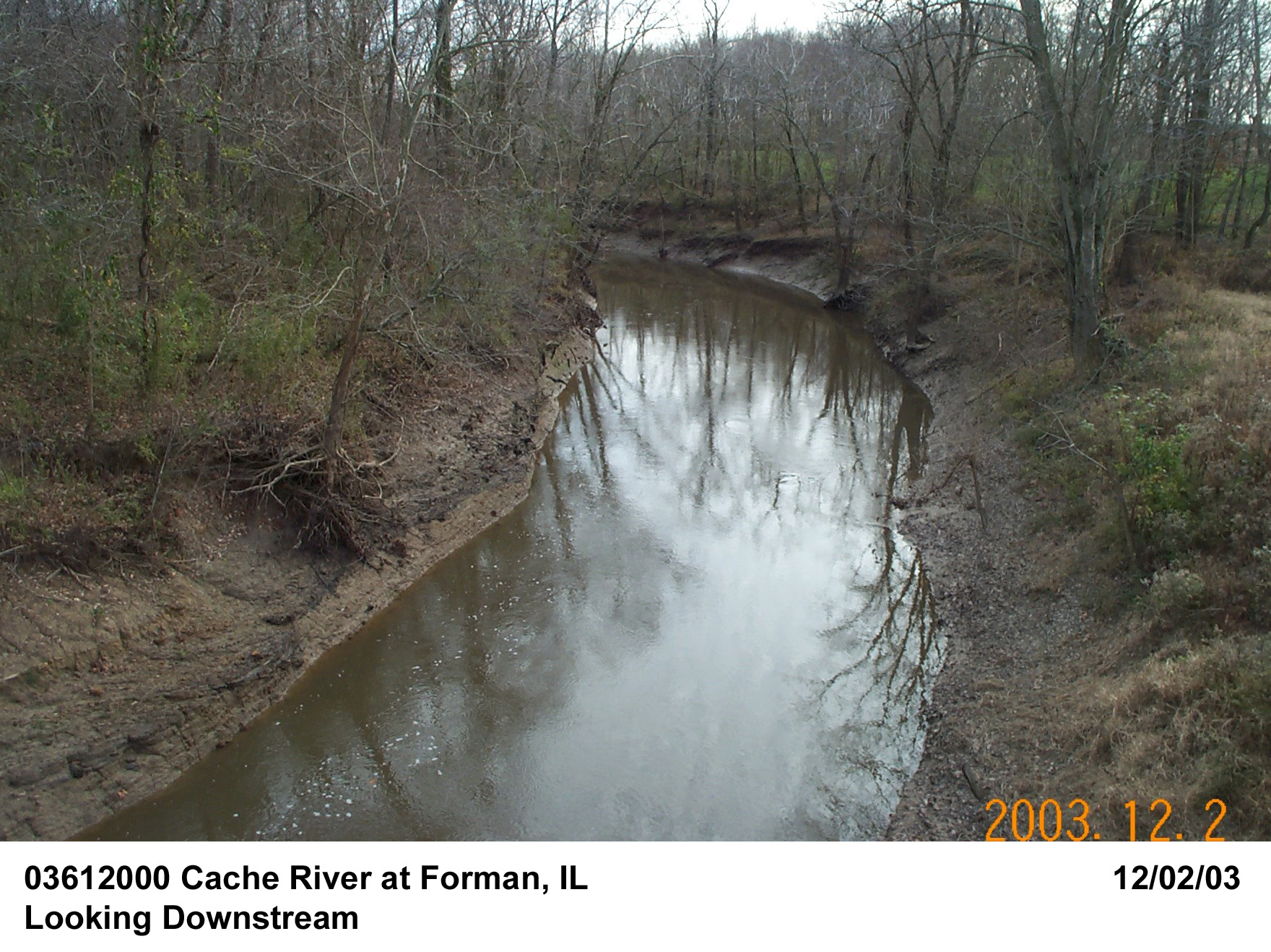
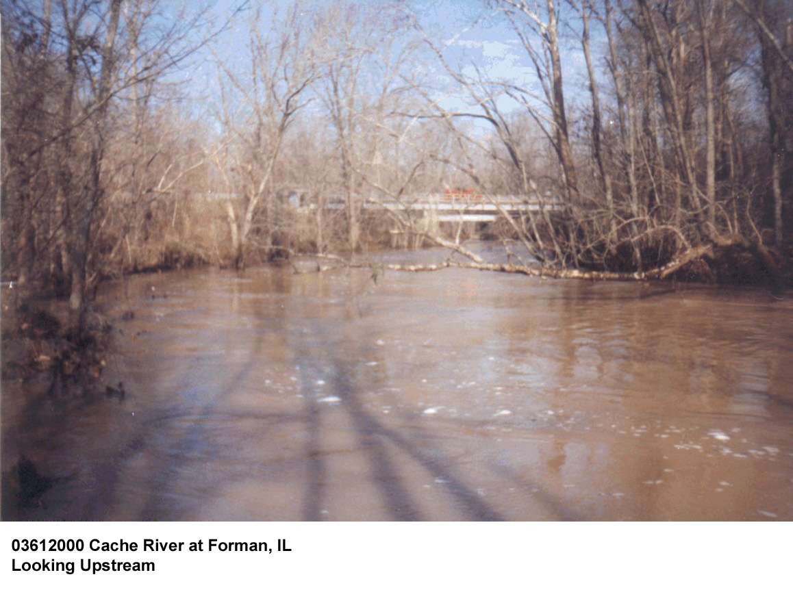
Description of Channel.--Overall, the channel is a deep, dredged ditch. Localized channel scouring, bed deposition, and bank failures are observed in the original trapezoidal channel sections. The streambed is composed of clay-sand mixtures, gravel, and scattered boulders. The bottom width of the channel is approximately 30 ft. The bank heights are about 20 ft. with a top width of about 100 ft. The bank slopes are steep. The bank faces are covered with dense grasses, with brush and trees on top of the banks and on the flood plains. There is little flood plain on the left-hand-side of the channel and flood plains on the right-hand-side of the bank are limited by a levee approximately 200 ft away from the bankline. Overflow to the flood plains occurs at a stage of about 22 ft. Also, backwater from the Ohio River may reach the channel under consideration when the staff gages at Metropolis and Lock 53 exceed approximately 30 ft. Therefore, over-the-bank events and those susceptible to backwater effects were not used. The study reach is considered as straight.
Floods.-- Maximum gage height 42.29 ft March 12, 1935, site then in use, current datum, from graph based on gage readings; Discharge, 9,630 cfs. Maximum gage height at present site, 39.01 ft, current datum, on March 20, 2008, Discharge 20,400 cfs.

![]() U.S. Department of the Interior |
U.S. Geological Survey
U.S. Department of the Interior |
U.S. Geological Survey
URL: http://il.water.usgs.gov/proj/nvalues/db/sites/03612000.shtml[an error occurred while processing this directive]?
Page Contact Information: David Soong
Page Last Modified: February 4, 2013
