

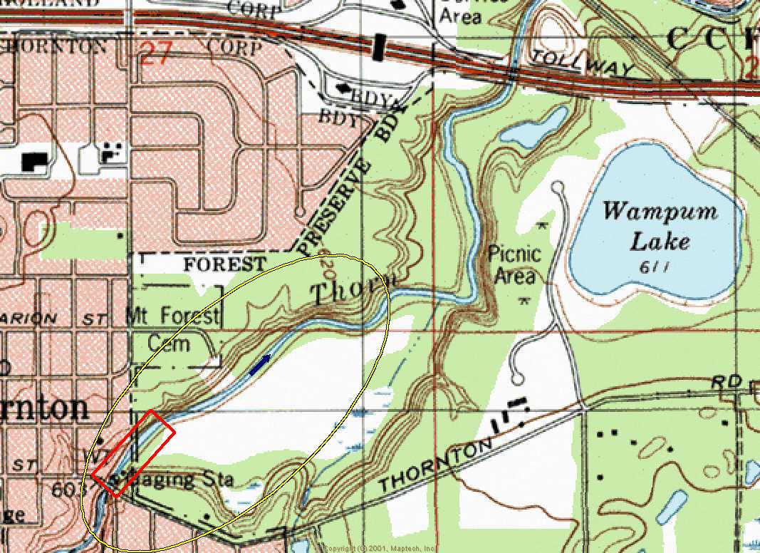
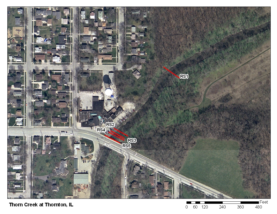
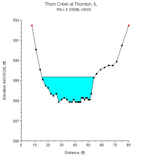
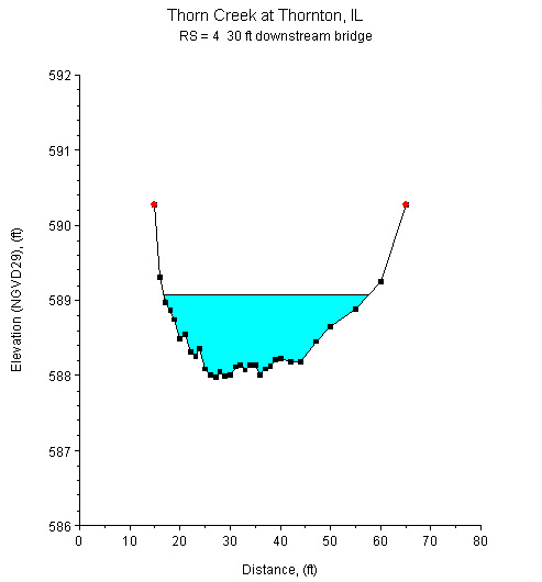
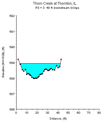
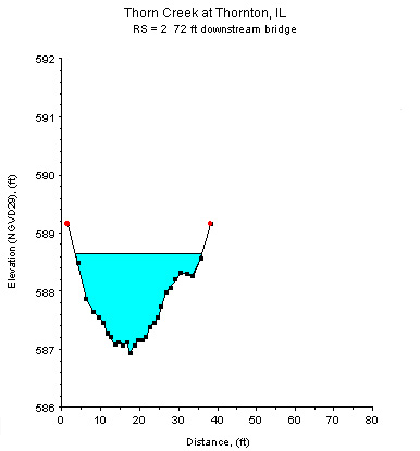
Study Reach.--The channel reach is meandering and natural and located in a forest preserve, as shown in the quadrangle map on the top left. The study reach extends from the USGS gage on the Margaret Street bridge to 600 ft downstream from the gage. Three cross sections (surveyed by the U.S. Geological Survey in April 2001, and reconstructed from a measurement done in February 1999) are used for evaluating channel characteristics at this site. The alignment of the study reach, approximate variations in channel width and bank conditions, and locations of the surveyed cross sections are shown in the aerial photograph on the top-right. Cross-sectional geometries are shown in the cross section plots above.
Gage Location.--Lat 41°34’06”, long 87°36’28”, in SE1/4 NW1/4 sec.34, T.36N., R.14E., Cook County, Hydrologic Unit 07120003, on the right bank at the downstream side of the bridge on Margaret Street in Thornton, 1.0 mi downstream from North Creek, and at mile 4.2. The USGS streamgage station number is 05536275.
Drainage Area.--104 sq mi.
Gage Datum and Elevations of Reference Points.--Datum of the gage is 586.43 ft. A wire-weight gage (WWG) is located on the downstream guardrail of the Margaret Street bridge. Four reference points (RP-N) were established for the n-values project:
	RP-N1 is a nail in a tree 75 ft downstream from the gage on the right bank, elevation=594.788 ft.
	RP-N2 is a nail in a tree 280 ft downstream from the gage on the right bank, elevation=593.560 ft.
	RP-N3 is a nail in a tree 500 ft downstream from the gage on the left bank, elevation=593.430 ft.
	RP-N4 is a nail in a tree 700 ft downstream from the gage on the right bank, elevation=592.763 ft.
All elevations are referenced to NGVD29.
Stage, Discharge Measurements, and Computed n-Values.--Water-surface elevations were measured by reading the WWG and by taping down from the reference points along the channel during the discharge measurement. Discharge measurements were made using the conventional current-meter method.
| Date of Observation | Discharge (ft3/s) | Average Cross Section Area (ft2) | Hydraulic Radius (ft) | Mean Velocity (ft/s) | Slope (ft/ft) | Coefficient of Roughness n |
|---|---|---|---|---|---|---|
| 10/21/1998 | 33.8 | 47.3 | 1.21 | 0.84 | 0.000233 | 0.041 |
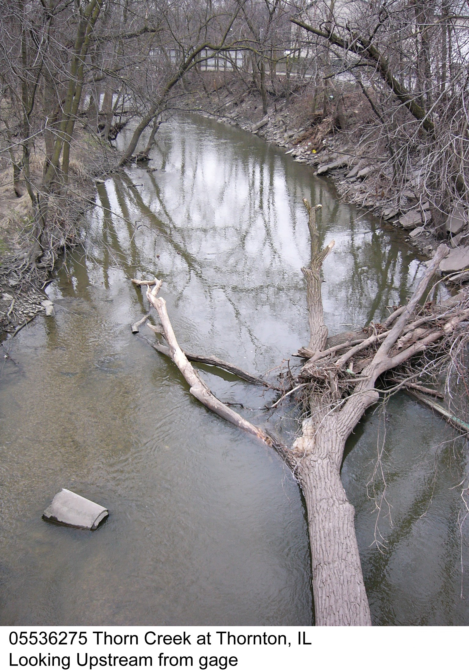
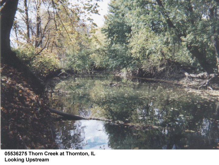
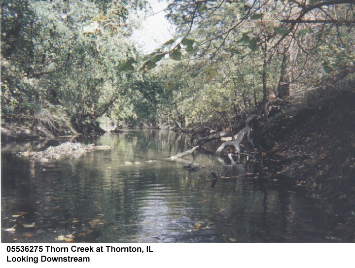
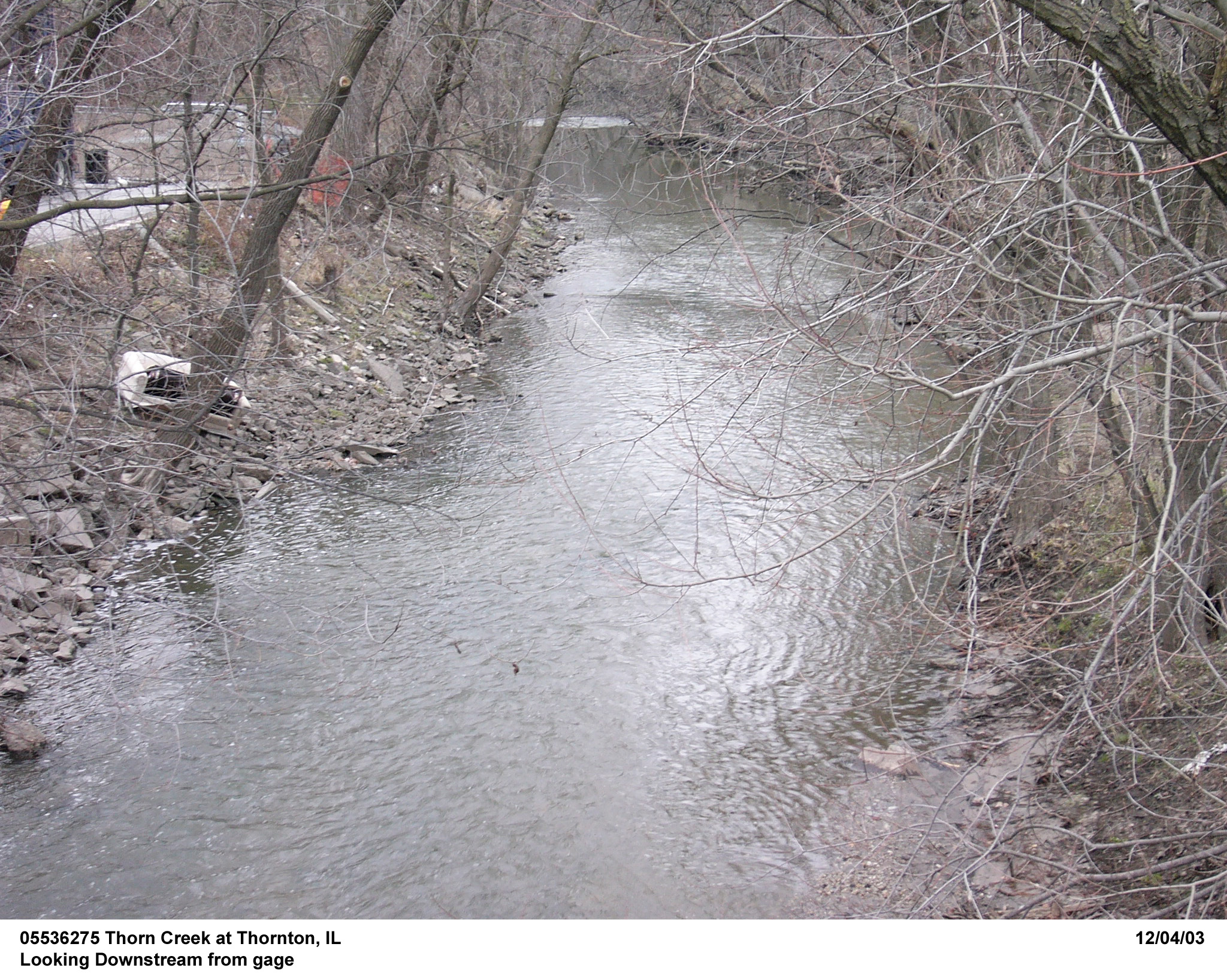
Description of Channel.--This is a natural channel in a forest preserve. The streambed is composed of sand and gravel on rock riffles. The streambed is subject to considerable aquatic vegetation during the growing seasons. The banks are steep and thickly wooded. The channel is subject to accumulation and dissipation of woody debris as well as urban debris, such as small appliances, tires and assorted garbage. The study reach is straight.
Floods.--Maximum discharge, 5,860 ft3/s on Sept. 14, 2008, gage height, 15.89 ft; maximum gage height, 17.06 ft. on June 14, 1981, discharge, 4,140 ft3/s. Flood of Apr. 5, 1947 reached a stage of 14.34 ft. (from flood mark), discharge, 4,200 ft3/s.

![]() U.S. Department of the Interior |
U.S. Geological Survey
U.S. Department of the Interior |
U.S. Geological Survey
URL: http://il.water.usgs.gov/proj/nvalues/db/sites/05536275.shtml[an error occurred while processing this directive]?
Page Contact Information: David Soong
Page Last Modified: February 4, 2013
