

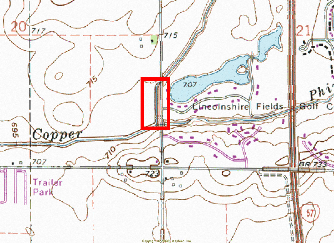

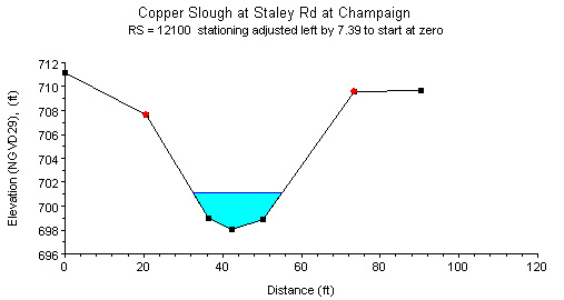
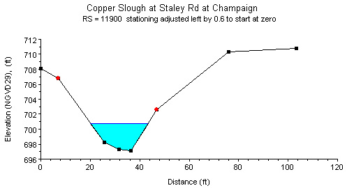
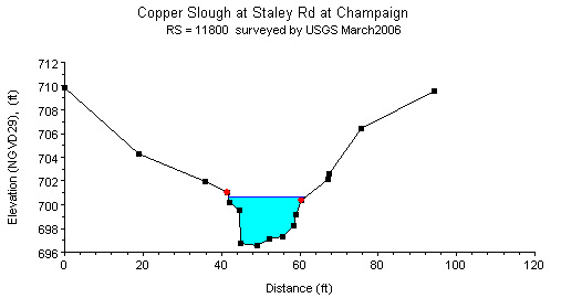
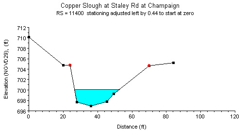
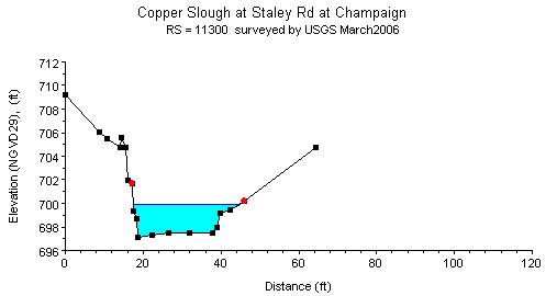
Study Reach.--The channel reach is a constructed channel in an urban setting, as shown in the quadrangle map at the top left. The study reach, about 750 ft. long, is located just downstream of the Staley Road bridge and upstream of the confluence with Phinney Branch. Four cross sections (surveyed by Clark-Dietz, Inc. in January 2005) are available for describing the channel geometries in the study reach. The channel alignment, approximate variations in channel width and bank conditions, and locations of cross sections are shown in the aerial photograph on the top right. Because of the similarities in cross sectional geometries, cross sectional plots depicted as river stations (RS) 11900, 11800, 11400, and 11300, plotted above, are selected as representative cross sections.
Gage Location.--Lat 40°05'20.5"N, long 88°18'50.7"W (NAD of 1983), in SW1/4 NW1/4 SW1/4 sec. 21, T.19N., R.08E., M.3, Champaign County, Hydrologic Unit 07140201, on the right upstream side of the bridge on Staley Road, immediately north of Lake Point Dr., 0.35 mi. north of Windsor Road (CR 1400 North), 0.6 mi. south of Kirby Avenue, and at river mile 2.3. The USGS streamgage station number is 05590060.
Drainage Area.--8.26 sq mi.
Gage Datum and Elevations of Reference Points.--No gage is established at this site. Staff gage 2 is located 245 ft. downstream of the bridge, elevation of the brass screw on the staff = 702.567 ft. Staff gage 1 is located 488 ft. downstream of the bridge, elevation of brass screw on the staff = 702.428 ft. Starting from January 26, 2007, two staff gages have been put in by HDCA staff. Staff gage 2 is 320 ft. downstream of the bridge (at CS 11800), elevation of the brass screw on the staff = 701.108 ft. Staff gage 1 is 748 ft. downstream of the bridge (at CS 11300), elevation of the brass screw on the staff = 700.279 ft. A bench mark represented by two file marks is made at the middle of pylons 4 and 5 (counted from left facing downstream). Elevation of the bench mark is 714.13 ft. All elevations are referenced to NGVD29.
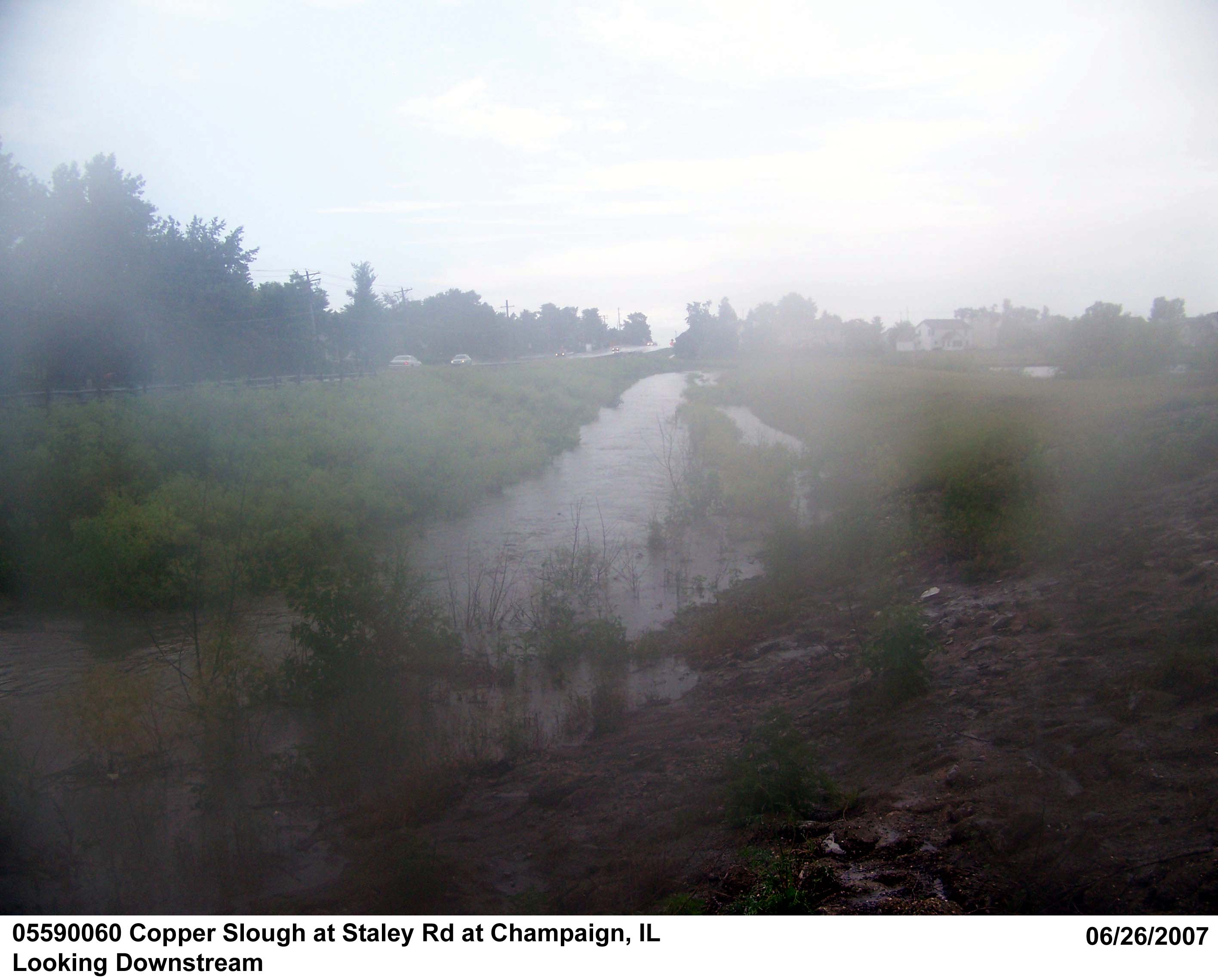
Stage, Discharge Measurements and Computed n-Values.--Low-water measurements are made by wading at a cross section upstream of the confluence with Phinney Branch, near RP-N2. High-stage measurements are made from the Staley Road bridge sidewalk. When possible, multiple discharge measurements were made during a rise and recession to provide data for calculating n-values over a range in stage. The computed n-values are listed in the following table. Whenever possible, the computed n-values are associated with a photograph taken at the time of the measurement. The photographs are arranged from low to high discharge in order to illustrate the contributing factors of n-values at a particular discharge.
| Date of Observation | Discharge (ft3/s) | Average Cross Section Area (ft2) | Hydraulic Radius (ft) | Mean Velocity (ft/s) | Slope (ft/ft) | Coefficient of Roughness n |
|---|---|---|---|---|---|---|
| 1/26/2007 | 7.8 | 9.6 | 0.61 | 0.90 | 0.000724 | 0.049 |
| 4/11/2007 | 36.1 | 17.6 | 0.99 | 2.16 | 0.000911 | 0.027 |
| 4/11/2007 | 36.8 | 17.3 | 0.97 | 2.25 | 0.000911 | 0.026 |
| 4/11/2007 | 37.2 | 17.0 | 0.96 | 2.31 | 0.000935 | 0.025 |
| 4/11/2007 | 38.1 | 17.5 | 0.98 | 2.30 | 0.000911 | 0.026 |
| 4/11/2007 | 38.5 | 17.3 | 0.97 | 2.35 | 0.000935 | 0.025 |
| 7/11/2006 | 63.1 | 28.9 | 1.43 | 2.24 | 0.001598 | 0.041 |
| 7/11/2006 | 64.4 | 30.6 | 1.50 | 2.13 | 0.001516 | 0.043 |
| 4/6/2006 | 152.0 | 53.0 | 2.06 | 2.88 | 0.001535 | 0.035 |
| 4/6/2006 | 156.0 | 53.6 | 2.07 | 2.93 | 0.001405 | 0.034 |
| 4/6/2006 | 156.3 | 53.8 | 2.07 | 2.92 | 0.001462 | 0.034 |
| 4/6/2006 | 164.2 | 53.3 | 2.06 | 3.10 | 0.001435 | 0.032 |
| 6/26/2007 | 371.0 | 135.0 | 3.26 | 2.77 | 0.000958 | 0.039 |


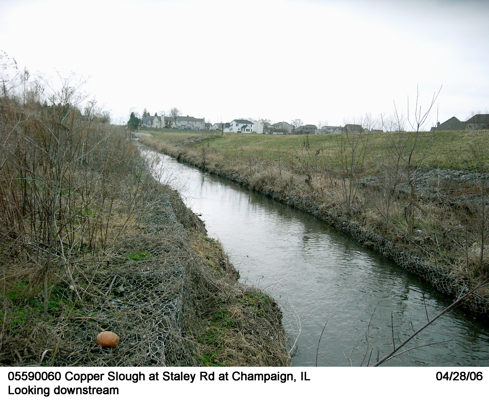
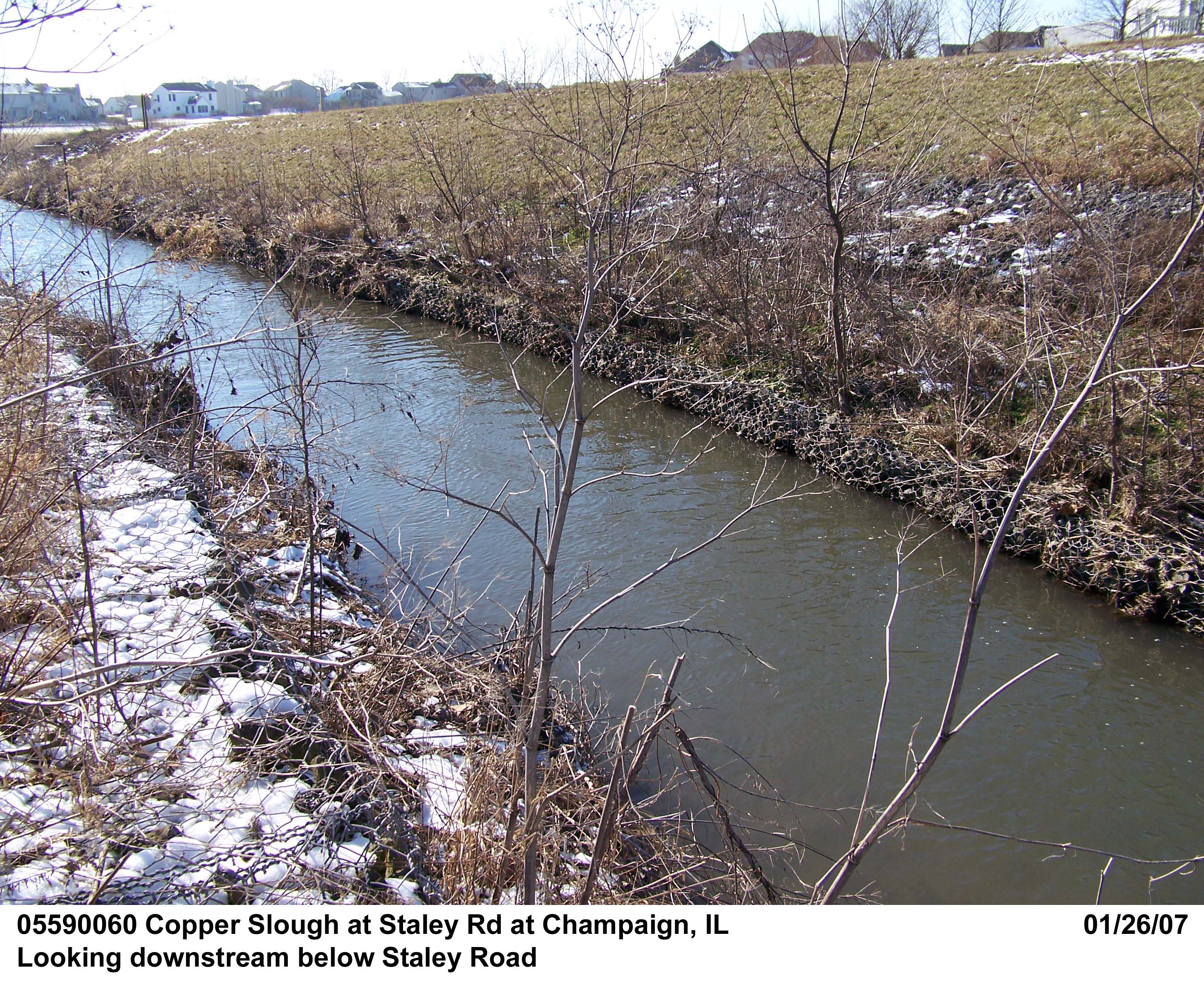
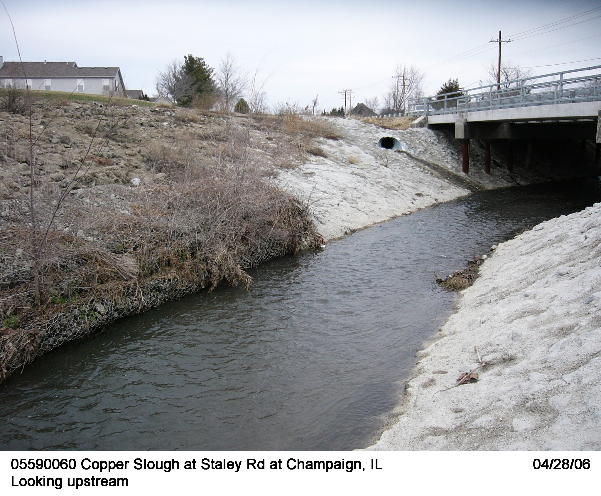
Description of Channel.--This channel has concrete sidewalls along the north end of the reach but reverts to a grassy embankment for the downstream portion. The bed materials consist of mud, sand, gravel and small cobbles. The low water control is the channel. Higher stages are controlled downstream of Staley Road by gabion boxes on both banks and a grassed, earthen berm above the gabions. The right berm is generally mowed as needed. Banks are wire gabion boxes filled with crushed rocks stacked three tiers high.
Floods.-- Not determined, not a regular USGS streamgage station

![]() U.S. Department of the Interior |
U.S. Geological Survey
U.S. Department of the Interior |
U.S. Geological Survey
URL: http://il.water.usgs.gov/proj/nvalues/db/sites/05590060.shtml[an error occurred while processing this directive]?
Page Contact Information: David Soong
Page Last Modified: February 4, 2013
