

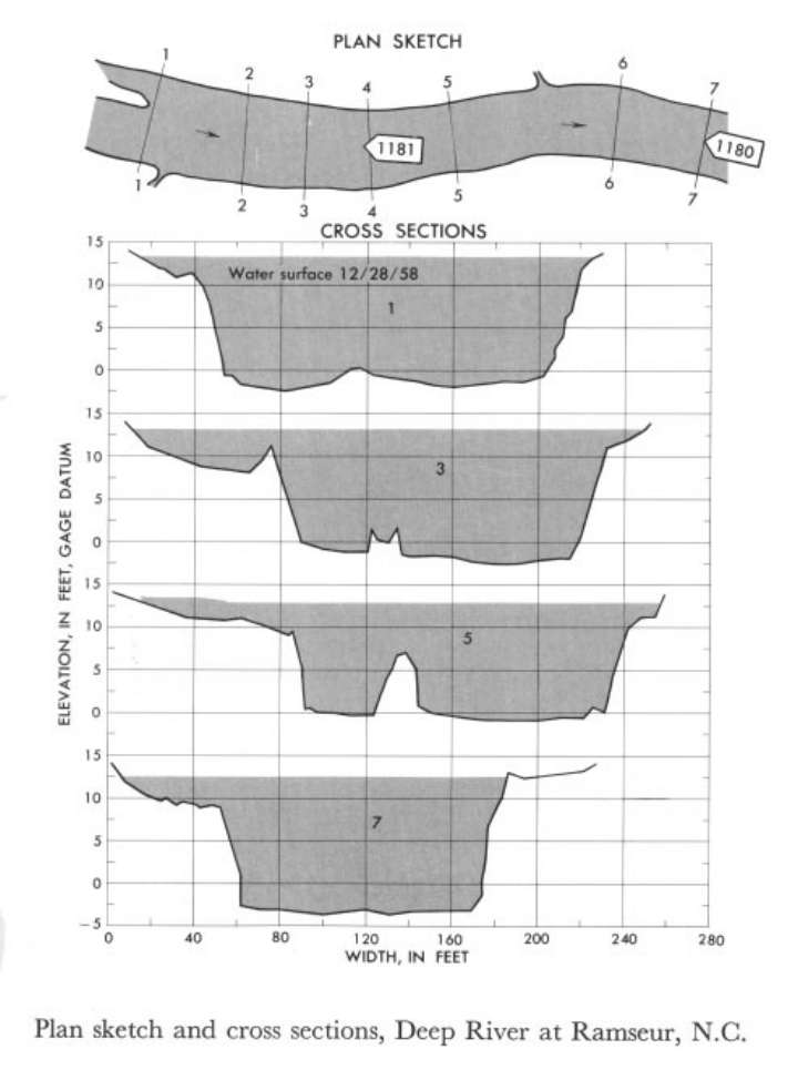
Study Reach.--Section 1 is about 30 ft downstream from gage.
Gage Location.--Lat 35°44', long 79°30', on right bank 0.25 mile downstream from Main Street bridge in Ramseur, Randolph County, 0.5 downstream from mill dam, and 1.5 miles downstream from Sandy Creek.
Drainage Area.--346 sq mi.
Gage Datum and Elevations of Reference Points.--Not available.
Stage, Discharge Measurements and Computed n-Values.--Gage heights were 13.65 ft at gage; 13.62 ft at section 1. Peak discharges was 8,300 cfs on Dec. 28, 1958.
| Date of Observation | Discharge (ft3/s) | Average Cross Section Area (ft2) | Hydraulic Radius (ft) | Mean Velocity (ft/s) | Slope | Coefficient of Roughness n |
|---|---|---|---|---|---|---|
| 12/28/1958 | 8342.1 | 2214.4 | 9.77 | 3.77 | 0.000768 | 0.049 |
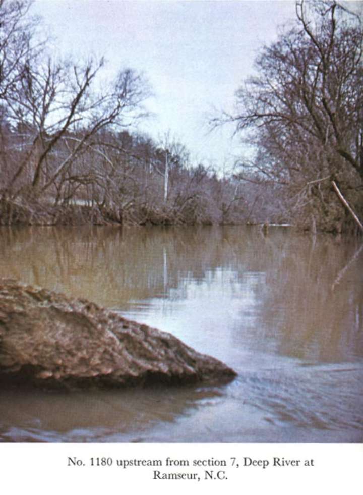
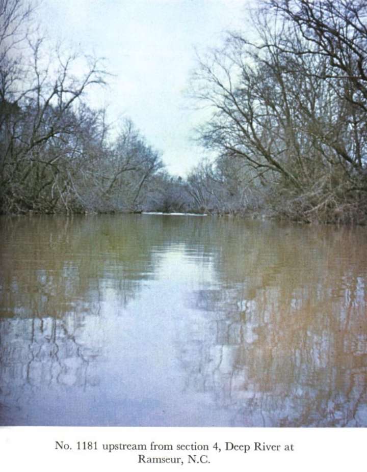
Description of Channel.--Bed is mostly coarse sand and contains some gravel and one conspicuous outcrop. Three small islands in the reach have a dense stand of small birch trees. The banks are fairly steep and contain medium growths of underbrush and large trees.

![]() U.S. Department of the Interior |
U.S. Geological Survey
U.S. Department of the Interior |
U.S. Geological Survey
URL: http://il.water.usgs.gov/proj/nvalues/db_barnes/sites/02100500.shtml[an error occurred while processing this directive]?
Page Contact Information: David Soong
Page Last Modified: December 19, 2012
