

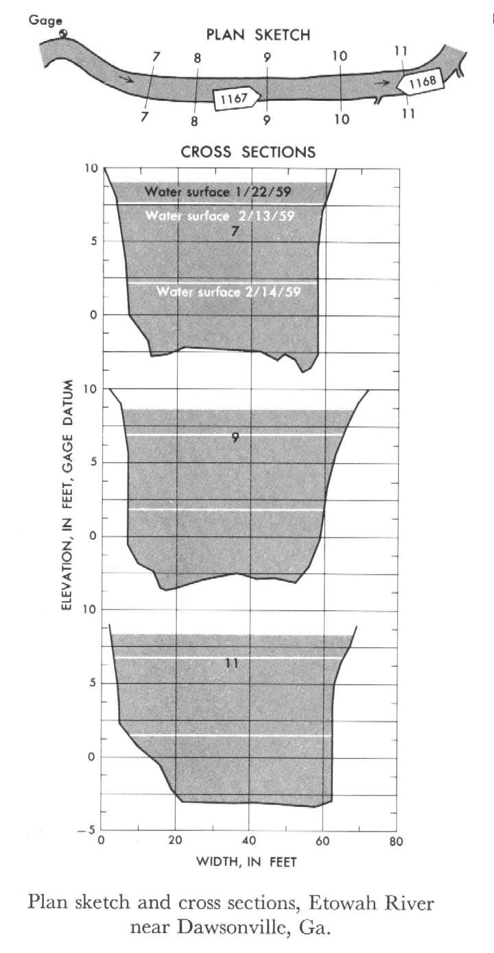
Study Reach.--Section 7 is 477 ft downstream from gage.
Gage Location.--Lat 34°23', long 84°04', on left bank 0.5 mile upstream from Palmer Creek, 1 mile downstream from Russell Creek, 4 miles southeast of Dawsonville, Dawson County, and 7.5 miles upstream from Shoal Creek.
Drainage Area.--103 sq mi.
Gage Datum and Elevations of Reference Points.--Not available.
Stage, Discharge Measurements and Computed n-Values.--Gage heights were 19.45 ft, 7.95 ft, 2.85 ft at gage; 9.02 ft, 7.55 ft, 2.18 ft at section 7. Peak discharges were 2,260 cfs on Jan. 22, 1959, 1,850 cfs on Feb. 13, 1959 and 515 cfs on Feb. 14, 1959.
| Date of Observation | Discharge (ft3/s) | Average Cross Section Area (ft2) | Hydraulic Radius (ft) | Mean Velocity (ft/s) | Slope | Coefficient of Roughness n |
|---|---|---|---|---|---|---|
| 2/14/1959 | 517.6 | 221.2 | 3.63 | 2.34 | 0.000610 | 0.035 |
| 2/13/1959 | 1846.9 | 529.2 | 7.20 | 3.49 | 0.000610 | 0.039 |
| 1/22/1959 | 2261.9 | 618.0 | 7.95 | 3.66 | 0.000647 | 0.041 |
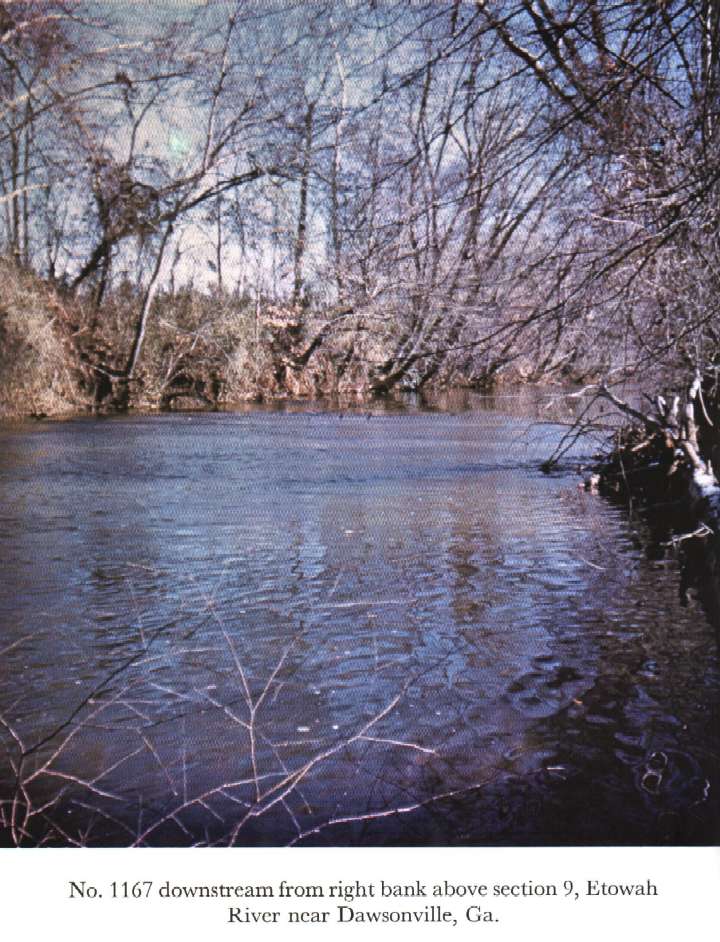
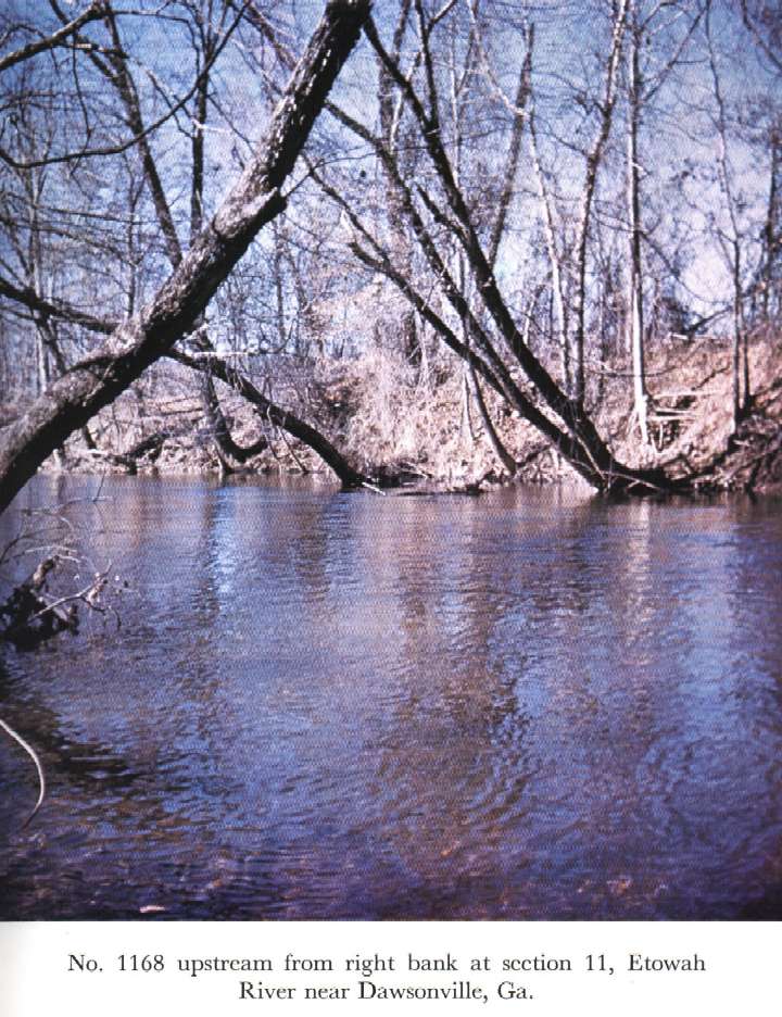
Description of Channel.--Bed is sand and gravel with several fallen trees in the reach. Banks are lined with overhanging trees and underbrush.

![]() U.S. Department of the Interior |
U.S. Geological Survey
U.S. Department of the Interior |
U.S. Geological Survey
URL: http://il.water.usgs.gov/proj/nvalues/db_barnes/sites/02389000.shtml[an error occurred while processing this directive]?
Page Contact Information: David Soong
Page Last Modified: December 19, 2012
