

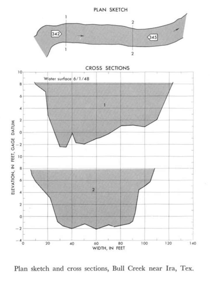
Study Reach.--Section 1 is about 1,000 ft downstream from gage.
Gage Location.--Lat 32°36'02", long 101°05'40", on left bank 800 ft upstream from bridge on Farm to Market Road 2085, 1.9 miles upstream from Colorado River, 5.3 miles downstream from Chimney Creek, 5.5 miles west of Ira, Scurry County, 7.7 miles northwest of Cuthbert, and 8.3 miles downstream from Bull Creek diversion dam.
Drainage Area.--388 sq mi., approximate contributing area.
Gage Datum and Elevations of Reference Points.--Not available.
Stage, Discharge Measurements and Computed n-Values.--Gage height were 8.84 ft at gage; 8.26 ft at section 1. Peak discharge was 3,220 cfs on June 1, 1948.
| Date of Observation | Discharge (ft3/s) | Average Cross Section Area (ft2) | Hydraulic Radius (ft) | Mean Velocity (ft/s) | Slope | Coefficient of Roughness n |
|---|---|---|---|---|---|---|
| 6/1/1948 | 3230.2 | 776.5 | 6.83 | 4.16 | 0.001206 | 0.041 |

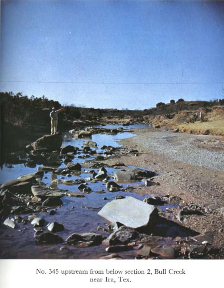
Description of Channel.--Bed is composed of sand, gravel, and small boulders with scattered large angular rocks. Banks are irregular and eroded, and have sparse cover of grass and scattered small trees. The channel reach between sections 1 and 2 is fairly straight. The channel curves sharply above the reach and moderately below it.

![]() U.S. Department of the Interior |
U.S. Geological Survey
U.S. Department of the Interior |
U.S. Geological Survey
URL: http://il.water.usgs.gov/proj/nvalues/db_barnes/sites/08118500.shtml[an error occurred while processing this directive]?
Page Contact Information: David Soong
Page Last Modified: December 19, 2012
