

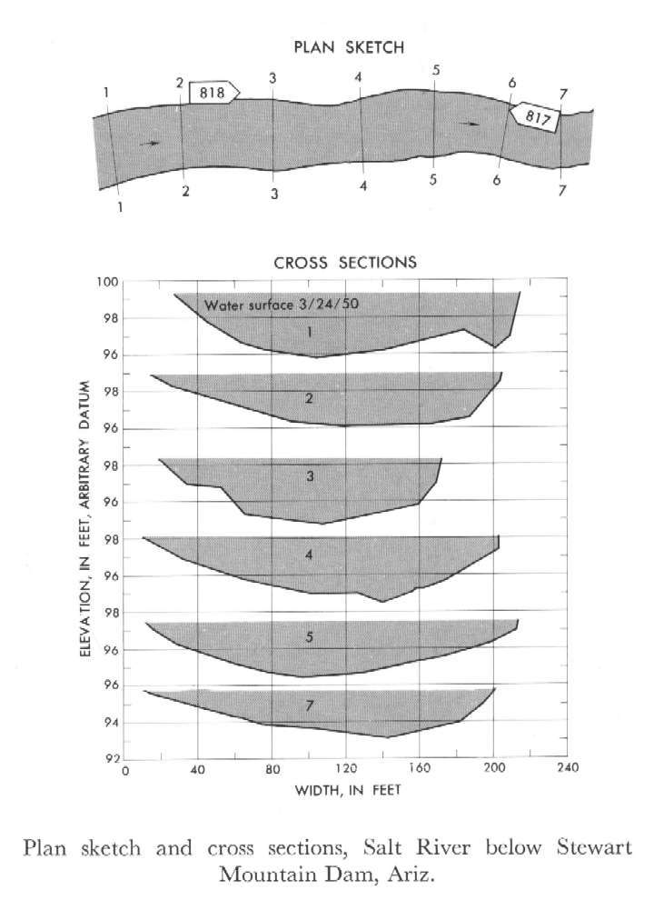
Study Reach.--Section 1 is about 2.25 miles downstream from gage.
Gage Location.--Lat 33°33'00", long 111°34'31", in N1/2 NW1/4 sec.6, T.2N., R.8E. (unsurveyed), on left bank 3.5 miles downstream from Stewart Mountain Dam and 6 miles upstream from Verde River.
Drainage Area.--6,230 sq mi., of which 21 sq mi. is below Stewart
Gage Datum and Elevations of Reference Points.--Not available.
Stage, Discharge Measurements and Computed n-Values.--Gage heights were 4.26 ft at gage; 99.26 ft (different datum) at section 1. Peak discharges was 1,280 cfs. on Mar. 24, 1950.
| Date of Observation | Discharge (ft3/s) | Average Cross Section Area (ft2) | Hydraulic Radius (ft) | Mean Velocity (ft/s) | Slope | Coefficient of Roughness n |
|---|---|---|---|---|---|---|
| 3/24/1950 | 1303.8 | 404.9 | 2.14 | 3.22 | 0.001903 | 0.032 |
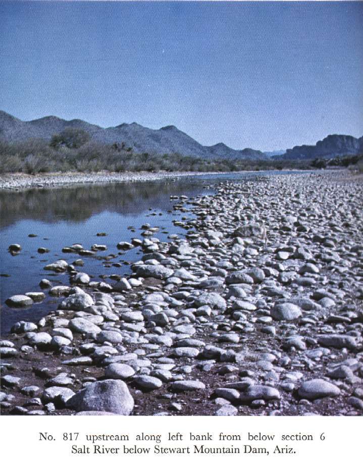
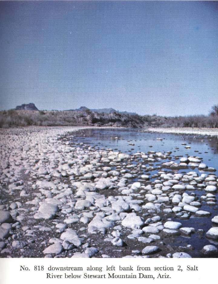
Description of Channel.--Bed and banks consist of smooth cobbles 4 to 10 inches in diameter, average diameter about 6 inches. A few boulders are as much as 18 inches in diameter.

![]() U.S. Department of the Interior |
U.S. Geological Survey
U.S. Department of the Interior |
U.S. Geological Survey
URL: http://il.water.usgs.gov/proj/nvalues/db_barnes/sites/09502000.shtml[an error occurred while processing this directive]?
Page Contact Information: David Soong
Page Last Modified: December 19, 2012
