

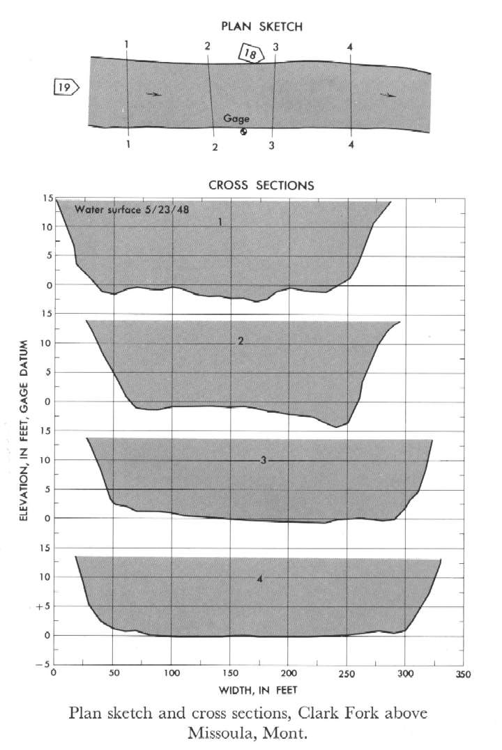
Study Reach.--Section 1 is 405 ft upstream from gage.
Gage Location.--Lat 46°52'40", long 113°55'40", in NW1/4 NW1/4 sec.19, T.13N, R.18W., on right bank 3 miles down stream from Blackfoot River and 3 miles east of Missoula.
Drainage Area.--5,999 sq mi.
Gage Datum and Elevations of Reference Points.--Not available.
Stage, Discharge Measurements and Computed n-Values.--Gage heights were 13.07 ft at gage; 14.54 ft at section 1. Peak discharges was 31,500 cfs on May 23, 1948.
| Date of Observation | Discharge (ft3/s) | Average Cross Section Area (ft2) | Hydraulic Radius (ft) | Mean Velocity (ft/s) | Slope | Coefficient of Roughness n |
|---|---|---|---|---|---|---|
| 5/23/1948 | 31547.4 | 3689.8 | 12.48 | 8.55 | 0.001254 | 0.030 |

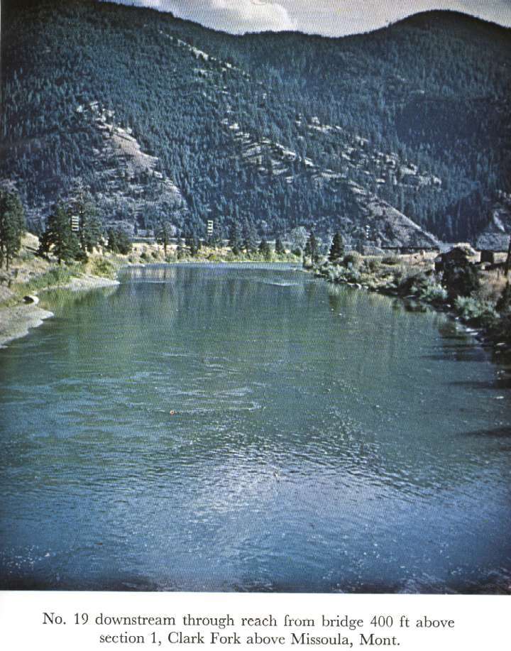
Description of Channel.--Bed is composed of sand, gravel, and boulders; d50 = 175 mm, d84 = 325 mm. Thick undergrowth is along right bank and along the left bank in the lower part of the reach.

![]() U.S. Department of the Interior |
U.S. Geological Survey
U.S. Department of the Interior |
U.S. Geological Survey
URL: http://il.water.usgs.gov/proj/nvalues/db_barnes/sites/12340500.shtml[an error occurred while processing this directive]?
Page Contact Information: David Soong
Page Last Modified: December 19, 2012
