

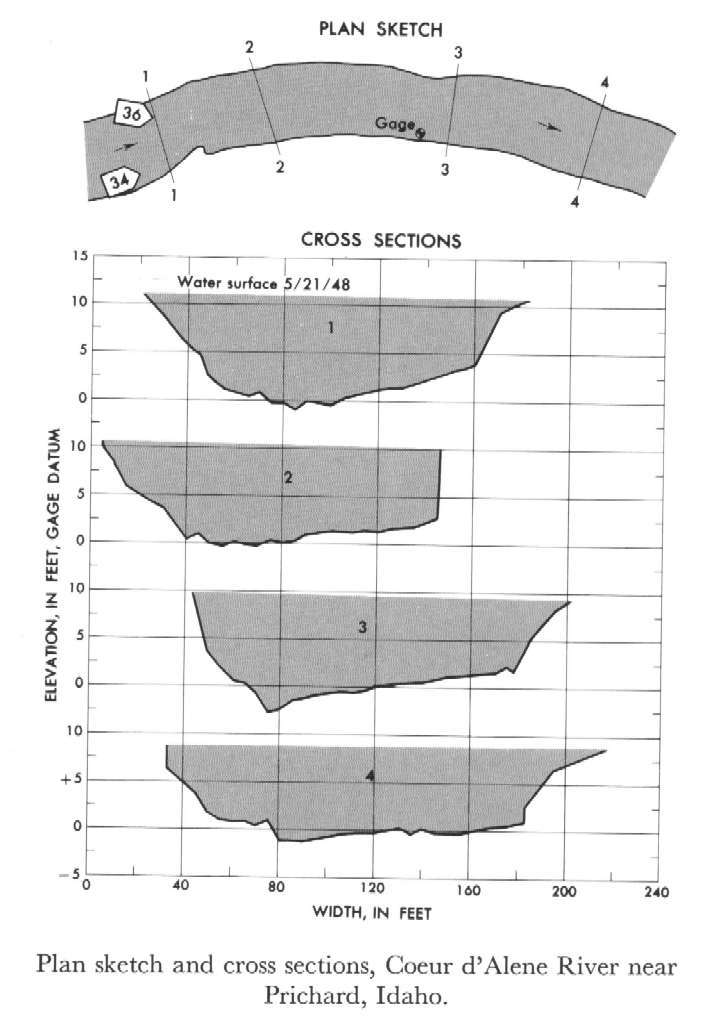
Study Reach.--Section 1 is 570 ft upstream from gage.
Gage Location.--Lat 47°38'05", long 115°58'55", in lot 7, sec.32, T.50N., R.4E., on right bank 0.2 mile downstream from Beaver Creek and 1.75 miles southwest of Prichard.
Drainage Area.--583 sq mi.
Gage Datum and Elevations of Reference Points.--Not available.
Stage, Discharge Measurements and Computed n-Values.--Gage heights were 9.24 ft at gage; 10.98 ft at section 1. Peak discharges was 11,300 cfs on May 21, 1948.
| Date of Observation | Discharge (ft3/s) | Average Cross Section Area (ft2) | Hydraulic Radius (ft) | Mean Velocity (ft/s) | Slope | Coefficient of Roughness n |
|---|---|---|---|---|---|---|
| 5/21/1948 | 11314.4 | 1269.5 | 7.62 | 8.91 | 0.002468 | 0.032 |
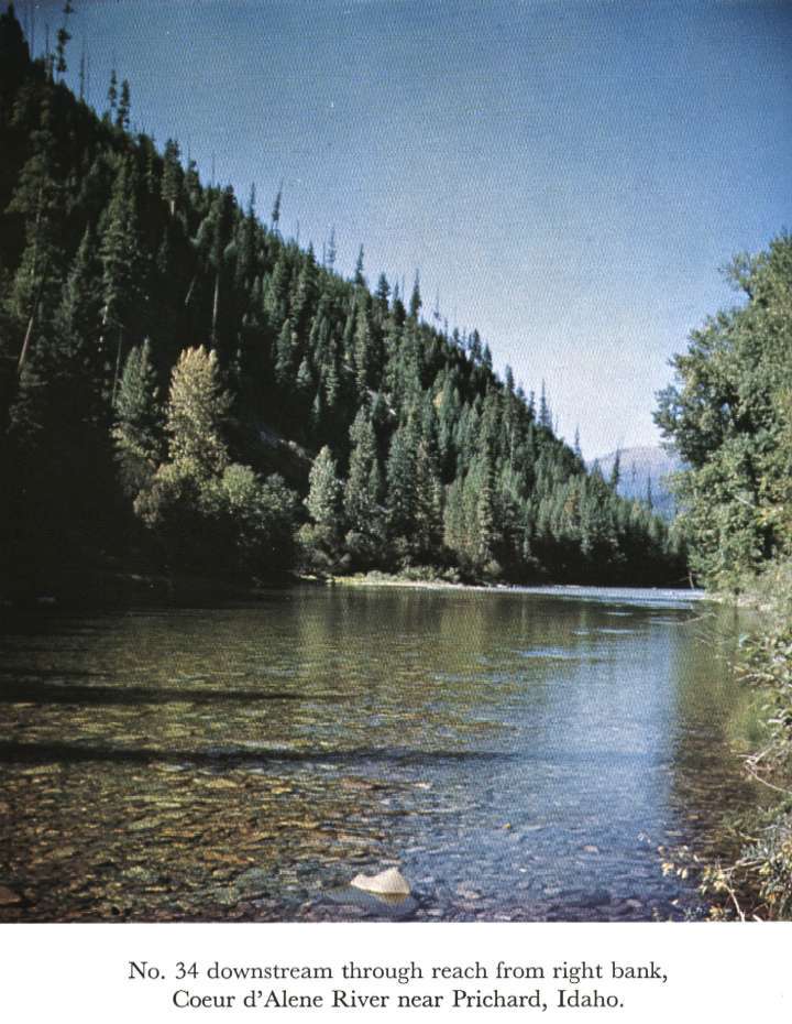
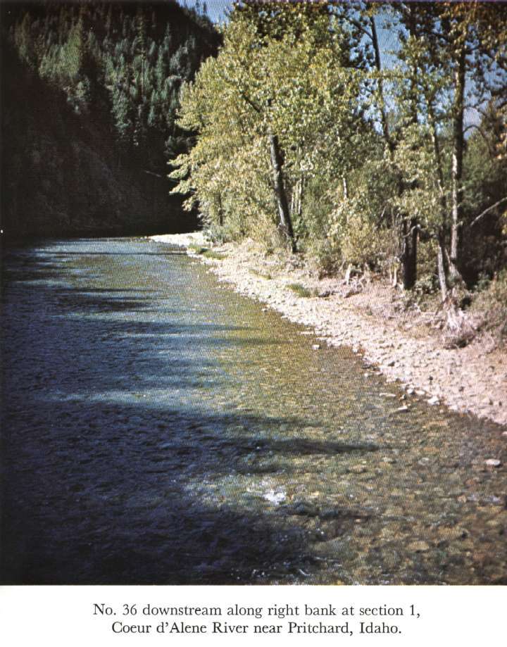
Description of Channel.--Bed is composed of rock along left edge, gravel and small boulders elsewhere; d50 = 103 mm, d84 = 650 mm. Left bank is irregular bedrock, steep and clean. Right bank consists of sand and gravel covered with heavy growth of brush and trees.

![]() U.S. Department of the Interior |
U.S. Geological Survey
U.S. Department of the Interior |
U.S. Geological Survey
URL: http://il.water.usgs.gov/proj/nvalues/db_barnes/sites/12412000.shtml[an error occurred while processing this directive]?
Page Contact Information: David Soong
Page Last Modified: December 19, 2012
