

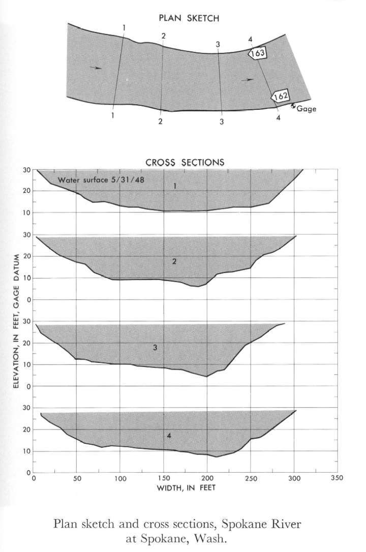
Study Reach.--Section 1 is about 800 ft upstream from gage.
Gage Location.--Lat 47°39'35", long 117°26'50", in SW1/4 sec.13, T.25N., R.42E., on right bank at Cochran Street in Spokane, 0.5 mile upstream from Latah Creek.
Drainage Area.--4,290 sq mi.
Gage Datum and Elevations of Reference Points.--Not available.
Stage, Discharge Measurements and Computed n-Values.--Gage heights were 28.35 ft at gage; 29.37 at section 1. Peak discharges was 39,600 cfs. on May 31, 1948.
| Date of Observation | Discharge (ft3/s) | Average Cross Section Area (ft2) | Hydraulic Radius (ft) | Mean Velocity (ft/s) | Slope | Coefficient of Roughness n |
|---|---|---|---|---|---|---|
| 5/31/1948 | 39613.1 | 4282.5 | 14.24 | 9.25 | 0.001768 | 0.038 |

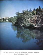
Description of Channel.--Bed is gravel and boulders; d50 = 195 mm, d84 = 360 mm. Banks are lined with trees and brush.

![]() U.S. Department of the Interior |
U.S. Geological Survey
U.S. Department of the Interior |
U.S. Geological Survey
URL: http://il.water.usgs.gov/proj/nvalues/db_barnes/sites/12422500.shtml[an error occurred while processing this directive]?
Page Contact Information: David Soong
Page Last Modified: December 19, 2012
