

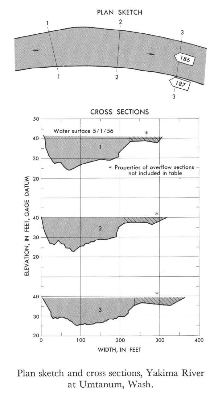
Study Reach.--Section 1 is about 650 ft upstream from gage.
Gage Location.--Lat 46°51'45", long 120°28'30", in NW1/4 sec.20, T.16N., R.19E., on right bank at Umtanum, 0.5 mile upstream from Umtanum Creek and 10 miles south of Ellensburg.
Drainage Area.--1,590 sq mi, approximately.
Gage Datum and Elevations of Reference Points.--Not available.
Stage, Discharge Measurements and Computed n-Values.--Gage heights were 38.98 ft at gage; 41.27 ft at section 1. Peak discharges was 27,700 cfs. on May 29, 1948.
| Date of Observation | Discharge (ft3/s) | Average Cross Section Area (ft2) | Hydraulic Radius (ft) | Mean Velocity (ft/s) | Slope | Coefficient of Roughness n |
|---|---|---|---|---|---|---|
| 5/29/1948 | 27714.8 | 2573.3 | 11.18 | 10.77 | 0.002955 | 0.036 |
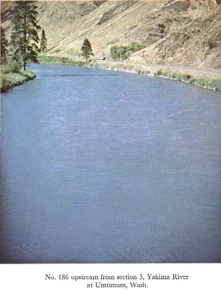
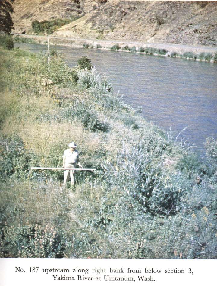
Description of Channel.--Bed consists of gravel and boulders. Left bank is rock riprap with bushes. Right bank is mildly sloped and has some boulders, brush, and weed cover.

![]() U.S. Department of the Interior |
U.S. Geological Survey
U.S. Department of the Interior |
U.S. Geological Survey
URL: http://il.water.usgs.gov/proj/nvalues/db_barnes/sites/12484500.shtml[an error occurred while processing this directive]?
Page Contact Information: David Soong
Page Last Modified: December 19, 2012
