

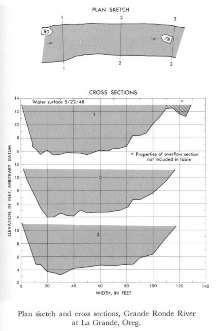
Study Reach.--Section 1 is 0.65 mile downstream from gage.
Gage Location.--Lat 45°21', long 118°08', near center of sec.36, T.2N., R.37E., on left bank 2 miles northwest of La Grande and 5 miles downstream from Fivepoint Creek.
Drainage Area.--678 sq mi.
Gage Datum and Elevations of Reference Points.--Not available.
Stage, Discharge Measurements and Computed n-Values.--Gage heights were 17.04 ft at gage; 12.95 ft (different datum) at section 1. Peak discharges was 4,620 cfs on May 22, 1948.
| Date of Observation | Discharge (ft3/s) | Average Cross Section Area (ft2) | Hydraulic Radius (ft) | Mean Velocity (ft/s) | Slope | Coefficient of Roughness n |
|---|---|---|---|---|---|---|
| 5/22/1948 | 4621.1 | 620.0 | 5.33 | 7.45 | 0.005255 | 0.043 |
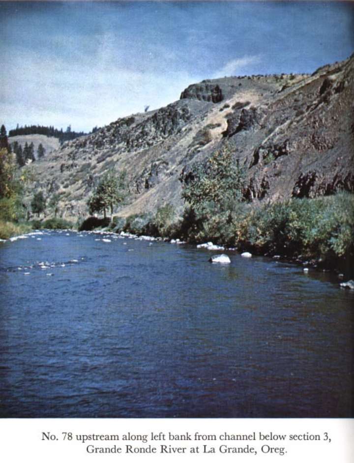
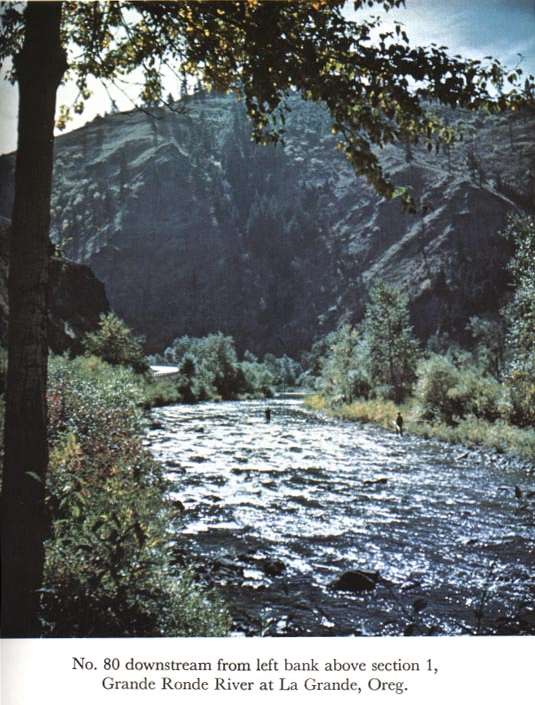
Description of Channel.--Bed consists of boulders; d50 = 93 mm, d84 = 157 mm. Right bank is fairly steep and has dense overhanging bushes.

![]() U.S. Department of the Interior |
U.S. Geological Survey
U.S. Department of the Interior |
U.S. Geological Survey
URL: http://il.water.usgs.gov/proj/nvalues/db_barnes/sites/13319000.shtml[an error occurred while processing this directive]?
Page Contact Information: David Soong
Page Last Modified: December 19, 2012
