

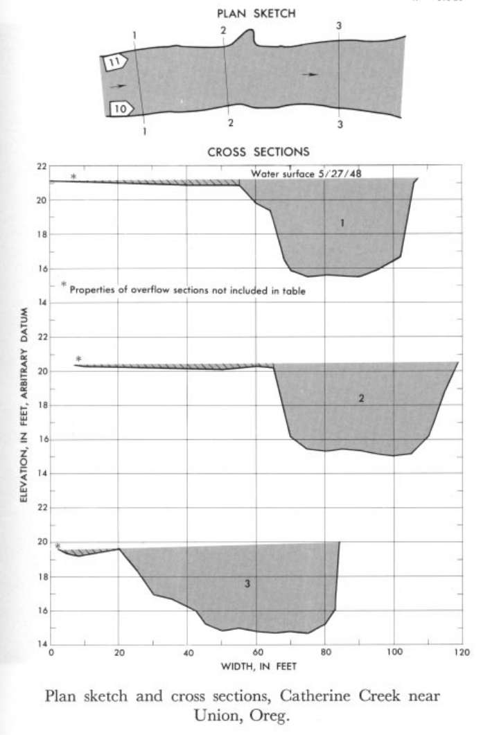
Study Reach.--Section 1 is about 0.75 mile downstream from gage.
Gage Location.--Lat 45°09'20", long 117°46'40", in SE1/4; sec.2, T.5 S., R.40E., on right bank 3 miles downstream from Little Catherine Creek and 6 miles southeast of Union.
Drainage Area.--105 sq mi.
Gage Datum and Elevations of Reference Points.--Not available.
Stage, Discharge Measurements and Computed n-Values.--Gage heights were 4.57 ft at gage; 21.21 ft (different datum) at section 1. Peak discharges was 1,740 cfs on May 27, 1948.
| Date of Observation | Discharge (ft3/s) | Average Cross Section Area (ft2) | Hydraulic Radius (ft) | Mean Velocity (ft/s) | Slope | Coefficient of Roughness n |
|---|---|---|---|---|---|---|
| 5/27/1948 | 1746.8 | 237.3 | 3.97 | 7.36 | 0.006651 | 0.043 |
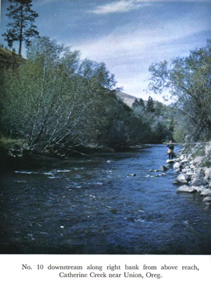

Description of Channel.--Bed consists of cobbles and small boulders. Banks are lined with small trees and brush, and limbs overhang along left bank.

![]() U.S. Department of the Interior |
U.S. Geological Survey
U.S. Department of the Interior |
U.S. Geological Survey
URL: http://il.water.usgs.gov/proj/nvalues/db_barnes/sites/13320000.shtml[an error occurred while processing this directive]?
Page Contact Information: David Soong
Page Last Modified: December 19, 2012
