Roughness Characteristics of Natural Channels
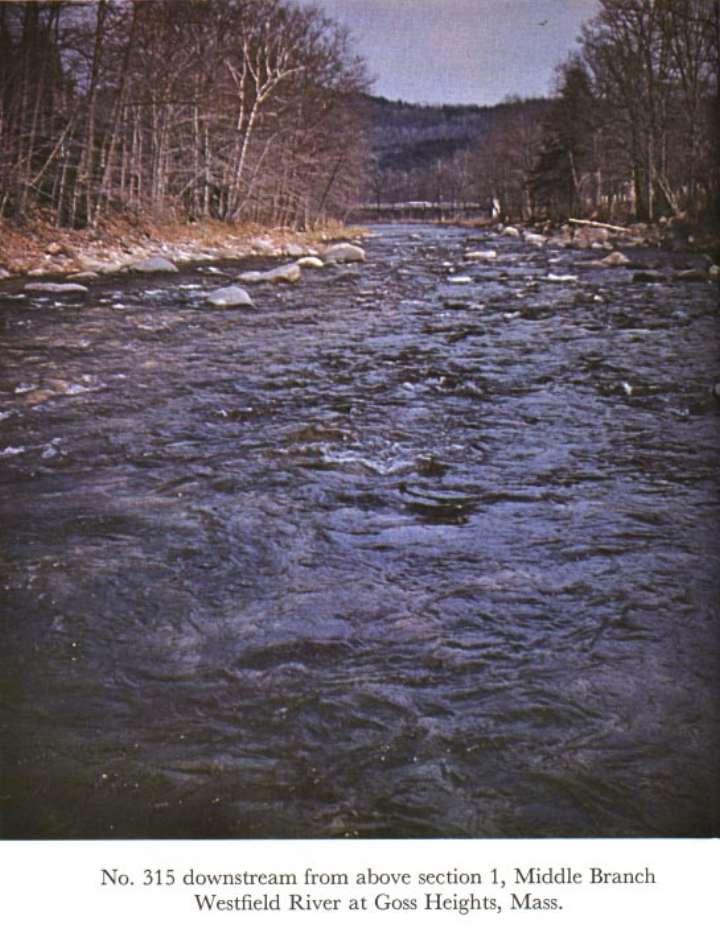
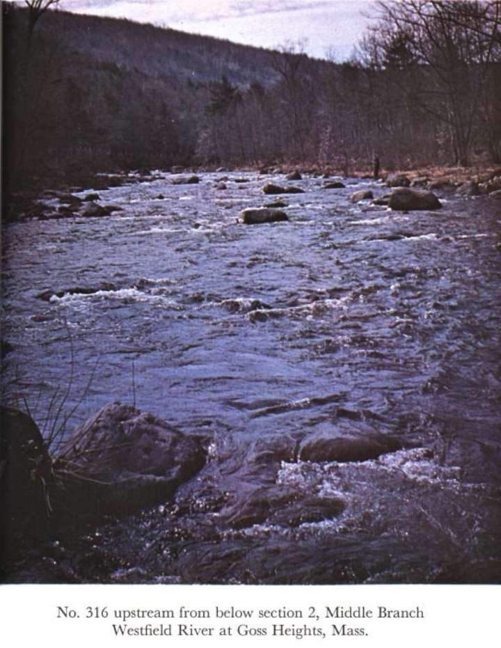
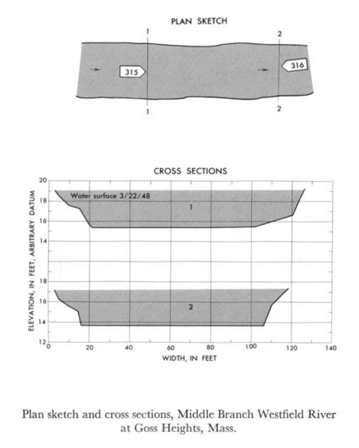
01180500 Middle Branch Westfield River at Goss Heights, Mass.
 Location
.-- Lat 42°15'31", long 72°52'23", near Goss Heights, Massachusetts.
Description of channel.--
| Date of observation | Average depth (ft) | Average surface width (ft) | Discharge (ft3/s) | Average cross section area (ft2) | Hydraulic radius (ft) | Mean velocity (ft/s) | Slope | Coefficient of roughness n |
|---|
| Mar. 22, 1948 |
4.35 |
--- |
3408.9 |
516.5 |
4.28 |
6.600 |
0.008679 |
0.056 |
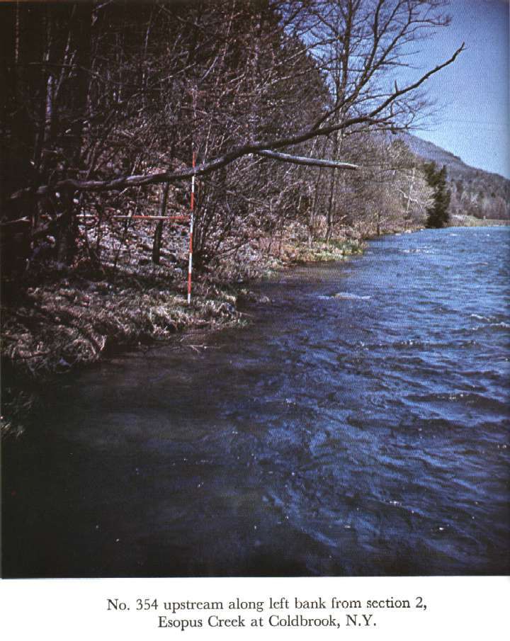
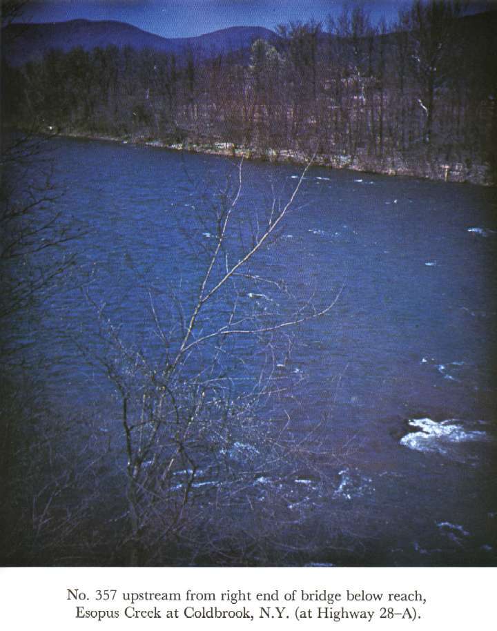
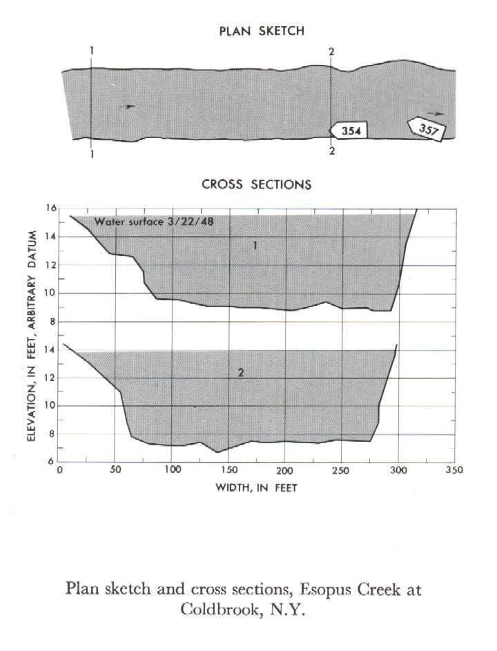
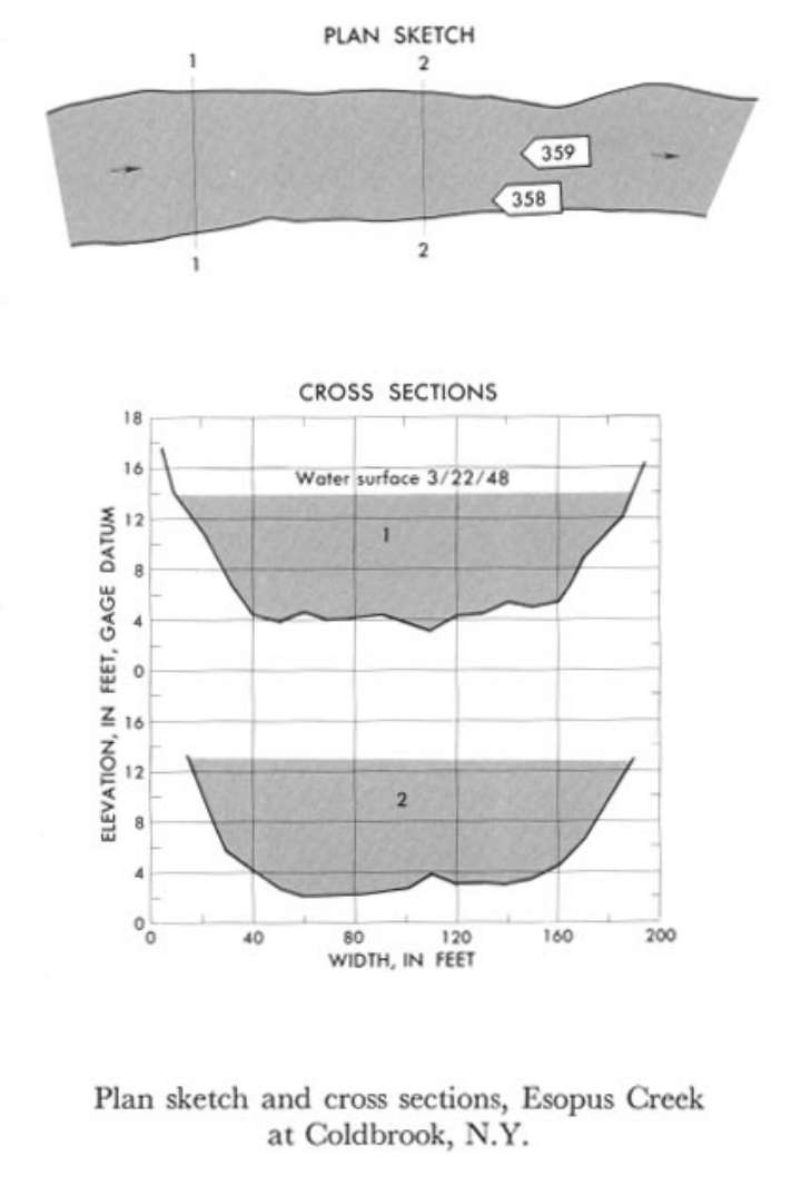
01362500 Esopus Creek at Coldbrook
 Location
.-- Lat 42°00'45", long 76°16'10", near Coldbrook, New York.
Description of channel.--
| Date of observation | Average depth (ft) | Average surface width (ft) | Discharge (ft3/s) | Average cross section area (ft2) | Hydraulic radius (ft) | Mean velocity (ft/s) | Slope | Coefficient of roughness n |
|---|
| Mar. 22, 1948 |
5.45 |
--- |
13935.9 |
1594.5 |
5.51 |
8.740 |
0.003397 |
0.030 |
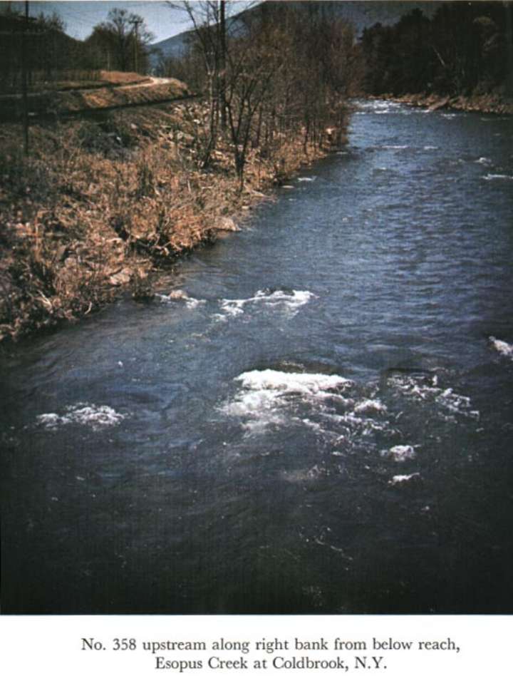
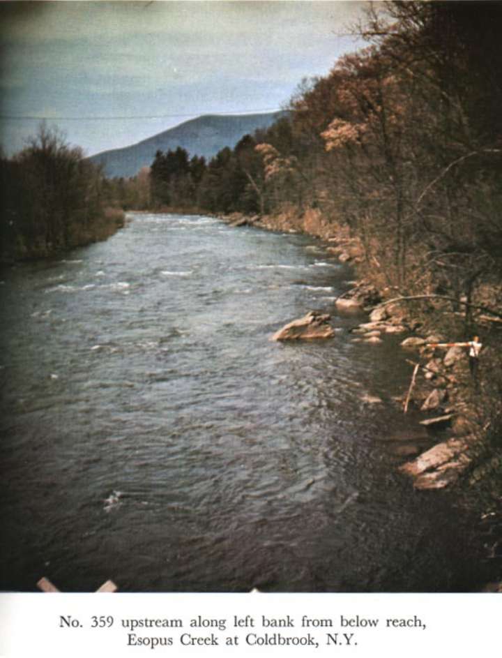
01362500 Esopus Creek at Coldbrook, N.Y.
 Location
.-- Lat 42°00'45", long 76°16'10", near Coldbrook, New York.
Description of channel.--
| Date of observation | Average depth (ft) | Average surface width (ft) | Discharge (ft3/s) | Average cross section area (ft2) | Hydraulic radius (ft) | Mean velocity (ft/s) | Slope | Coefficient of roughness n |
|---|
| May 22, 1948 |
8.25 |
--- |
13866.2 |
1465.0 |
8.13 |
9.465 |
0.004457 |
0.043 |
01420500 Beaver Kill at Cooks Falls
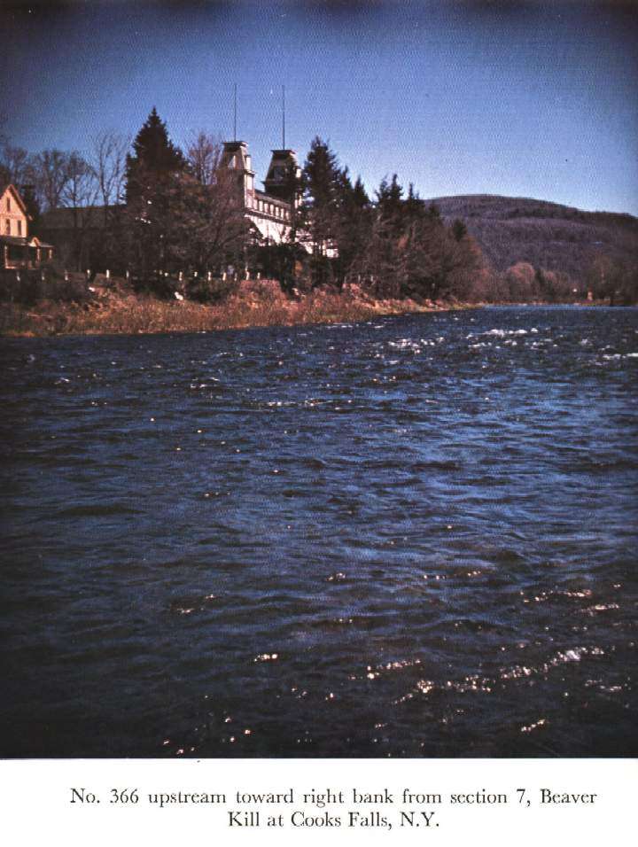
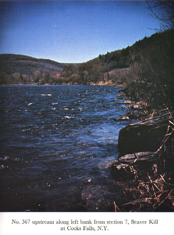
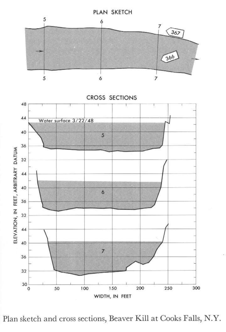 Location
.-- Lat 41°56'50", long 74°58'45", near Cooks Falls, New York.
Description of channel.--
| Date of observation | Average depth (ft) | Average surface width (ft) | Discharge (ft3/s) | Average cross section area (ft2) | Hydraulic radius (ft) | Mean velocity (ft/s) | Slope | Coefficient of roughness n |
|---|
| Mar. 22, 1948 |
7.40 |
--- |
15493.5 |
1650.0 |
7.27 |
9.390 |
0.003381 |
0.033 |
02100500 Deep River at Ramseur, N.C.
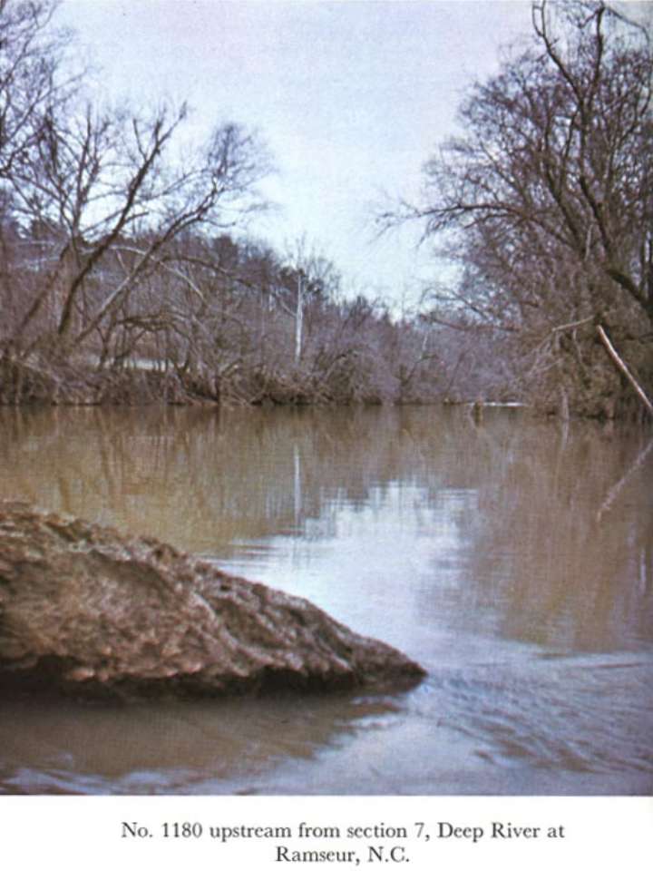
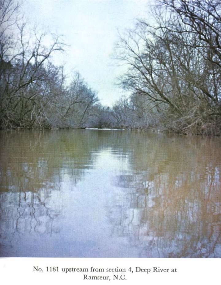
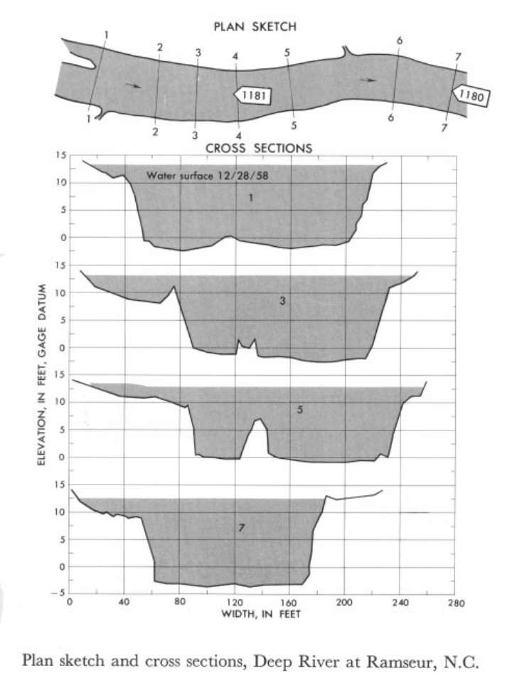 Location
.-- Lat 35°44'__", long 79°30'__", near Ramseur, North Carolina.
Description of channel.--
| Date of observation | Average depth (ft) | Average surface width (ft) | Discharge (ft3/s) | Average cross section area (ft2) | Hydraulic radius (ft) | Mean velocity (ft/s) | Slope | Coefficient of roughness n |
|---|
| Dec. 28, 1958 |
10.37 |
--- |
8342.1 |
2214.4 |
9.77 |
3.767 |
0.000768 |
0.049 |
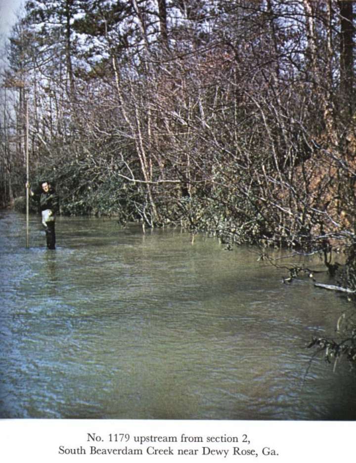
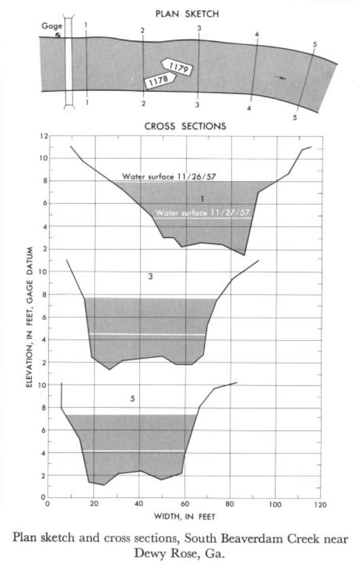
02188500 South Beaverdam Creek near Dewy Rose, Ga.
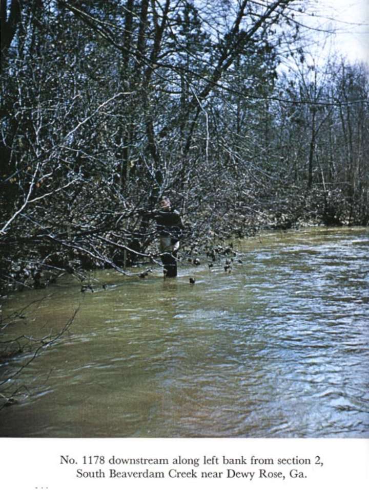
 Location
.-- Lat 34°11'__", long 82°57'__", near Dewy Rose, Georgia.
Description of channel.--
| Date of observation | Average depth (ft) | Average surface width (ft) | Discharge (ft3/s) | Average cross section area (ft2) | Hydraulic radius (ft) | Mean velocity (ft/s) | Slope | Coefficient of roughness n |
|---|
| Nov. 26, 1957 |
4.58 |
--- |
821.1 |
275.0 |
4.29 |
2.986 |
0.001596 |
0.052 |
| Nov. 27, 1957 |
2.24 |
--- |
224.0 |
107.2 |
2.15 |
2.090 |
0.001525 |
0.047 |
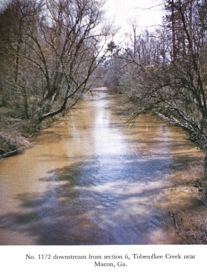
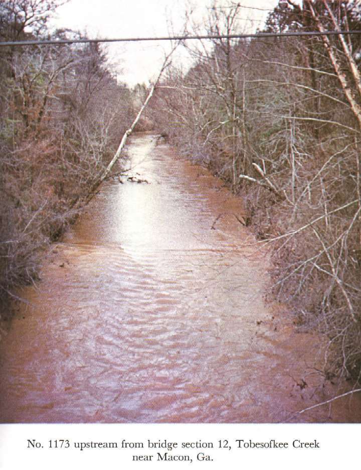
02213500 Tobesofkee Creek near Macon
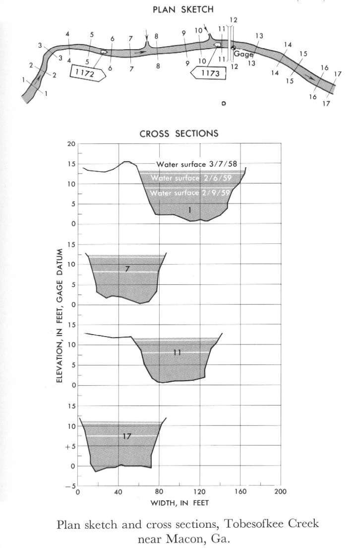 Location
.-- Lat 32°48'__", long 83°46'__", near Macon, Georgia.
Description of channel.--
| Date of observation | Average depth (ft) | Average surface width (ft) | Discharge (ft3/s) | Average cross section area (ft2) | Hydraulic radius (ft) | Mean velocity (ft/s) | Slope | Coefficient of roughness n |
|---|
| Mar. 7, 1958 |
6.22 |
--- |
1267.8 |
424.0 |
5.53 |
2.990 |
0.000729 |
0.043 |
| Feb. 6, 1959 |
8.66 |
--- |
2251.1 |
676.0 |
7.55 |
3.330 |
0.000707 |
0.041 |
| Feb. 9, 1959 |
9.02 |
--- |
2544.9 |
739.8 |
7.90 |
3.440 |
0.000771 |
0.039 |
02217500 Middle Oconee River near Athens, Ga.
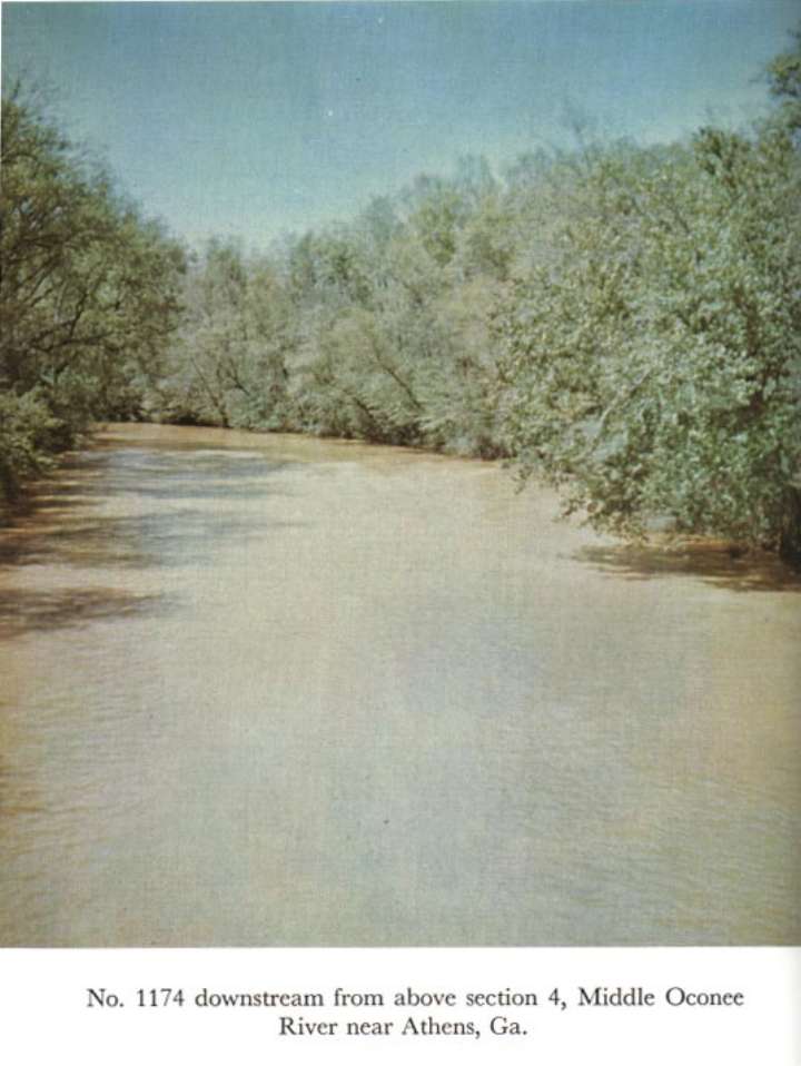
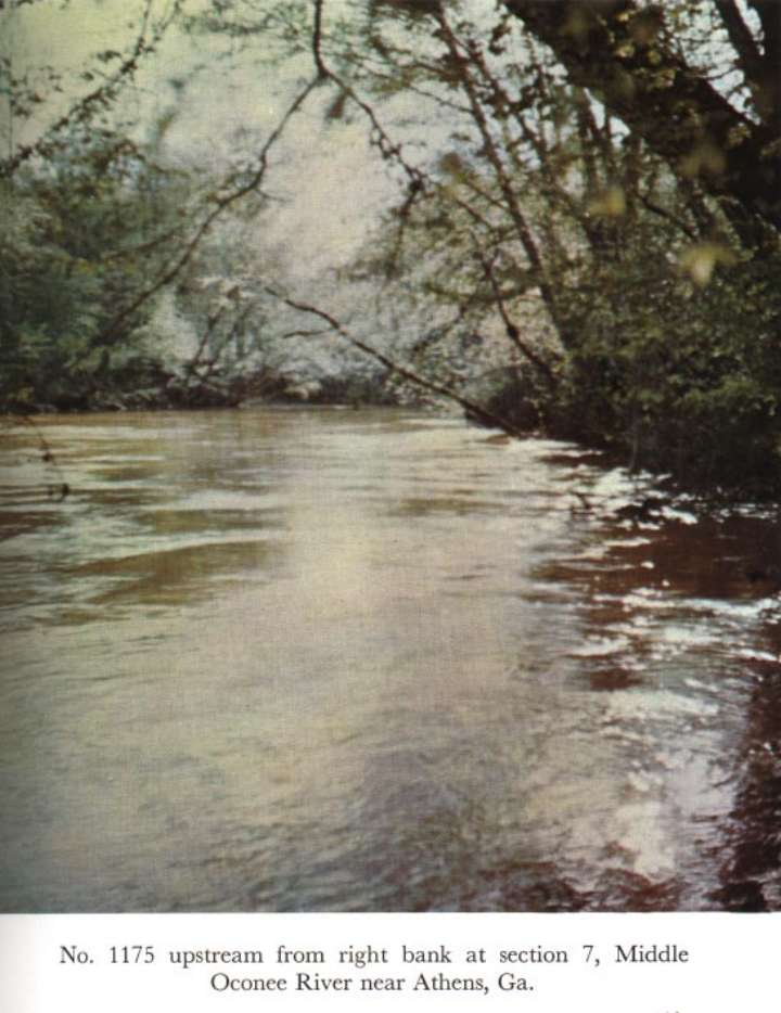
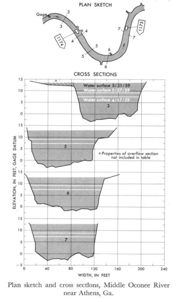 Location
.-- Lat 33°58'__", long 83°25'__", near Athens, Georgia.
Description of channel.--
| Date of observation | Average depth (ft) | Average surface width (ft) | Discharge (ft3/s) | Average cross section area (ft2) | Hydraulic radius (ft) | Mean velocity (ft/s) | Slope | Coefficient of roughness n |
|---|
| May 31, 1959 |
10.90 |
--- |
6114.3 |
1524.0 |
10.11 |
4.012 |
0.000467 |
0.042 |
| May 27, 1959 |
8.68 |
--- |
3140.8 |
976.0 |
8.10 |
3.218 |
0.000518 |
0.041 |
| Apr. 17, 1959 |
7.28 |
--- |
2216.9 |
780.6 |
6.84 |
2.840 |
0.000588 |
0.044 |
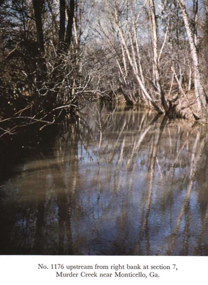
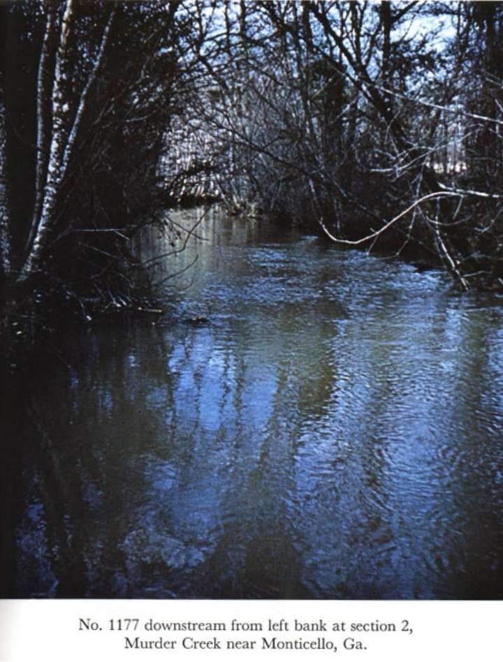
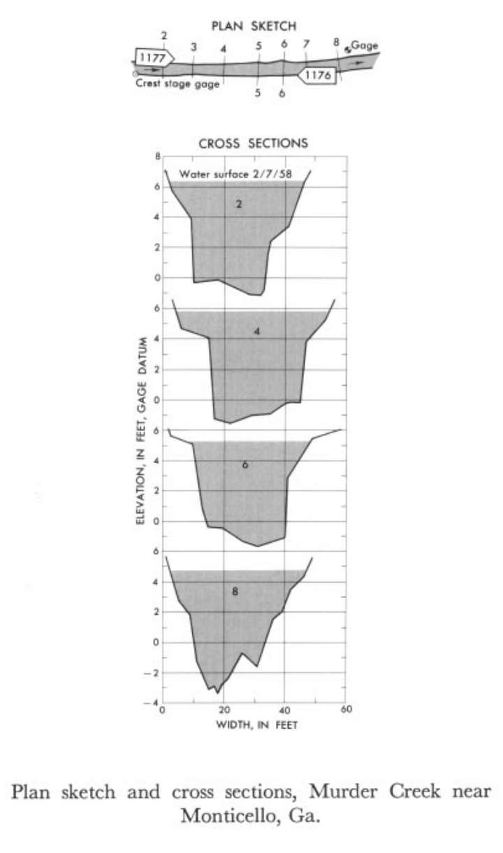
02221000 Murder Creek near Monticello, Ga.
 Location
.-- Lat 33°25'__", long 83°40'__", near Monticello, Georgia.
Description of channel.--
| Date of observation | Average depth (ft) | Average surface width (ft) | Discharge (ft3/s) | Average cross section area (ft2) | Hydraulic radius (ft) | Mean velocity (ft/s) | Slope | Coefficient of roughness n |
|---|
| Feb. 7, 1958 |
4.60 |
--- |
848.7 |
205.9 |
3.97 |
4.123 |
0.002674 |
0.045 |
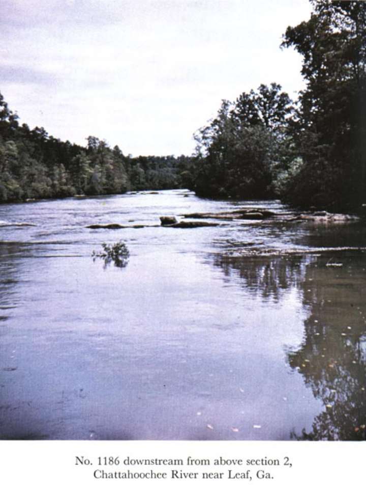
02331000 Chattahoochee River near Leaf, Ga.
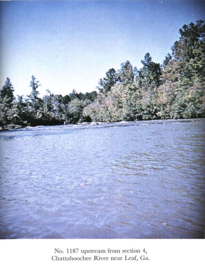
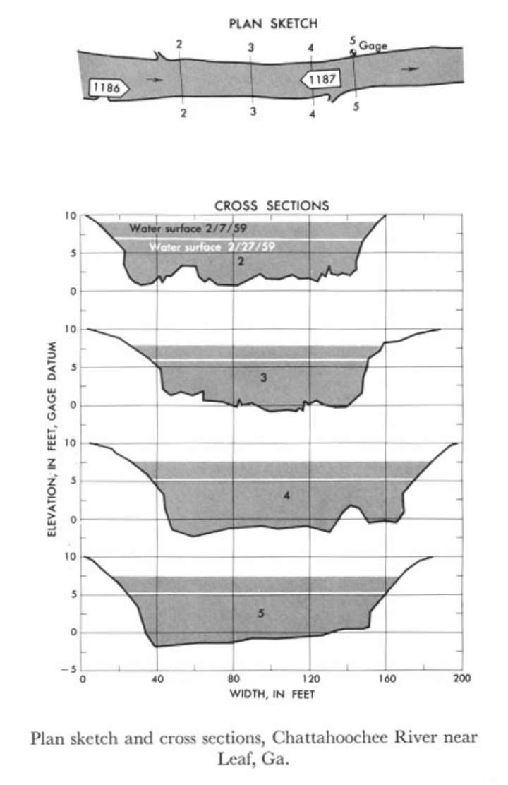 Location
.-- Lat 34°35'__", long 83°38'__", near Leaf, Georgia.
Description of channel.--
| Date of observation | Average depth (ft) | Average surface width (ft) | Discharge (ft3/s) | Average cross section area (ft2) | Hydraulic radius (ft) | Mean velocity (ft/s) | Slope | Coefficient of roughness n |
|---|
| Feb. 7, 1959 |
7.70 |
--- |
17518.7 |
1135.0 |
7.41 |
15.435 |
0.002428 |
0.051 |
| Feb. 27, 1959 |
6.25 |
--- |
2541.4 |
810.0 |
6.04 |
3.138 |
0.002775 |
0.074 |
02935000 Haw River near Benaja, N.C.
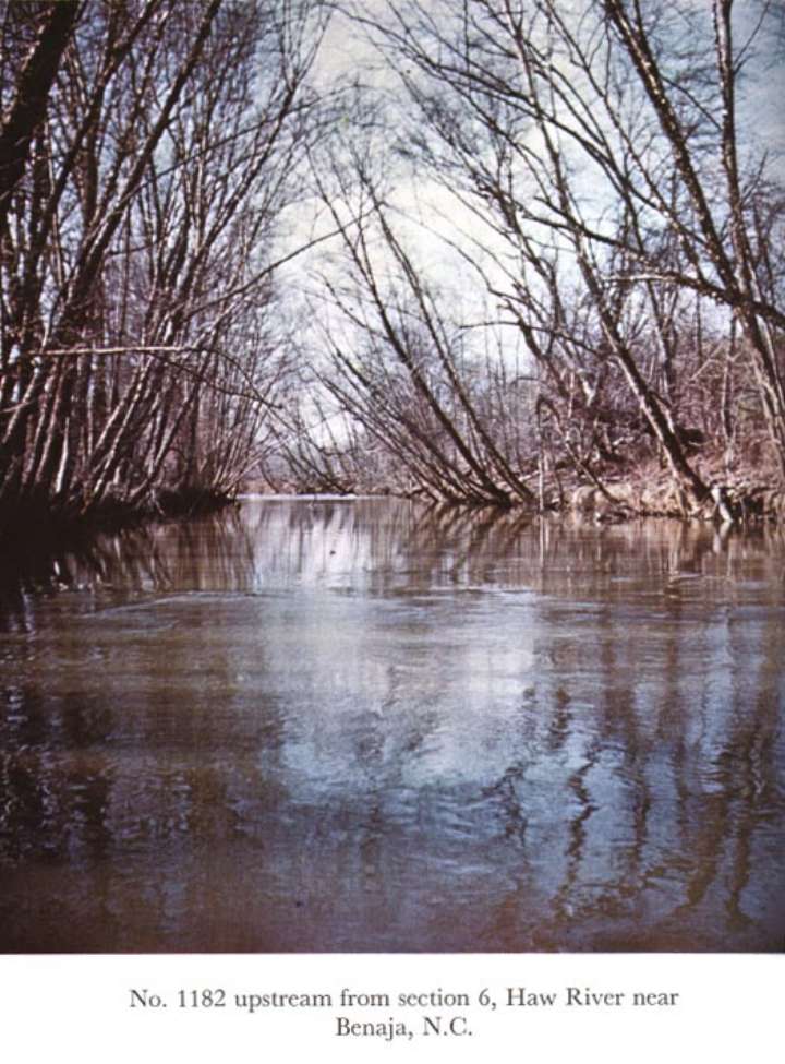
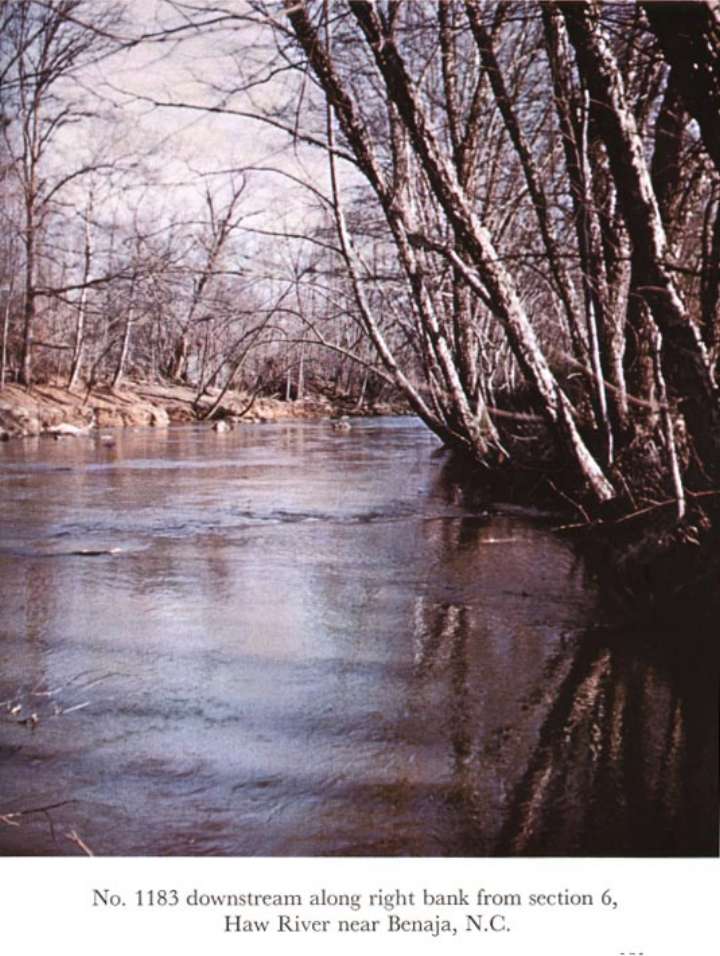
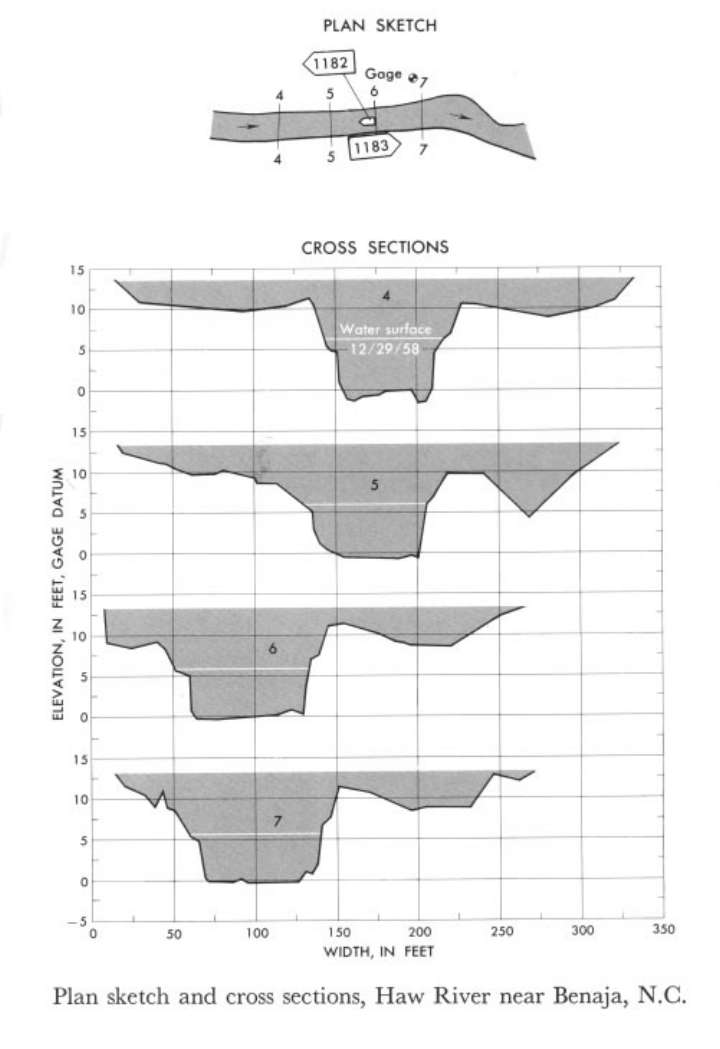 Location
.-- Lat 36°16'__", long 79°34'__", near Benaja, North Carolina.
Description of channel.--
| Date of observation | Average depth (ft) | Average surface width (ft) | Discharge (ft3/s) | Average cross section area (ft2) | Hydraulic radius (ft) | Mean velocity (ft/s) | Slope | Coefficient of roughness n |
|---|
| Dec. 29, 1958 |
5.28 |
--- |
1000.5 |
404.2 |
4.87 |
2.475 |
0.001152 |
0.059 |
03121500 Indian Fork below Atwood Dam
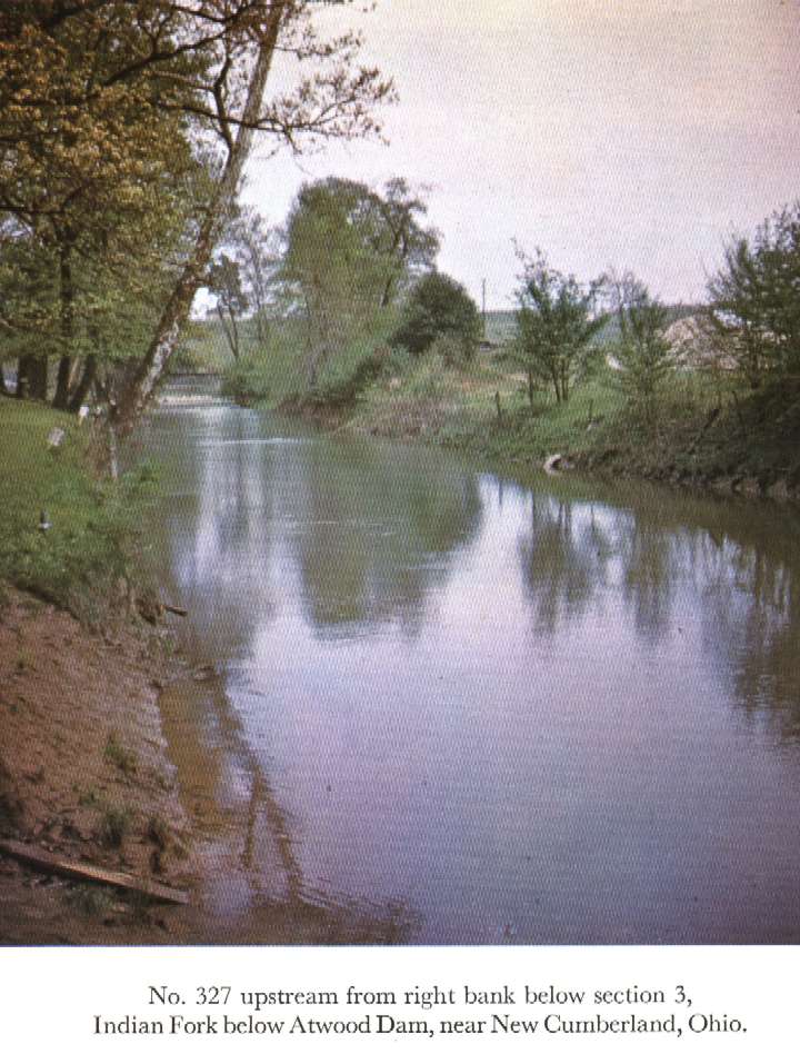
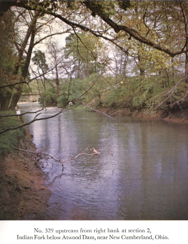
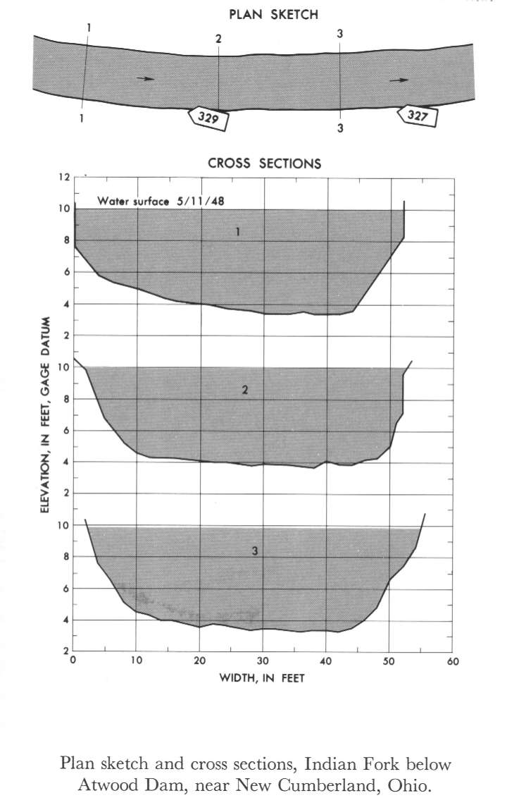 Location
.-- Lat 40°31'30", long 81°17'20", near New Cumberland, Ohio.
Description of channel.--
| Date of observation | Average depth (ft) | Average surface width (ft) | Discharge (ft3/s) | Average cross section area (ft2) | Hydraulic radius (ft) | Mean velocity (ft/s) | Slope | Coefficient of roughness n |
|---|
| May 11, 1948 |
5.40 |
--- |
767.3 |
277.0 |
4.87 |
2.770 |
0.000283 |
0.026 |
03301500 Rolling Fork near Boston, Ky.
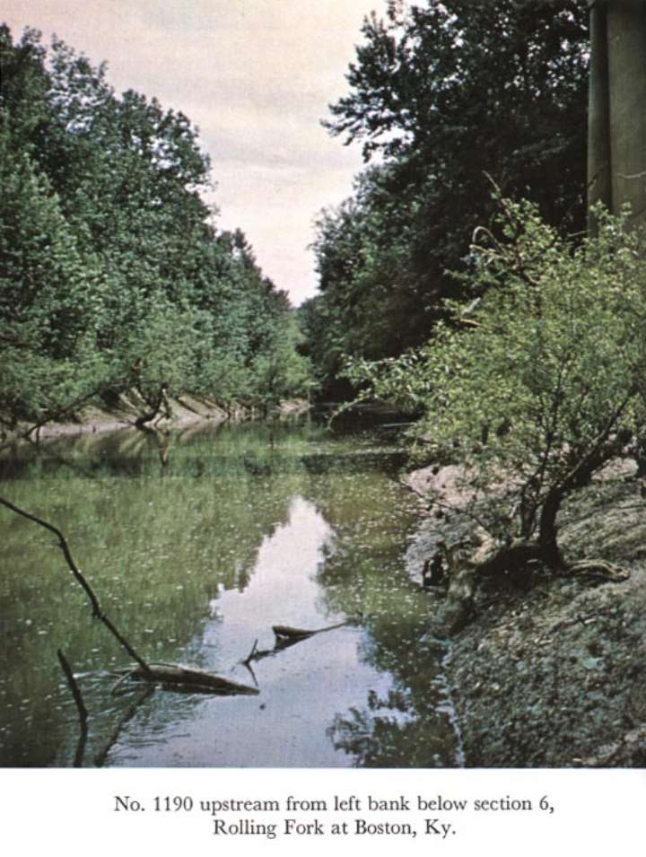
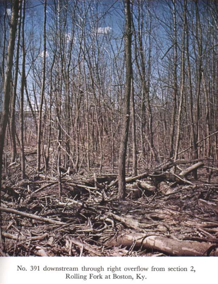
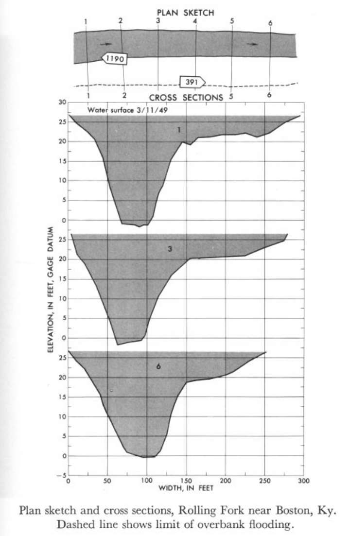 Location
.-- Lat 37°46'02", long 85°42'14", near Boston, Kentucky.
Description of channel.--
| Date of observation | Average depth (ft) | Average surface width (ft) | Discharge (ft3/s) | Average cross section area (ft2) | Hydraulic radius (ft) | Mean velocity (ft/s) | Slope | Coefficient of roughness n |
|---|
| Mar. 11, 1949 |
13.97 |
--- |
5780.2 |
2428.7 |
15.45 |
2.380 |
0.000158 |
0.046 |
| Mar. 11, 1949 |
4.85 |
--- |
325.8 |
603.3 |
4.85 |
0.540 |
0.000158 |
0.097 |
03302000 Pond Creek near Louisville, Ky.
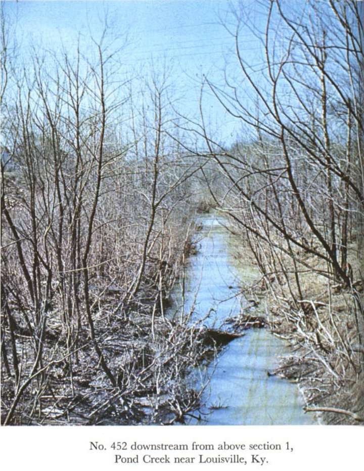
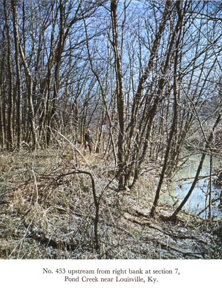
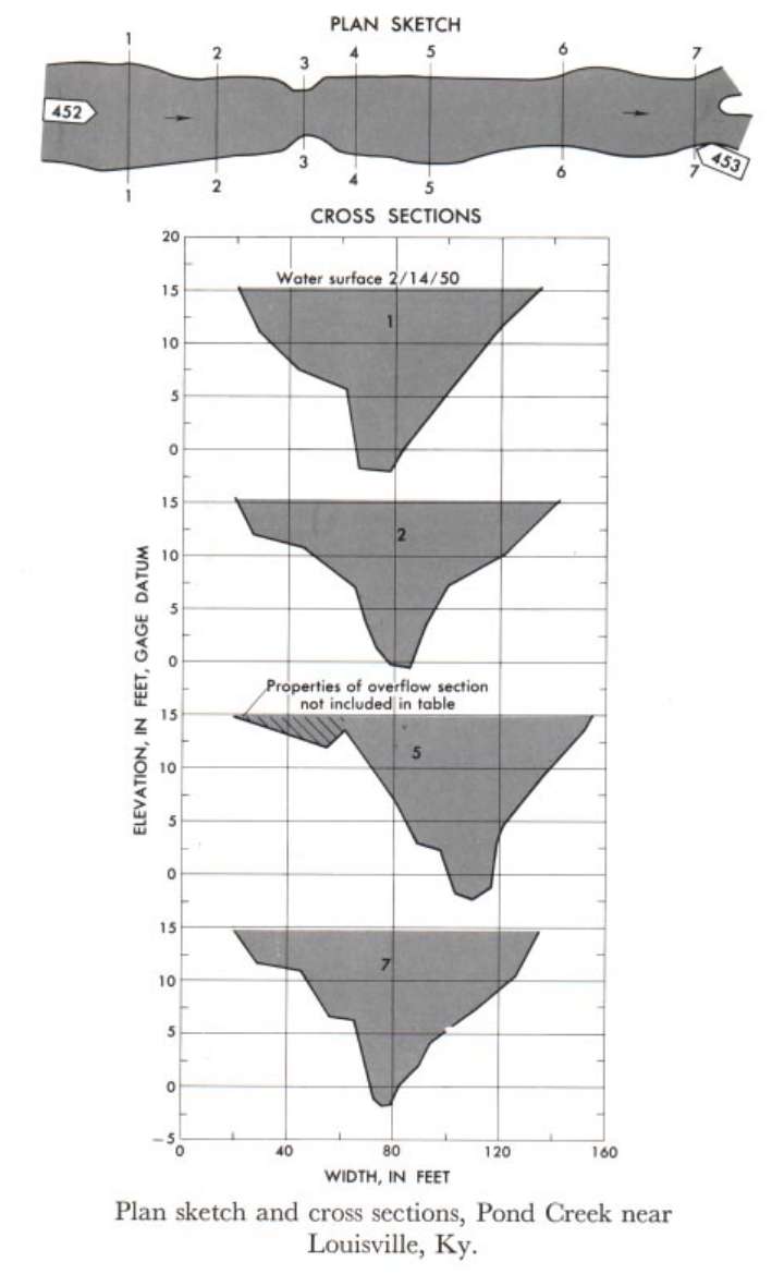 Location
.-- Lat 38°07'11", long 85°47'45", near Louisville, Kentucky.
Description of channel.--
| Date of observation | Average depth (ft) | Average surface width (ft) | Discharge (ft3/s) | Average cross section area (ft2) | Hydraulic radius (ft) | Mean velocity (ft/s) | Slope | Coefficient of roughness n |
|---|
| Feb. 14, 1950 |
5.22 |
--- |
1503.0 |
801.3 |
7.24 |
1.876 |
0.000637 |
0.070 |
03336645 Middle Fork Vermilion River near Danville
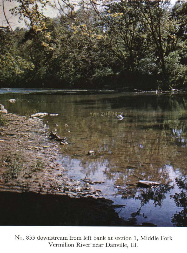
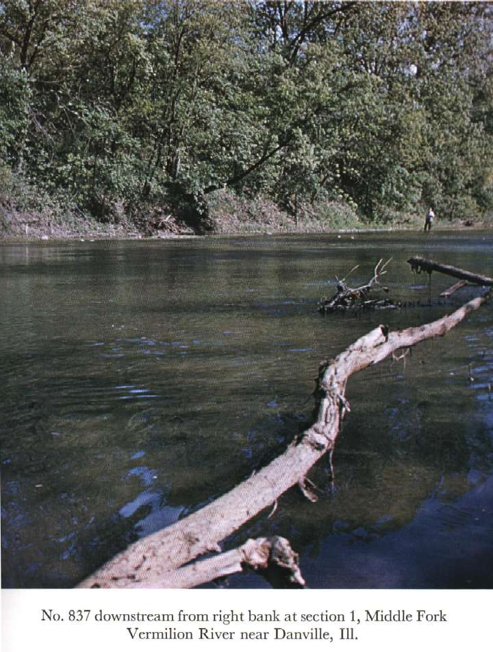
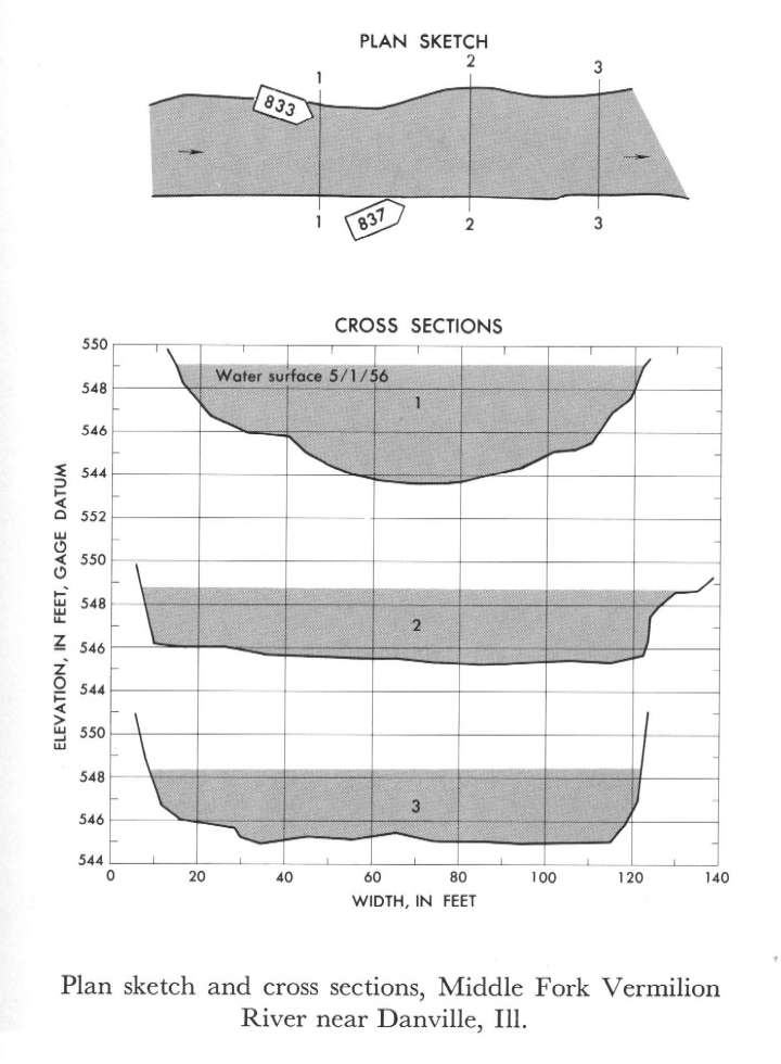 Location
.-- Lat 40°08'14", long 87°44'45", near Danville, Illinois.
Description of channel.--
| Date of observation | Average depth (ft) | Average surface width (ft) | Discharge (ft3/s) | Average cross section area (ft2) | Hydraulic radius (ft) | Mean velocity (ft/s) | Slope | Coefficient of roughness n |
|---|
| May 1, 1956 |
3.27 |
--- |
1632.1 |
378.7 |
3.22 |
4.310 |
0.003100 |
0.037 |
03337250 Boneyard Creek at Race St. at Urbana, Ill
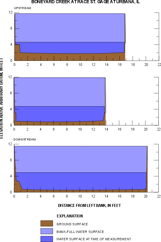

 Location
.-- Lat 40°06'53", long 88°12'33", near Urbana, Illinois.
Description of channel.--
| Date of observation | Average depth (ft) | Average surface width (ft) | Discharge (ft3/s) | Average cross section area (ft2) | Hydraulic radius (ft) | Mean velocity (ft/s) | Slope | Coefficient of roughness n |
|---|
| Oct. 25, 2001 |
4.17 |
--- |
303.5 |
79.2 |
3.96 |
3.900 |
0.000504 |
0.021 |
03448500 Hominy Creek at Candler, N.C.
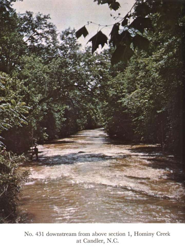
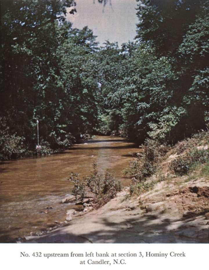
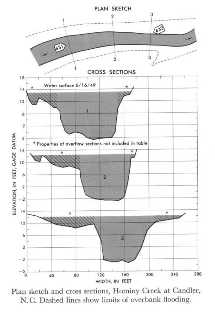 Location
.-- Lat 35°32'28", long 82°40'35", near Candler, North Carolina.
Description of channel.--
| Date of observation | Average depth (ft) | Average surface width (ft) | Discharge (ft3/s) | Average cross section area (ft2) | Hydraulic radius (ft) | Mean velocity (ft/s) | Slope | Coefficient of roughness n |
|---|
| June 16, 1949 |
12.60 |
--- |
6480.8 |
1216.7 |
11.56 |
5.327 |
0.002000 |
0.060 |
04275000 East Branch Ausable River at Au Sable Forks, N.Y.
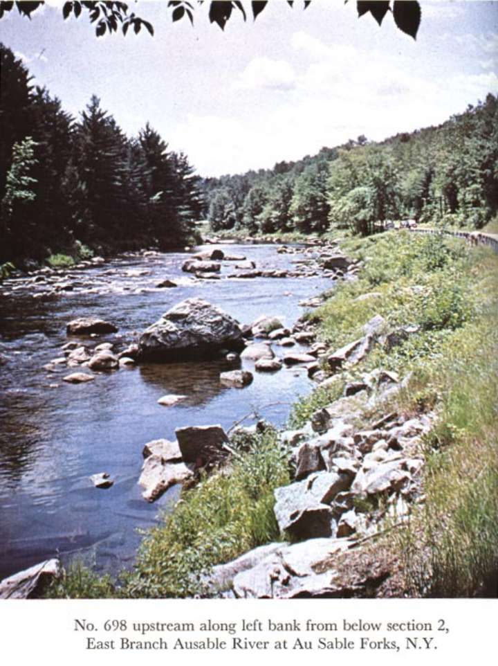
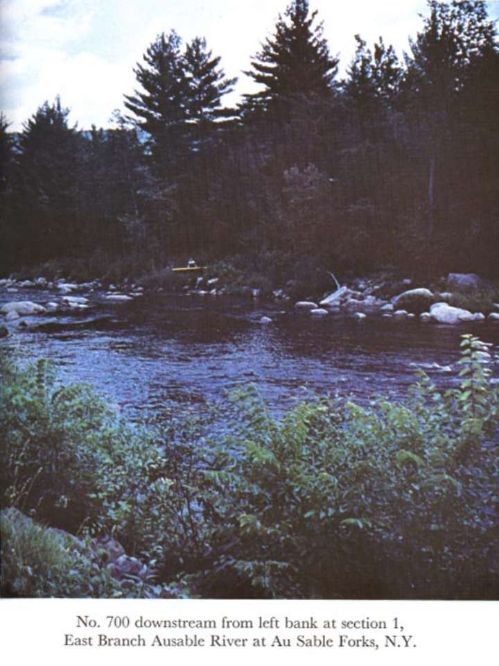
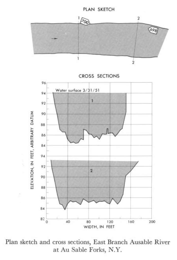 Location
.-- Lat 44°26'20", long 73°40'55", near Au Sable Forks, New York.
Description of channel.--
| Date of observation | Average depth (ft) | Average surface width (ft) | Discharge (ft3/s) | Average cross section area (ft2) | Hydraulic radius (ft) | Mean velocity (ft/s) | Slope | Coefficient of roughness n |
|---|
| Mar. 31, 1951 |
7.10 |
--- |
7773.6 |
1070.0 |
6.72 |
7.265 |
0.005618 |
0.055 |
06394000 Beaver Creek near Newcastle, Wyo.
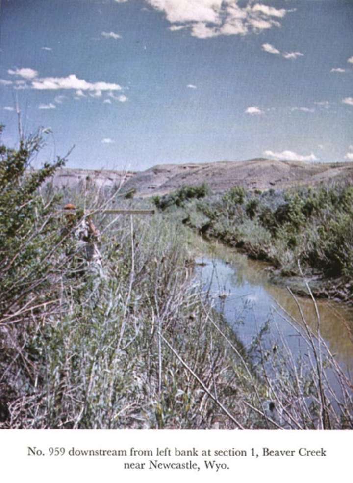
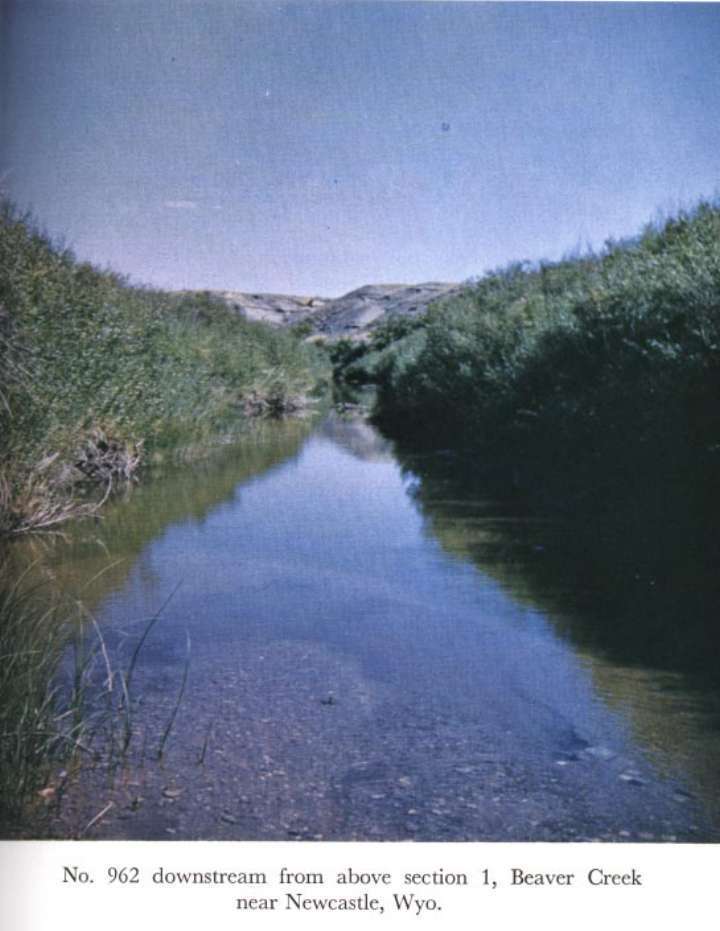
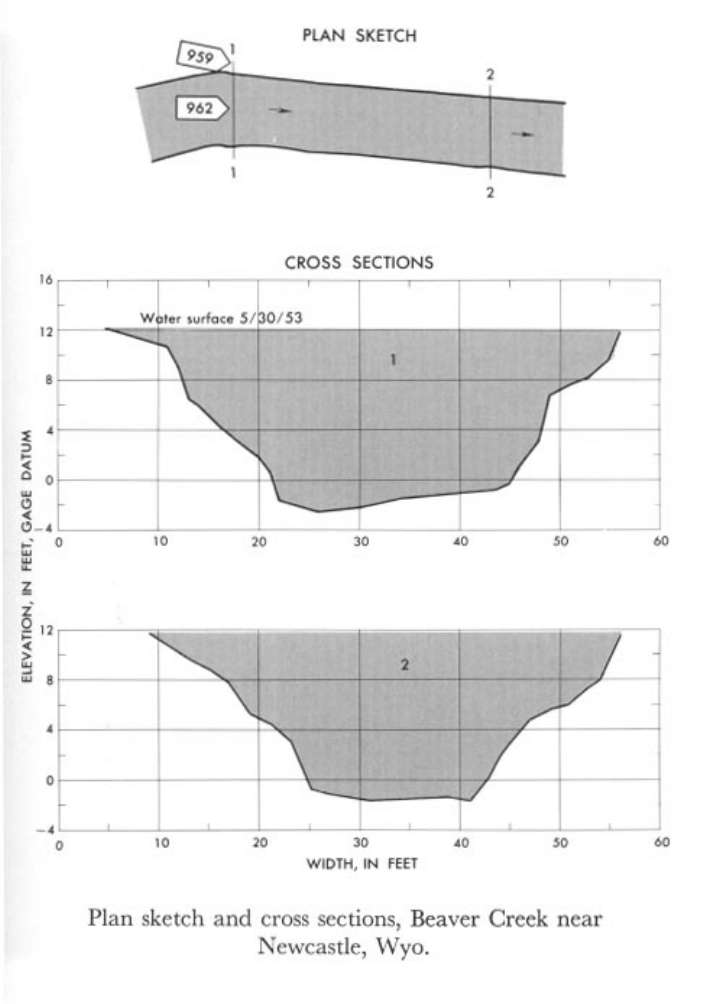 Location
.-- Lat 43°32'05", long 104°07'00", near Newcastle, Wyoming.
Description of channel.--
| Date of observation | Average depth (ft) | Average surface width (ft) | Discharge (ft3/s) | Average cross section area (ft2) | Hydraulic radius (ft) | Mean velocity (ft/s) | Slope | Coefficient of roughness n |
|---|
| May 30, 1953 |
8.65 |
--- |
1615.0 |
425.0 |
6.94 |
3.800 |
0.001237 |
0.043 |
06719500 Clear Creek near Golden, Colo.
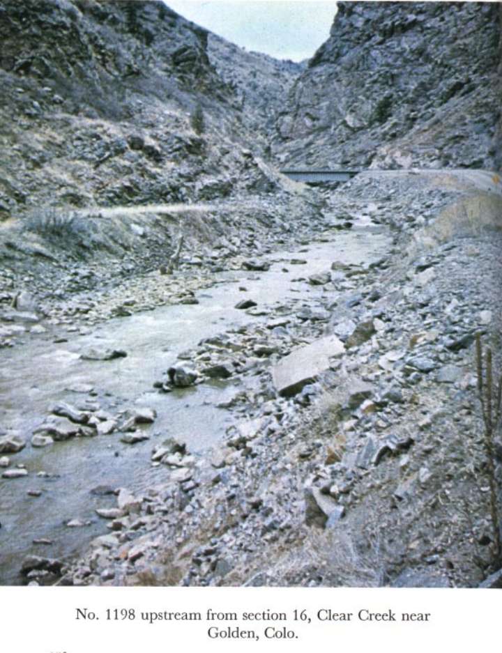
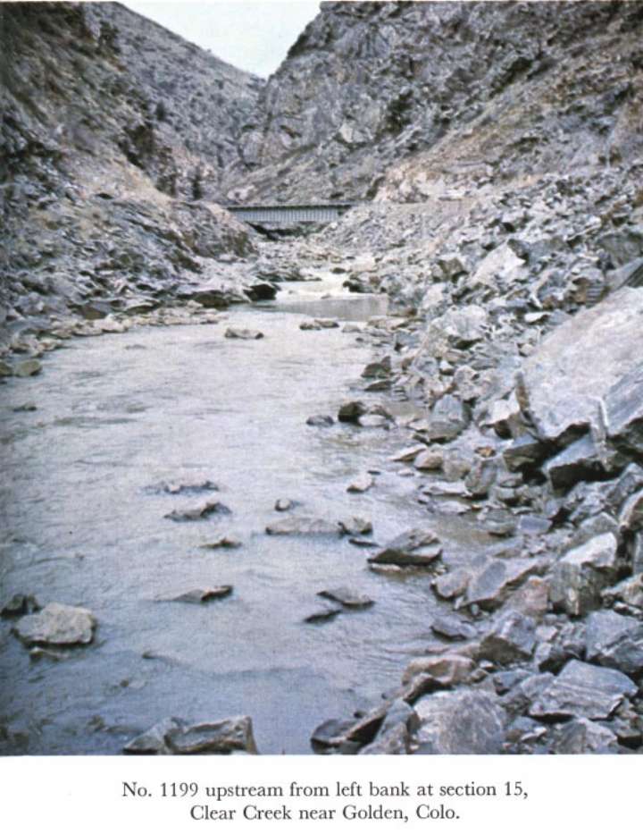
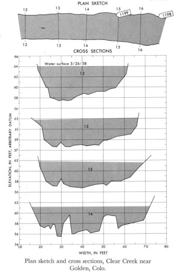 Location
.-- Lat 39°45'05", long 105°14'55", near Golden, Colorado.
Description of channel.--
| Date of observation | Average depth (ft) | Average surface width (ft) | Discharge (ft3/s) | Average cross section area (ft2) | Hydraulic radius (ft) | Mean velocity (ft/s) | Slope | Coefficient of roughness n |
|---|
| May 26, 1958 |
3.82 |
--- |
1383.4 |
191.4 |
3.48 |
7.228 |
0.016768 |
0.050 |
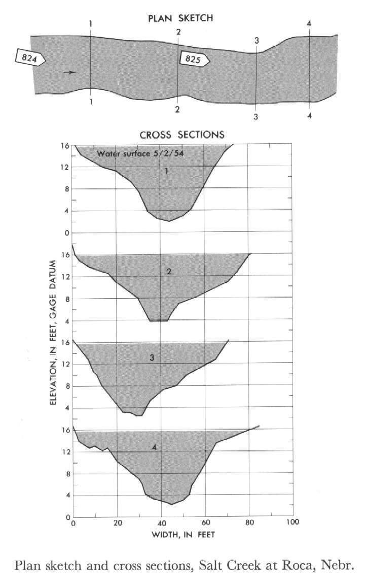
06803000 Salt Creek at Roca
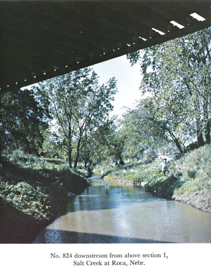
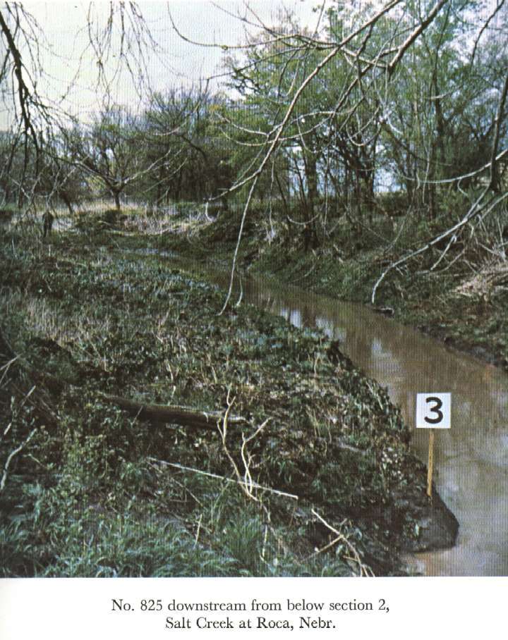
 Location
.-- Lat 40°39'33", long 96°39'39", near Roca, Nebraska.
Description of channel.--
| Date of observation | Average depth (ft) | Average surface width (ft) | Discharge (ft3/s) | Average cross section area (ft2) | Hydraulic radius (ft) | Mean velocity (ft/s) | Slope | Coefficient of roughness n |
|---|
| May 2, 1954 |
6.83 |
--- |
1853.2 |
506.0 |
6.28 |
3.663 |
0.000560 |
0.030 |
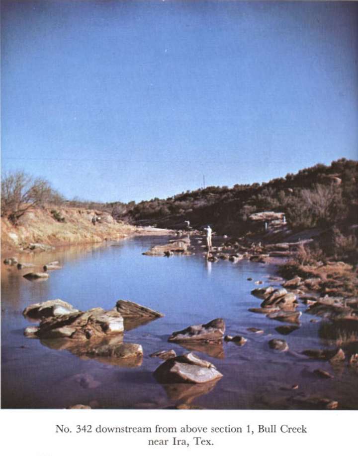
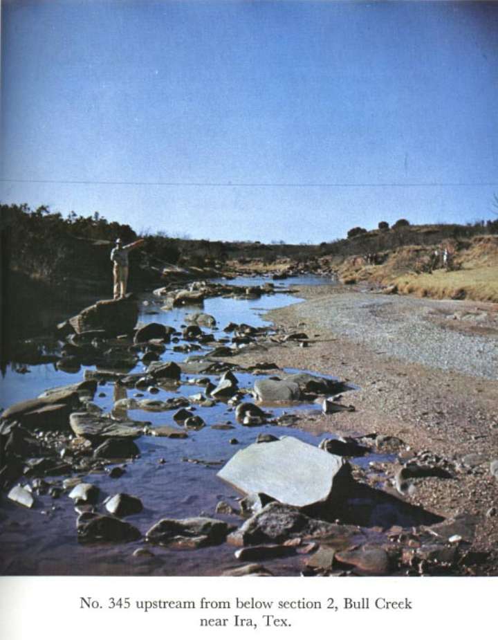
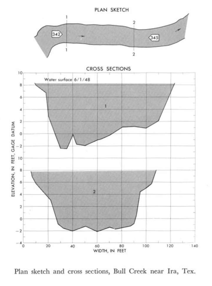
08118500 Bull Creek near Ira
 Location
.-- Lat 32°36'02", long 101°05'40", near Ira, Texas.
Description of channel.--
| Date of observation | Average depth (ft) | Average surface width (ft) | Discharge (ft3/s) | Average cross section area (ft2) | Hydraulic radius (ft) | Mean velocity (ft/s) | Slope | Coefficient of roughness n |
|---|
| June 1, 1948 |
7.20 |
--- |
3230.2 |
776.5 |
6.83 |
4.160 |
0.001206 |
0.041 |
08123500 Champlin Creek near Colorado City
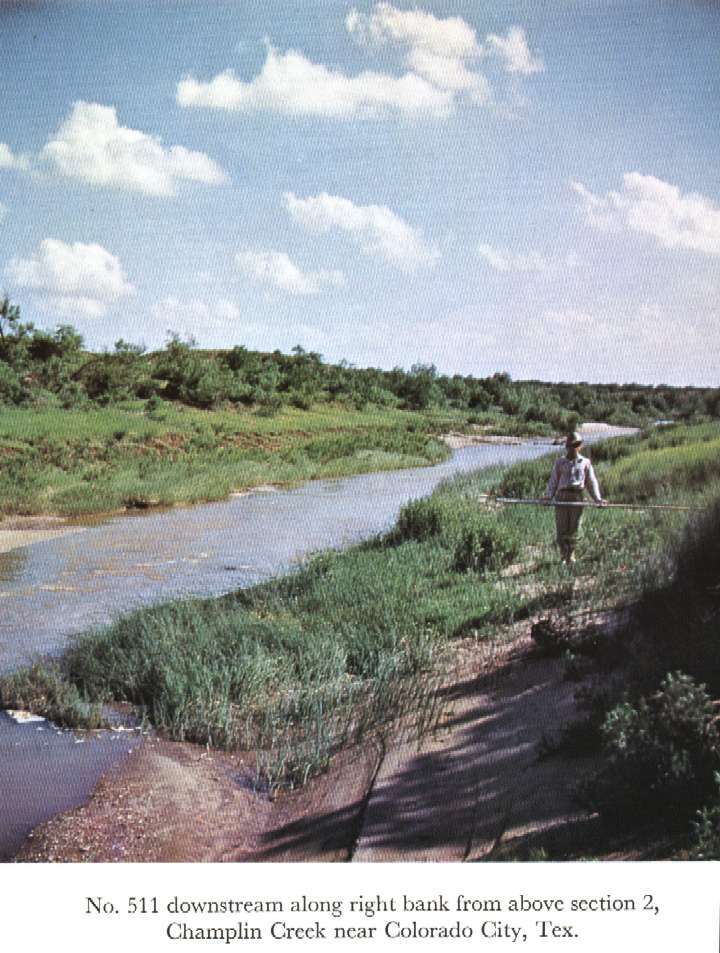
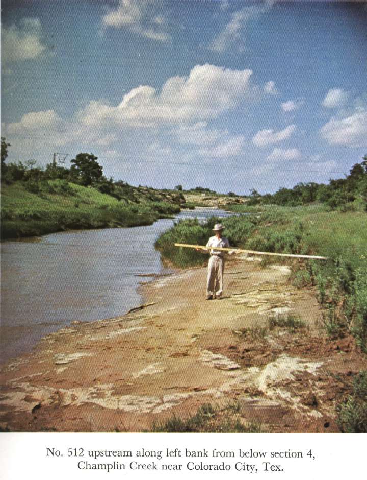
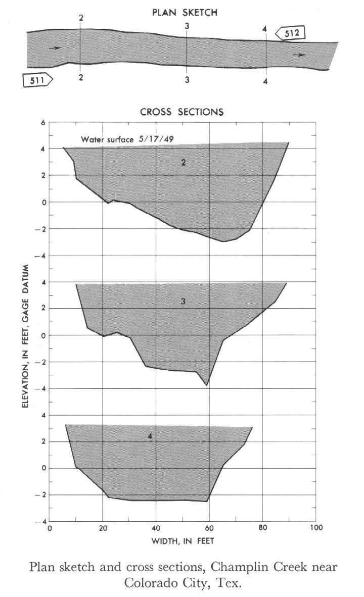 Location
.-- Lat 32°19'__", long 100°49'__", near Colorado City, Texas.
Description of channel.--
| Date of observation | Average depth (ft) | Average surface width (ft) | Discharge (ft3/s) | Average cross section area (ft2) | Hydraulic radius (ft) | Mean velocity (ft/s) | Slope | Coefficient of roughness n |
|---|
| May 17, 1949 |
4.53 |
--- |
2427.2 |
354.3 |
4.38 |
6.850 |
0.003519 |
0.027 |
08290000 Rio Chama near Chamita
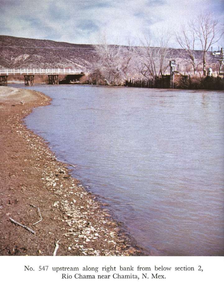
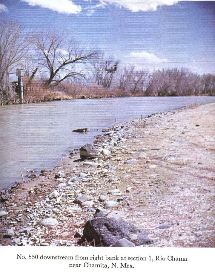
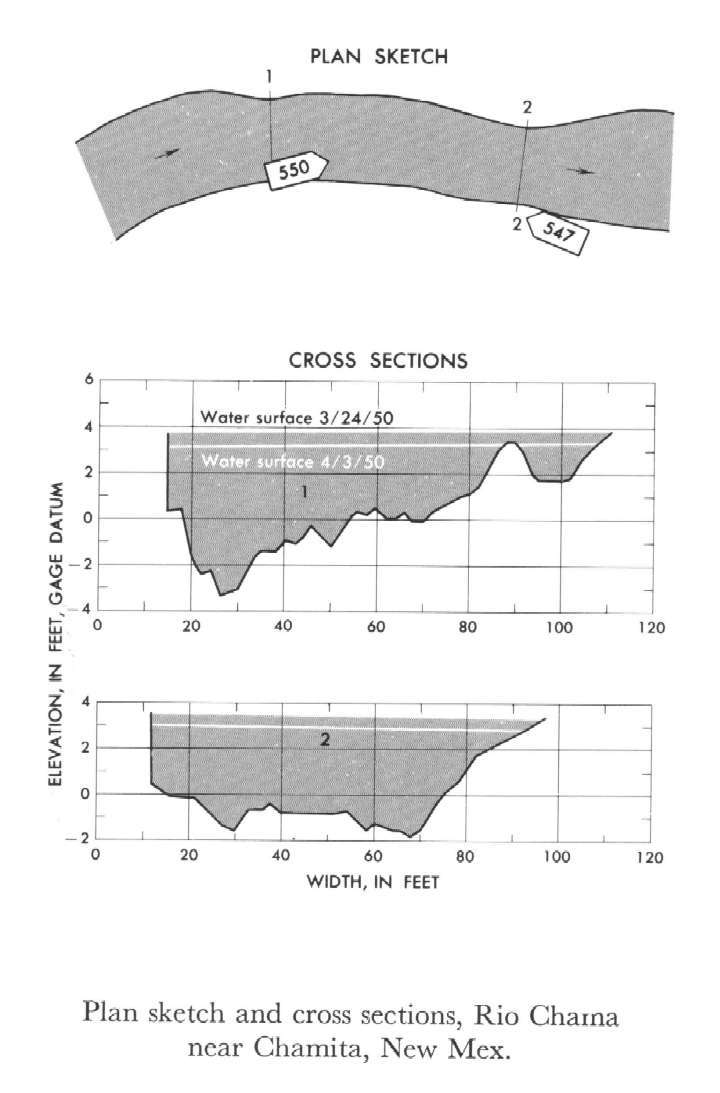 Location
.-- Lat 36°04'25", long 106°06'39", near Chamita, New Mexico.
Description of channel.--
| Date of observation | Average depth (ft) | Average surface width (ft) | Discharge (ft3/s) | Average cross section area (ft2) | Hydraulic radius (ft) | Mean velocity (ft/s) | Slope | Coefficient of roughness n |
|---|
| Mar. 24, 1950 |
3.40 |
--- |
1062.7 |
304.5 |
3.29 |
3.490 |
0.001188 |
0.032 |
| Mar. 24, 1950 |
2.85 |
--- |
684.9 |
242.0 |
2.74 |
2.830 |
0.001139 |
0.036 |
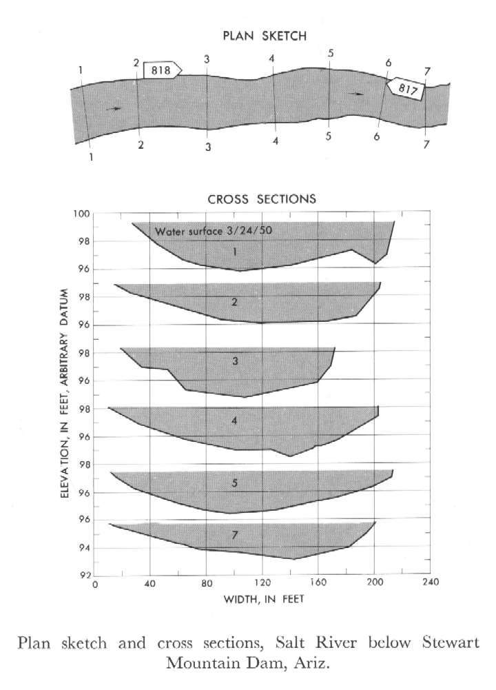
09502000 Salt River below Stewart Mountain Dam
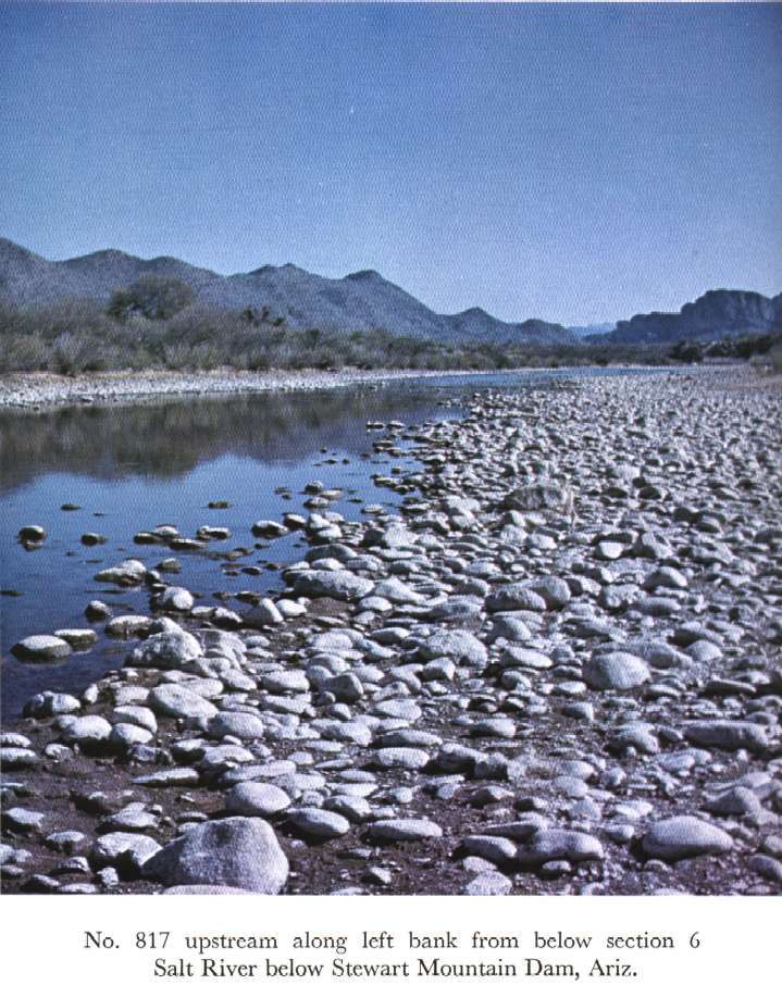
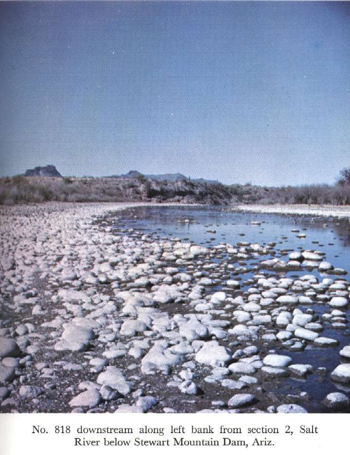
 Location
.-- Lat 33°33'00", long 111°34'31", near Stewart, Arizona.
Description of channel.--
| Date of observation | Average depth (ft) | Average surface width (ft) | Discharge (ft3/s) | Average cross section area (ft2) | Hydraulic radius (ft) | Mean velocity (ft/s) | Slope | Coefficient of roughness n |
|---|
| Mar. 24, 1950 |
2.18 |
--- |
1303.8 |
404.9 |
2.14 |
3.220 |
0.001903 |
0.032 |
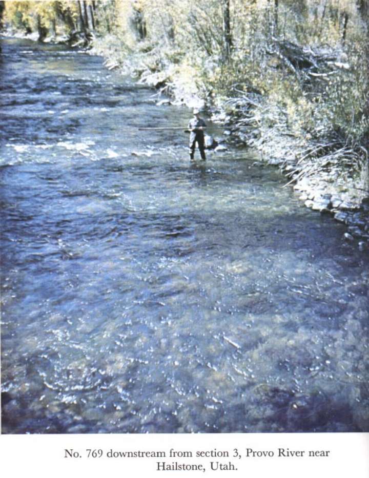
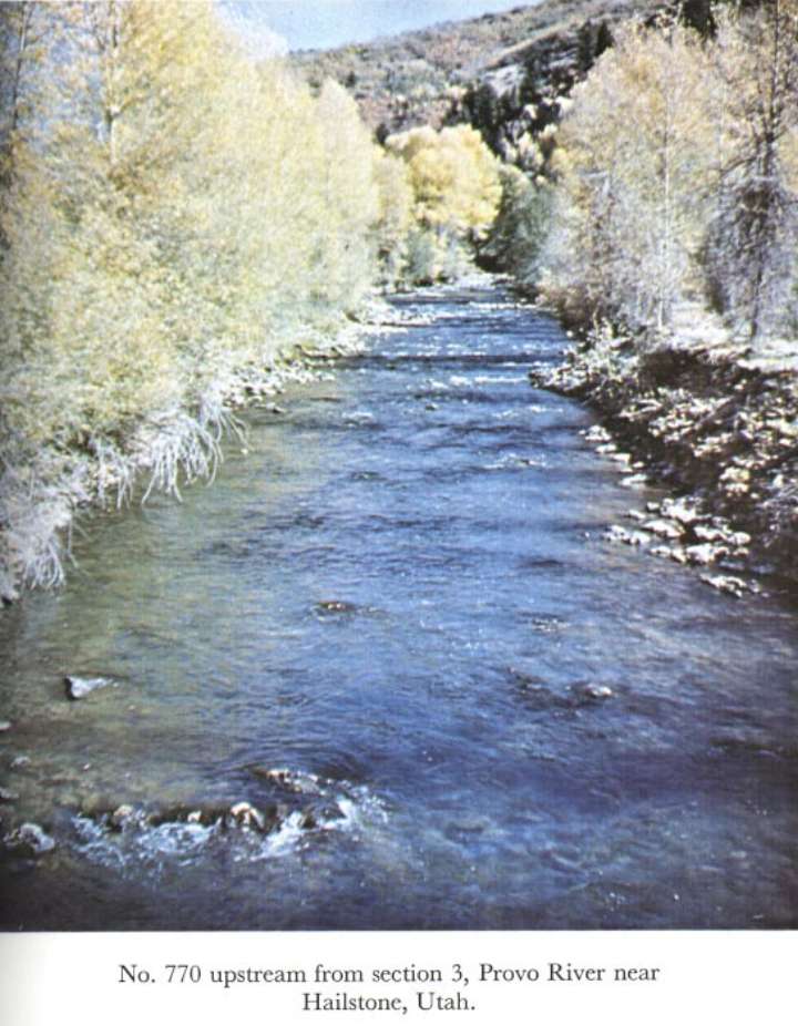
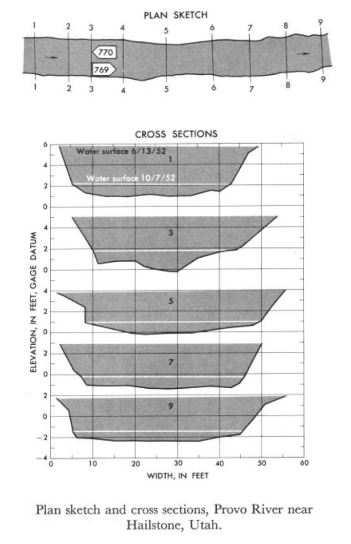
10155000 Provo River near Hailstone, Utah
 Location
.-- Lat 40°36'__", long 111°22'__", near Hailstone, Utah.
Description of channel.--
| Date of observation | Average depth (ft) | Average surface width (ft) | Discharge (ft3/s) | Average cross section area (ft2) | Hydraulic radius (ft) | Mean velocity (ft/s) | Slope | Coefficient of roughness n |
|---|
| June 13, 1952 |
3.48 |
--- |
1202.2 |
176.8 |
3.34 |
6.800 |
0.008953 |
0.045 |
| Oct. 7, 1952 |
0.98 |
--- |
64.9 |
34.6 |
0.90 |
1.876 |
0.008279 |
0.073 |
11264500 Merced River at Happy Isles Bridge, near Yosemite, Calif.
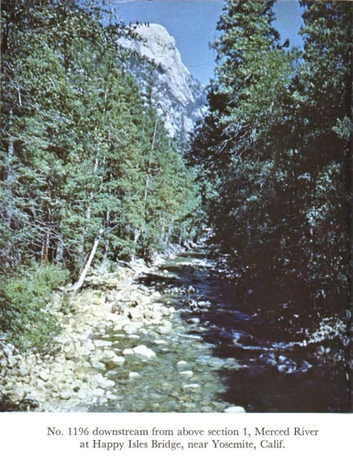
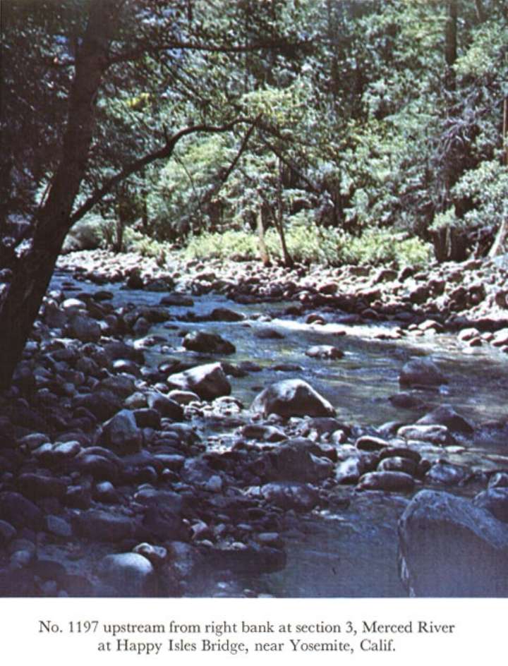
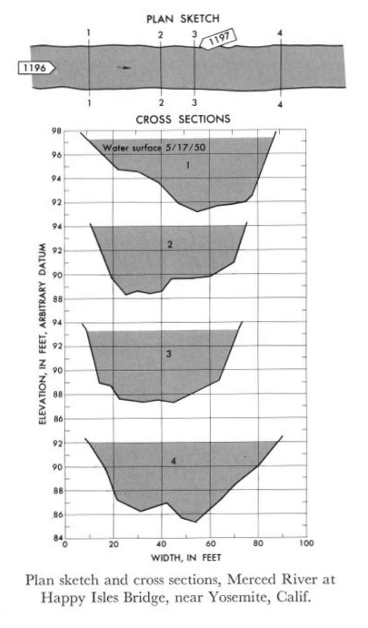 Location
.-- Lat 37°43'54", long 119°33'28", near Yosemite, California.
Description of channel.--
d50 = 253 mm.
d84 = 550 mm.
| Date of observation | Average depth (ft) | Average surface width (ft) | Discharge (ft3/s) | Average cross section area (ft2) | Hydraulic radius (ft) | Mean velocity (ft/s) | Slope | Coefficient of roughness n |
|---|
| May 17, 1950 |
4.30 |
--- |
1969.7 |
301.8 |
3.41 |
6.527 |
0.012976 |
0.065 |
11451000 Cache Creek near Lower Lake, Calif.
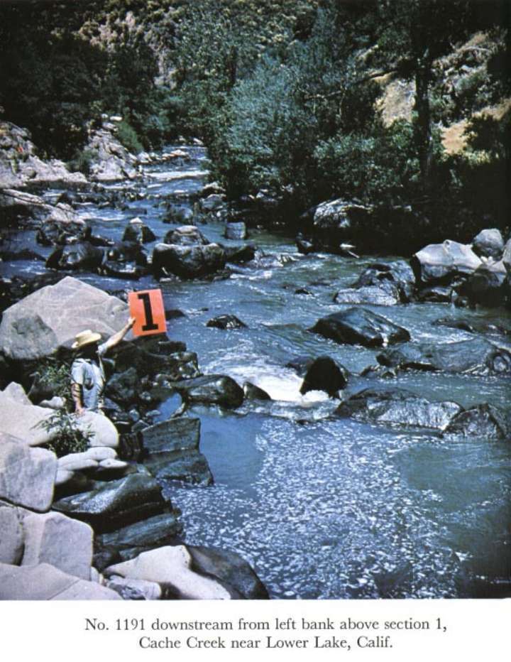
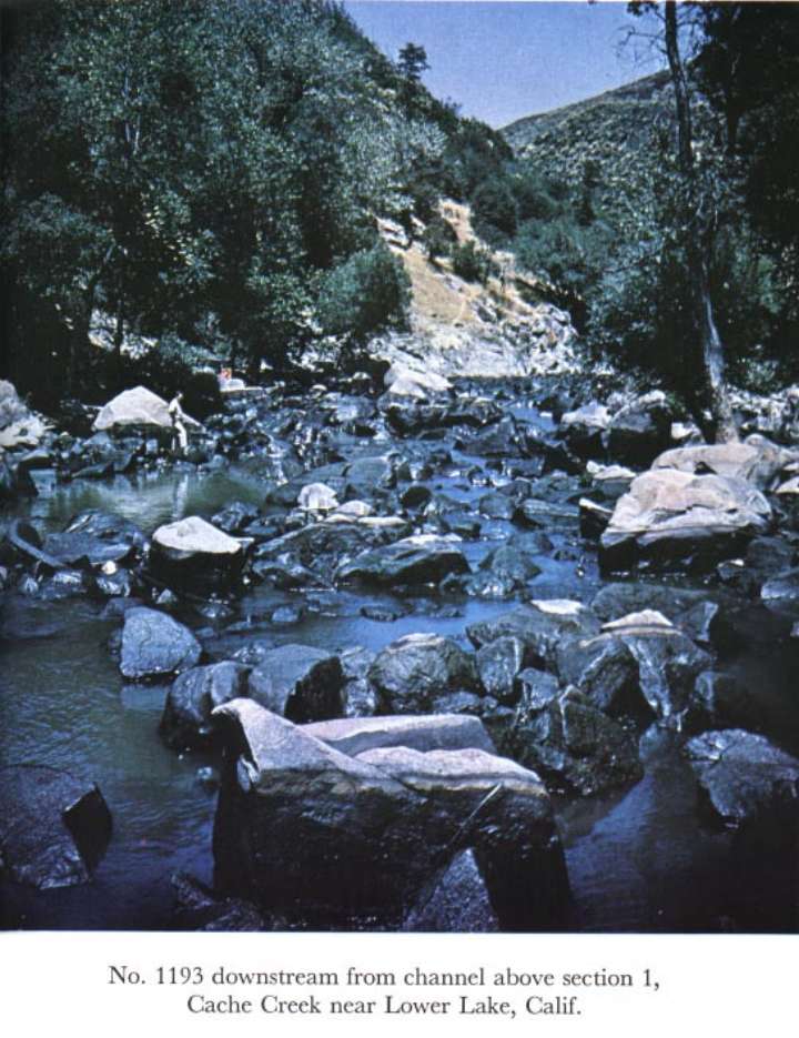
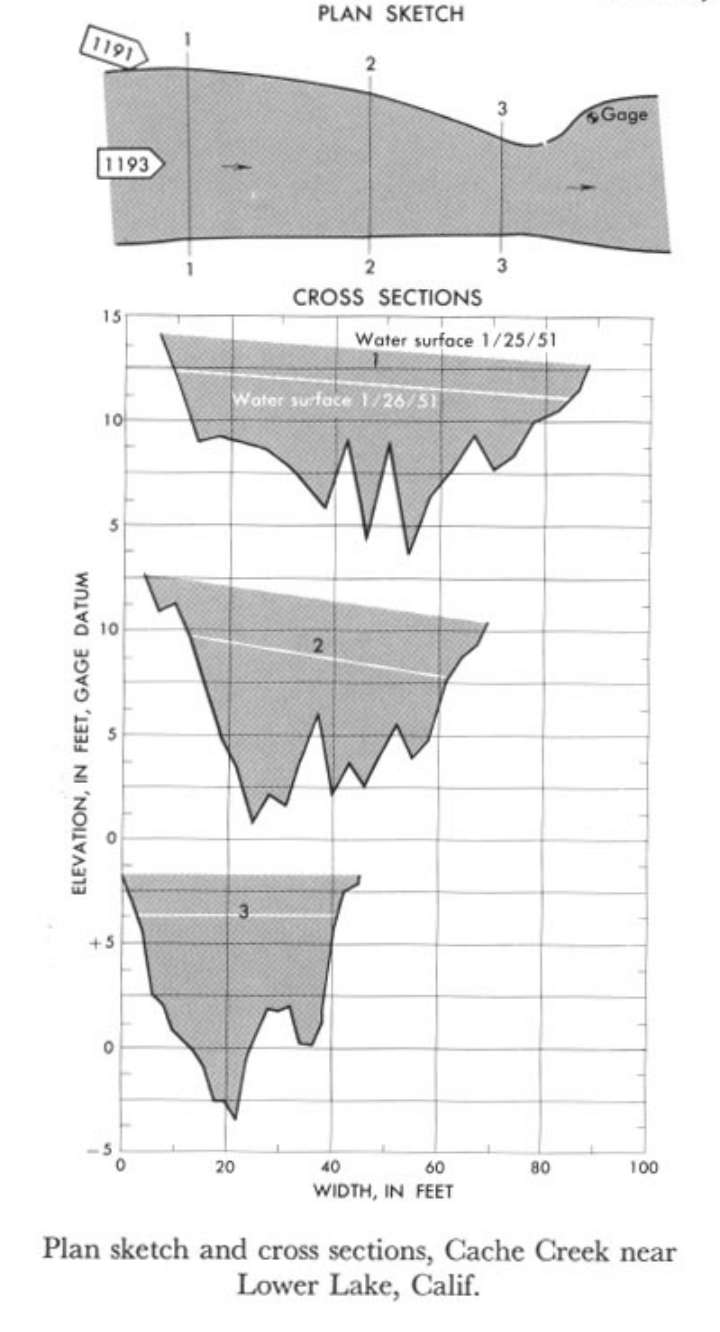 Location
.-- Lat 38°55'27", long 122°33'53", near Lower Lake, California.
Description of channel.--
| Date of observation | Average depth (ft) | Average surface width (ft) | Discharge (ft3/s) | Average cross section area (ft2) | Hydraulic radius (ft) | Mean velocity (ft/s) | Slope | Coefficient of roughness n |
|---|
| Jan. 25, 1951 |
5.83 |
--- |
3913.2 |
360.0 |
4.85 |
10.870 |
0.029878 |
0.053 |
| Jan. 24, 1951 |
4.60 |
--- |
1848.5 |
239.3 |
3.81 |
7.723 |
0.032317 |
0.079 |
12113500 North Fork Cedar River near Lester, Wash.
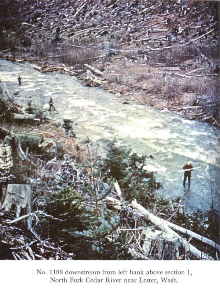
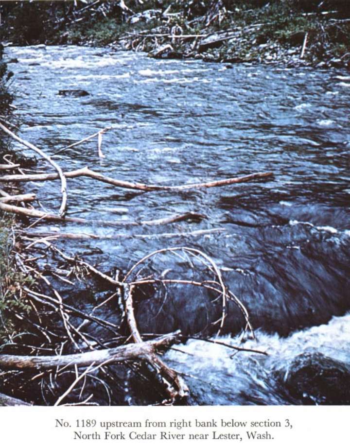
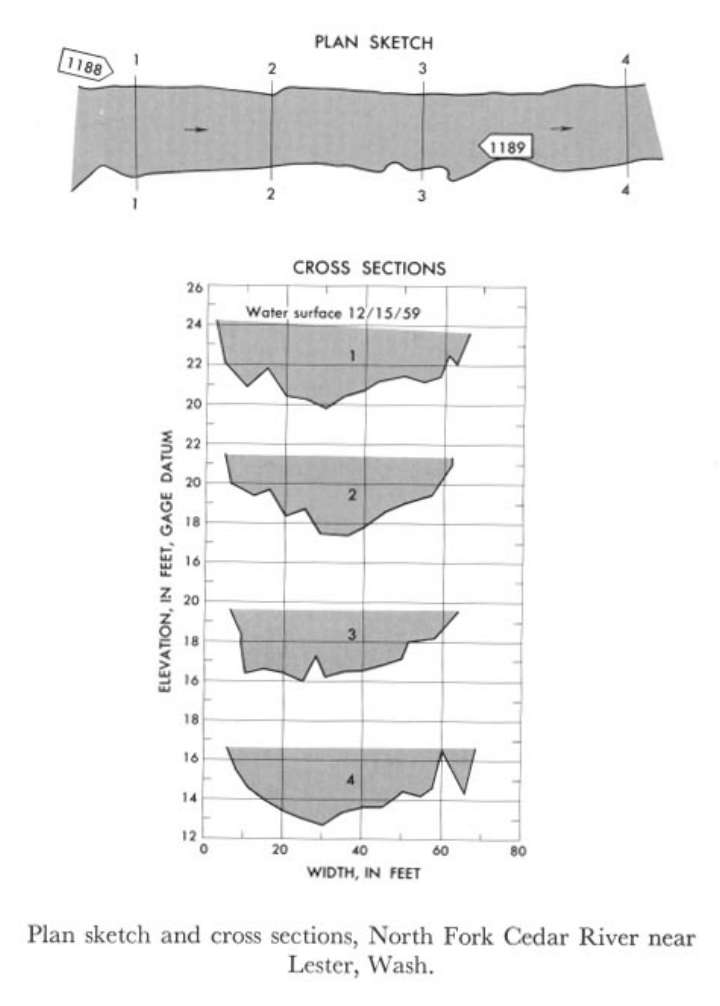 Location
.-- Lat 47°19'10", long 121°30'05", near Lester, Washington.
Description of channel.--
| Date of observation | Average depth (ft) | Average surface width (ft) | Discharge (ft3/s) | Average cross section area (ft2) | Hydraulic radius (ft) | Mean velocity (ft/s) | Slope | Coefficient of roughness n |
|---|
| Dec. 15, 1959 |
2.58 |
--- |
1000.9 |
157.2 |
2.49 |
6.365 |
0.023718 |
0.059 |
12306500 Moyie River at Eastport
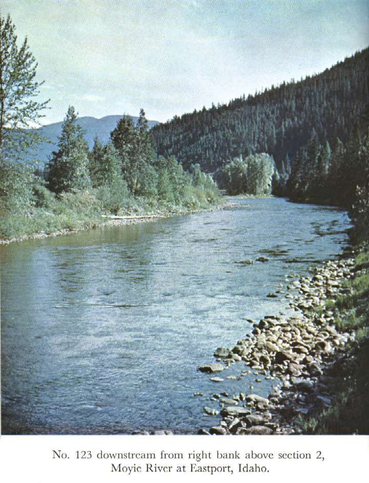
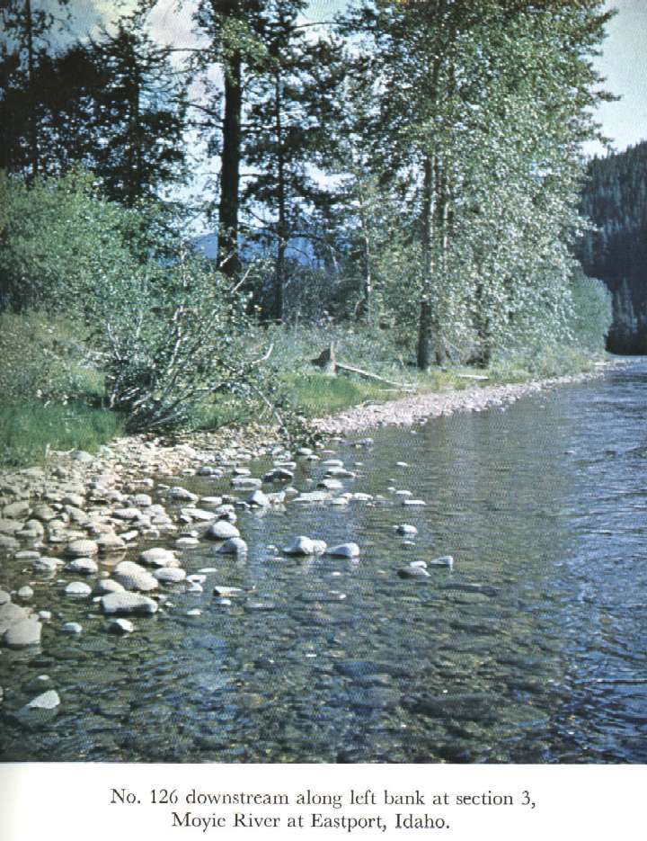
 Location
.-- Lat 49°00'__", long 116°11'__", near Eastport, Idaho.
Description of channel.--
| Date of observation | Average depth (ft) | Average surface width (ft) | Discharge (ft3/s) | Average cross section area (ft2) | Hydraulic radius (ft) | Mean velocity (ft/s) | Slope | Coefficient of roughness n |
|---|
| May 24, 1948 |
7.13 |
--- |
8145.1 |
1044.2 |
6.93 |
7.800 |
0.003647 |
0.038 |
12321500 Boundary Creek near Porthill, Idaho
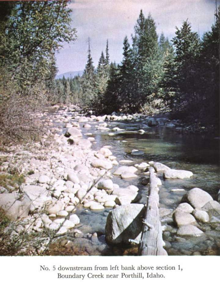
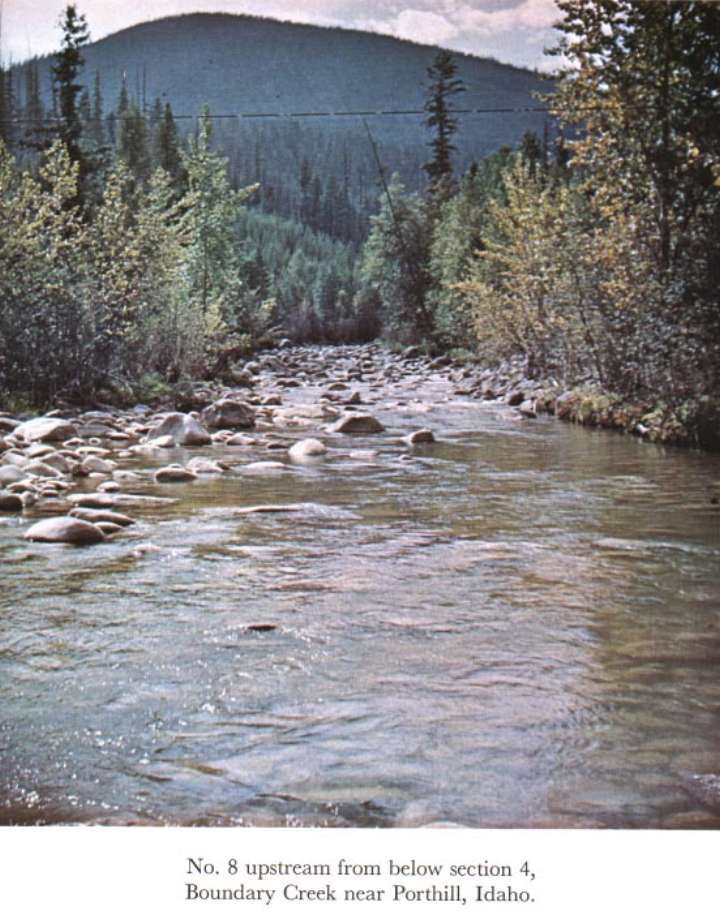
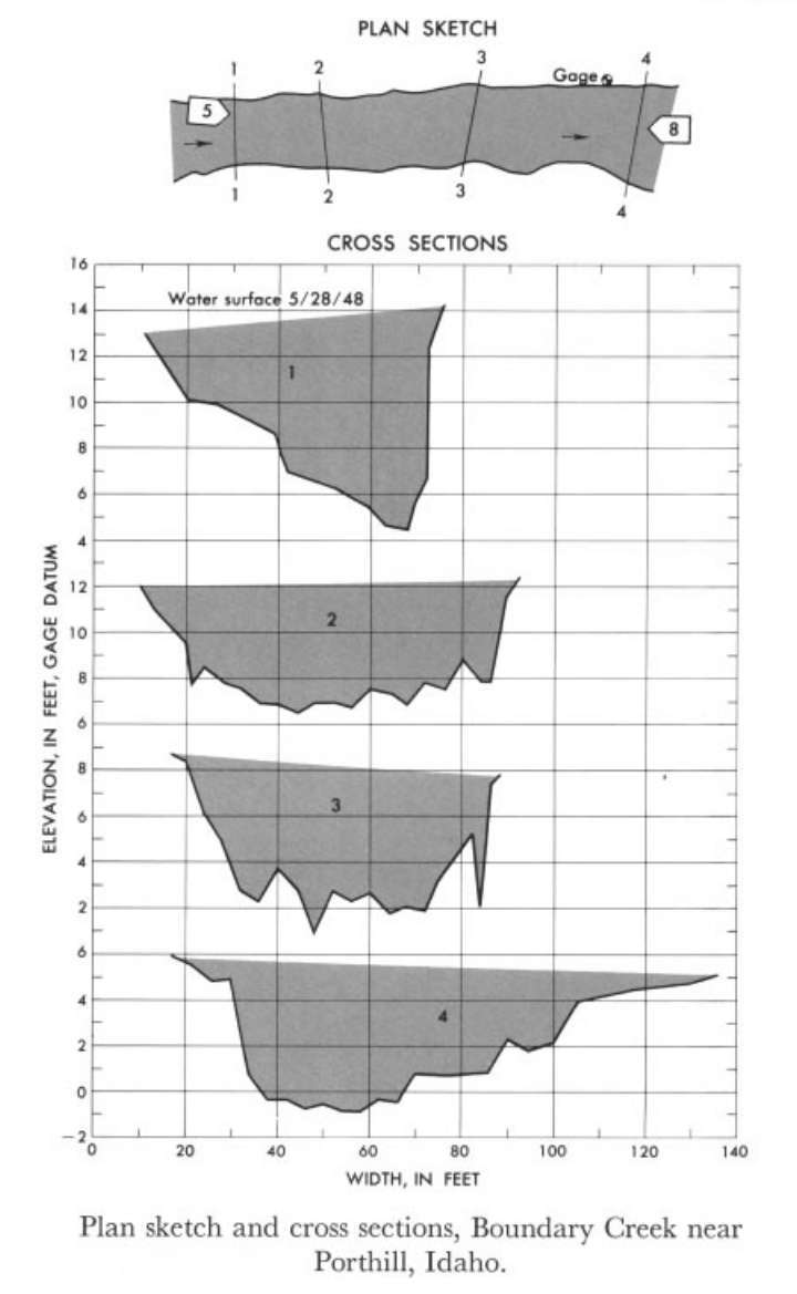 Location
.-- Lat 48°59'50", long 116°34'05", near Porthill, Idaho.
Description of channel.--
d50 = 210 mm.
d84 = 375 mm.
| Date of observation | Average depth (ft) | Average surface width (ft) | Discharge (ft3/s) | Average cross section area (ft2) | Hydraulic radius (ft) | Mean velocity (ft/s) | Slope | Coefficient of roughness n |
|---|
| May 28, 1948 |
4.40 |
--- |
2545.3 |
354.0 |
4.05 |
7.190 |
0.018664 |
0.073 |
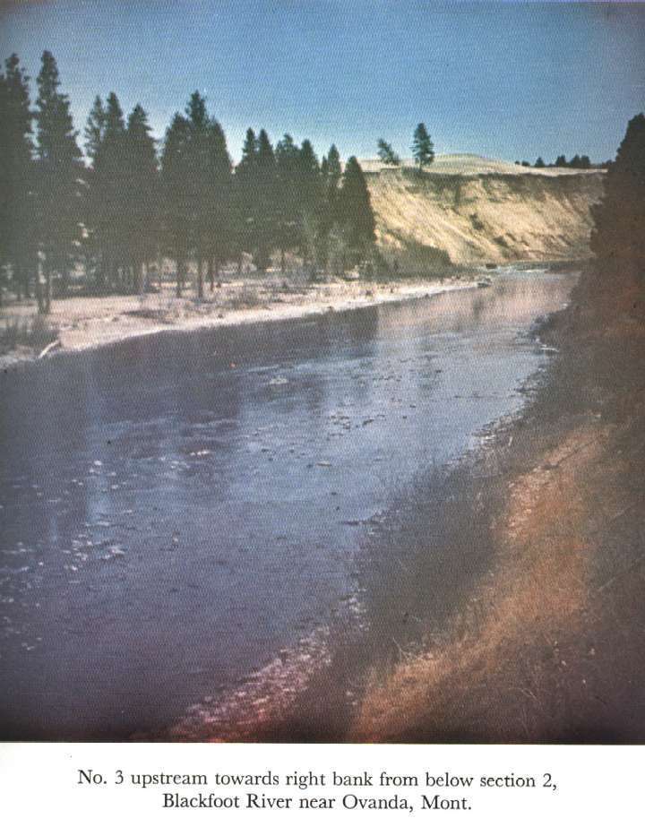
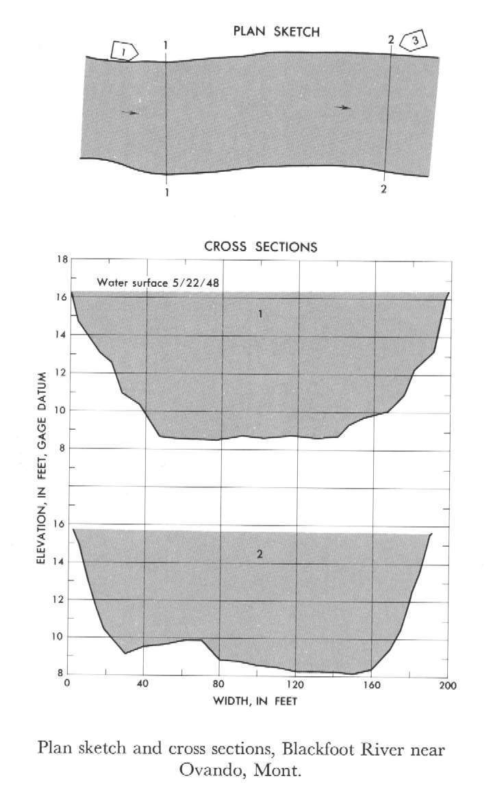
12338500 Blackfoot River near Ovando
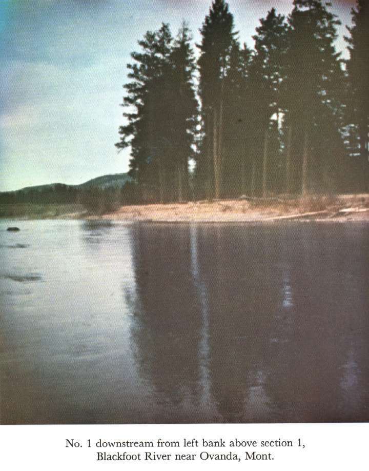
 Location
.-- Lat 47°01'10", long 113°13'40", near Ovando, Montana.
Description of channel.--
d50 = 155 mm.
d84 = 280 mm.
| Date of observation | Average depth (ft) | Average surface width (ft) | Discharge (ft3/s) | Average cross section area (ft2) | Hydraulic radius (ft) | Mean velocity (ft/s) | Slope | Coefficient of roughness n |
|---|
| May 22, 1948 |
6.12 |
--- |
8212.0 |
1185.0 |
6.05 |
6.930 |
0.002329 |
0.031 |
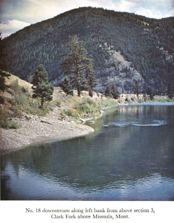
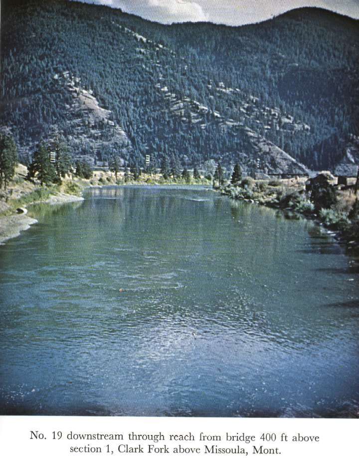
12340500 Clark Fork above Missoula
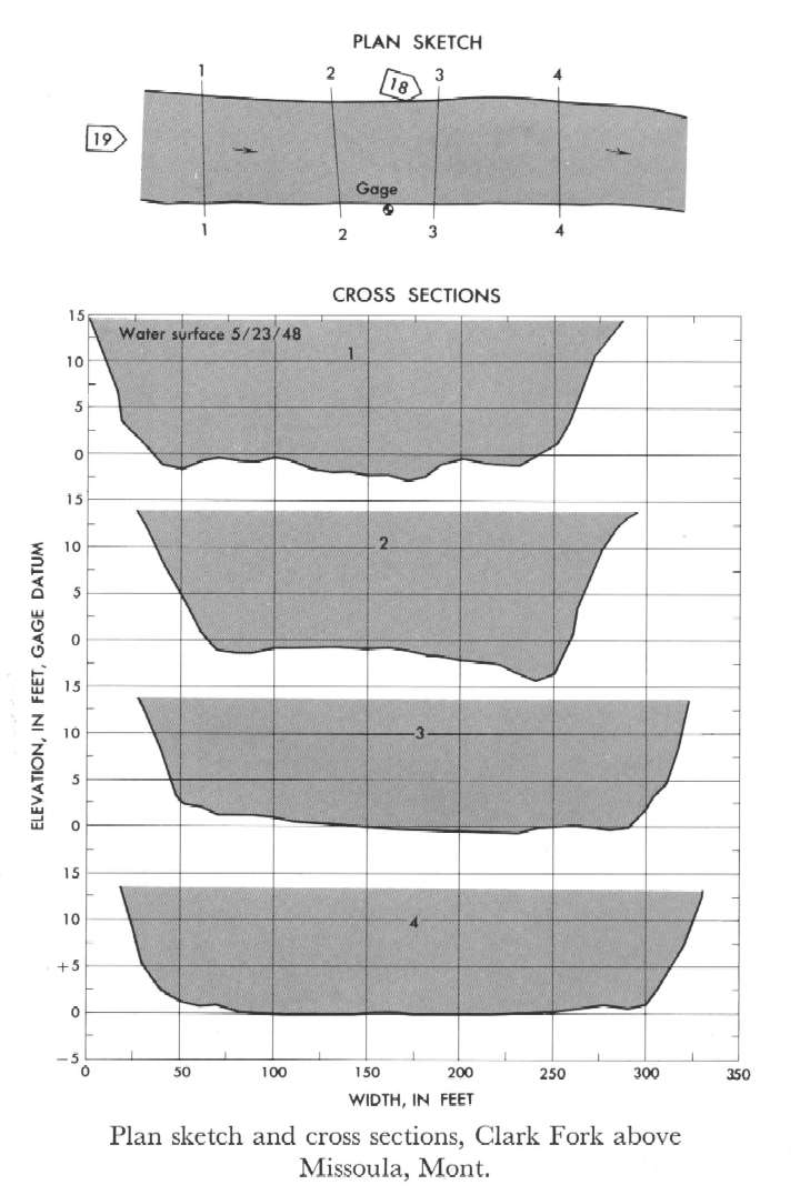 Location
.-- Lat 46°52'40", long 113°55'40", near Missoula, Montana.
Description of channel.--
d50 = 175 mm.
d84 = 325 mm.
| Date of observation | Average depth (ft) | Average surface width (ft) | Discharge (ft3/s) | Average cross section area (ft2) | Hydraulic radius (ft) | Mean velocity (ft/s) | Slope | Coefficient of roughness n |
|---|
| May 23, 1948 |
12.76 |
--- |
31547.4 |
3689.8 |
12.48 |
8.550 |
0.001254 |
0.030 |
12342500 West Fork Bitterroot River near Conner
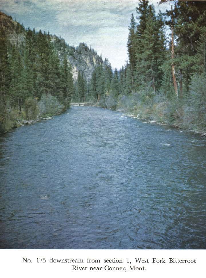
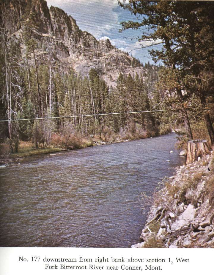
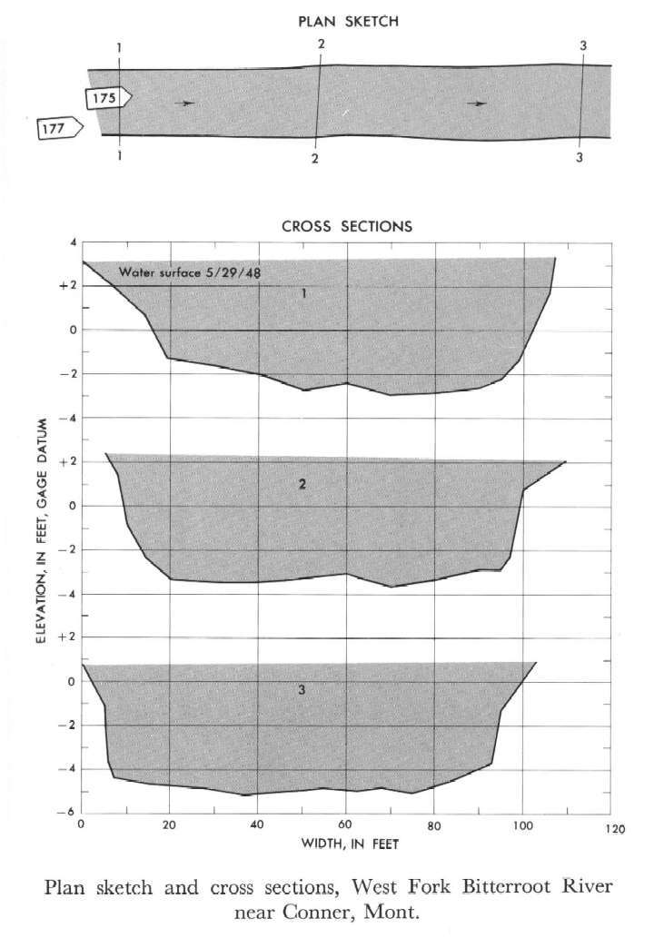 Location
.-- Lat 45°44'__", long 114°17'__", near Conner, Montana.
Description of channel.--
d50 = 172 mm.
d84 = 265 mm.
| Date of observation | Average depth (ft) | Average surface width (ft) | Discharge (ft3/s) | Average cross section area (ft2) | Hydraulic radius (ft) | Mean velocity (ft/s) | Slope | Coefficient of roughness n |
|---|
| May 29, 1948 |
4.80 |
--- |
3880.9 |
504.7 |
4.67 |
7.690 |
0.004618 |
0.036 |
12345000 Rock Creek near Darby, Mont.
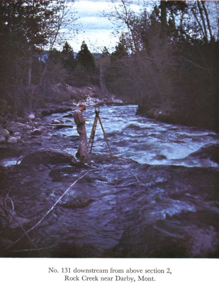
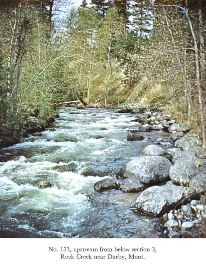
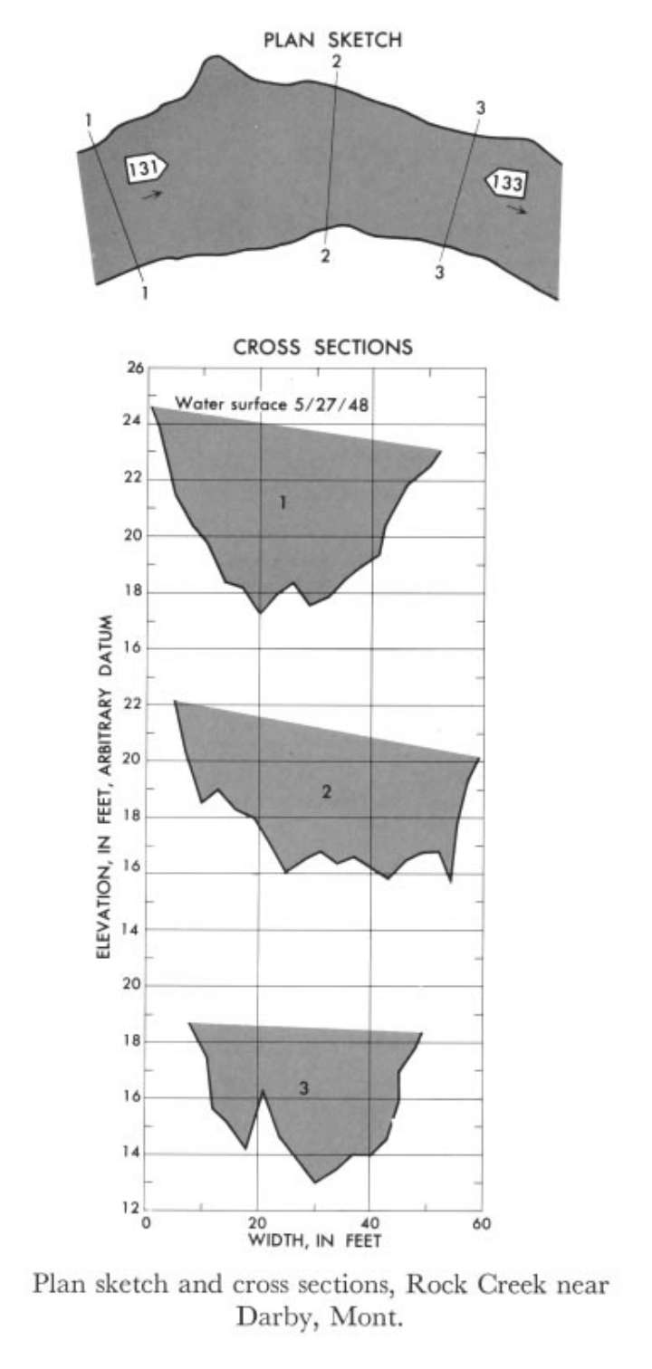 Location
.-- Lat 46°04'10", long 114°13'20", near Darby, Montana.
Description of channel.--
d50 = 220 mm.
d84 = 415 mm.
| Date of observation | Average depth (ft) | Average surface width (ft) | Discharge (ft3/s) | Average cross section area (ft2) | Hydraulic radius (ft) | Mean velocity (ft/s) | Slope | Coefficient of roughness n |
|---|
| May 27, 1948 |
3.69 |
--- |
1566.7 |
183.7 |
3.46 |
8.530 |
0.040476 |
0.075 |
12345500 Rock Creek Canal near Darby, Mont.
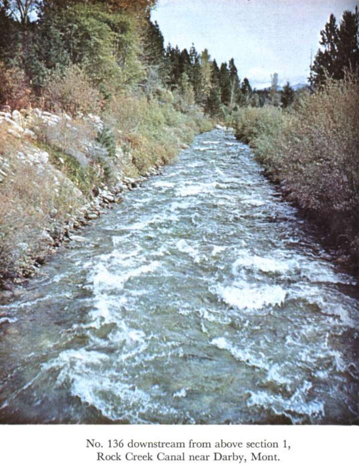
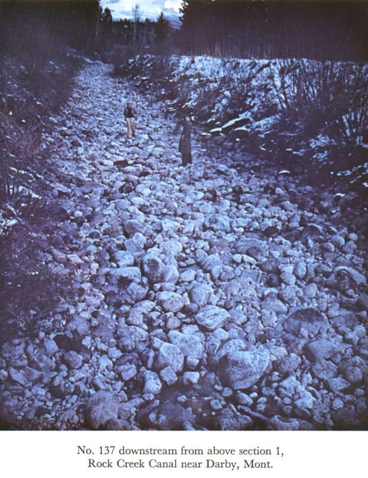
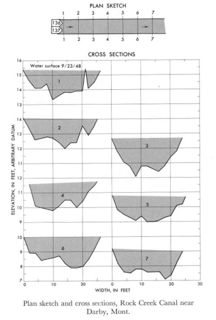 Location
.-- Lat 46°04'40", long 114°12'40", near Darby, Montana.
Description of channel.--
d50 = 210 mm.
d84 = 375 mm.
| Date of observation | Average depth (ft) | Average surface width (ft) | Discharge (ft3/s) | Average cross section area (ft2) | Hydraulic radius (ft) | Mean velocity (ft/s) | Slope | Coefficient of roughness n |
|---|
| Sept. 23, 1948 |
1.32 |
--- |
139.3 |
33.0 |
1.29 |
4.220 |
0.020983 |
0.060 |
12354500 Clark Fork at St. Regis
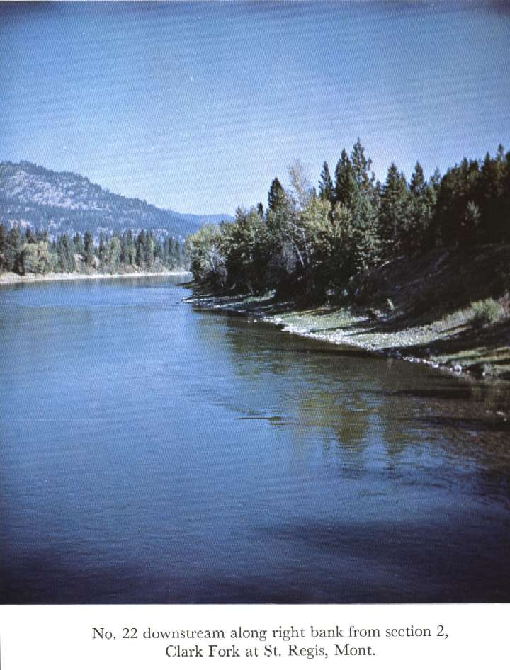
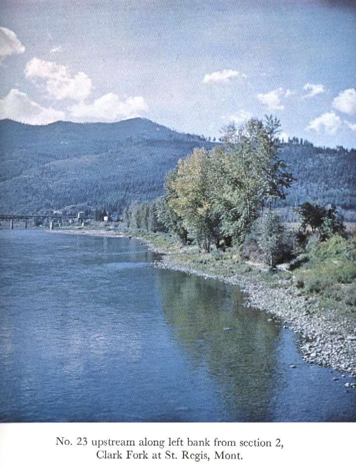
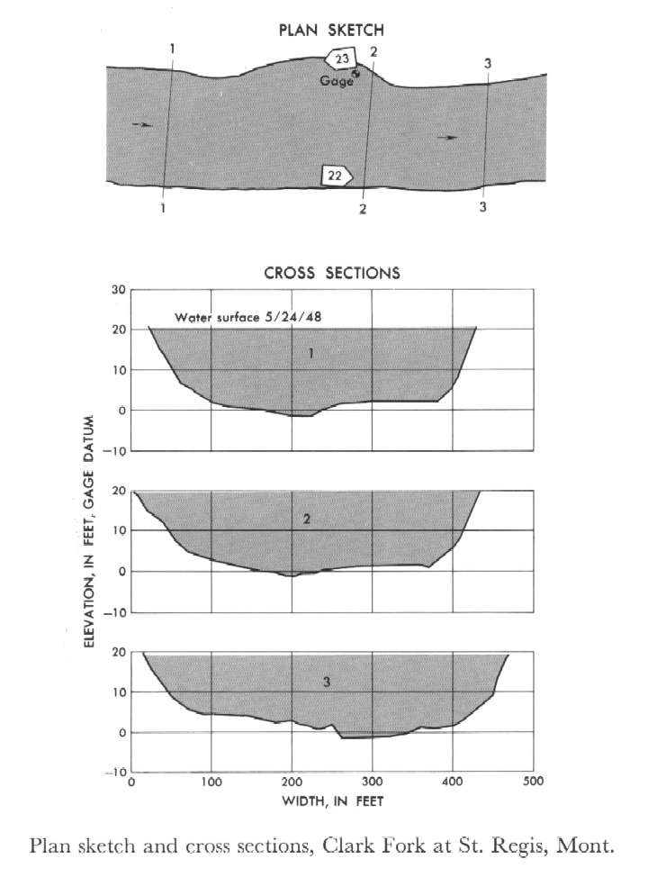 Location
.-- Lat 47°18'05", long 115°05'15", near St. Regis, Montana.
Description of channel.--
d50 = 135 mm.
d84 = 205 mm.
| Date of observation | Average depth (ft) | Average surface width (ft) | Discharge (ft3/s) | Average cross section area (ft2) | Hydraulic radius (ft) | Mean velocity (ft/s) | Slope | Coefficient of roughness n |
|---|
| May 24, 1948 |
16.36 |
--- |
68908.3 |
7010.0 |
16.13 |
9.830 |
0.000733 |
0.028 |
12355700 Middle Fork Flathead River near Essex, Mont.
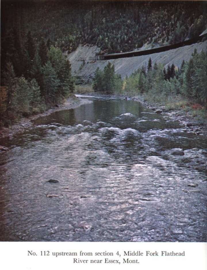
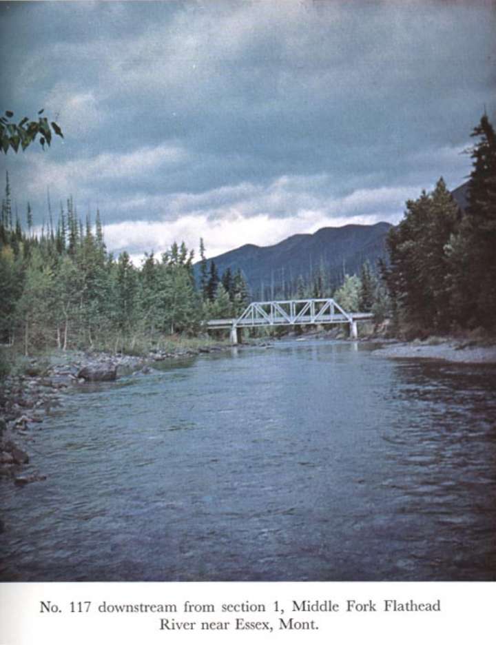
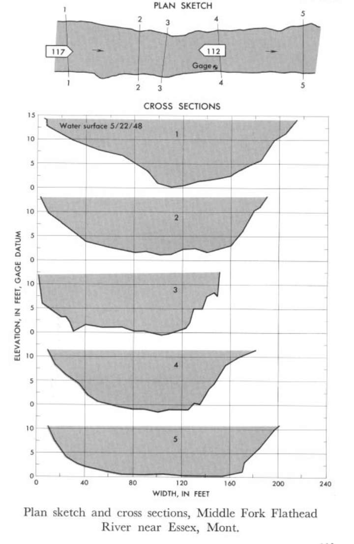 Location
.-- Lat 48°10'20", long 113°32'40", near Essex, Montana.
Description of channel.--
d50 = 142 mm.
d84 = 285 mm.
| Date of observation | Average depth (ft) | Average surface width (ft) | Discharge (ft3/s) | Average cross section area (ft2) | Hydraulic radius (ft) | Mean velocity (ft/s) | Slope | Coefficient of roughness n |
|---|
| May 22, 1948 |
8.85 |
--- |
14558.7 |
1596.0 |
8.58 |
9.122 |
0.014312 |
0.041 |
12412000 Coeur d'Alene River near Prichard
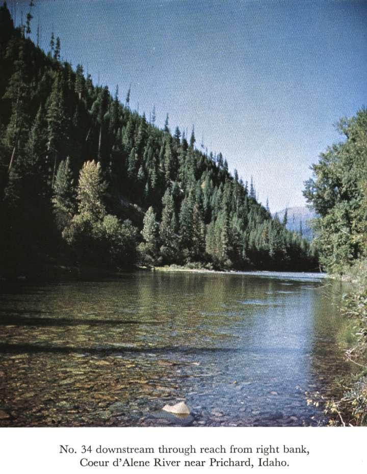
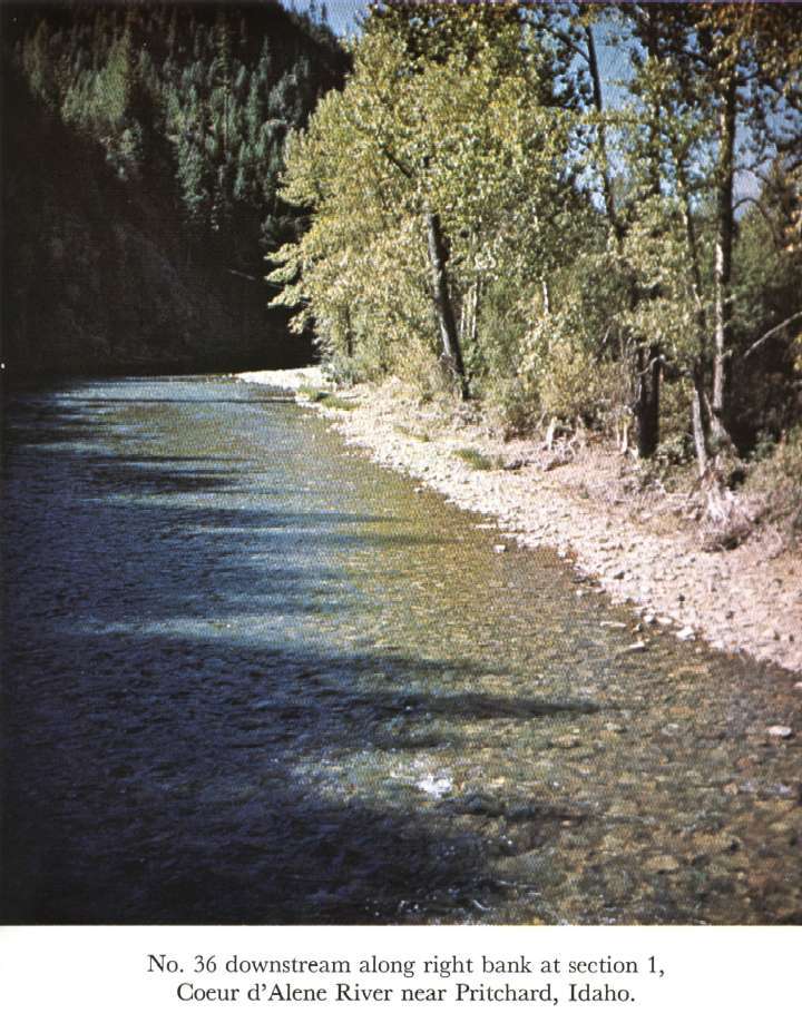
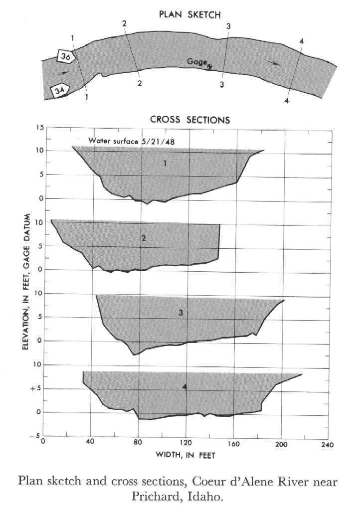 Location
.-- Lat 47°38'05", long 115°58'55", near Pritchard, Idaho.
Description of channel.--
d50 = 103 mm.
d84 = 650 mm.
| Date of observation | Average depth (ft) | Average surface width (ft) | Discharge (ft3/s) | Average cross section area (ft2) | Hydraulic radius (ft) | Mean velocity (ft/s) | Slope | Coefficient of roughness n |
|---|
| May 21, 1948 |
7.90 |
--- |
11314.4 |
1269.5 |
7.62 |
8.912 |
0.002468 |
0.032 |
12422500 Spokane River at Spokane
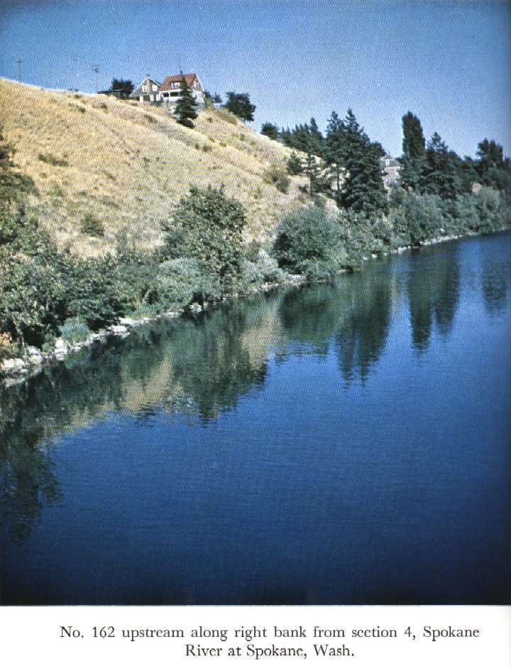
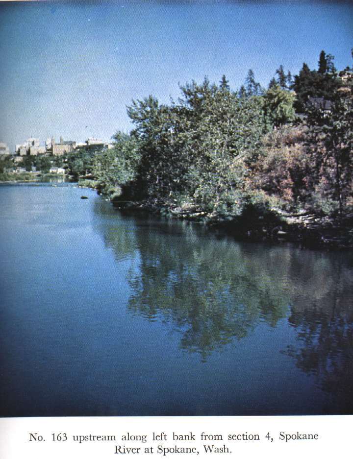
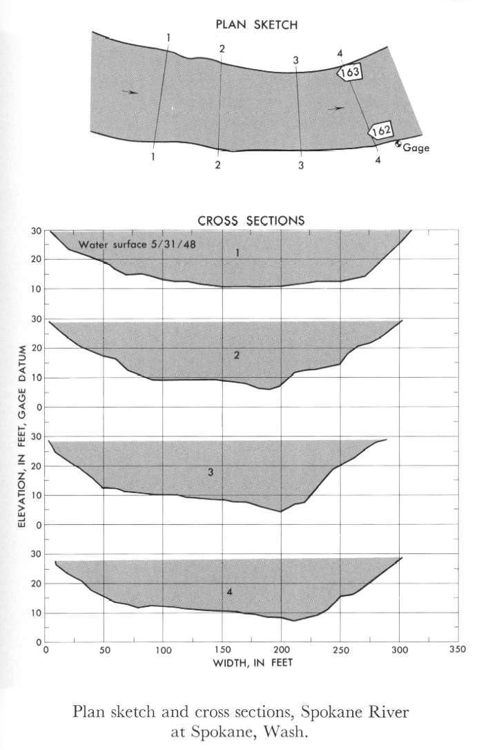 Location
.-- Lat 47°39'35", long 117°26'50", near Spokane, Washington.
Description of channel.--
d50 = 195 mm.
d84 = 360 mm.
| Date of observation | Average depth (ft) | Average surface width (ft) | Discharge (ft3/s) | Average cross section area (ft2) | Hydraulic radius (ft) | Mean velocity (ft/s) | Slope | Coefficient of roughness n |
|---|
| May 31, 1948 |
14.55 |
--- |
39613.1 |
4282.5 |
14.24 |
9.250 |
0.001768 |
0.038 |
12456500 Chiwawa River near Plain, Wash.
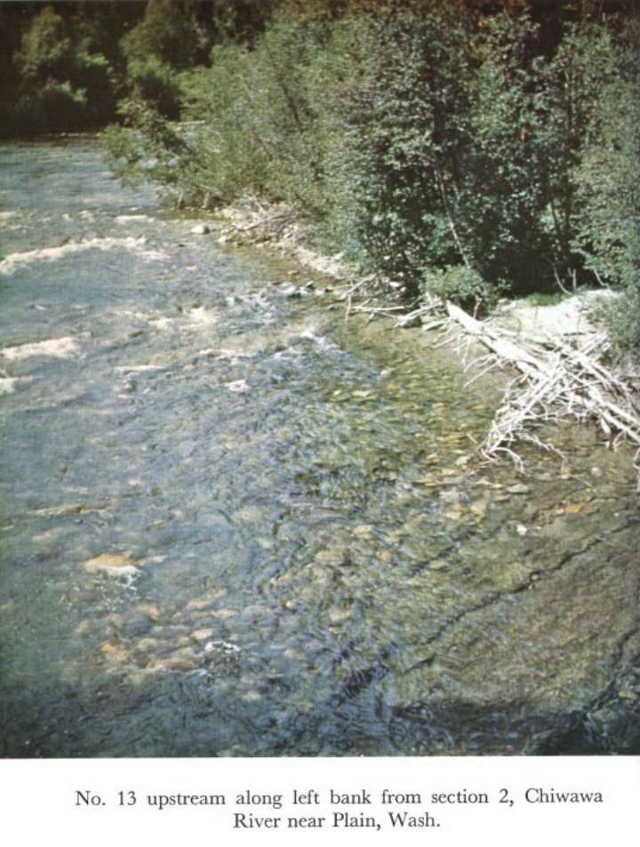
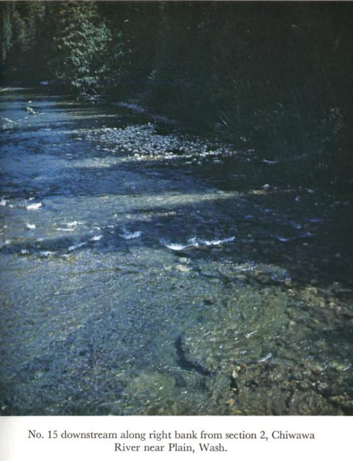
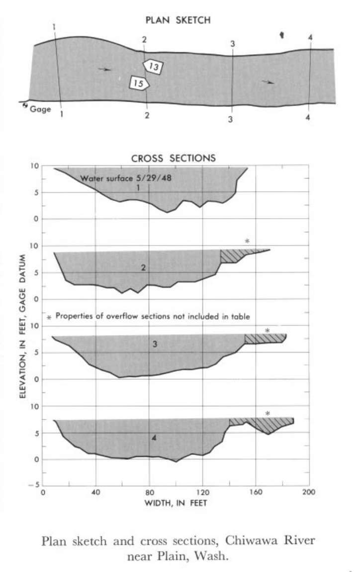 Location
.-- Lat 47°50'30", long 120°39'40", near Plain, Washington.
Description of channel.--
| Date of observation | Average depth (ft) | Average surface width (ft) | Discharge (ft3/s) | Average cross section area (ft2) | Hydraulic radius (ft) | Mean velocity (ft/s) | Slope | Coefficient of roughness n |
|---|
| May 29, 1948 |
5.63 |
--- |
5884.8 |
766.0 |
5.49 |
7.683 |
0.004947 |
0.043 |
12457000 Wenatchee River at Plain
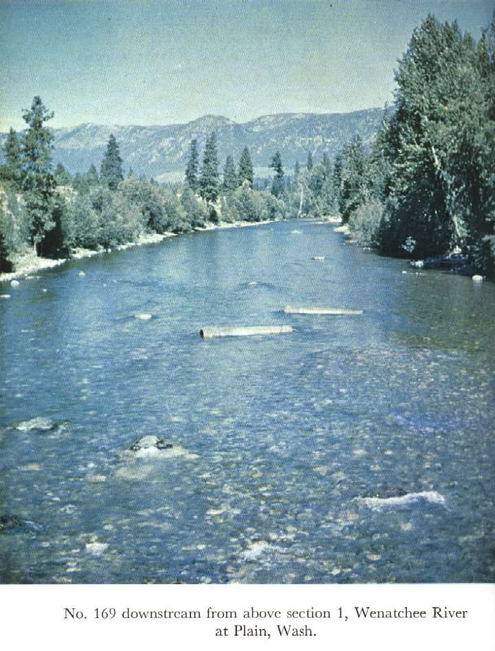
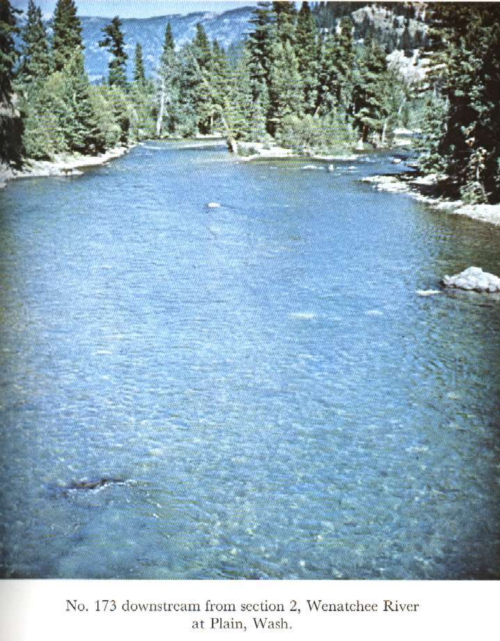
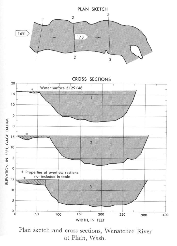 Location
.-- Lat 47°45'50", long 120°39'30", near Plain, Washington.
Description of channel.--
d50 = 162 mm.
d84 = 320 mm.
| Date of observation | Average depth (ft) | Average surface width (ft) | Discharge (ft3/s) | Average cross section area (ft2) | Hydraulic radius (ft) | Mean velocity (ft/s) | Slope | Coefficient of roughness n |
|---|
| May 29, 1948 |
10.73 |
--- |
22687.3 |
2463.3 |
10.50 |
9.210 |
0.002358 |
0.037 |
12462000 Mission Creek near Cashmere, Wash.
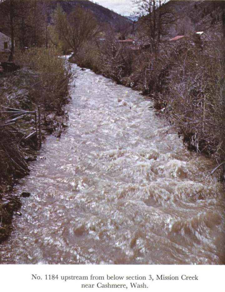
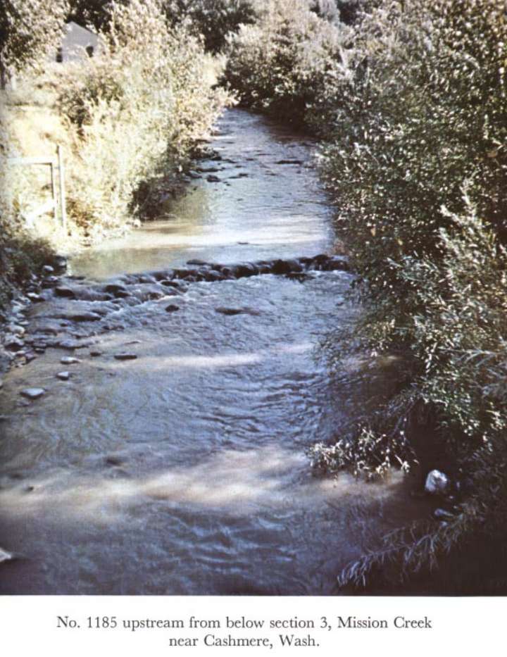
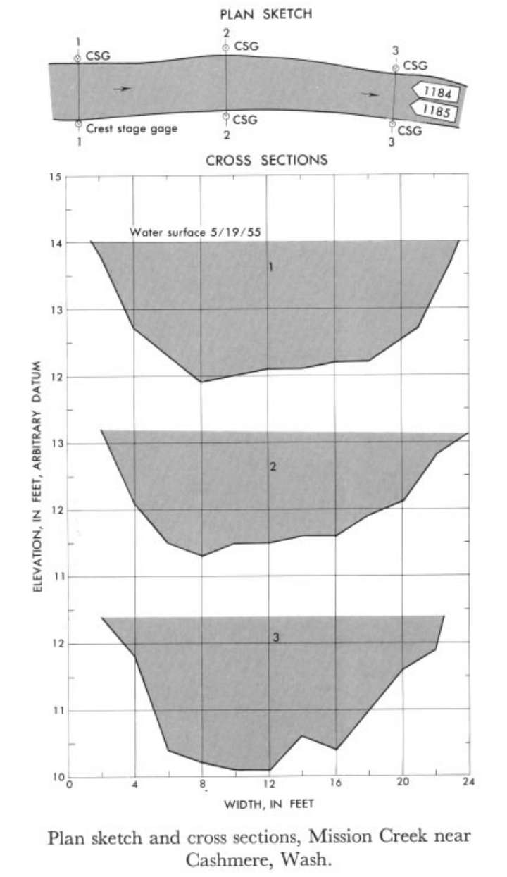 Location
.-- Lat 47°30'15", long 120°28'30", near Cashmere, Washington.
Description of channel.--
| Date of observation | Average depth (ft) | Average surface width (ft) | Discharge (ft3/s) | Average cross section area (ft2) | Hydraulic radius (ft) | Mean velocity (ft/s) | Slope | Coefficient of roughness n |
|---|
| May 19, 1955 |
1.45 |
--- |
123.5 |
31.0 |
1.40 |
3.983 |
0.016947 |
0.057 |
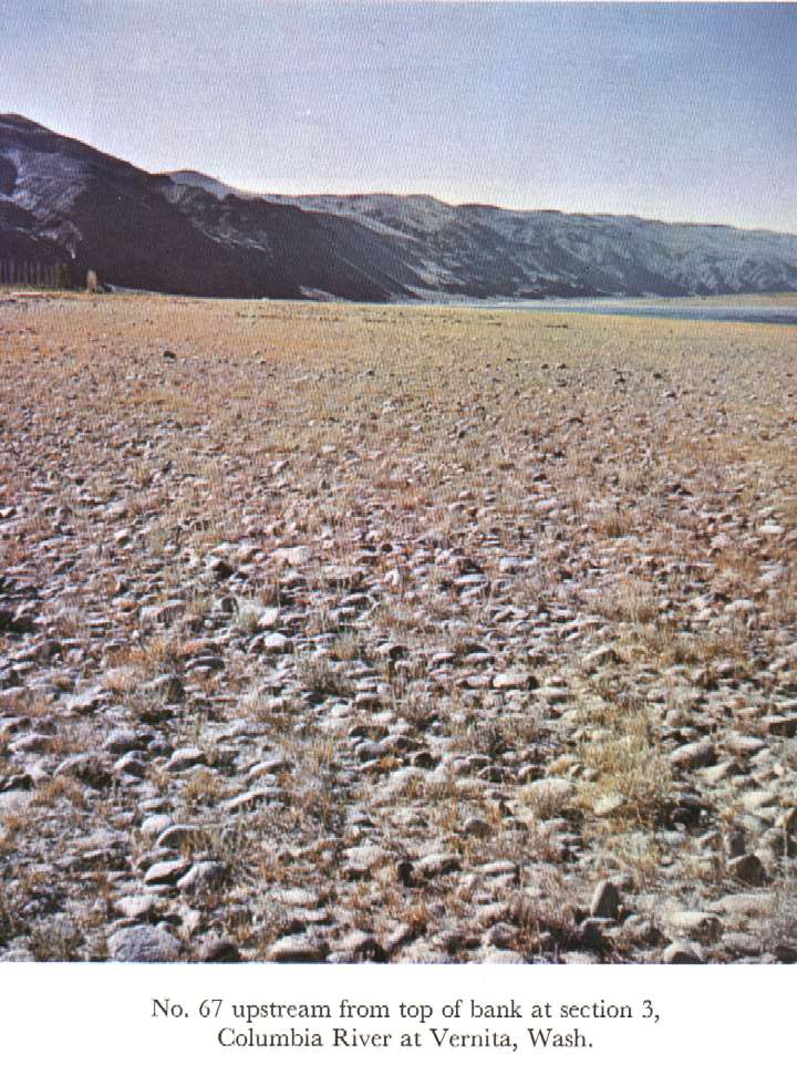
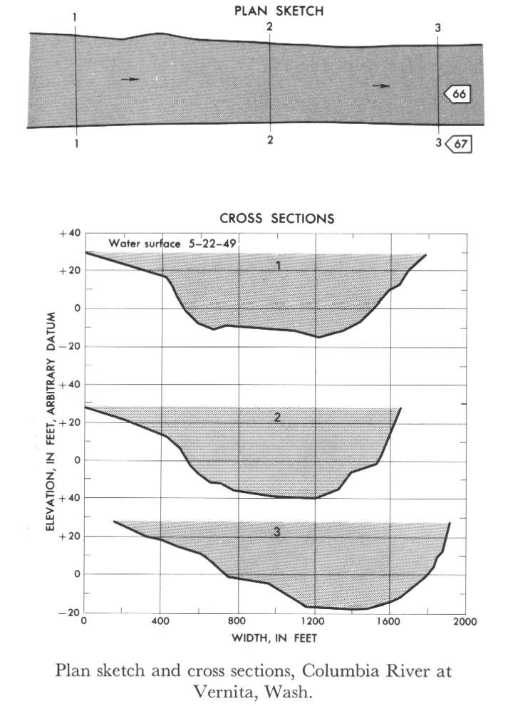
12464500 Columbia River at Vernita
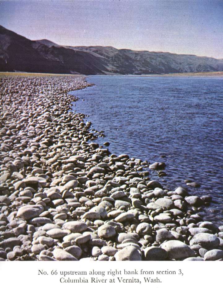
 Location
.-- Lat __°__'__", long __°__'__", near Vernita, Washington.
Description of channel.--
| Date of observation | Average depth (ft) | Average surface width (ft) | Discharge (ft3/s) | Average cross section area (ft2) | Hydraulic radius (ft) | Mean velocity (ft/s) | Slope | Coefficient of roughness n |
|---|
| May 22, 1949 |
28.03 |
--- |
406308.8 |
48566.7 |
27.94 |
8.366 |
0.000194 |
0.024 |
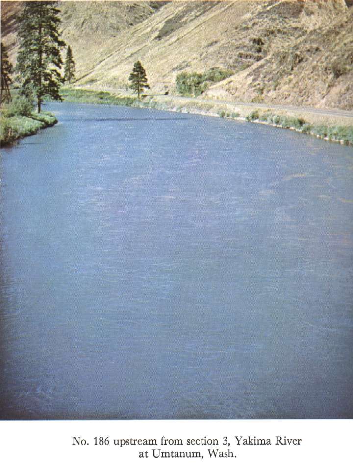
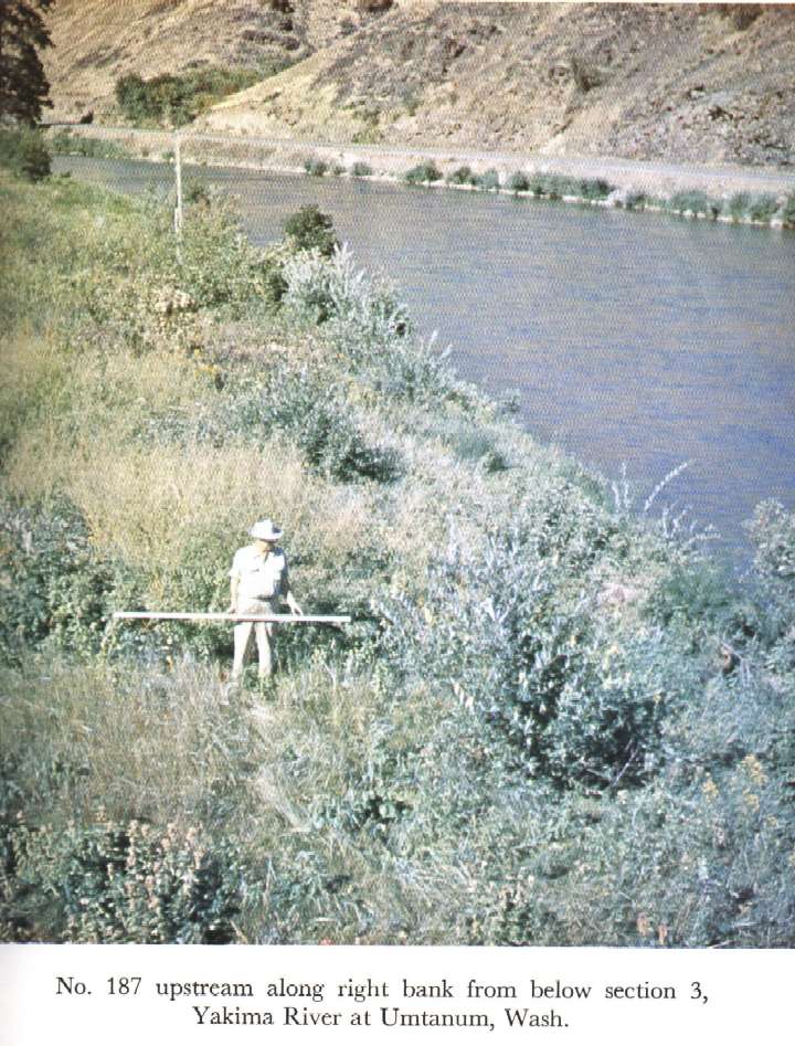
12484500 Yakima River at Umtanum
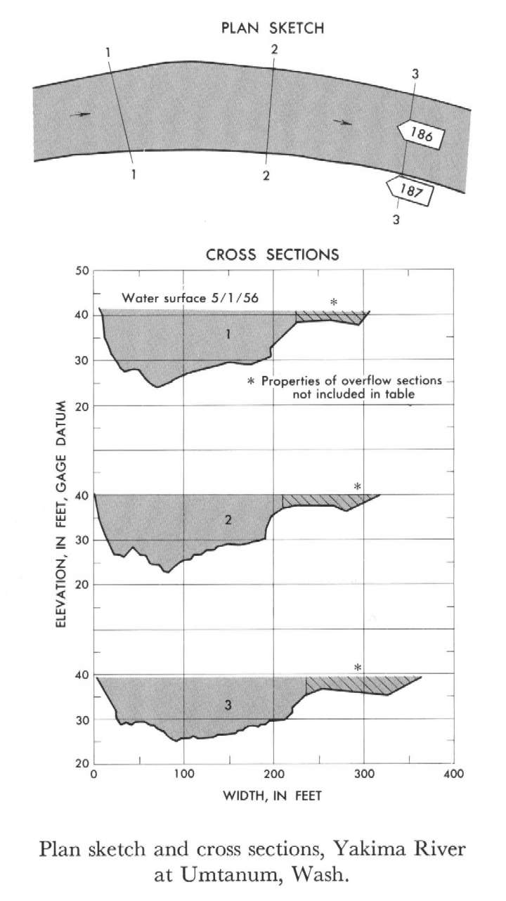 Location
.-- Lat 46°51'45", long 120°28'30", near Umtanum, Washington.
Description of channel.--
| Date of observation | Average depth (ft) | Average surface width (ft) | Discharge (ft3/s) | Average cross section area (ft2) | Hydraulic radius (ft) | Mean velocity (ft/s) | Slope | Coefficient of roughness n |
|---|
| May 29, 1948 |
11.70 |
--- |
27714.8 |
2573.3 |
11.18 |
10.770 |
0.002955 |
0.036 |
13319000 Grande Ronde River at La Grande, Oreg.
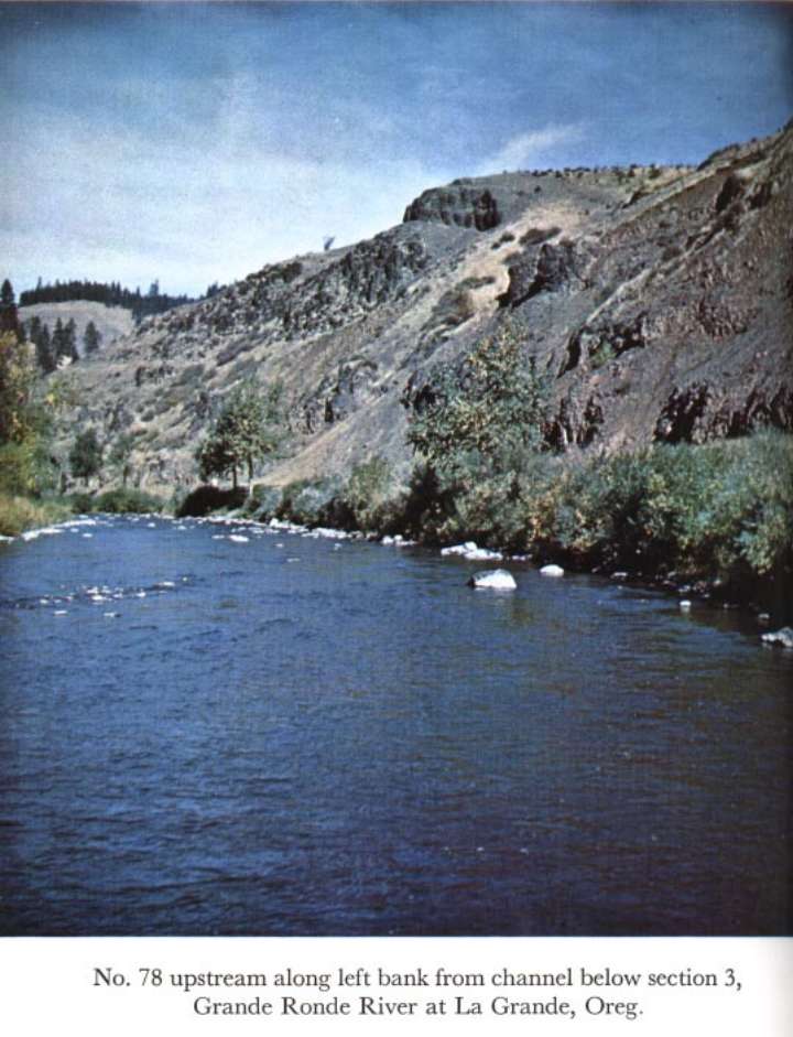
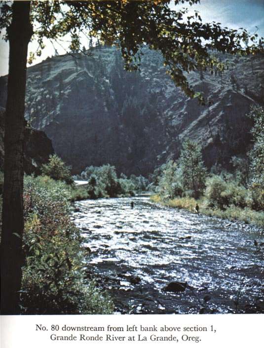
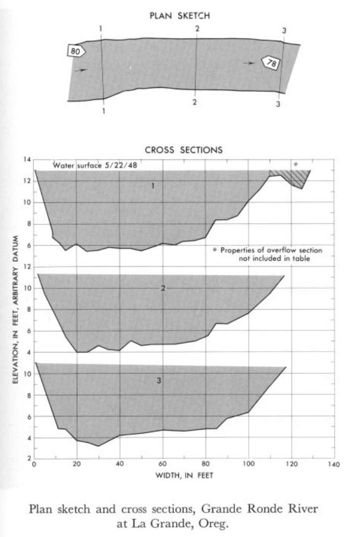 Location
.-- Lat 45°21'__", long 118°08'__", near La Grande, Oregon.
Description of channel.--
d50 = 93 mm.
d84 = 157 mm.
| Date of observation | Average depth (ft) | Average surface width (ft) | Discharge (ft3/s) | Average cross section area (ft2) | Hydraulic radius (ft) | Mean velocity (ft/s) | Slope | Coefficient of roughness n |
|---|
| May 22, 1948 |
5.44 |
--- |
4621.1 |
620.0 |
5.33 |
7.453 |
0.005255 |
0.043 |
13320000 Catherine Creek near Union, Oreg.
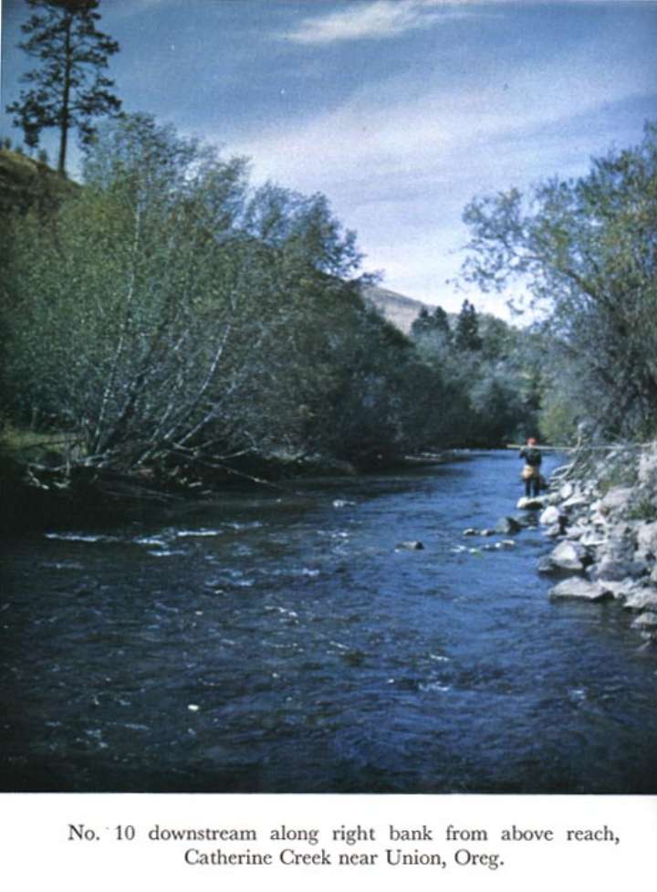
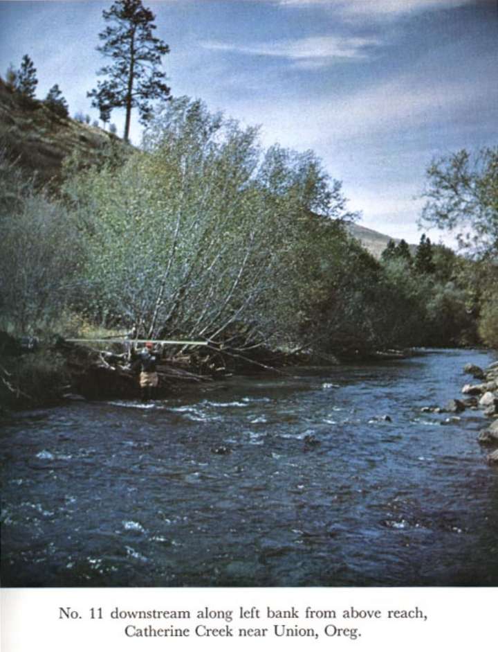
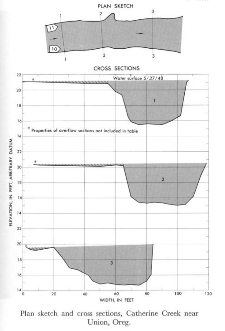 Location
.-- Lat 45°09'20", long 117°46'40", near Union, Oregon.
Description of channel.--
| Date of observation | Average depth (ft) | Average surface width (ft) | Discharge (ft3/s) | Average cross section area (ft2) | Hydraulic radius (ft) | Mean velocity (ft/s) | Slope | Coefficient of roughness n |
|---|
| May 27, 1948 |
4.20 |
--- |
1746.8 |
237.3 |
3.97 |
7.360 |
0.006651 |
0.043 |
13338000 South Fork Clearwater River near Grangeville, Idaho
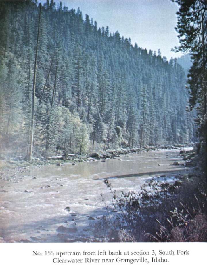
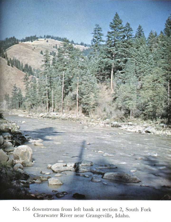
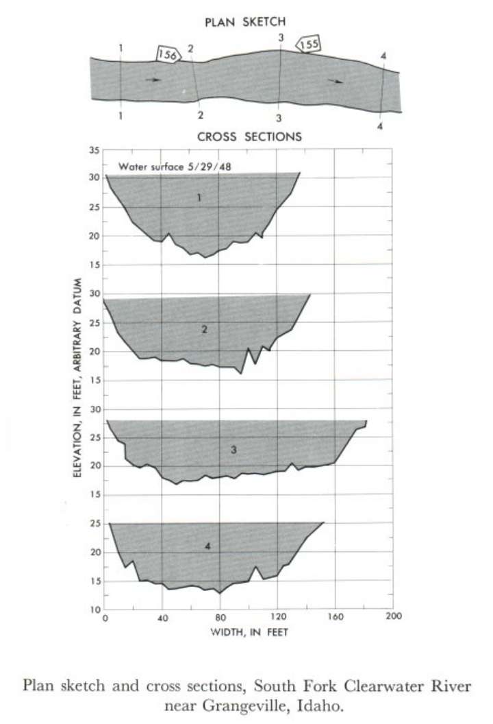 Location
.-- Lat 45°55'__", long 116°01'__", near Grangeville, Idaho.
Description of channel.--
d50 = 250 mm.
d84 = 440 mm.
| Date of observation | Average depth (ft) | Average surface width (ft) | Discharge (ft3/s) | Average cross section area (ft2) | Hydraulic radius (ft) | Mean velocity (ft/s) | Slope | Coefficient of roughness n |
|---|
| May 29, 1948 |
8.88 |
--- |
12625.3 |
1334.2 |
8.51 |
9.463 |
0.006284 |
0.051 |
13339000 Clearwater River at Kamiah
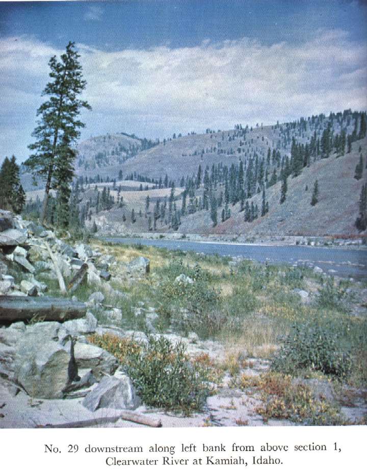
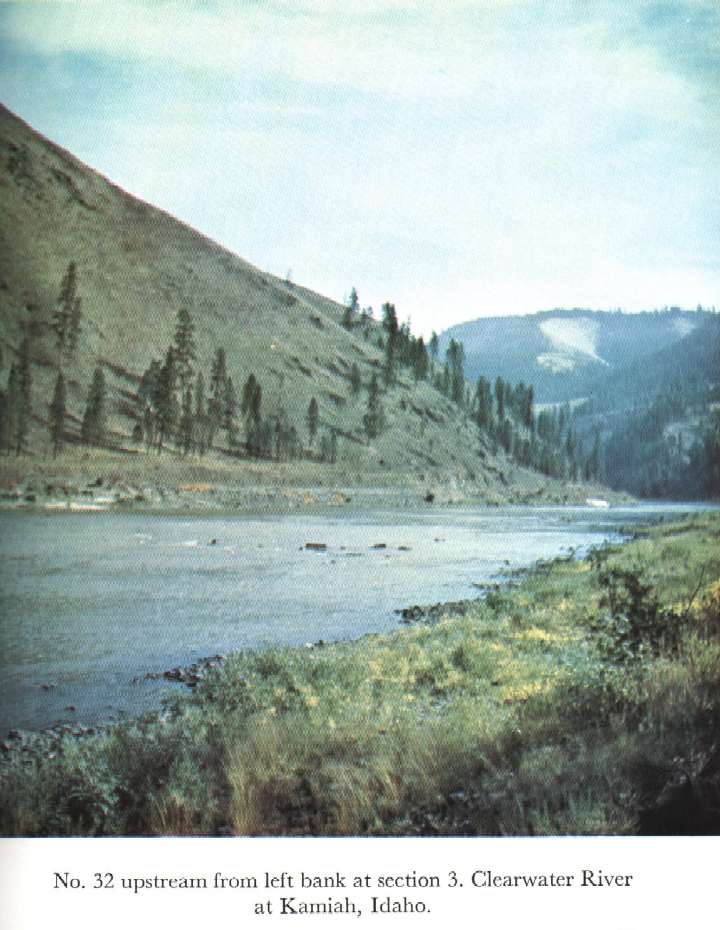
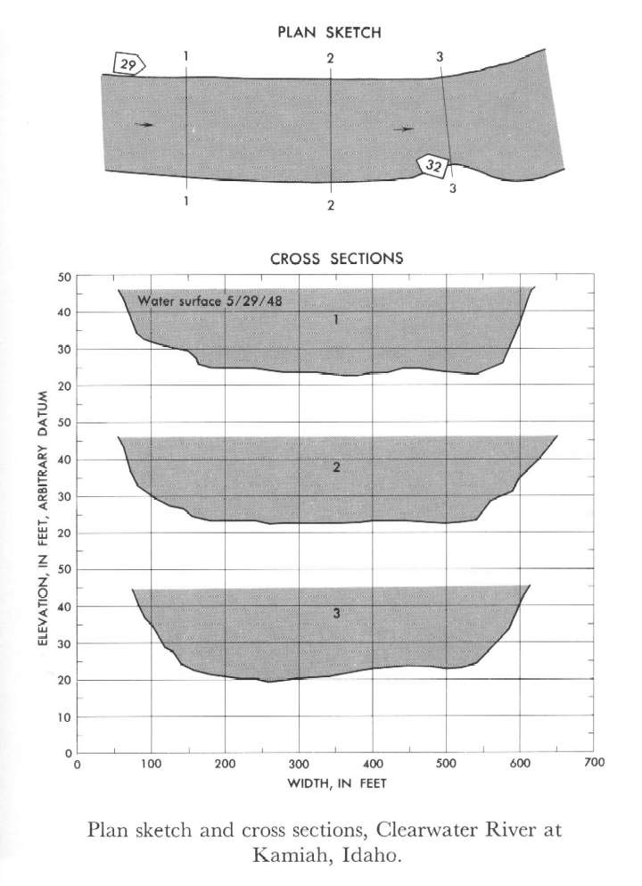 Location
.-- Lat 46°14'__", long 116°01'__", near Kamiah, Idaho.
Description of channel.--
| Date of observation | Average depth (ft) | Average surface width (ft) | Discharge (ft3/s) | Average cross section area (ft2) | Hydraulic radius (ft) | Mean velocity (ft/s) | Slope | Coefficient of roughness n |
|---|
| May 29, 1948 |
19.72 |
--- |
99013.4 |
11213.3 |
19.61 |
8.830 |
0.000789 |
0.033 |
13339000 Etowah River near Dawsonville
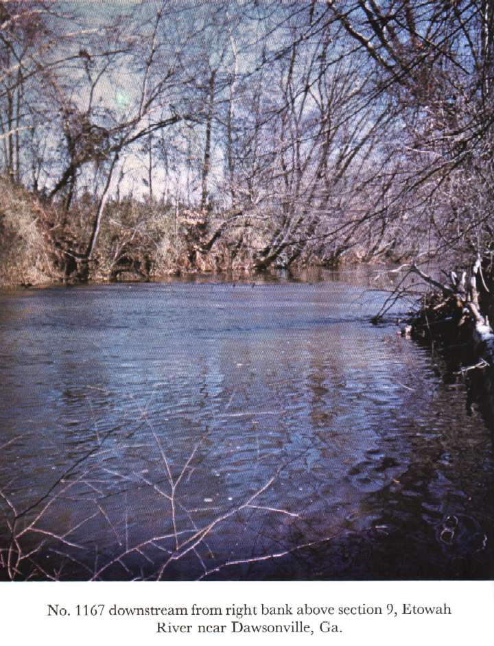
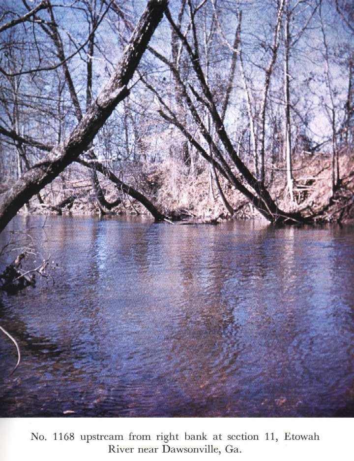
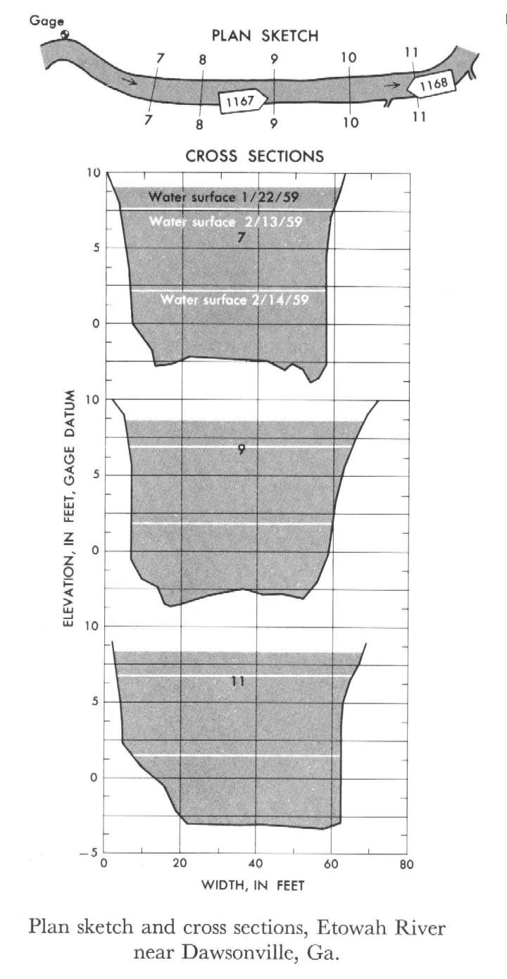 Location
.-- Lat 34°23'__", long 84°04'__", near Dawsonville, Georgia.
Description of channel.--
| Date of observation | Average depth (ft) | Average surface width (ft) | Discharge (ft3/s) | Average cross section area (ft2) | Hydraulic radius (ft) | Mean velocity (ft/s) | Slope | Coefficient of roughness n |
|---|
| Jan. 22, 1959 |
9.72 |
--- |
2261.9 |
618.0 |
7.95 |
3.660 |
0.000647 |
0.041 |
| Feb. 13, 1959 |
8.76 |
--- |
1846.9 |
529.2 |
7.20 |
3.490 |
0.000610 |
0.039 |
| Feb. 14, 1959 |
4.00 |
--- |
517.6 |
221.2 |
3.63 |
2.340 |
0.000610 |
0.035 |
14105700 Columbia River at The Dalles
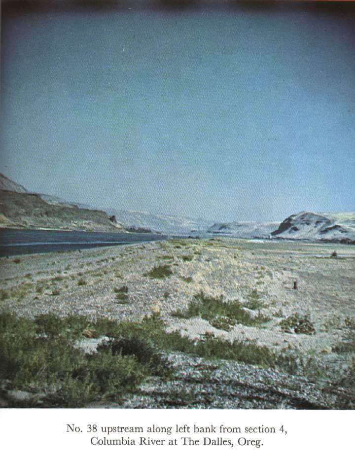
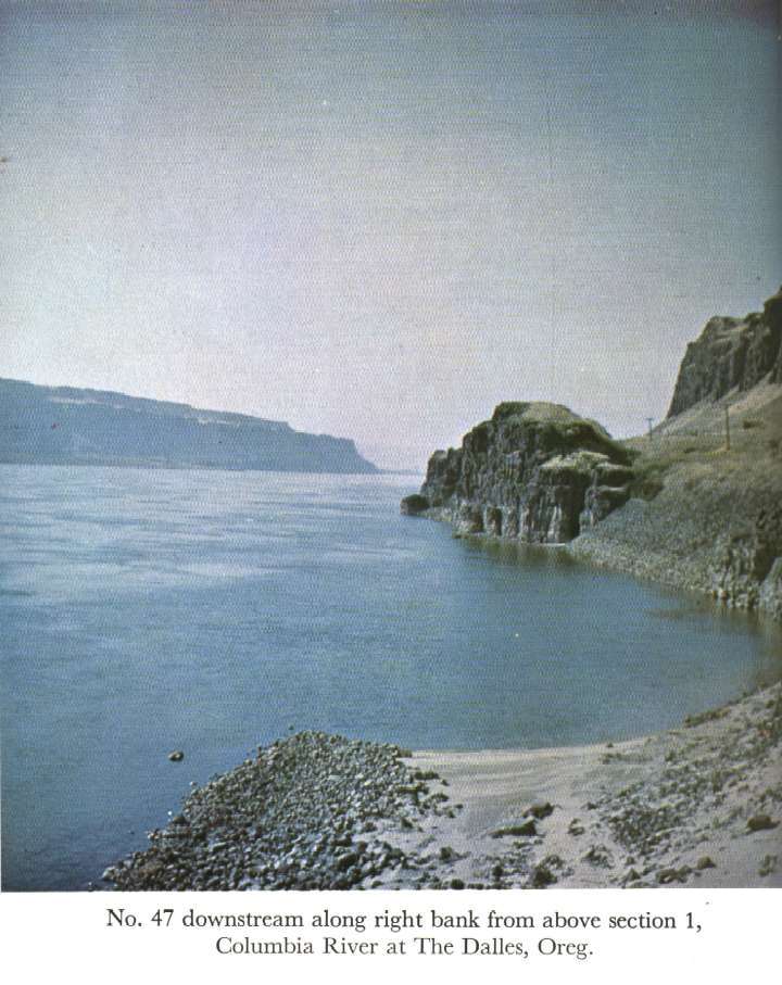
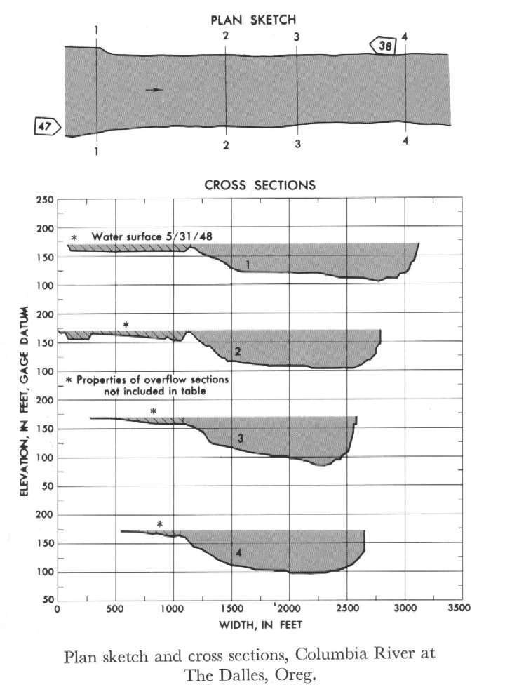 Location
.-- Lat 45°36'10", long 121°10'40", near The Dalles, Oregon.
Description of channel.--
| Date of observation | Average depth (ft) | Average surface width (ft) | Discharge (ft3/s) | Average cross section area (ft2) | Hydraulic radius (ft) | Mean velocity (ft/s) | Slope | Coefficient of roughness n |
|---|
| May 31, 1948 |
55.14 |
--- |
1000473.7 |
91597.5 |
53.75 |
10.922 |
0.000266 |
0.030 |


