

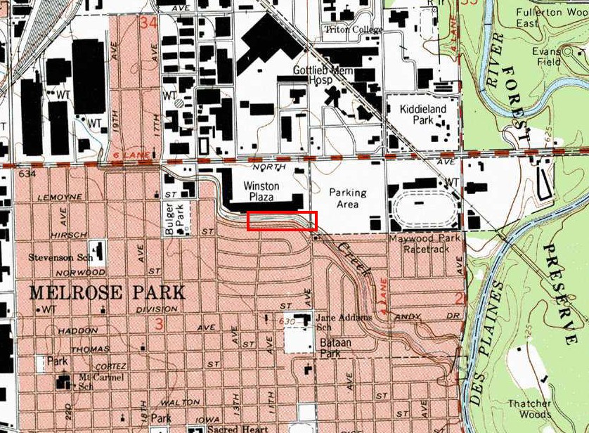
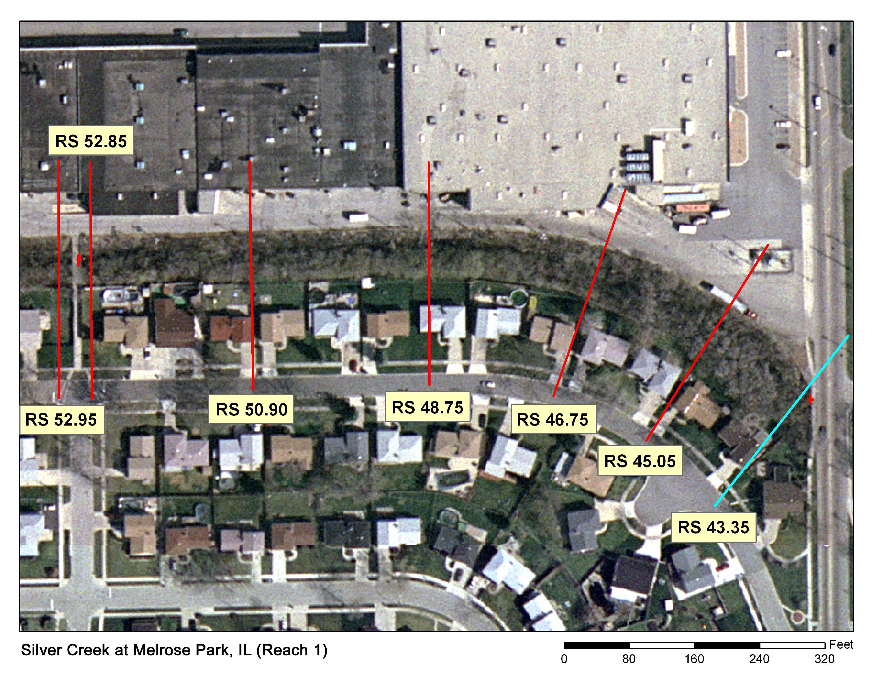
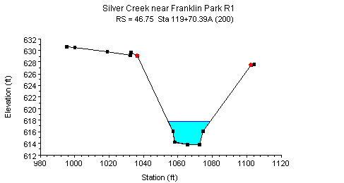
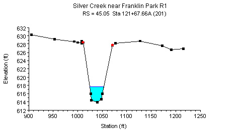
Study Reach.--The study reach is located between the downstream side of a footbridge off of the corner of Park and 12th Avenues (behind Winston Plaza) and the upstream side of 9th Avenue. The length of the reach is 950 ft.
Gage Location.--The location where discharge measurements are made is lat 41°54’17”, long 87°50’42”. The study reach is at SW1/4 NW1/4 NW1/4 sec.2, T.39N, R.12E, Cook County, Hydrologic Unit 07120004. The USGS streamgage station number is 05530700.
Drainage Area.--11.16 sq mi.
Gage Datum and Elevations of Reference Points.--The upstream reference point (RP-N2) is located on the downstream face of the foot bridge, elevation= 632.34ft. The downstream reference point (RP-N1) is located on the upstream face of the 9th Avenue bridge, elevation=631.27ft. All elevations are referenced to NGVD29.
Stage, Discharge Measurements, and Computed n-Values.--Discharge measurements are made upstream of the 9th Avenue bridge. At low-water stages less than 1 ft, discharge measurements are made by wading at a section upstream of the 9th Avenue bridge. At medium and high flows discharges are measured from the bridge. During periods of extremely slow-moving water, discharge can be measured just downstream of the riffles below the footbridge. The water surface elevations are measured from reference points set on bridges using a weighted tape. Discharge measurements are made using the conventional current meter method or an Acoustic Doppler Current Profiler (ADCP).
| Date of Observation | Discharge (ft3/s) | Average Cross Section Area (ft2) | Hydraulic Radius (ft) | Mean Velocity (ft/s) | Slope (ft/ft) | Coefficient of Roughness n |
|---|---|---|---|---|---|---|
| 5/2/2006 | 24.9 | 38.9 | 1.49 | 0.72 | 0.001993 | 0.136 |
| 6/26/2006 | 43.4 | 44.3 | 1.62 | 1.09 | 0.001991 | 0.093 |
| 4/25/2007 | 125.0 | 75.3 | 2.29 | 2.00 | 0.001077 | 0.042 |
| 4/25/2007 | 132.0 | 76.2 | 2.31 | 2.08 | 0.001105 | 0.041 |
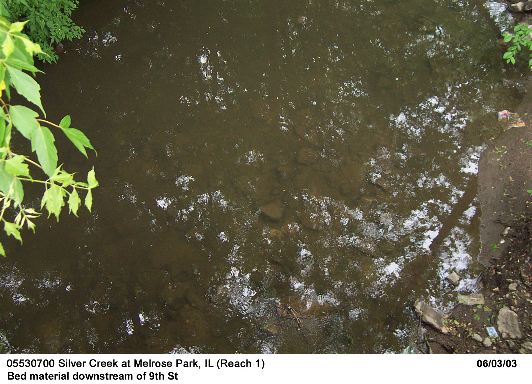


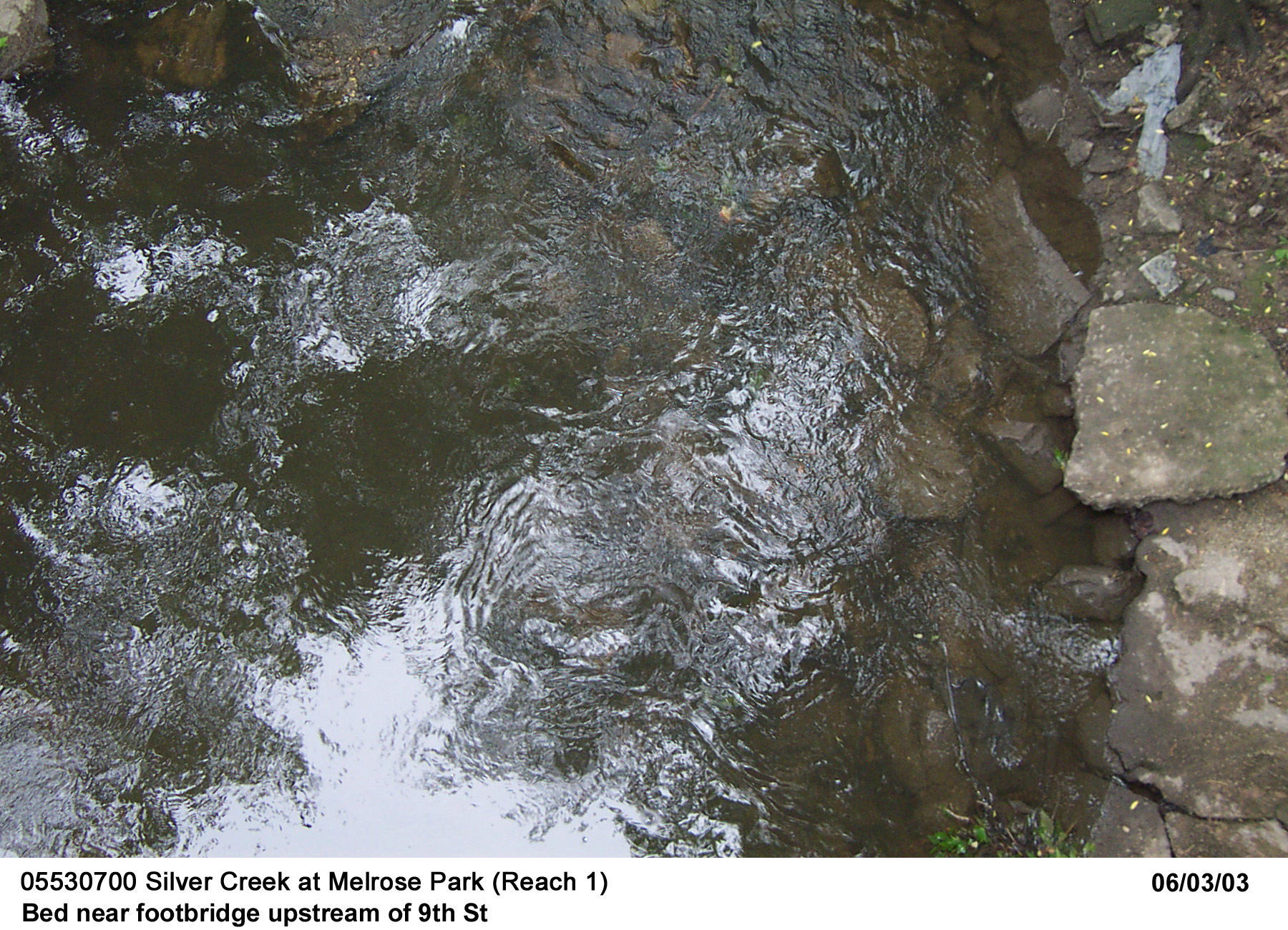
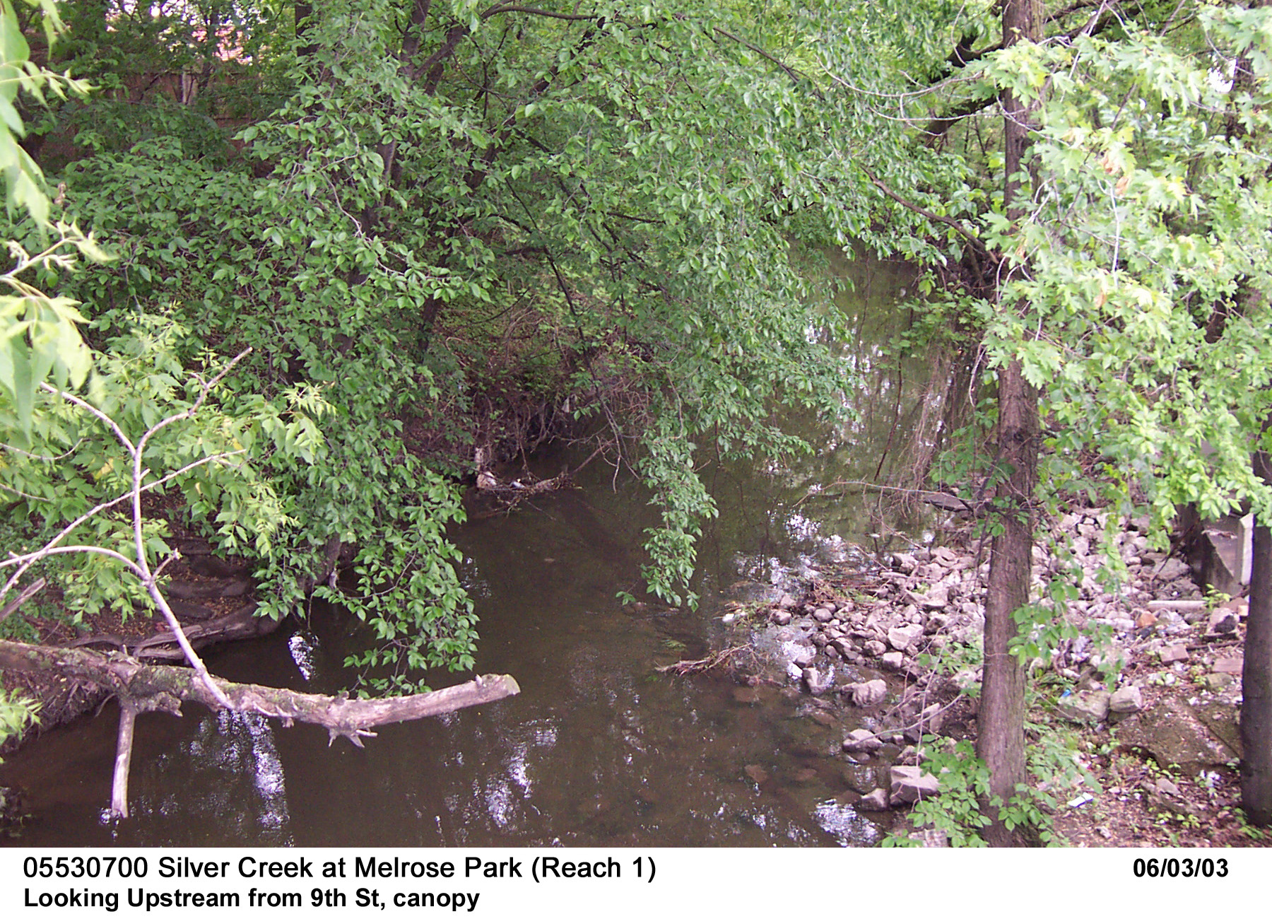

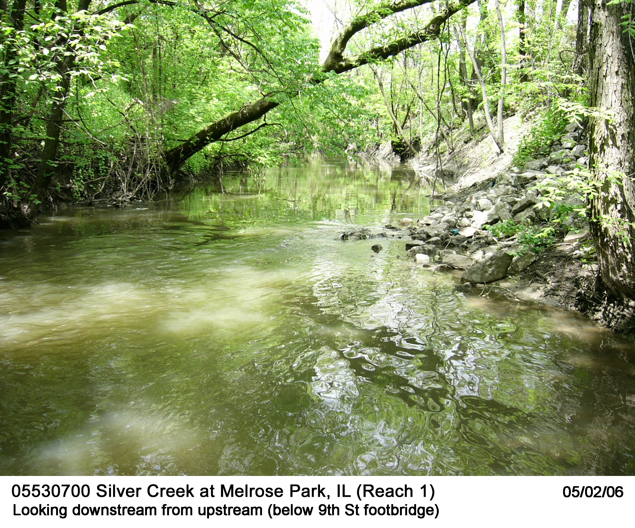
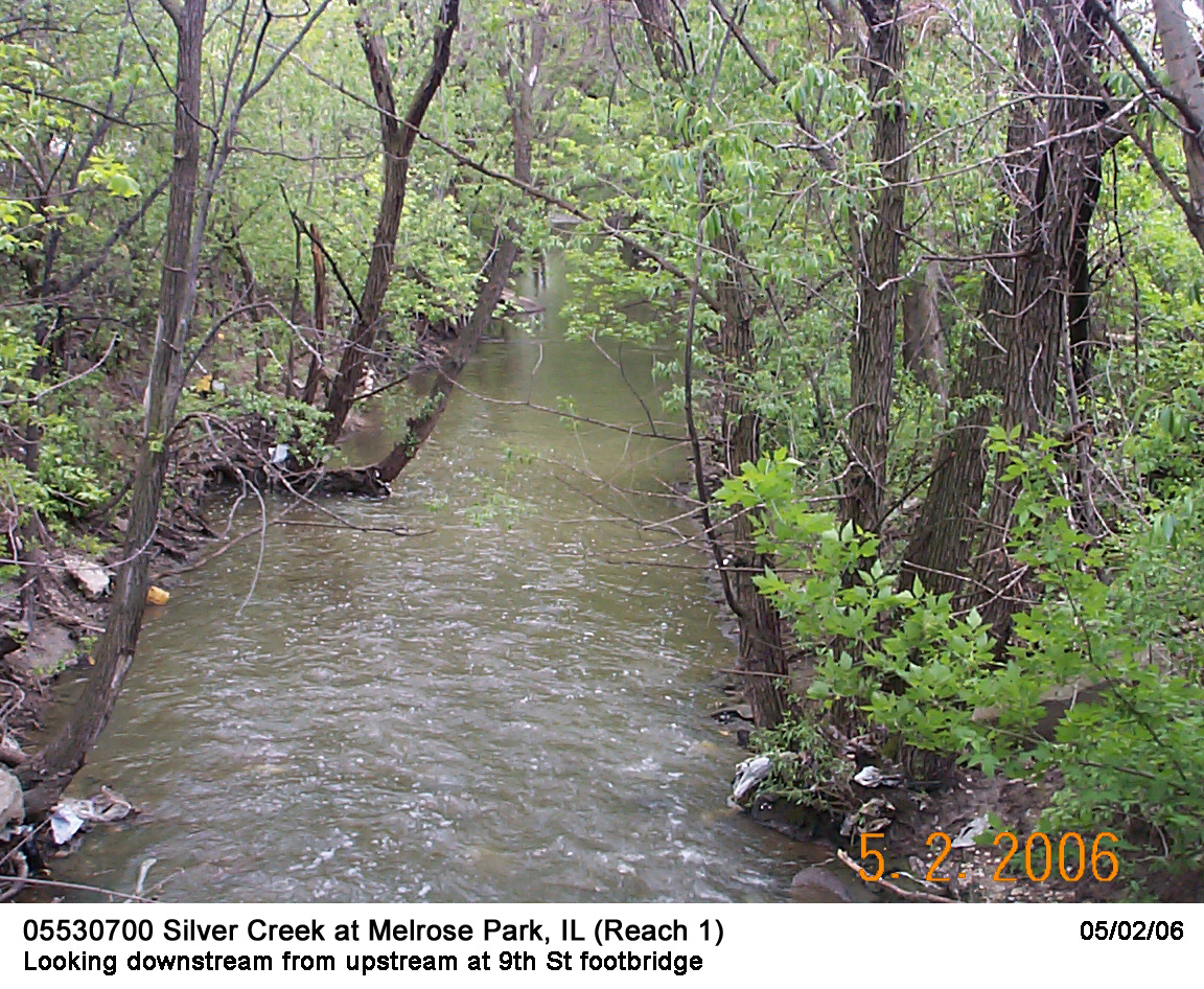
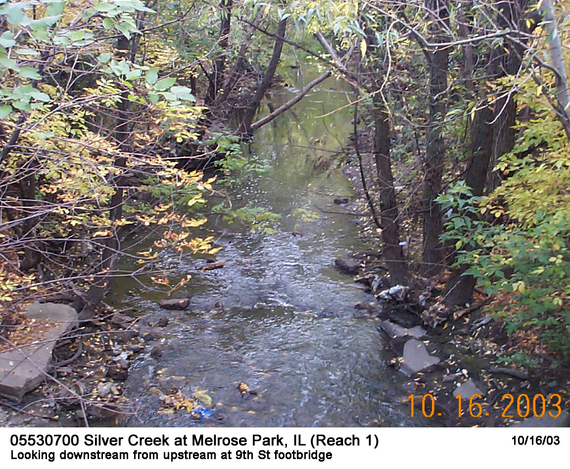

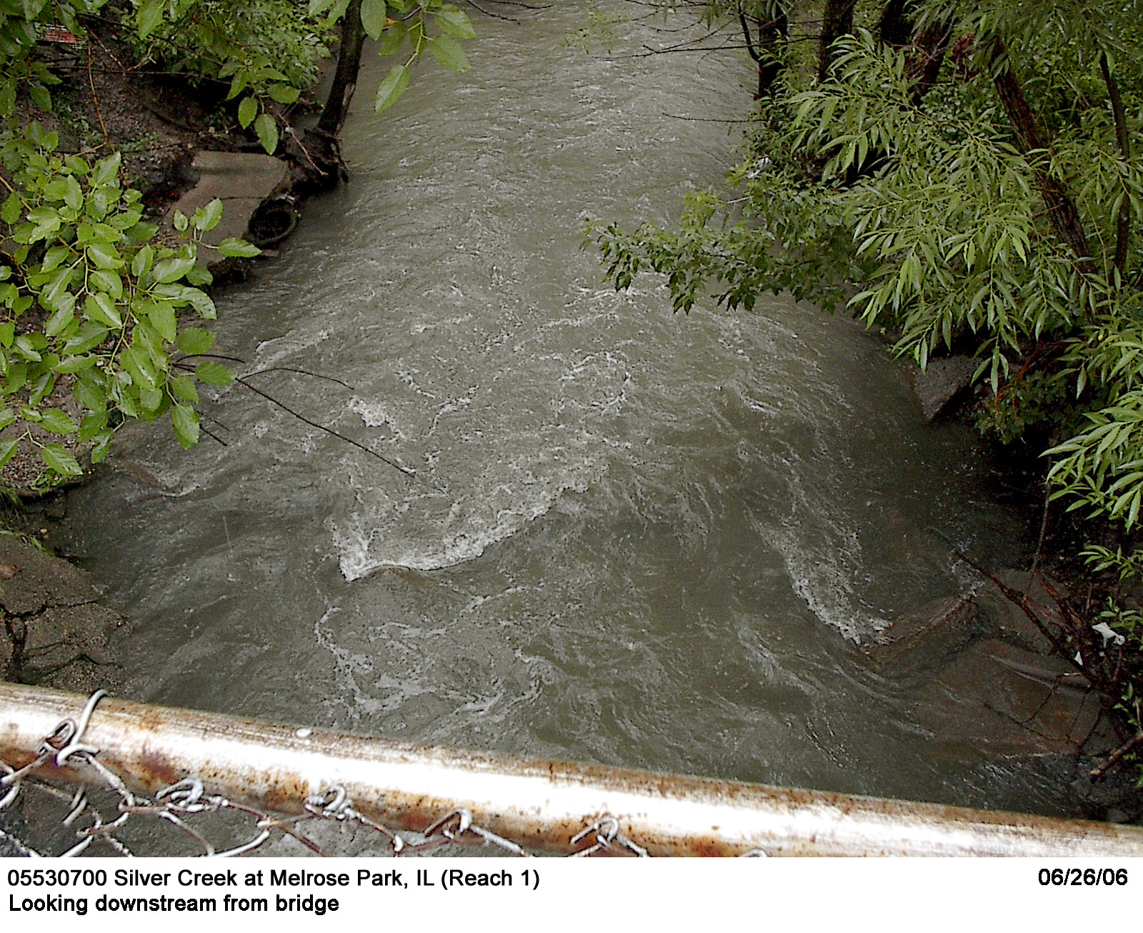
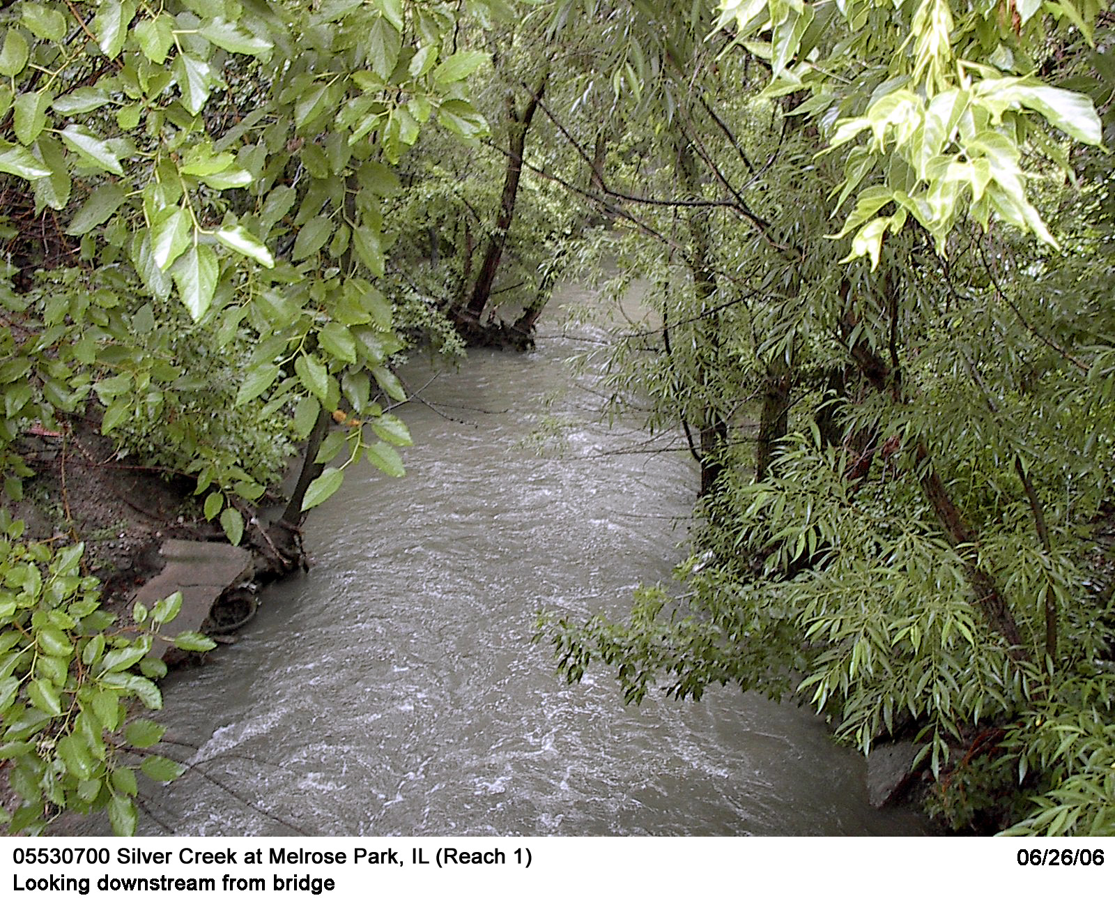
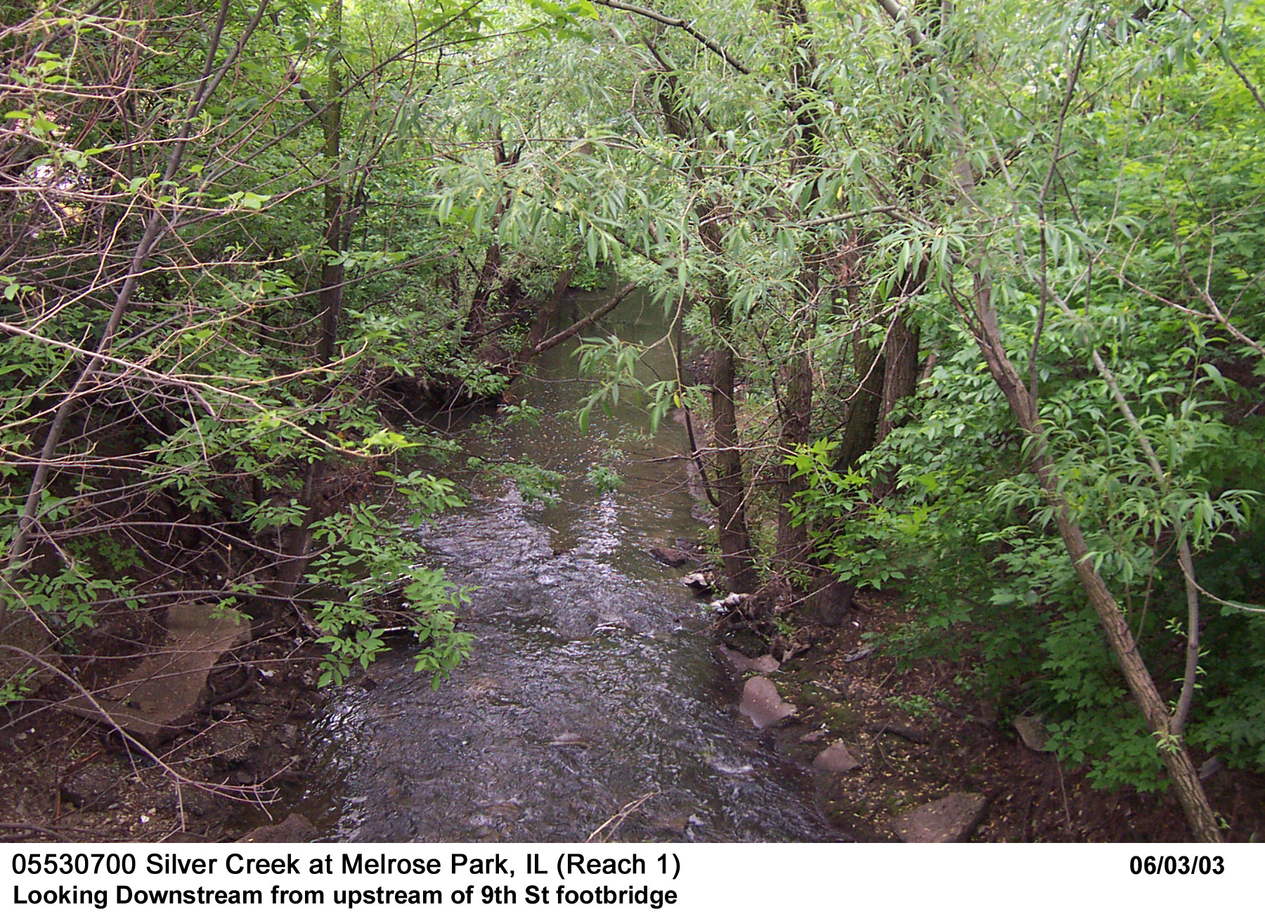
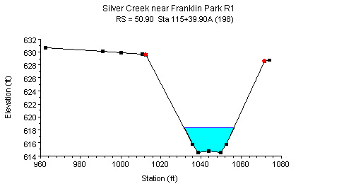
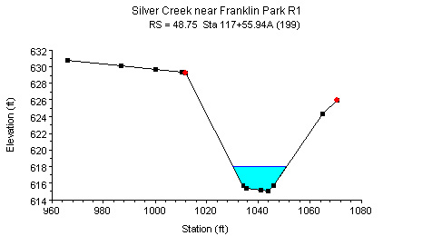
Description of Channel.--The study reach is slightly meandering with alternating pools and riffles. Cross sectional shape is basically trapezoidal. Top width varies around 40 ft., bank height is about 15 ft., and bottom width is around 20 ft. The channel bed consists of sand, gravel, a matrix of cobbles, and drifted debris. The bank slope is steep and bank materials vary in alternating sections from cobbles in firm clay to matted tree roots with light tree coverage. Trees on top of banks are dense but have diameters less than 1 foot, in general. Canopy cover overhangs the channel and touches the water surface at low flows.
Floods.--Maximum discharge, 15,500 ft3/s, Apr. 13, 1994, gage height, 20.46 feet.

![]() U.S. Department of the Interior |
U.S. Geological Survey
U.S. Department of the Interior |
U.S. Geological Survey
URL: http://il.water.usgs.gov/proj/nvalues/db/sites/05530700.shtml[an error occurred while processing this directive]?
Page Contact Information: David Soong
Page Last Modified: February 4, 2013
