

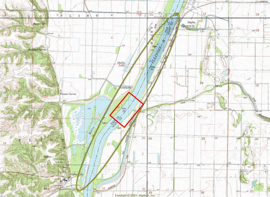
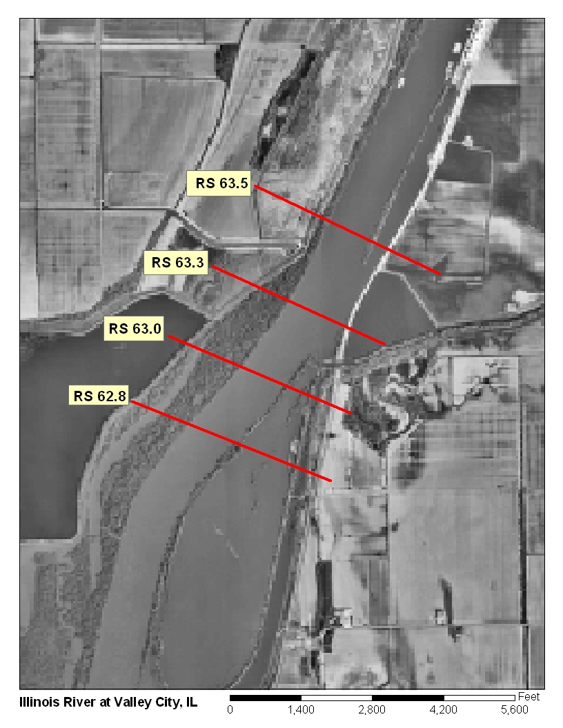
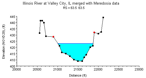
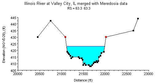
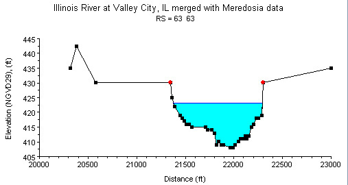
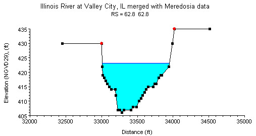
Study Reach.--The channel reach is a free-flowing navigation channel. The study reach, approximately 3,700 ft long, is located from the State Highway 104 bridge near Meredosia to the County Road 10 bridge near Valley City, as shown in the quadrangle map on the top left. There are 24 surveyed cross sections (surveyed by the U.S. Army Corps of Engineers, in August 1998) available for describing the channel geometry, four of them are in the study reach. The channel alignment, approximate variations in channel width and bank conditions, and locations of the four cross sections are shown in the aerial photograph on the top right. The general shapes of cross sections in the study reach are plotted above.
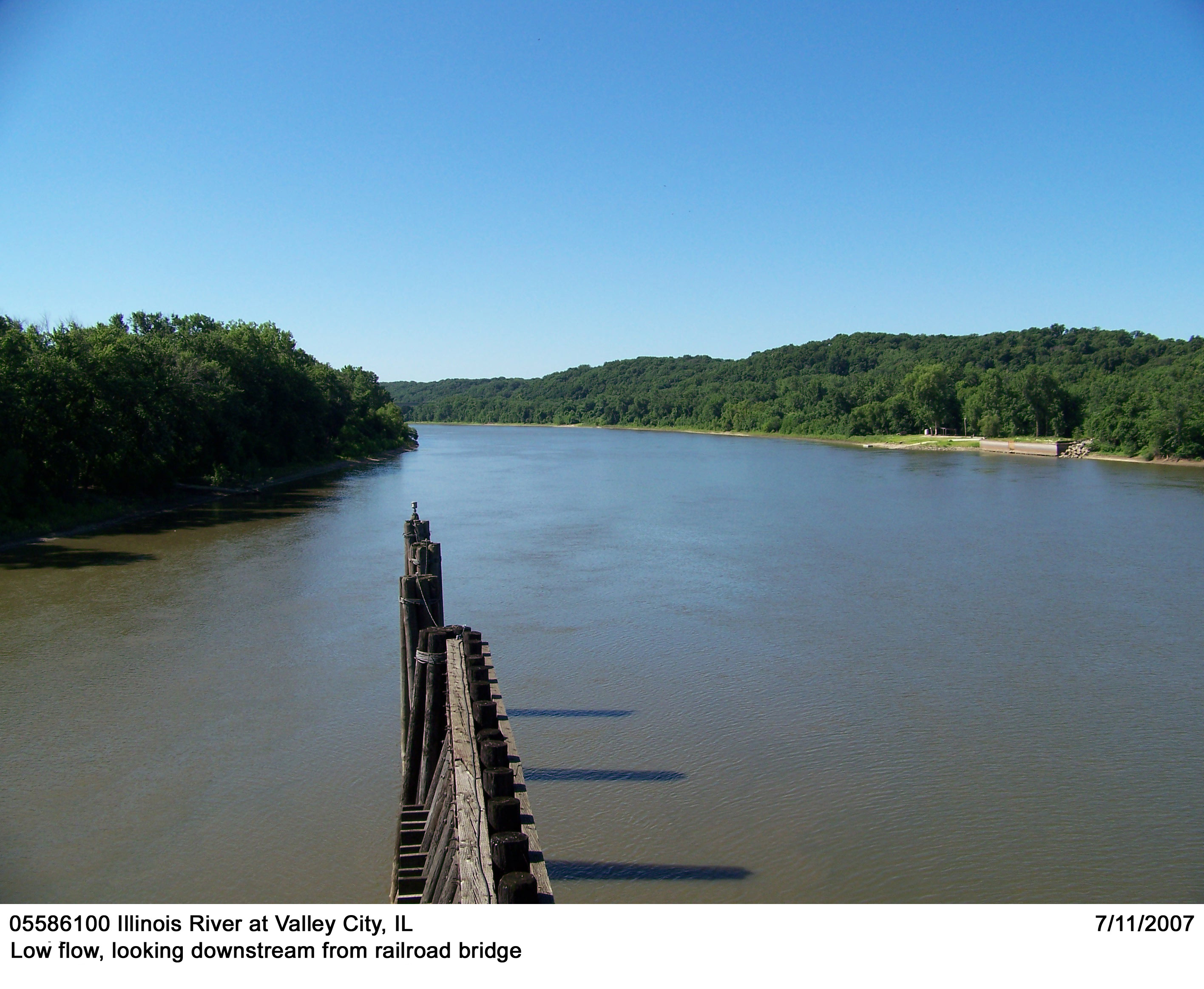
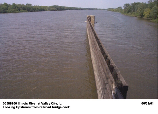
Gage Location.--Lat 39°42'12", long 90°38'43", in SE1/4 NW1/4 sec.34, T.15N., R.14W., Scott County, Hydrologic Unit 07130011, on the upstream side of the Norfolk & Southern Corporation Railroad bridge at Flints Creek, 0.4 mi east of Valley City, 1.8 mi downstream from Mauvaise Terre Creek, and at river mi 61.3. The USGS streamgage station number is 05586100.
Drainage Area.--26,743 sq mi.
Gage Datum and Elevations of Reference Points.--This is a slope station site where the auxiliary gage is located at the Illinois River at Meredosia, 9.5 miles upstream. Datum of both the base and auxiliary gages is 418.00 ft. All elevations are referenced to NGVD29.
Stage, Discharge Measurements, and Computed n-Values.--Since water year 1993, discharge measurements have been made by boat using an Acoustic Doppler Current Profiler (ADCP) in the vicinity of the Valley City gage but away from the shear fence of the railroad bridge. Events for the n-value study were selected from ADCP measurements that represent main-channel flows and were free of backwater effects from the Upper Mississippi River (river stage at Grafton on the Mississippi River is lower than that at Valley City on the Illinois River by 2 ft).
| Date of Observation | Discharge (ft3/s) | Average Cross Section Area (ft2) | Hydraulic Radius (ft) | Mean Velocity (ft/s) | Slope (ft/ft) | Coefficient of Roughness n |
|---|---|---|---|---|---|---|
| 10/9/2003 | 4290.0 | 6495.3 | 8.37 | 0.66 | 0.000002 | 0.014 |
| 10/24/2002 | 5700.0 | 6565.8 | 8.43 | 0.87 | 0.000002 | 0.011 |
| 1/9/2003 | 5770.0 | 6216.5 | 8.14 | 0.93 | 0.000006 | 0.015 |
| 8/22/2003 | 7340.0 | 6782.7 | 8.59 | 1.09 | 0.000004 | 0.011 |
| 7/24/2001 | 8830.0 | 7092.9 | 8.81 | 1.25 | 0.000006 | 0.012 |
| 9/6/2001 | 10500.0 | 7205.6 | 8.89 | 1.46 | 0.000008 | 0.012 |
| 8/1/2002 | 10500.0 | 7507.8 | 9.11 | 1.40 | 0.000008 | 0.012 |
| 1/29/2002 | 10700.0 | 7385.6 | 9.02 | 1.46 | 0.000011 | 0.015 |
| 4/24/2003 | 11400.0 | 7523.9 | 9.12 | 1.52 | 0.000007 | 0.011 |
| 10/4/2000 | 11700.0 | 7101.2 | 8.82 | 1.65 | 0.000015 | 0.015 |
| 1/24/2001 | 14500.0 | 8758.3 | 10.06 | 1.66 | 0.000011 | 0.014 |
| 12/13/2001 | 15900.0 | 9105.4 | 10.35 | 1.75 | 0.000016 | 0.016 |
| 7/10/2003 | 19400.0 | 9143.8 | 10.38 | 2.12 | 0.000020 | 0.015 |
| 3/5/2007 | 60000.0 | 23906.4 | 11.08 | 2.57 | 0.000038 | 0.017 |
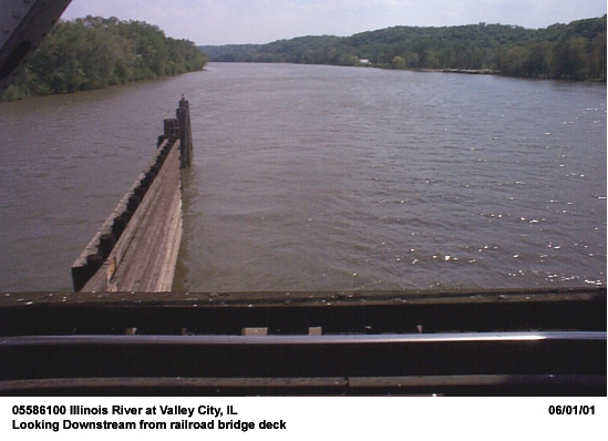
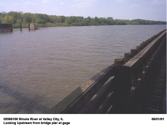
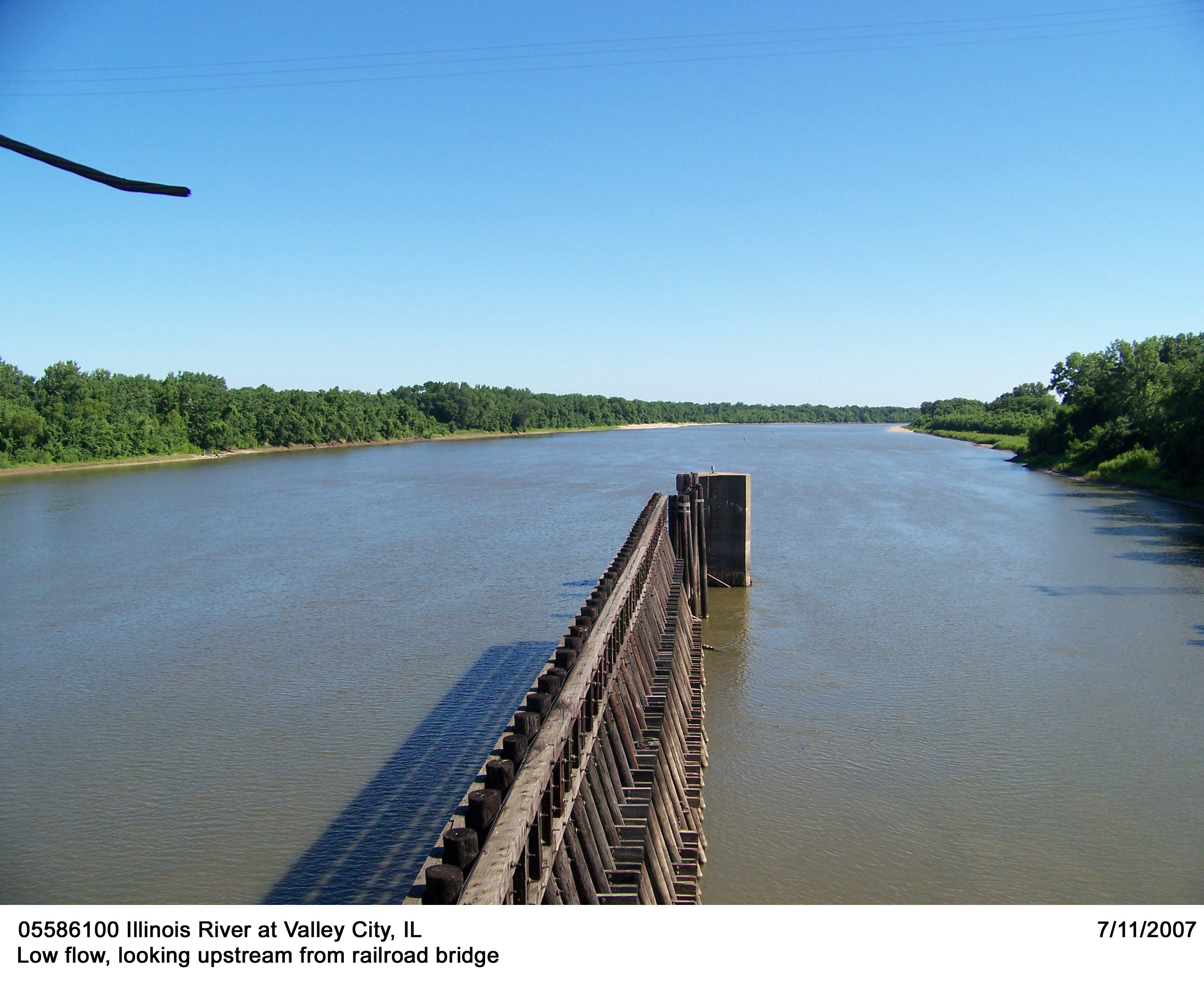
Description of Channel.--This channel is natural in the navigable river. The streambed at Valley City consists of silt, sand and gravel. Cross-sectional geometry is a wide semicircle. Bank materials are also mixtures of silt, sand and gravels with dense shrubs and trees on top of the bank. The average channel width at bank points is approximately 1000 ft with an average depth 22 ft. The study reach is straight except for a small bend in the lower portion. Longitudinal variation in channel width and cross-sectional shape is gradual.
Floods.-- Maximum discharge, 123,000 ft3/s, May 26-28, 1943; maximum gage height 28.61 ft, May 26, 1943 at Meredosia. Flood of July 27, 1993 reached a stage of 25.95 ft., caused by backwater from the flooding on the Mississippi River.

![]() U.S. Department of the Interior |
U.S. Geological Survey
U.S. Department of the Interior |
U.S. Geological Survey
URL: http://il.water.usgs.gov/proj/nvalues/db/sites/05586100.shtml[an error occurred while processing this directive]?
Page Contact Information: David Soong
Page Last Modified: February 4, 2013
