

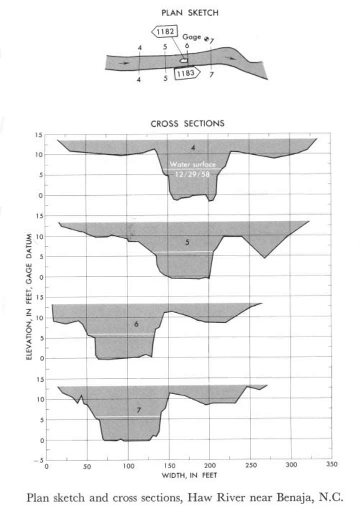
Study Reach.--Section 4 is about 400 ft upstream from gage.
Gage Location.--Lat 36°16', long 79°34', on left bank 200 ft upstream from site of old High Rock Mill, 500 ft upstream from bridge on Secondary Road 2620, 0.5 mile upstream from Rockingham-Guilford County line, 6 miles down stream from Troublesome Creek, and 6 miles east of Benaja, Rockingham County.
Drainage Area.--168 sq mi.
Gage Datum and Elevations of Reference Points.--Not available.
Stage, Discharge Measurements and Computed n-Values.--Gage heights were 5.70 ft at gage; 6.09 ft at section 4. Peak discharges was 1,000 cfs on Dec. 29, 1958.
| Date of Observation | Discharge (ft3/s) | Average Cross Section Area (ft2) | Hydraulic Radius (ft) | Mean Velocity (ft/s) | Slope | Coefficient of Roughness n |
|---|---|---|---|---|---|---|
| 12/29/1958 | 1000.5 | 404.3 | 4.87 | 2.48 | 0.001152 | 0.059 |
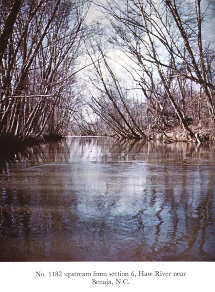

Description of Channel.--Bed is composed of coarse sand and a few outcrops. Banks on both sides are heavily lined with overhanging birch trees.

![]() U.S. Department of the Interior |
U.S. Geological Survey
U.S. Department of the Interior |
U.S. Geological Survey
URL: http://il.water.usgs.gov/proj/nvalues/db_barnes/sites/02935000.shtml[an error occurred while processing this directive]?
Page Contact Information: David Soong
Page Last Modified: December 19, 2012
