

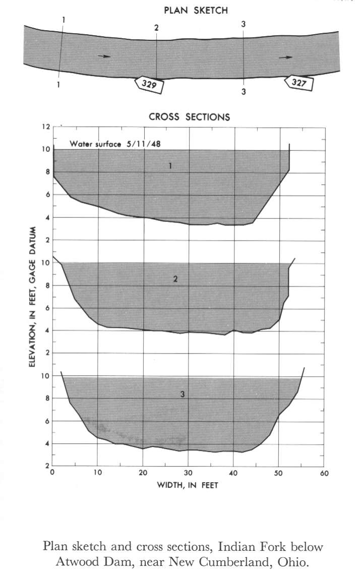
Study Reach.--Section 1 is about 300 ft downstream from gage.
Gage Location.--Lat 40°31'30", long 81°17'20", in SE1/4 sec.28, T.15N., R.7W., on left bank 500 ft downstream from Atwood Dam, 0.5 mile upstream from mouth, and 1.5 miles southeast of New Cumberland, Tuscarawas County.
Drainage Area.--70.3 sq mi.
Gage Datum and Elevations of Reference Points.--Not available.
Stage, Discharge Measurements and Computed n-Values.--Gage heights were 10.27 ft at gage; 9.99 ft at section 1. Peak discharges was 768 cfs on May 11, 1948.
| Date of Observation | Discharge (ft3/s) | Average Cross Section Area (ft2) | Hydraulic Radius (ft) | Mean Velocity (ft/s) | Slope | Coefficient of Roughness n |
|---|---|---|---|---|---|---|
| 5/11/1948 | 767.3 | 277.0 | 4.87 | 2.77 | 0.000283 | 0.026 |
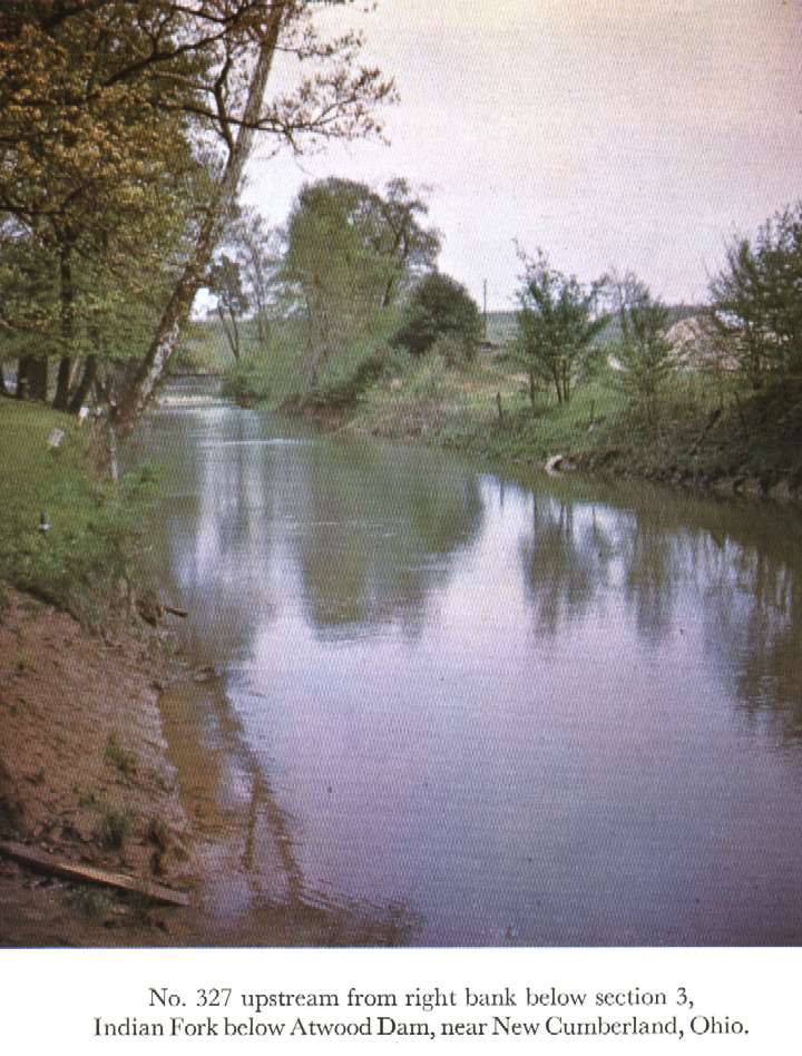
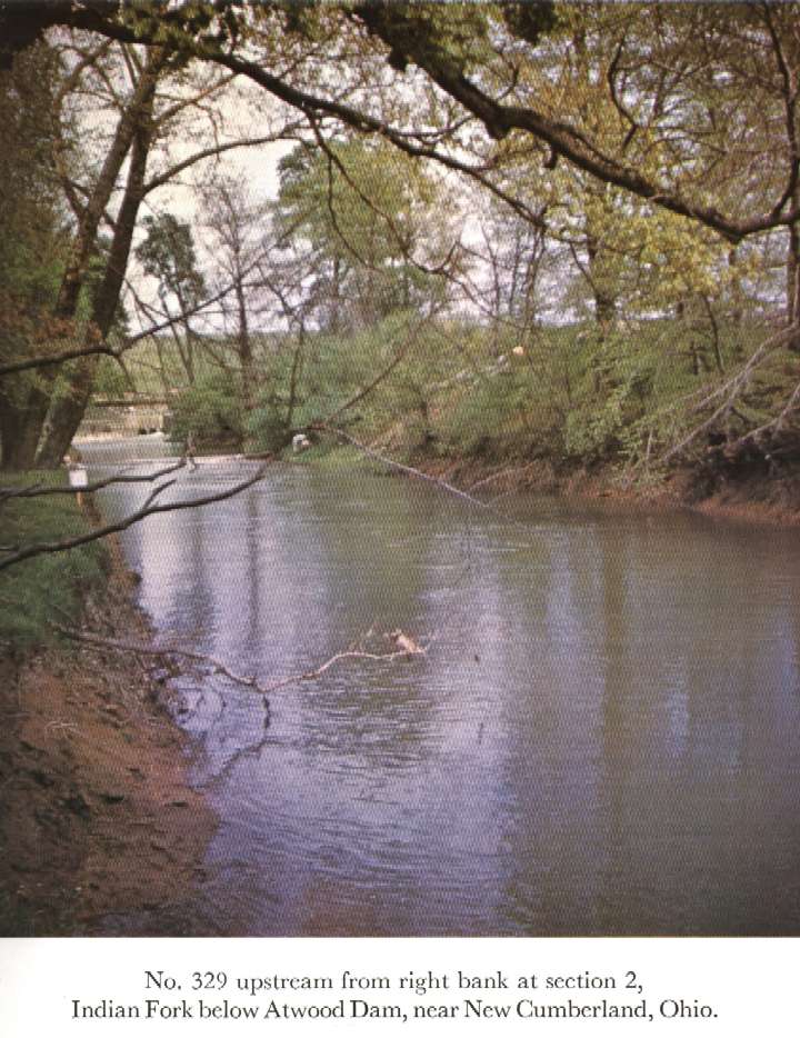
Description of Channel.--Bed and banks are composed of clay. Banks are clear except for short grass and exposed tree roots in some places.

![]() U.S. Department of the Interior |
U.S. Geological Survey
U.S. Department of the Interior |
U.S. Geological Survey
URL: http://il.water.usgs.gov/proj/nvalues/db_barnes/sites/03121500.shtml[an error occurred while processing this directive]?
Page Contact Information: David Soong
Page Last Modified: December 19, 2012
