

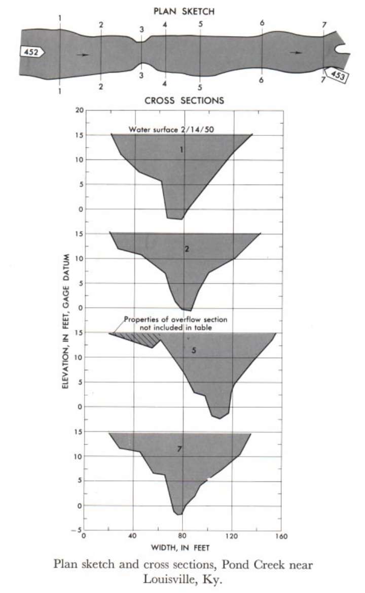
Study Reach.--Section 1 is about 550 ft upstream from gage.
Gage Location.--Lat 38°07'11", long 85°47'45", on downstream side of bridge on Manslick Road, 0.4 mile south of Third Street Road, 0.6 mile downstream from Bee Lick Creek, and 2.4 miles south of Louisville City Limits, Jefferson County.
Drainage Area.--64.0 sq mi.
Gage Datum and Elevations of Reference Points.--Not available.
Stage, Discharge Measurements and Computed n-Values.--Gage heights were 15.00 ft at gage; 15.1 ft at section 1. Peak discharges was 1,480 cfs on Feb. 14, 1950.
| Date of Observation | Discharge (ft3/s) | Average Cross Section Area (ft2) | Hydraulic Radius (ft) | Mean Velocity (ft/s) | Slope | Coefficient of Roughness n |
|---|---|---|---|---|---|---|
| 2/14/1950 | 1503.0 | 801.3 | 7.24 | 1.88 | 0.000637 | 0.070 |
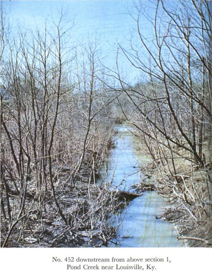
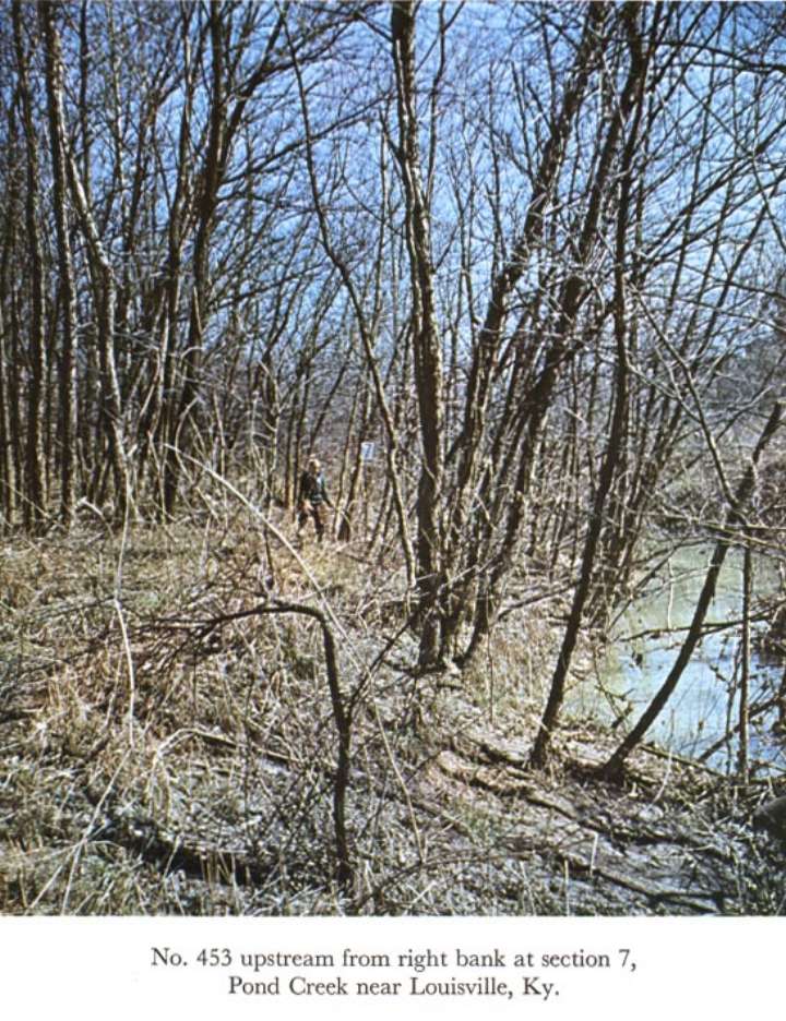
Description of Channel.--Bed is fine sand and silt. Banks are irregular with fairly heavy growth of 2- to 8-inch trees on the banks above low water, particularly on the left bank. Reach sections 1, 2, 5, 6, 7 used to determine roughness coefficient. Bridge abutments form constriction at section 3.

![]() U.S. Department of the Interior |
U.S. Geological Survey
U.S. Department of the Interior |
U.S. Geological Survey
URL: http://il.water.usgs.gov/proj/nvalues/db_barnes/sites/03302000.shtml[an error occurred while processing this directive]?
Page Contact Information: David Soong
Page Last Modified: December 19, 2012
