

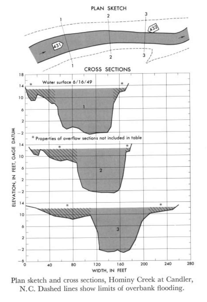
Study Reach.--Section 1 is about 250 ft downstream from gage.
Gage Location.--Lat 35°32'28", long 82°40'35", on left bank 0.1 mile downstream from Pole Creek, 0.4 mile downstream from bridge on State Highway 112, and 1 mile east of Candler, Buncombe County.
Drainage Area.--79.8 sq mi.
Gage Datum and Elevations of Reference Points.--Not available.
Stage, Discharge Measurements and Computed n-Values.--Gage heights were 13.75 ft at gage; 13.33 ft at section 1. Peak discharges was 6,800 cfs total, 6,460 cfs in the main channel on June 16, 1949.
| Date of Observation | Discharge (ft3/s) | Average Cross Section Area (ft2) | Hydraulic Radius (ft) | Mean Velocity (ft/s) | Slope | Coefficient of Roughness n |
|---|---|---|---|---|---|---|
| 6/16/1949 | 6480.8 | 1216.7 | 11.56 | 5.33 | 0.002000 | 0.060 |
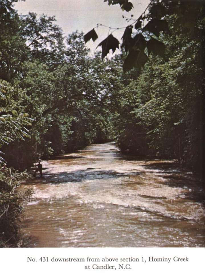
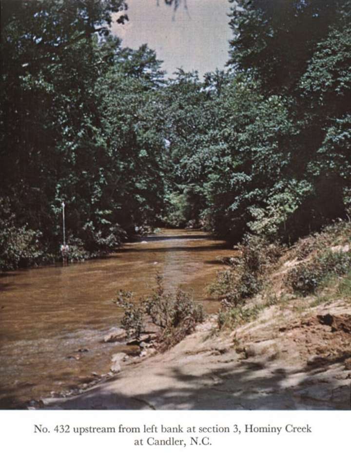
Description of Channel.--Bed is sand and gravel with some boul ders as much as 20 inches in diameter. Both banks are lined with overhanging trees and bushes.

![]() U.S. Department of the Interior |
U.S. Geological Survey
U.S. Department of the Interior |
U.S. Geological Survey
URL: http://il.water.usgs.gov/proj/nvalues/db_barnes/sites/03448500.shtml[an error occurred while processing this directive]?
Page Contact Information: David Soong
Page Last Modified: December 19, 2012
