

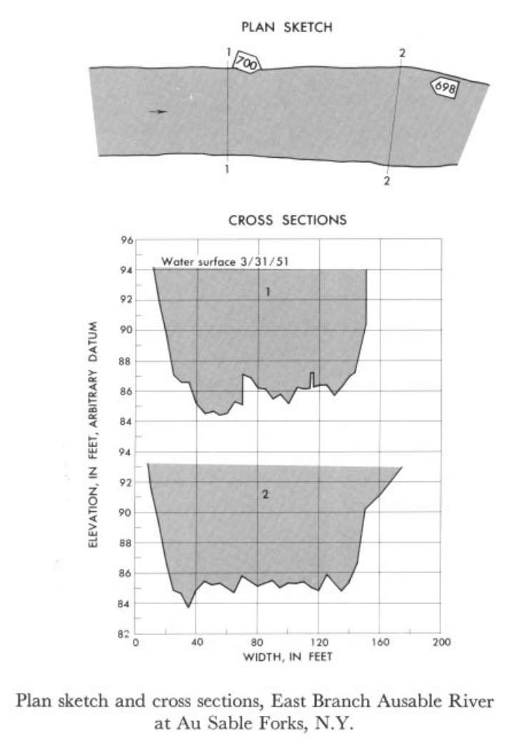
Study Reach.--Section 1 is about 0.75 mile upstream from gage.
Gage Location.--Lat 44°26'20", long 73°40'55", on left bank 700 ft upstream from upper highway bridge in Au Sable Forks, Essex County, and 0.5 mile upstream from confluence with West Branch.
Drainage Area.--198 sq mi.
Gage Datum and Elevations of Reference Points.--Not available.
Stage, Discharge Measurements and Computed n-Values.--Gage heights were 8.20 ft at gage; 94.08 ft (different datum) at section 1. Peak discharges was 7,790 cfs on Mar. 31, 1951.
| Date of Observation | Discharge (ft3/s) | Average Cross Section Area (ft2) | Hydraulic Radius (ft) | Mean Velocity (ft/s) | Slope | Coefficient of Roughness n |
|---|---|---|---|---|---|---|
| 3/31/1951 | 7773.6 | 1070.0 | 6.72 | 7.27 | 0.005618 | 0.055 |
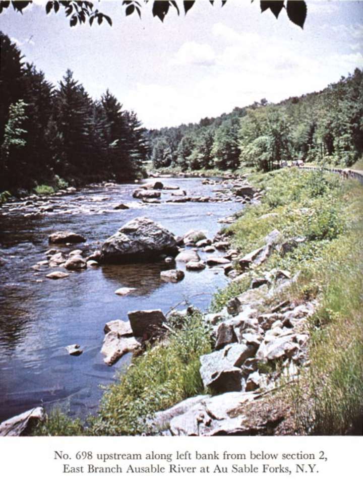
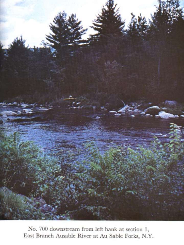
Description of Channel.--Bed consists of gravel, rock, and boulders as much as 5 ft in diameter. Banks are lined with boulders, small trees, and bushes.

![]() U.S. Department of the Interior |
U.S. Geological Survey
U.S. Department of the Interior |
U.S. Geological Survey
URL: http://il.water.usgs.gov/proj/nvalues/db_barnes/sites/04275000.shtml[an error occurred while processing this directive]?
Page Contact Information: David Soong
Page Last Modified: December 19, 2012
