

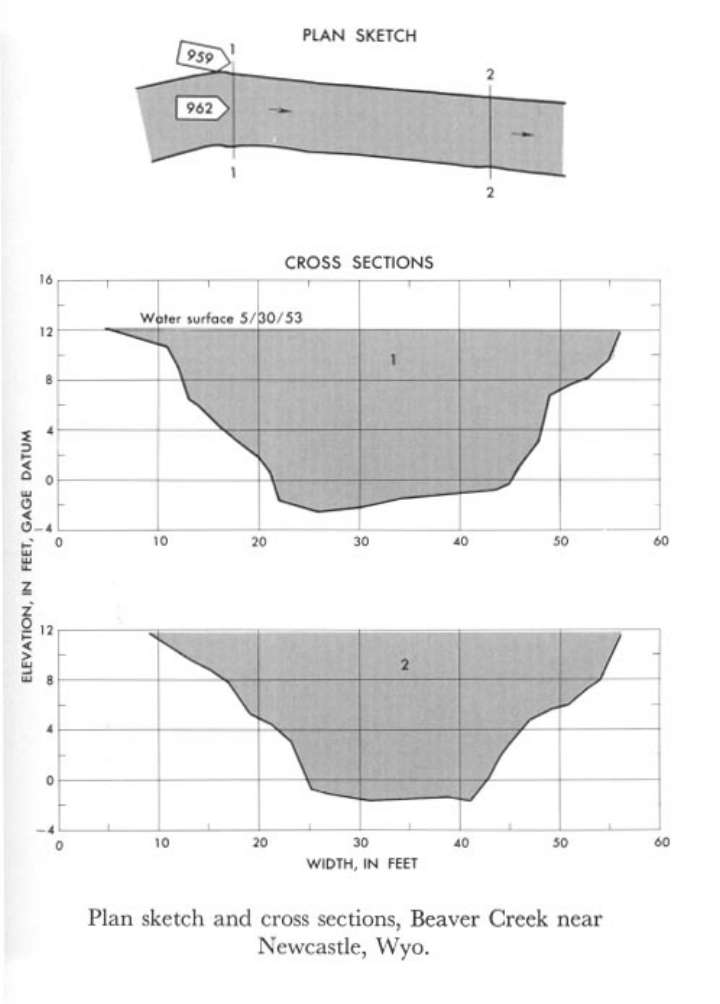
Study Reach.--Section 1 is about 300 ft downstream from gage.
Gage Location.--Lat 43°32'05", long 104°07'00", in NW1/4 sec.18, T.41N., R.60W., at highway bridge, 2.5 miles down stream from Sheep Creek, and 23 miles south of Newcastle.
Drainage Area.--1,320 sq mi., approximately.
Gage Datum and Elevations of Reference Points.--Not available.
Stage, Discharge Measurements and Computed n-Values.--Gage height were12.75 ft at gage; 11.98 ft at section 1. Peak discharge was l,600 cfs on May 30, 1953.
| Date of Observation | Discharge (ft3/s) | Average Cross Section Area (ft2) | Hydraulic Radius (ft) | Mean Velocity (ft/s) | Slope | Coefficient of Roughness n |
|---|---|---|---|---|---|---|
| 5/30/1953 | 1615.0 | 425.0 | 6.94 | 3.80 | 0.001237 | 0.043 |
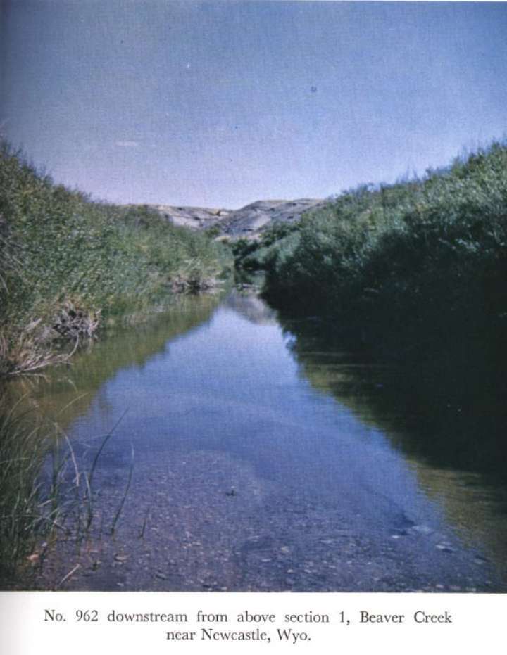
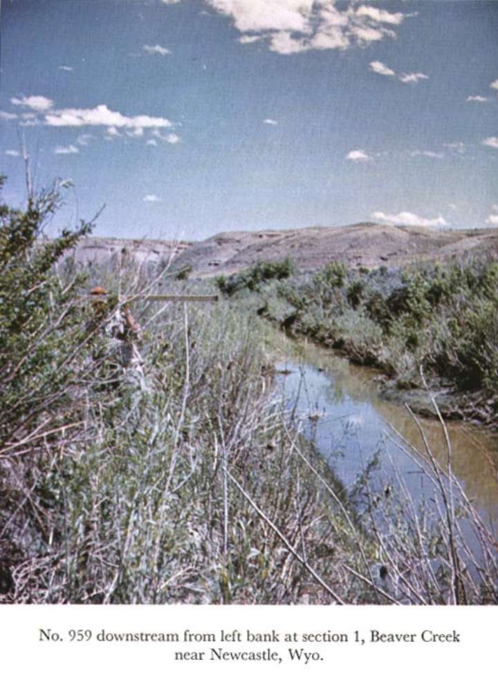
Description of Channel.--Bed is mostly sand and silt. Banks are irregular and have thick growth of brush. Channel curves about 20° to the right above the reach and straightens below it.

![]() U.S. Department of the Interior |
U.S. Geological Survey
U.S. Department of the Interior |
U.S. Geological Survey
URL: http://il.water.usgs.gov/proj/nvalues/db_barnes/sites/06394000.shtml[an error occurred while processing this directive]?
Page Contact Information: David Soong
Page Last Modified: December 19, 2012
