

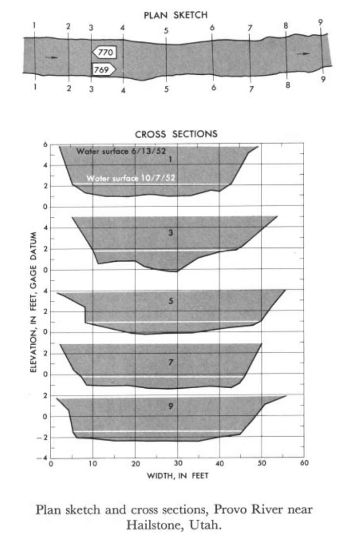
Study Reach.--Section 1 is about 120 ft upstream from gage.
Gage Location.--Lat 40°36', long 111° 22', in SE1/4 sec.34, T.2S., R.5E., on right bank 3 miles upstream from Ross Creek and Hailstone.
Drainage Area.--233 sq mi.
Gage Datum and Elevations of Reference Points.--Not available.
Stage, Discharge Measurements and Computed n-Values.--Gage heights were 4.66 ft, 1.58 at gage and 5.66 ft, 2.14 ft at section 1. Peak discharges were 1,200 cfs and 64.8 cfs.on June 13 and Oct. 7, 1952.
| Date of Observation | Discharge (ft3/s) | Average Cross Section Area (ft2) | Hydraulic Radius (ft) | Mean Velocity (ft/s) | Slope | Coefficient of Roughness n |
|---|---|---|---|---|---|---|
| 10/7/1952 | 64.9 | 34.6 | 0.90 | 1.88 | 0.008279 | 0.073 |
| 6/13/1952 | 1202.2 | 176.8 | 3.34 | 6.80 | 0.008953 | 0.045 |
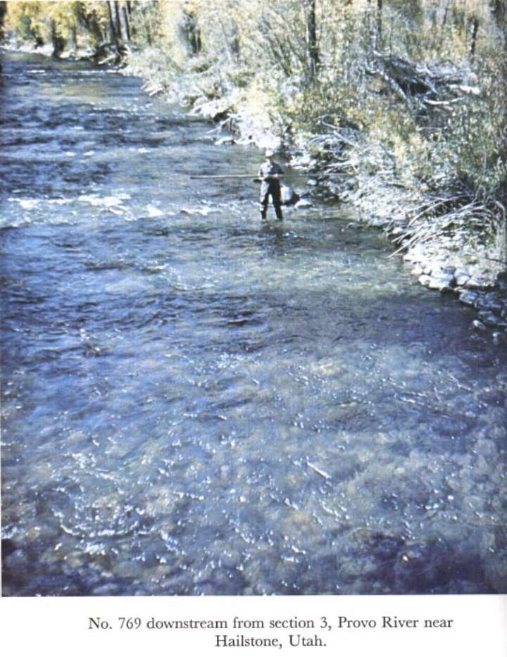
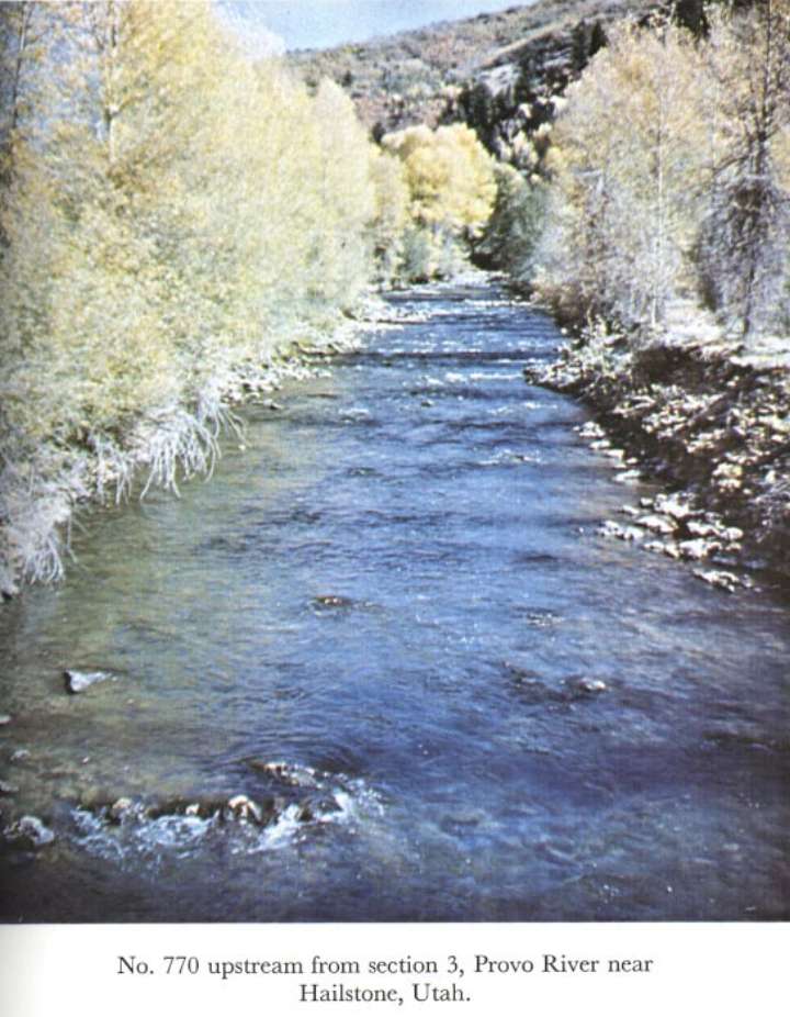
Description of Channel.--Bed and banks consist of smooth rounded rocks as much as 1 ft in diameter. Some undergrowth is below water elevations of June 13.

![]() U.S. Department of the Interior |
U.S. Geological Survey
U.S. Department of the Interior |
U.S. Geological Survey
URL: http://il.water.usgs.gov/proj/nvalues/db_barnes/sites/10155000.shtml[an error occurred while processing this directive]?
Page Contact Information: David Soong
Page Last Modified: December 19, 2012
