

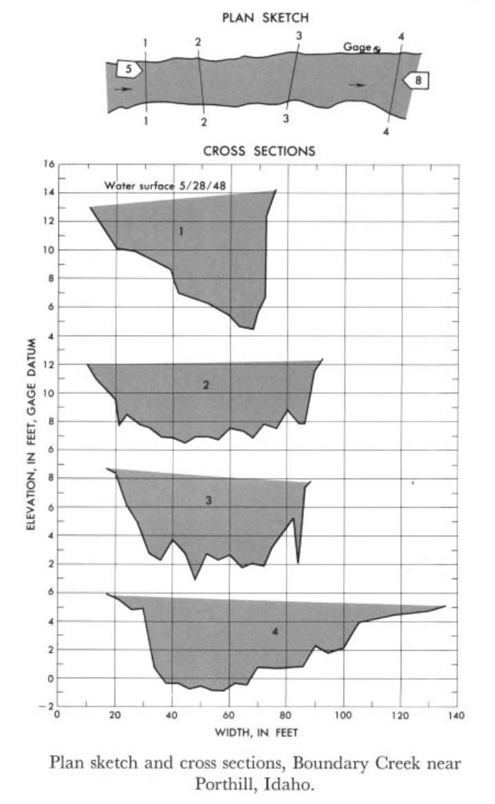
Study Reach.--Section 1 is 413 ft upstream from gage.
Gage Location.--Lat 48°59'50", long 116°34'05", in SW1/4 sec.11, T.65N., R.2W., on left bank near mouth of canyon, 0.2 mile south of international boundary, and 3 miles west of Porthill.
Drainage Area.--97 sq mi., approximately.
Gage Datum and Elevations of Reference Points.--Not available.
Stage, Discharge Measurements and Computed n-Values.--Gage height were 5.34 ft at gage; 13.60 ft at section 1. Peak discharge was 2,530 cfs on May 28, 1948.
| Date of Observation | Discharge (ft3/s) | Average Cross Section Area (ft2) | Hydraulic Radius (ft) | Mean Velocity (ft/s) | Slope | Coefficient of Roughness n |
|---|---|---|---|---|---|---|
| 5/28/1948 | 2545.3 | 354.0 | 4.05 | 7.19 | 0.018664 | 0.073 |
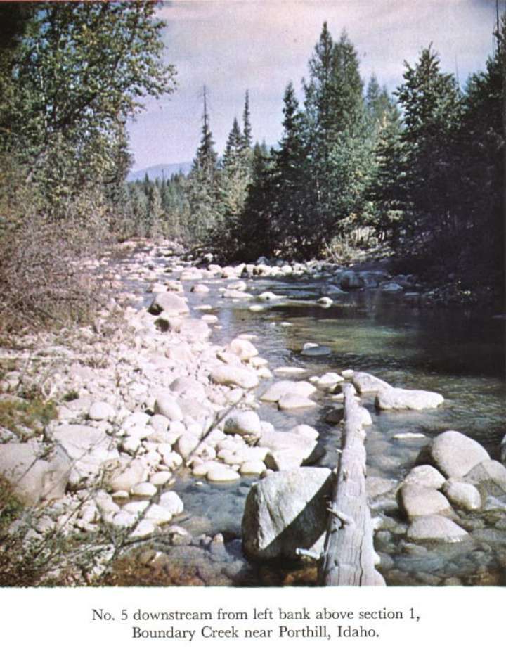
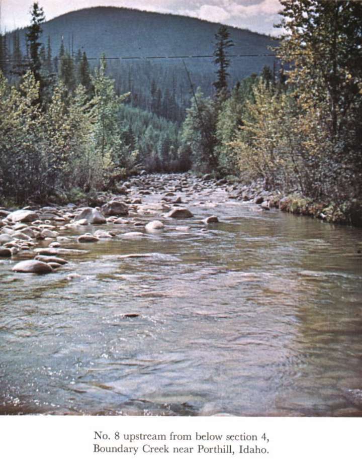
Description of Channel.--Bed consists of boulders; d50 = 210 mm, d84 = 375 mm. Banks are composed of boulders and have trees and brush along top.

![]() U.S. Department of the Interior |
U.S. Geological Survey
U.S. Department of the Interior |
U.S. Geological Survey
URL: http://il.water.usgs.gov/proj/nvalues/db_barnes/sites/12321500.shtml[an error occurred while processing this directive]?
Page Contact Information: David Soong
Page Last Modified: December 19, 2012
