

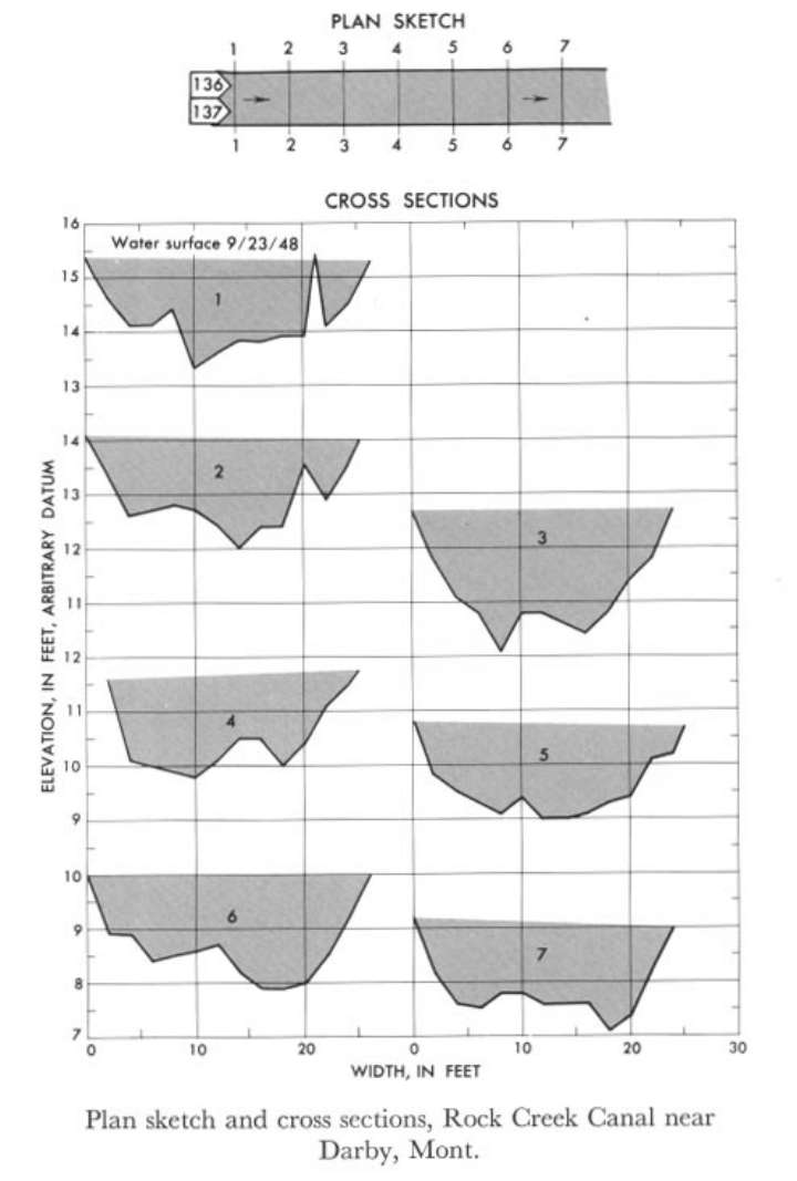
Study Reach.--Section 1 is about 0.25 mile upstream from gage.
Gage Location.--Lat 46°04'40", long 114°12'40", in SW1/4 sec.28, T.4N., R.21W., on downstream side of footbridge, 0.25 mile downstream from diversion dam, 1.5 miles downstream from Como Lake, and 4 miles northwest of Darby.
Drainage Area.--Not available.
Gage Datum and Elevations of Reference Points.--Not available.
Stage, Discharge Measurements and Computed n-Values.--Gage heights were 3.34 ft at gage; 15.33 ft at section 1. Peak discharges was 138 cfs. on Sept. 23, 1948.
| Date of Observation | Discharge (ft3/s) | Average Cross Section Area (ft2) | Hydraulic Radius (ft) | Mean Velocity (ft/s) | Slope | Coefficient of Roughness n |
|---|---|---|---|---|---|---|
| 9/23/1948 | 139.3 | 33.0 | 1.29 | 4.22 | 0.020983 | 0.060 |
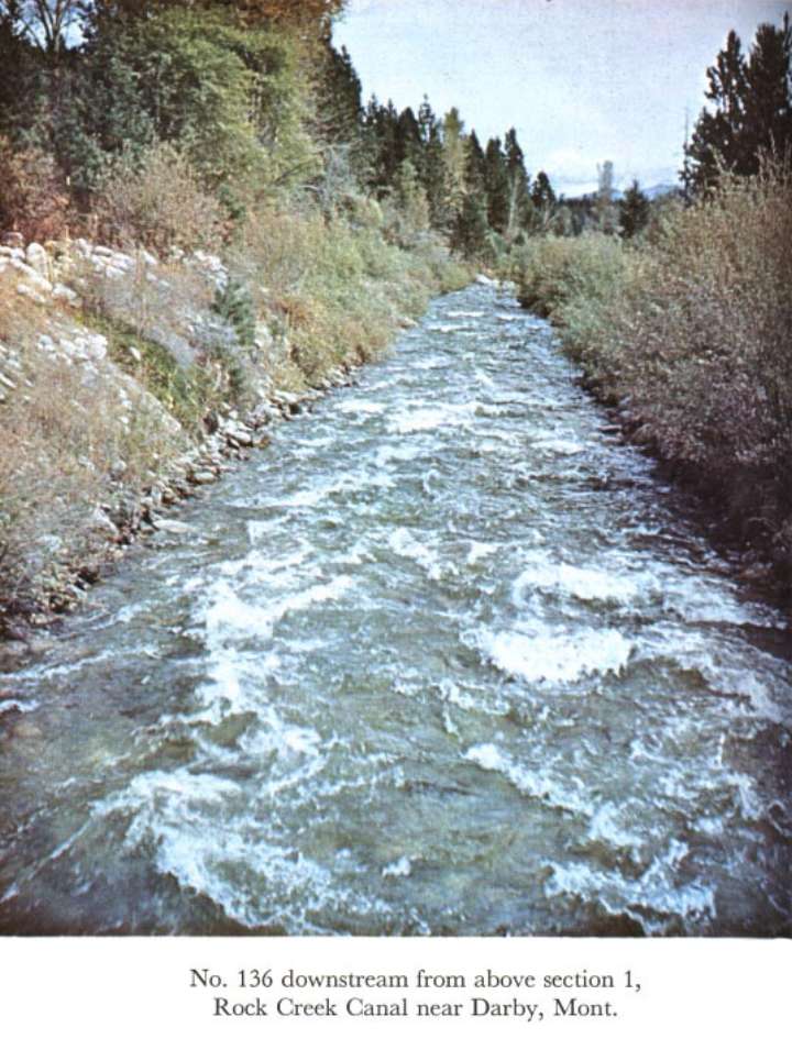
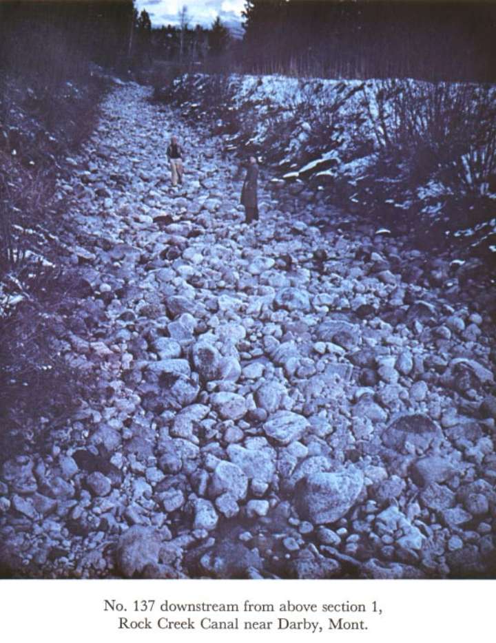
Description of Channel.--Bed and bank consist of boulders; d50 = 210 mm, d84 = 375 mm.

![]() U.S. Department of the Interior |
U.S. Geological Survey
U.S. Department of the Interior |
U.S. Geological Survey
URL: http://il.water.usgs.gov/proj/nvalues/db_barnes/sites/12345500.shtml[an error occurred while processing this directive]?
Page Contact Information: David Soong
Page Last Modified: December 19, 2012
