

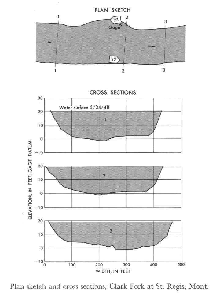
Study Reach.--Section 1 is 660 ft upstream from gage.
Gage Location.--Lat 47°18'05", long 115°05'15", in center of SW1/4 sec.19, T.18N., R.27W., on left bank at St. Regis, 0.5 mile downstream from St. Regis River.
Drainage Area.--10,709 sq mi.
Gage Datum and Elevations of Reference Points.--Not available.
Stage, Discharge Measurements and Computed n-Values.--Gage heights were 19.96 ft at gage; 20.42 ft at section 1. Peak discharges was 68,900 cfs on May 24, 1948.
| Date of Observation | Discharge (ft3/s) | Average Cross Section Area (ft2) | Hydraulic Radius (ft) | Mean Velocity (ft/s) | Slope | Coefficient of Roughness n |
|---|---|---|---|---|---|---|
| 5/24/1948 | 68908.3 | 7010.0 | 16.13 | 9.83 | 0.000733 | 0.028 |
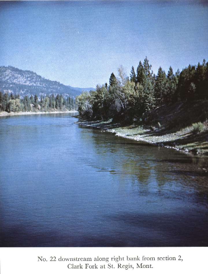

Description of Channel.--Bed consists of well-rounded boulders; d50 = 135 mm, d84 = 205 mm. Banks are composed of gravel and boulders, and have tree and brush cover.

![]() U.S. Department of the Interior |
U.S. Geological Survey
U.S. Department of the Interior |
U.S. Geological Survey
URL: http://il.water.usgs.gov/proj/nvalues/db_barnes/sites/12354500.shtml[an error occurred while processing this directive]?
Page Contact Information: David Soong
Page Last Modified: December 19, 2012
