

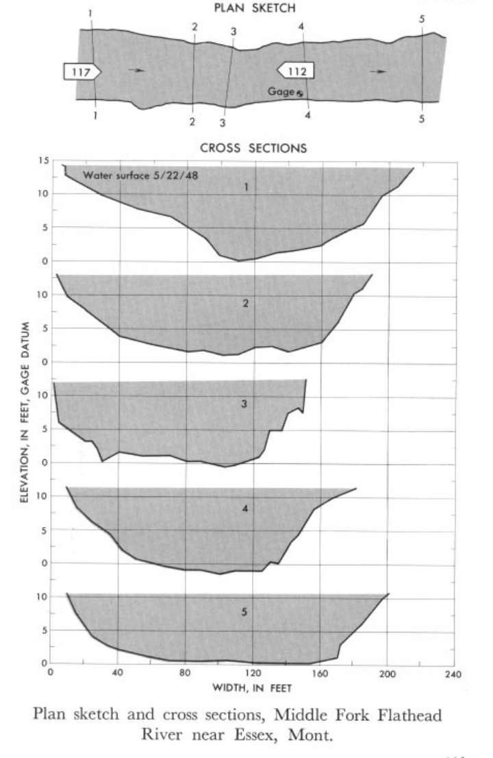
Study Reach.--Section 1 is 600 ft upstream from gage.
Gage Location.--Lat 48°10'20", long 113°32'40", near center of sec.19, T.28N., R.15W., on right bank 0.25 mile downstream from Spruce Park Cabin, 1 mile downstream from Charlie Creek, and 7.5 miles southeast of Essex.
Drainage Area.--408 sq mi.
Gage Datum and Elevations of Reference Points.--Not available.
Stage, Discharge Measurements and Computed n-Values.--Gage heights were 10.95 ft at gage; 14.21 ft at section 1. Peak discharges was 14,500 cfs on May 22, 1948.
| Date of Observation | Discharge (ft3/s) | Average Cross Section Area (ft2) | Hydraulic Radius (ft) | Mean Velocity (ft/s) | Slope | Coefficient of Roughness n |
|---|---|---|---|---|---|---|
| 5/22/1948 | 14558.7 | 1596.0 | 8.58 | 9.12 | 0.014312 | 0.041 |
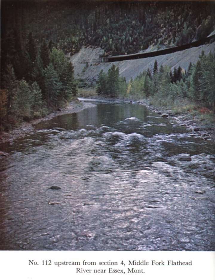
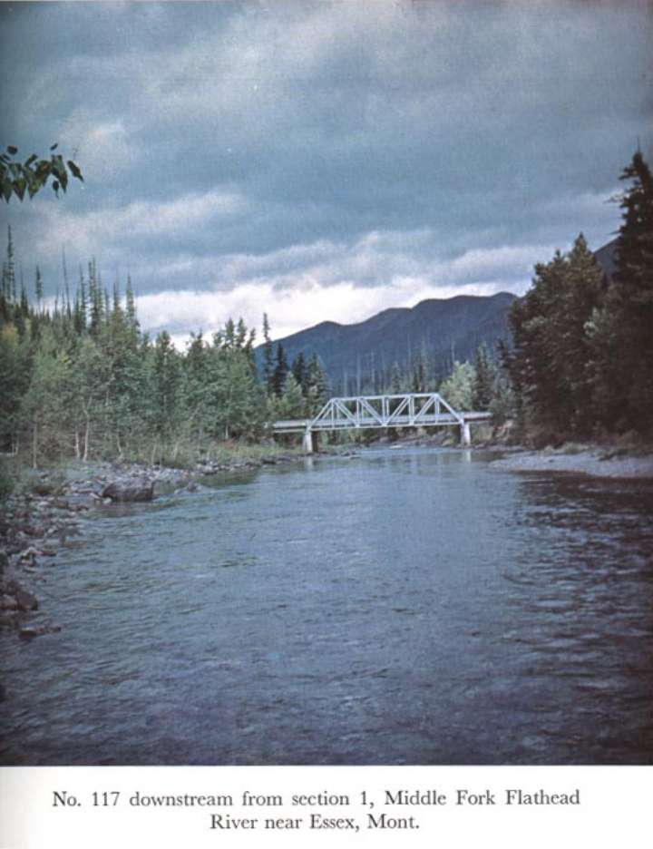
Description of Channel.--Bed consists of boulders; d50 = 142 mm, d84 = 285 mm. Banks are composed of gravel and -boulders, and have trees and brush along the tops.

![]() U.S. Department of the Interior |
U.S. Geological Survey
U.S. Department of the Interior |
U.S. Geological Survey
URL: http://il.water.usgs.gov/proj/nvalues/db_barnes/sites/12355700.shtml[an error occurred while processing this directive]?
Page Contact Information: David Soong
Page Last Modified: December 19, 2012
