

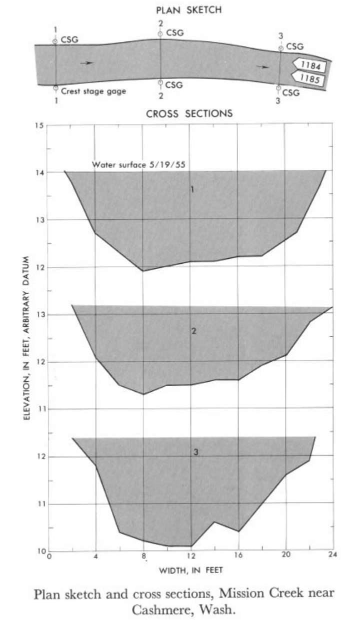
Study Reach.--Bed is gravel and small cobbles. Banks are lined with trees and small underbrush.
Gage Location.--Lat 47°30'15", long 120°28'30", in SE1/4 NE1/4sec.8, T.23N., R.19E., on right bank 1.5 miles upstream from mouth and 1.5 miles south of Cashmere. Section 1 is about 0.5 mile downstream.
Drainage Area.--79.1 sq mi.
Gage Datum and Elevations of Reference Points.--Not available.
Stage, Discharge Measurements and Computed n-Values.--Gage heights were 1.73 ft at gage; 14.00 ft (different datum) at section 1. Peak discharges was 123 cfs on May 19, 1955.
| Date of Observation | Discharge (ft3/s) | Average Cross Section Area (ft2) | Hydraulic Radius (ft) | Mean Velocity (ft/s) | Slope | Coefficient of Roughness n |
|---|---|---|---|---|---|---|
| 5/19/1955 | 123.5 | 31.0 | 1.40 | 3.98 | 0.016947 | 0.057 |
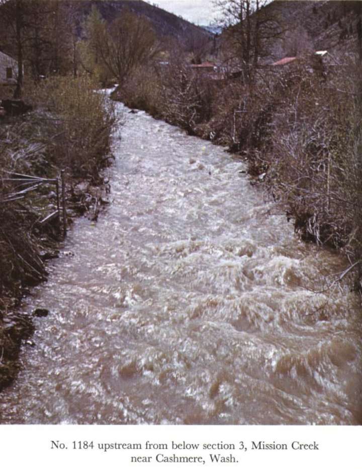

Description of Channel.--Bed of angular-shaped boulders as much as 1 ft. in diameter. Both banks are lined with overhanging bushes.

![]() U.S. Department of the Interior |
U.S. Geological Survey
U.S. Department of the Interior |
U.S. Geological Survey
URL: http://il.water.usgs.gov/proj/nvalues/db_barnes/sites/12462000.shtml[an error occurred while processing this directive]?
Page Contact Information: David Soong
Page Last Modified: December 19, 2012
