

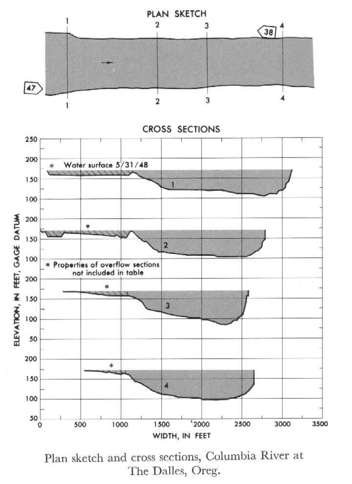
Study Reach.--Section 4 is at cableway 9 miles upstream from gage.
Gage Location.--Lat 45°36'10", long 121°10'40", in NW1/4 sec.3, T.1N., R.13E., at upstream end of Port of The Dalles dock at The Dalles, 3.2 miles downstream from The Dalles Dam and at mile 189.3.
Drainage Area.--237,000 sq mi., approximately.
Gage Datum and Elevations of Reference Points.--Not available.
Stage, Discharge Measurements and Computed n-Values.--Gage heights were 154.56 ft at gage; 171.44 ft at section 1. Peak discharges was 1,000,000 cfs on May 31, 1948.
| Date of Observation | Discharge (ft3/s) | Average Cross Section Area (ft2) | Hydraulic Radius (ft) | Mean Velocity (ft/s) | Slope | Coefficient of Roughness n |
|---|---|---|---|---|---|---|
| 5/31/1948 | 1000473.7 | 91597.5 | 53.75 | 10.92 | 0.000266 | 0.030 |
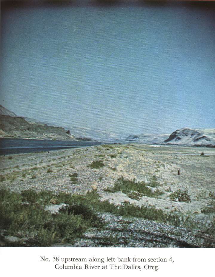
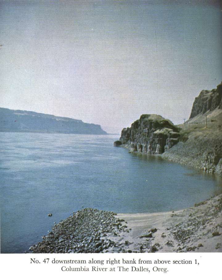
Description of Channel.--Left bank consists of sand, gravel, and boulders, and has light cover of brush in some places. Right bank is formed by severely scalloped basalt cliffs. The bed material is fairly well graded from 18-inch boulders along the left bank down to sand at the base of the right bank.

![]() U.S. Department of the Interior |
U.S. Geological Survey
U.S. Department of the Interior |
U.S. Geological Survey
URL: http://il.water.usgs.gov/proj/nvalues/db_barnes/sites/14105700.shtml[an error occurred while processing this directive]?
Page Contact Information: David Soong
Page Last Modified: December 19, 2012
