Verification of Roughness Coefficients for Selected Natural and Constructed Stream Channels in Arizona
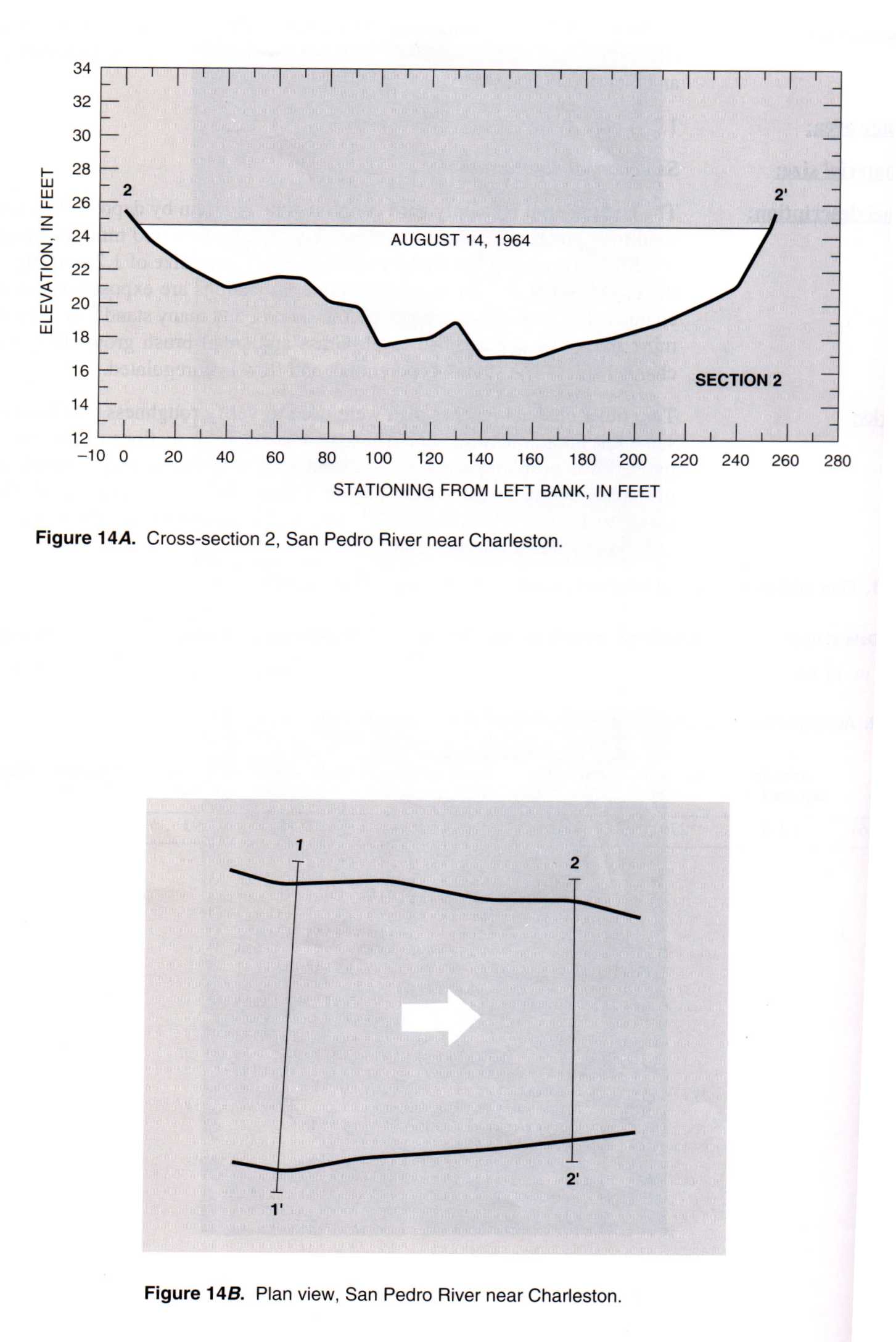
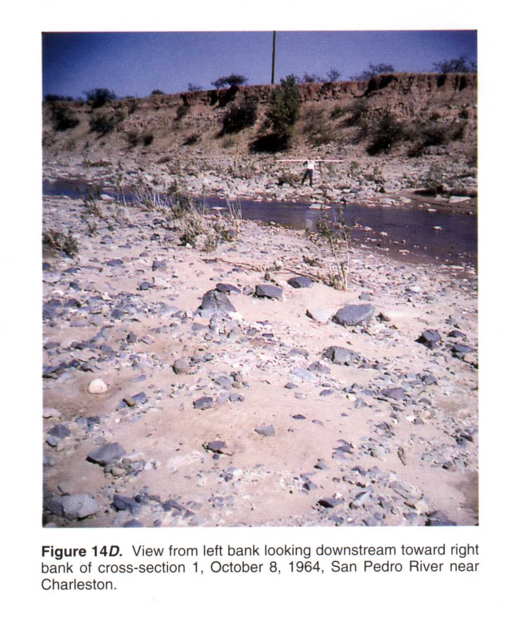
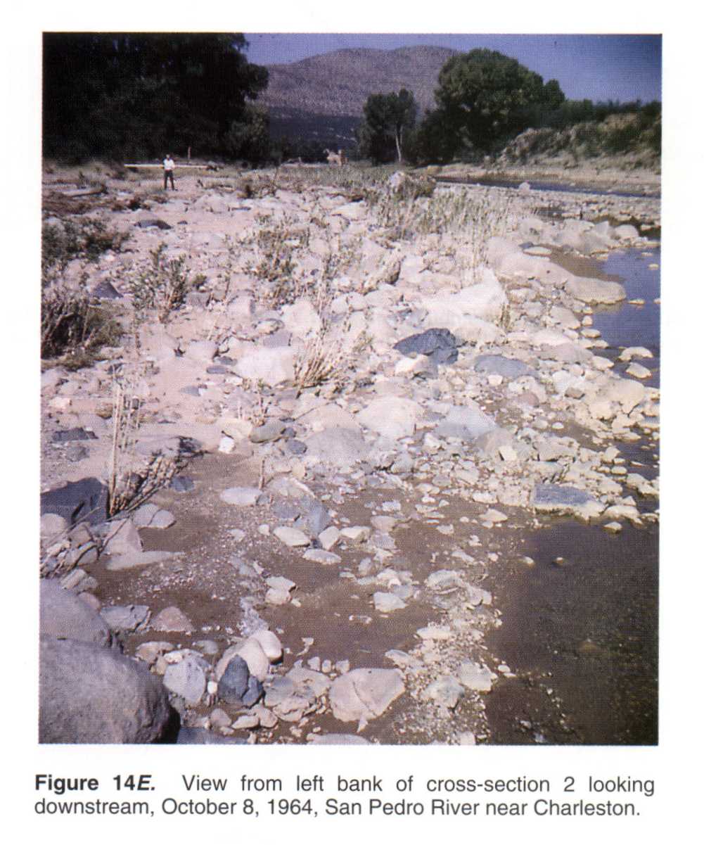
09471000 San Pedro River near Charleston, Ariz.
 Location
.-- Lat 31°37'33", long 110°10'26", near Charleston, Arizona.
Description of channel.--
| Date of observation | Average depth (ft) | Average surface width (ft) | Discharge (ft3/s) | Average cross section area (ft2) | Hydraulic radius (ft) | Mean velocity (ft/s) | Slope | Coefficient of roughness n |
|---|
| Aug. 14, 1964 |
--- |
--- |
7550.0 |
1268.0 |
4.62 |
5.900 |
0.004800 |
0.048 |
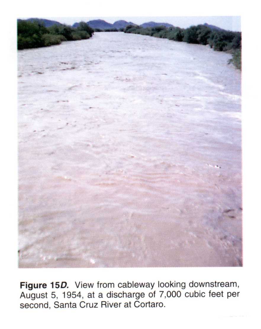
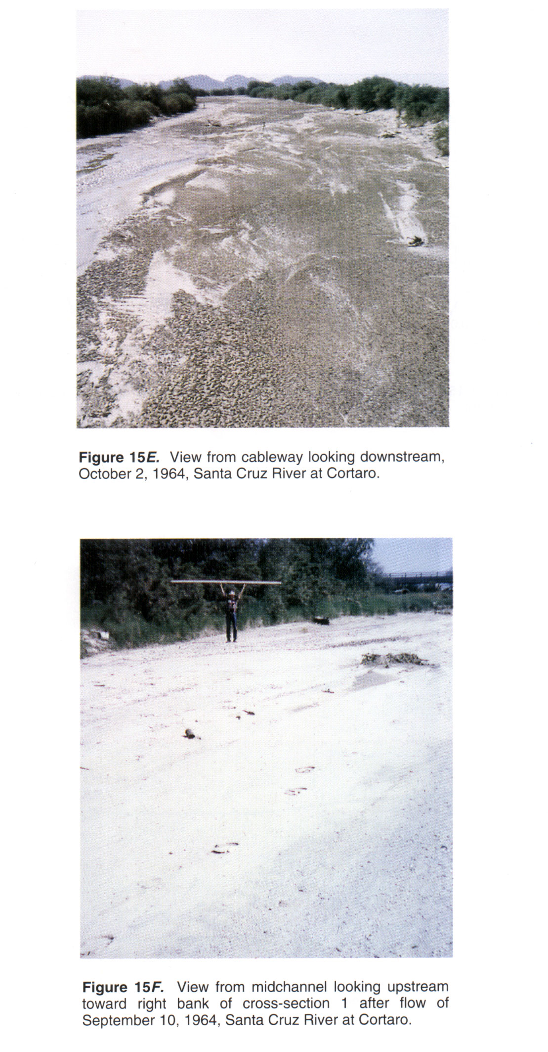
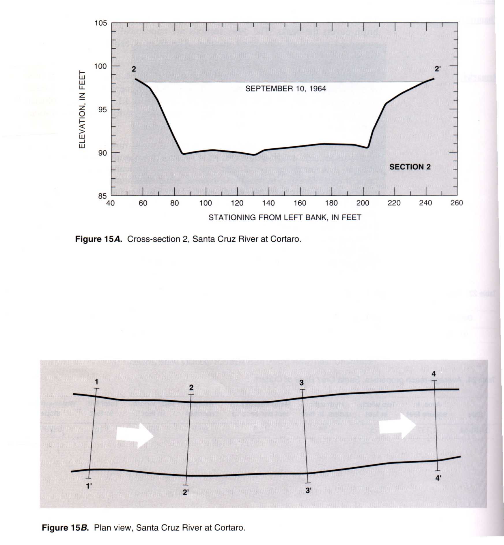
09486500 Santa Cruz River at Cortaro, Ariz.
 Location
.-- Lat 32°21'04", long 111°05'38", near Cortaro, Arizona.
Description of channel.--
d50 = 1 mm.
| Date of observation | Average depth (ft) | Average surface width (ft) | Discharge (ft3/s) | Average cross section area (ft2) | Hydraulic radius (ft) | Mean velocity (ft/s) | Slope | Coefficient of roughness n |
|---|
| Sept. 10, 1964 |
--- |
--- |
14200.0 |
1137.0 |
6.36 |
12.500 |
0.003700 |
0.020 |
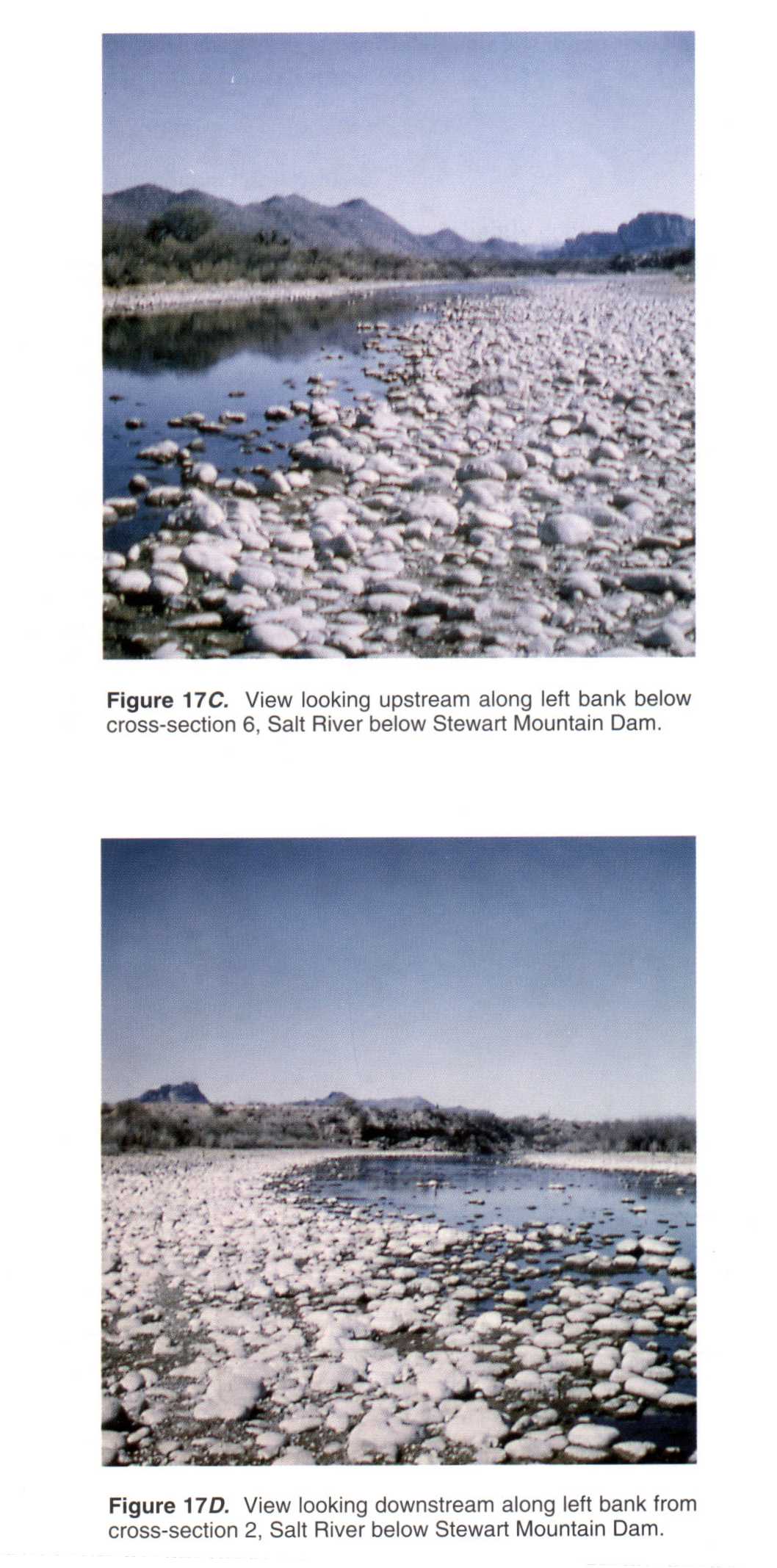
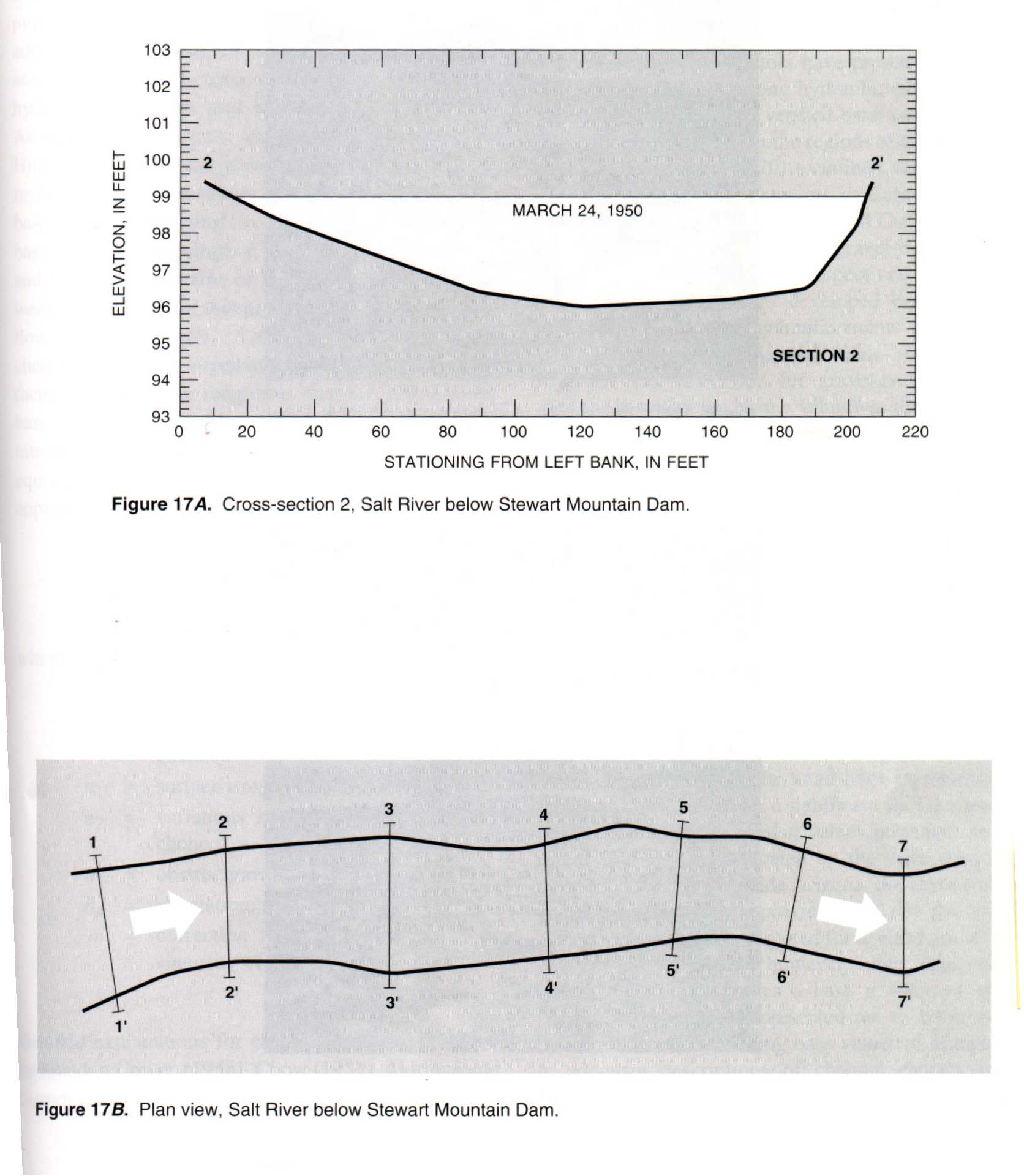
09502000 Salt River below Stewart Mountain Dam, Ariz.
 Location
.-- Lat 33°33'00", long 111°34'31", near Stewart Mountain Dam, Arizona.
Description of channel.--
| Date of observation | Average depth (ft) | Average surface width (ft) | Discharge (ft3/s) | Average cross section area (ft2) | Hydraulic radius (ft) | Mean velocity (ft/s) | Slope | Coefficient of roughness n |
|---|
| Mar. 24, 1950 |
--- |
--- |
1280.0 |
405.0 |
2.14 |
3.220 |
0.001900 |
0.032 |
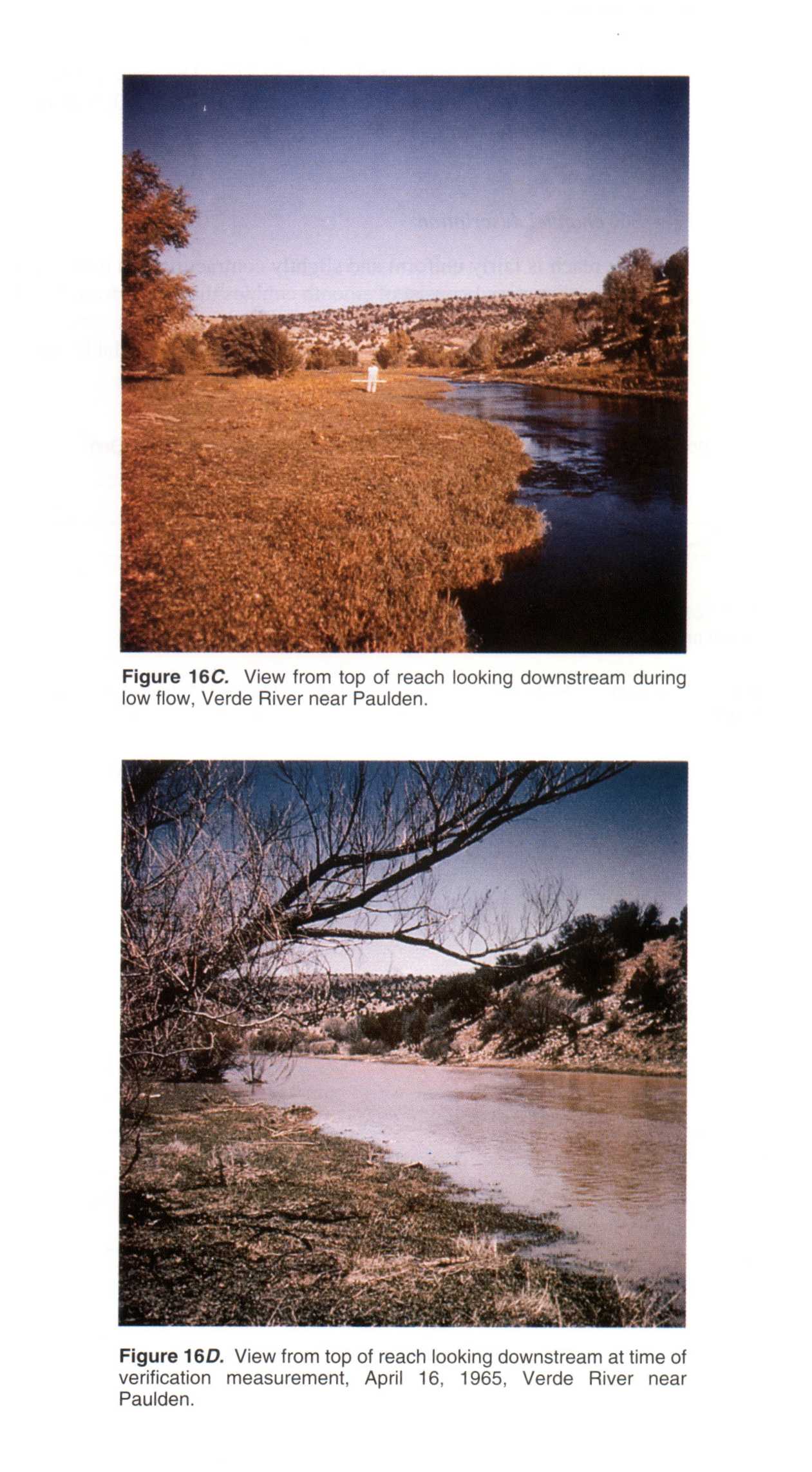
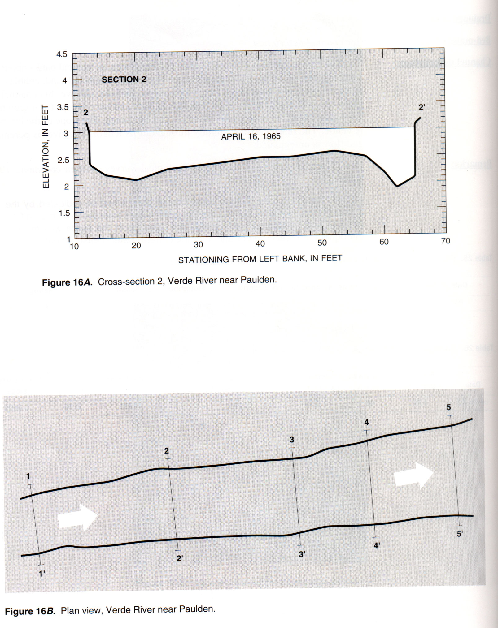
09503700 Verde River near Paulden, Ariz.
 Location
.-- Lat 34°53'40", long 112°20'32", near Paulden, Arizona.
Description of channel.--
| Date of observation | Average depth (ft) | Average surface width (ft) | Discharge (ft3/s) | Average cross section area (ft2) | Hydraulic radius (ft) | Mean velocity (ft/s) | Slope | Coefficient of roughness n |
|---|
| Apr. 16, 1965 |
--- |
--- |
313.0 |
139.0 |
2.19 |
2.190 |
0.000800 |
0.029 |
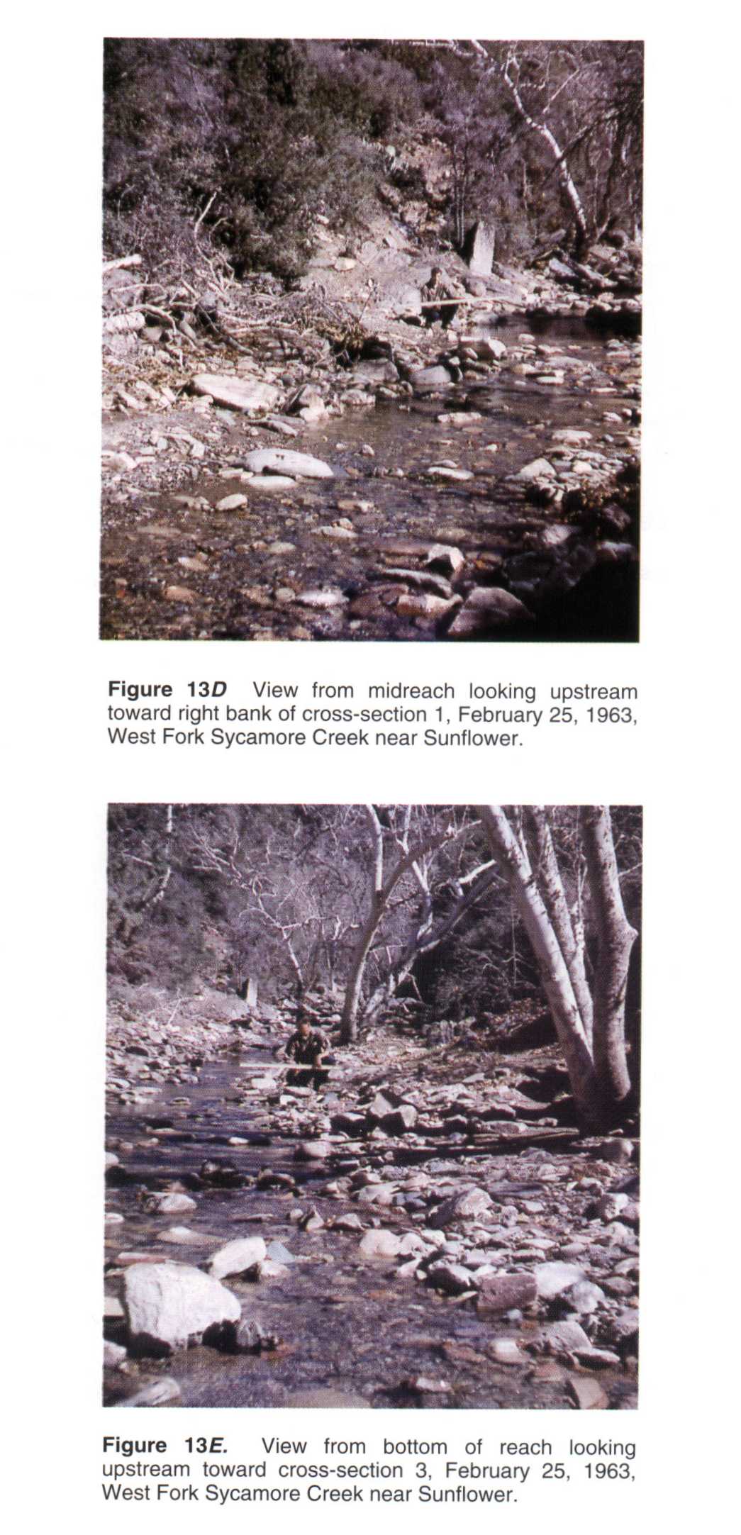
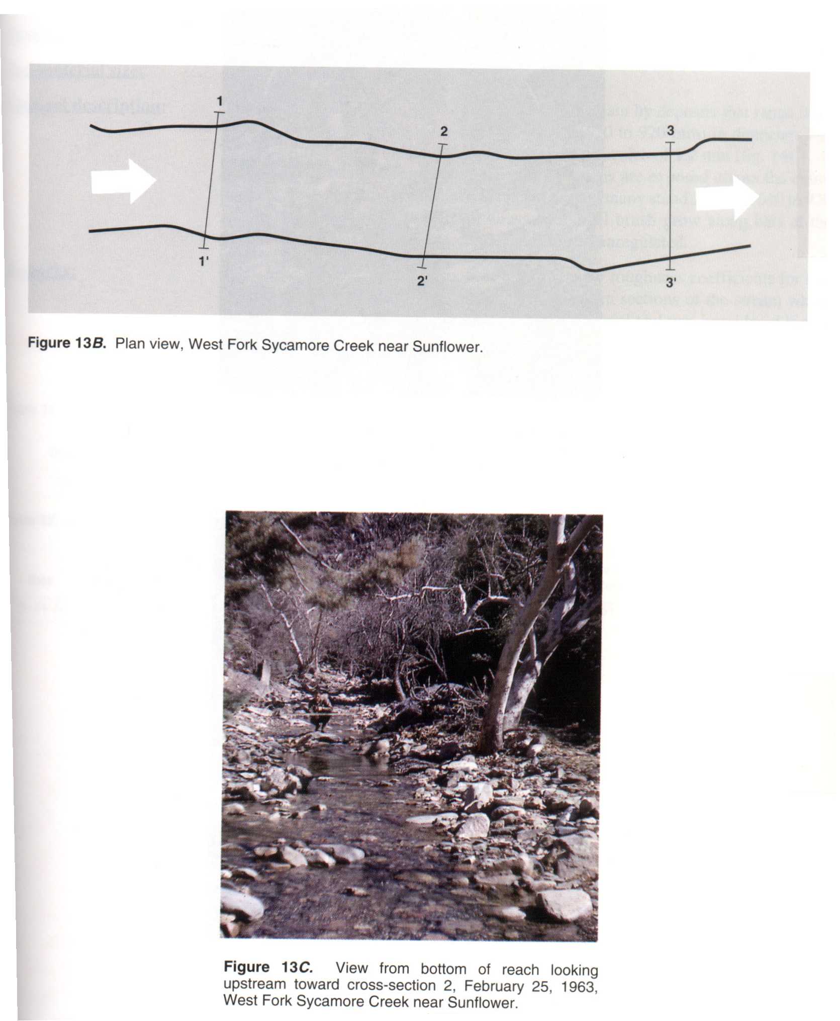
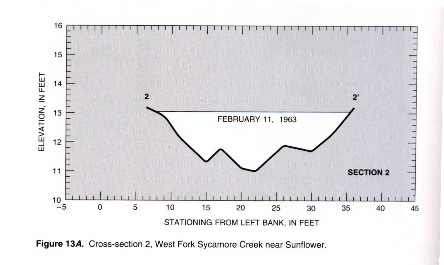
09510120 West Fork Sycamore Creek near Sunflower, Ariz.
 Location
.-- Lat 33°57'20", long 111°29'25", near Sunflower, Arizona.
Description of channel.--
| Date of observation | Average depth (ft) | Average surface width (ft) | Discharge (ft3/s) | Average cross section area (ft2) | Hydraulic radius (ft) | Mean velocity (ft/s) | Slope | Coefficient of roughness n |
|---|
| Feb. 11, 1963 |
--- |
--- |
117.0 |
36.2 |
1.21 |
3.290 |
0.018100 |
0.067 |
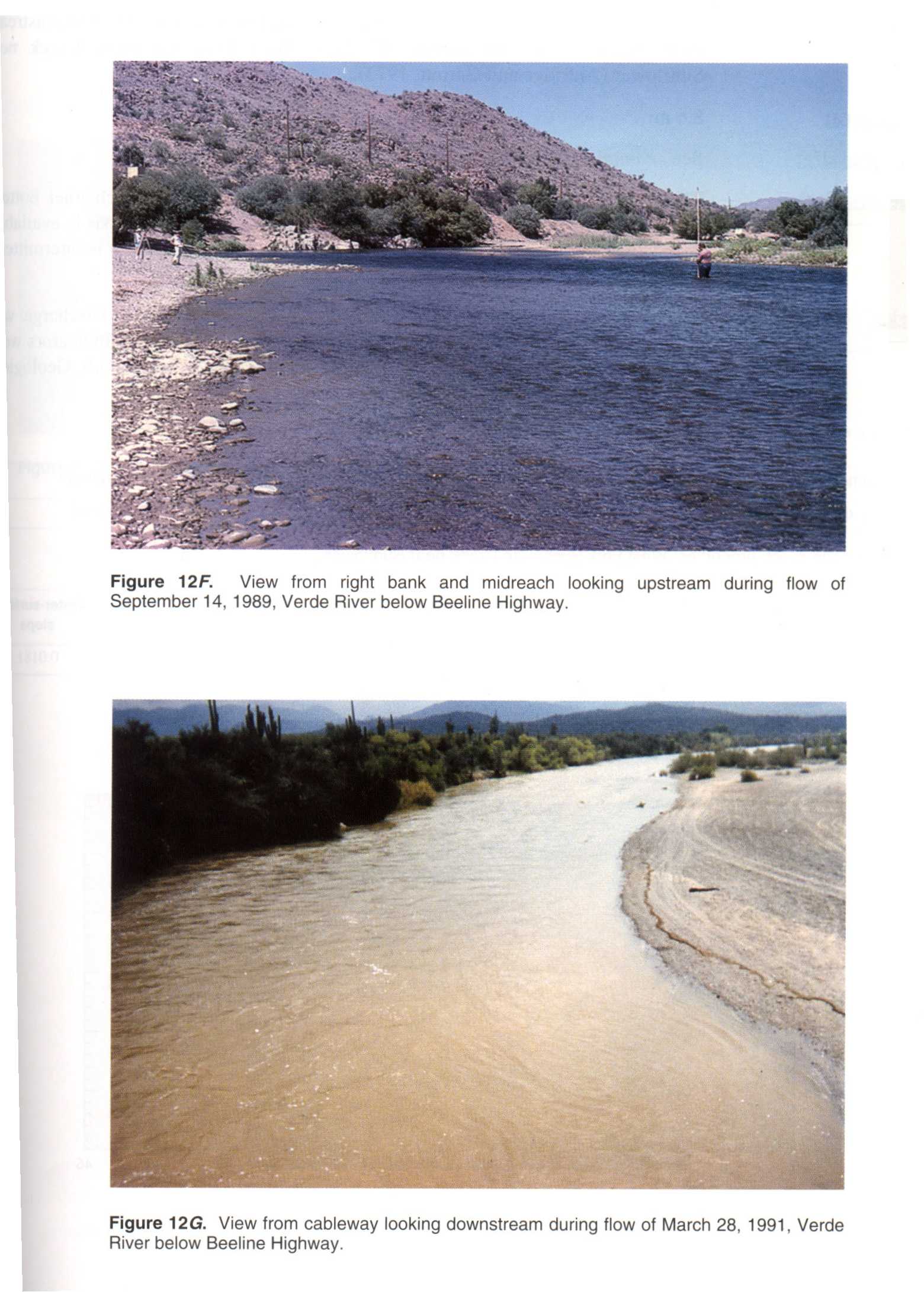
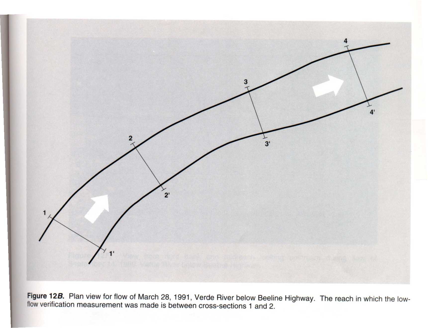
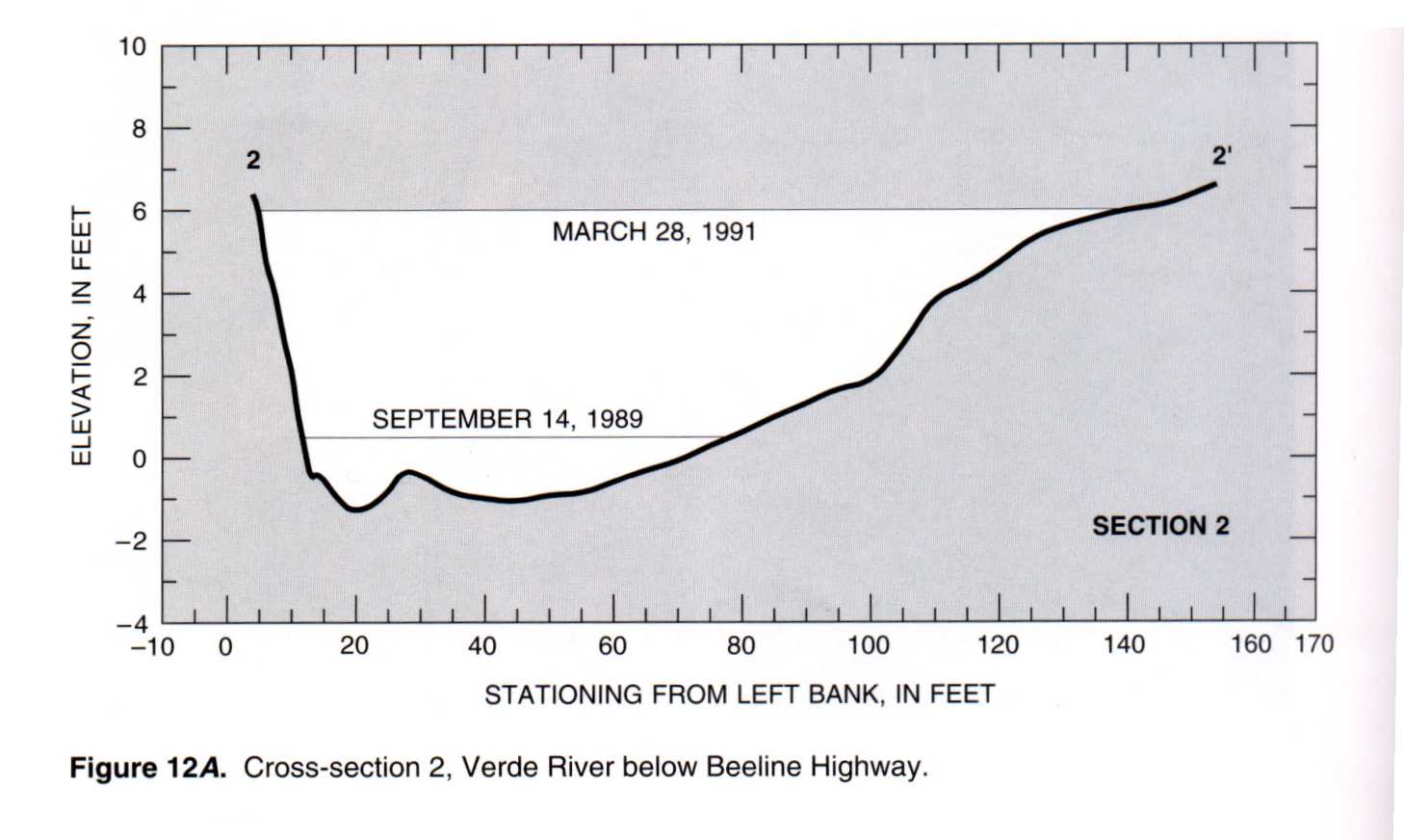
09511300 Verde River near Scottsdale, Ariz.
 Location
.-- Lat 33°33'31", long 111°40'07", near Scottsdale, Arizona.
Description of channel.--
d50 = 110 mm.
| Date of observation | Average depth (ft) | Average surface width (ft) | Discharge (ft3/s) | Average cross section area (ft2) | Hydraulic radius (ft) | Mean velocity (ft/s) | Slope | Coefficient of roughness n |
|---|
| Mar. 28, 1991 |
--- |
--- |
2860.0 |
610.0 |
3.94 |
4.690 |
0.001300 |
0.030 |
| Sept. 14, 1989 |
--- |
--- |
225.0 |
87.9 |
1.00 |
2.570 |
0.003800 |
0.036 |
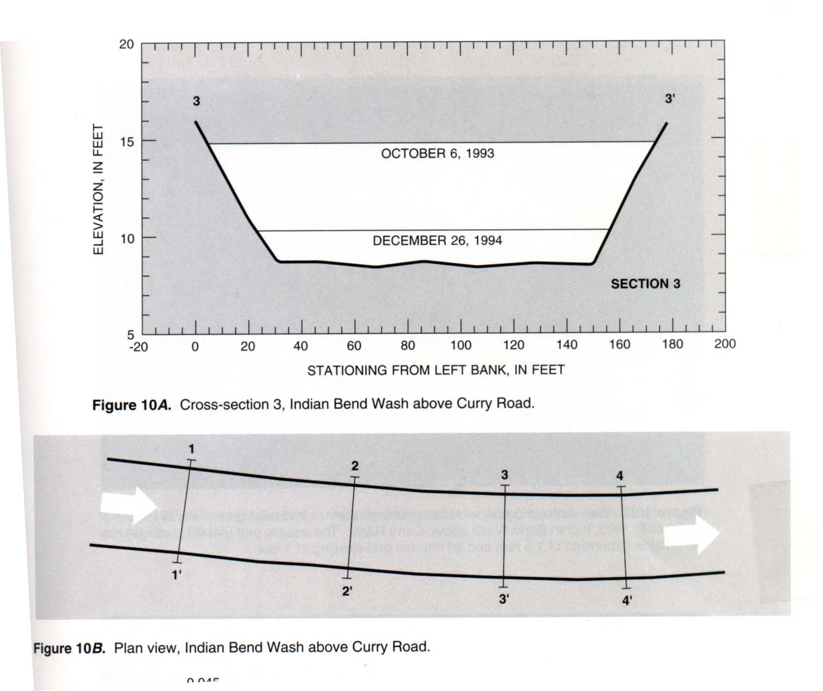
09512162 Indian Bend Wash at Curry Road, Ariz.
 Location
.-- Lat 33°26'50", long 111°54'55", near Curry Road, Arizona.
Description of channel.--
| Date of observation | Average depth (ft) | Average surface width (ft) | Discharge (ft3/s) | Average cross section area (ft2) | Hydraulic radius (ft) | Mean velocity (ft/s) | Slope | Coefficient of roughness n |
|---|
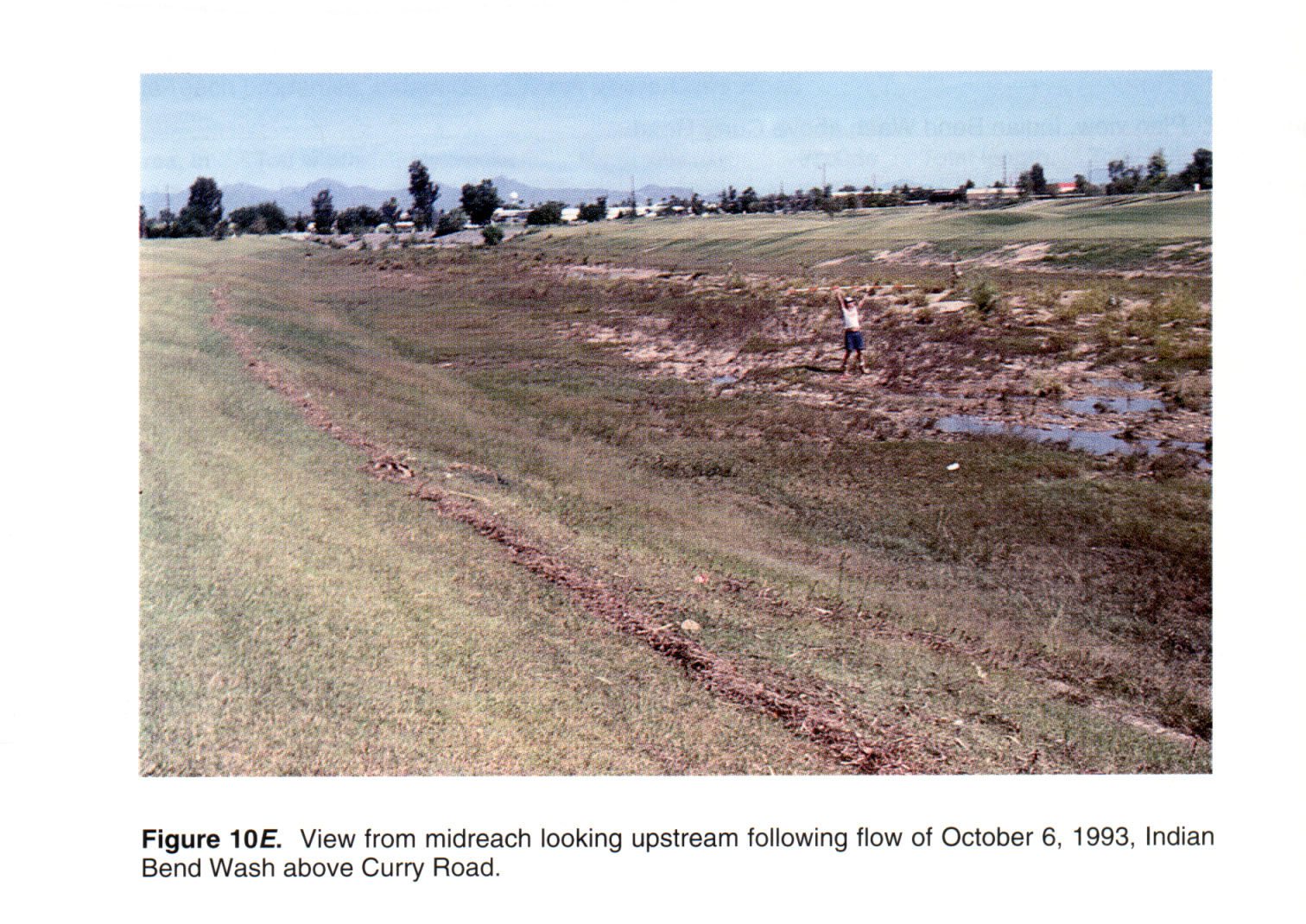
| Oct. 06, 1993 |
--- |
--- |
6480.0 |
905.0 |
5.36 |
7.160 |
0.001400 |
0.024 |
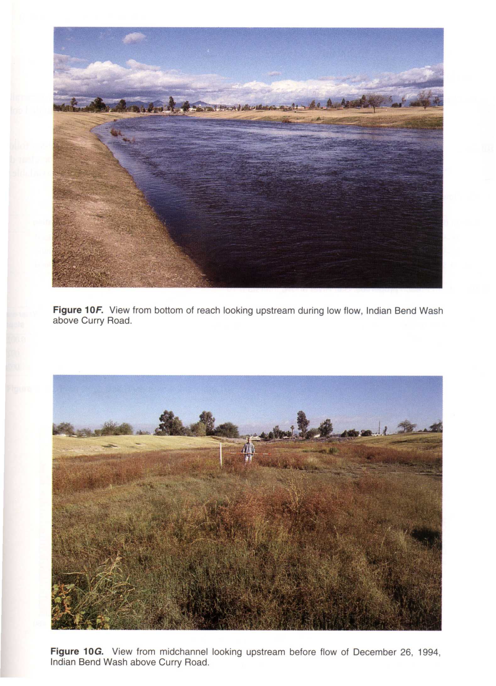
| Dec. 26, 1994 |
--- |
--- |
449.0 |
200.0 |
1.52 |
2.250 |
0.001600 |
0.036 |
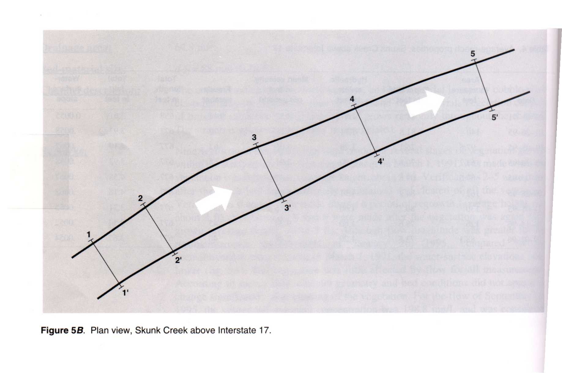
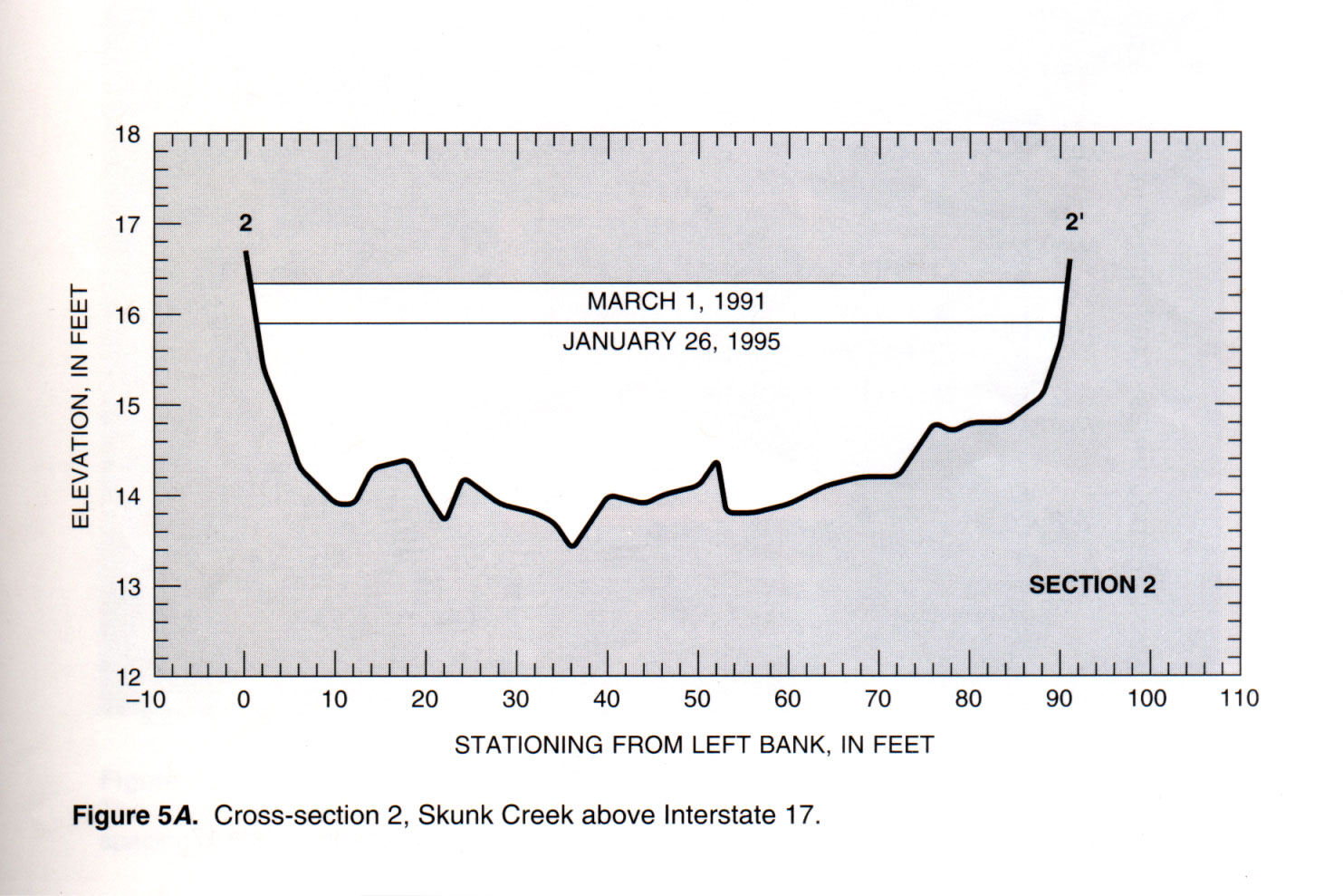
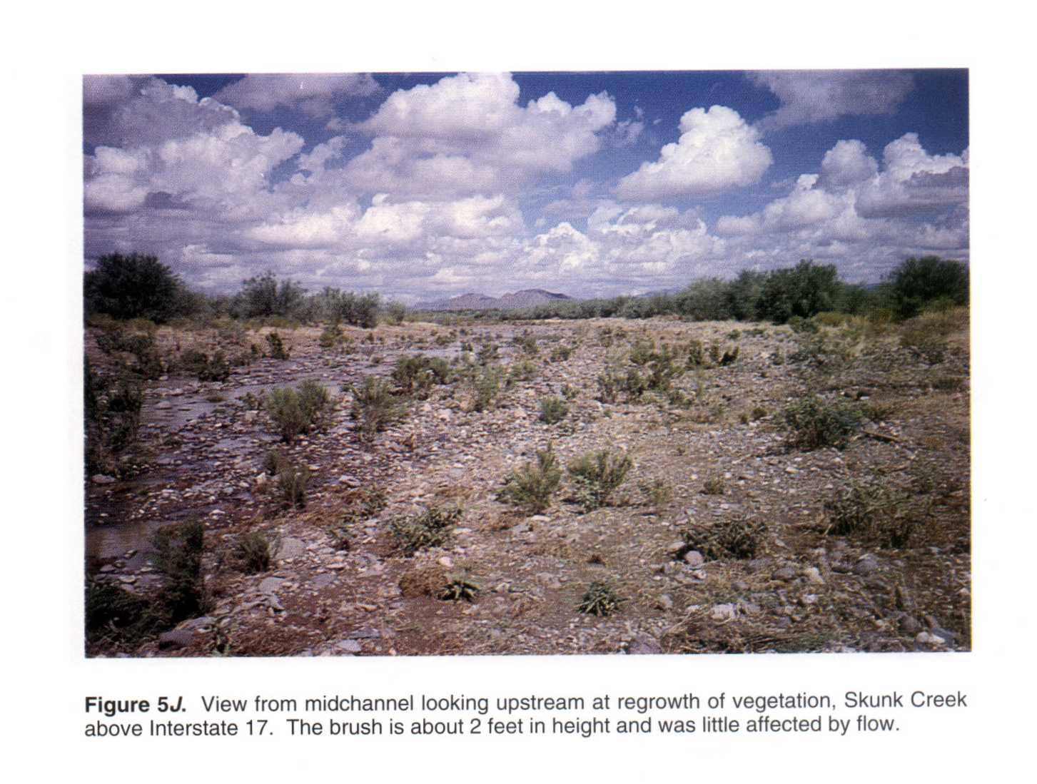
09513860 Skunk Creek near Phoenix, Ariz.
 Location
.-- Lat 33°43'56", long 112°06'57", near Phoenix, Arizona.
Description of channel.--
d50 = 88 mm.
| Date of observation | Average depth (ft) | Average surface width (ft) | Discharge (ft3/s) | Average cross section area (ft2) | Hydraulic radius (ft) | Mean velocity (ft/s) | Slope | Coefficient of roughness n |
|---|
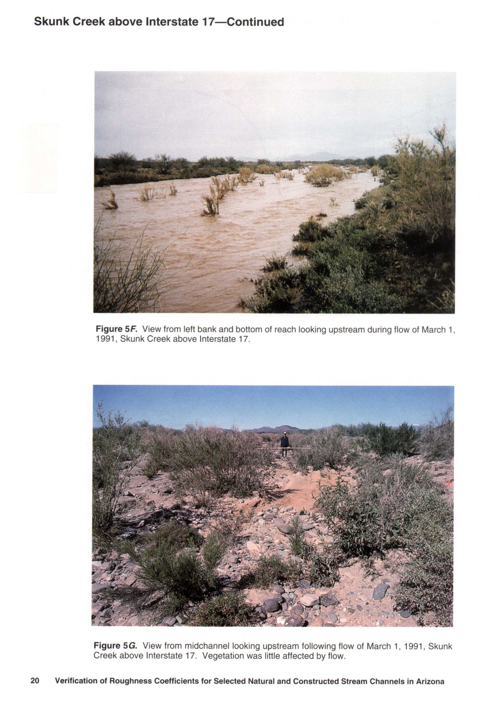
| Mar. 01, 1991 |
--- |
--- |
618.0 |
176.0 |
1.97 |
3.520 |
0.005500 |
0.048 |
| Jan. 26, 1995 |
--- |
--- |
723.0 |
140.0 |
1.71 |
5.180 |
0.005800 |
0.031 |
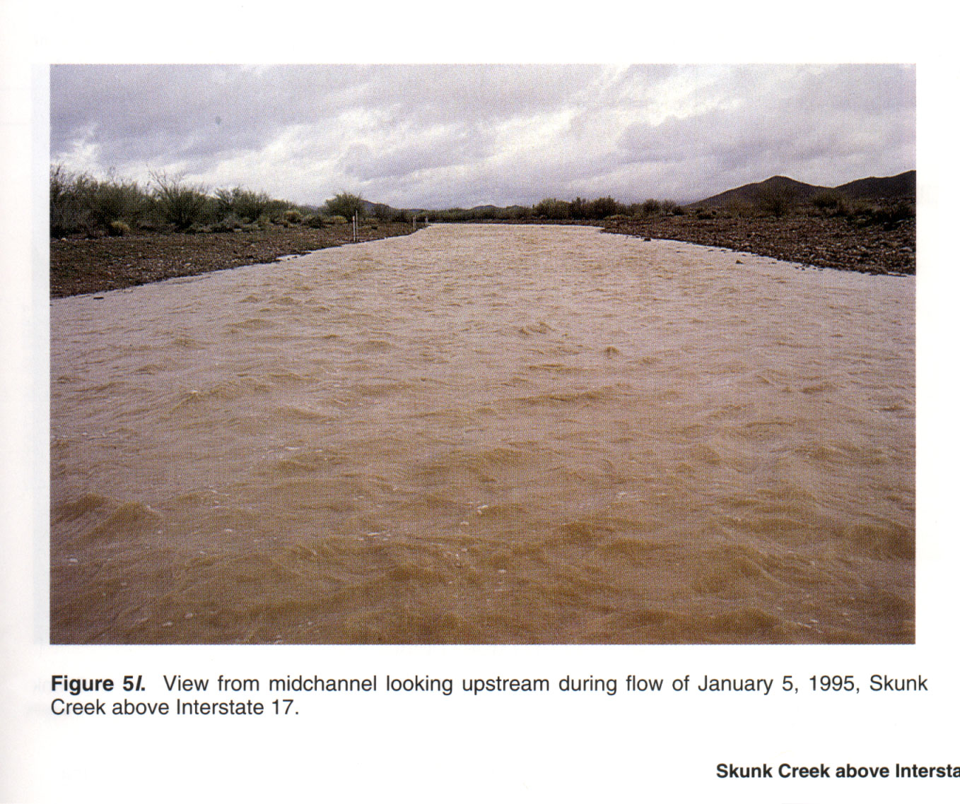
| Jan. 05, 1995 |
--- |
--- |
393.0 |
97.5 |
1.28 |
4.060 |
0.006200 |
0.034 |
| Jan. 26, 1995 |
--- |
--- |
180.0 |
63.2 |
0.90 |
2.910 |
0.005800 |
0.035 |
| Jan. 05, 1995 |
--- |
--- |
168.0 |
57.6 |
0.83 |
3.070 |
0.006700 |
0.037 |
| Sept. 28, 1995 |
--- |
--- |
822.0 |
162.0 |
1.91 |
5.090 |
0.006200 |
0.035 |
| Nov. 01, 1995 |
--- |
--- |
500.0 |
130.0 |
1.60 |
3.160 |
0.005500 |
0.039 |
| Aug. 14, 1996 |
--- |
--- |
403.0 |
126.0 |
1.60 |
3.240 |
0.005200 |
0.048 |
| Sept. 02, 1996 |
--- |
--- |
215.0 |
88.1 |
1.20 |
2.480 |
0.005400 |
0.052 |
09516500 Hassayampa River near Morristown, Ariz.
 Location
.-- Lat 33°53'06", long 112°39'41", near Morristown, Arizona.
Description of channel.--
d50 = 0 mm.
| Date of observation | Average depth (ft) | Average surface width (ft) | Discharge (ft3/s) | Average cross section area (ft2) | Hydraulic radius (ft) | Mean velocity (ft/s) | Slope | Coefficient of roughness n |
|---|
| Feb. 20, 1993 |
--- |
--- |
7330.0 |
652.0 |
3.80 |
11.200 |
0.006200 |
0.025 |
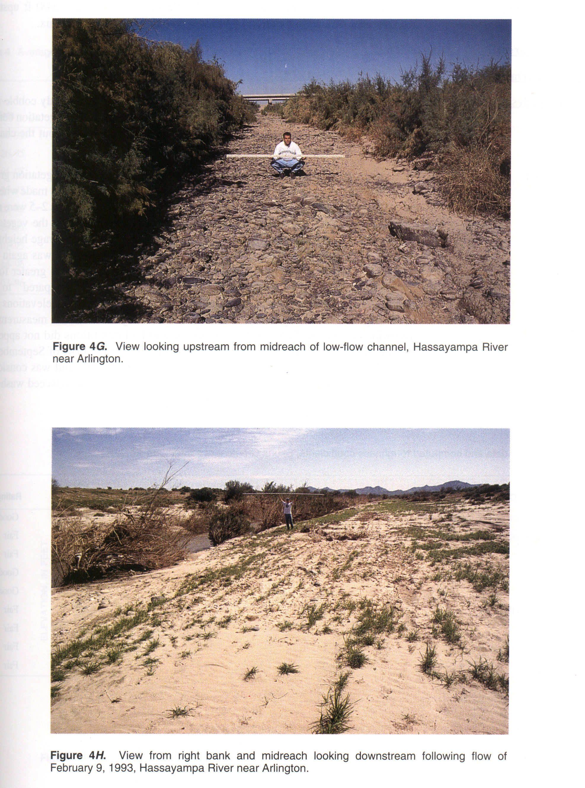
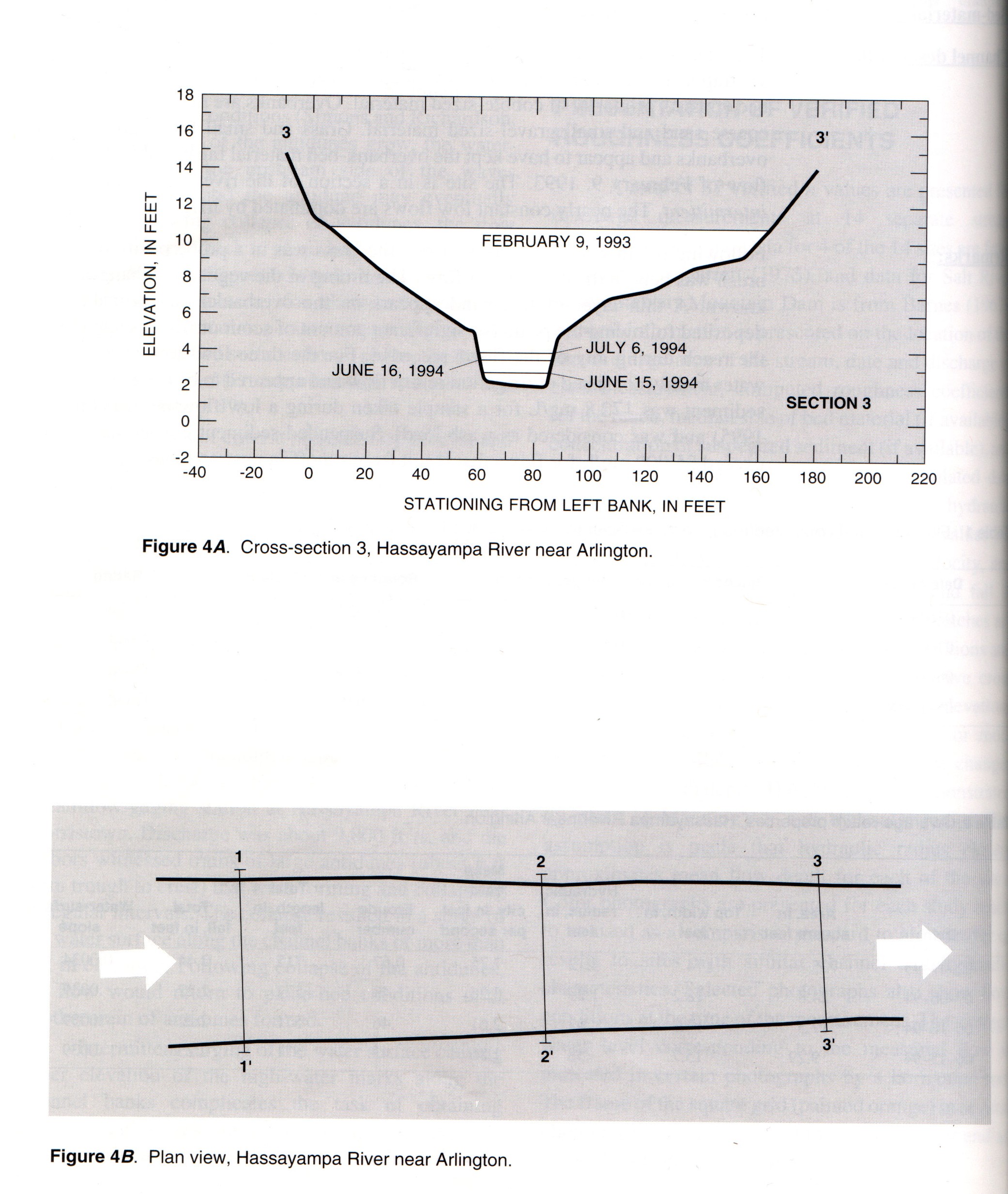
09517000 Hassayampa River near Arlington, Ariz.
 Location
.-- Lat 33°20'50", long 112°20'30", near Arlington, Arizona.
Description of channel.--
| Date of observation | Average depth (ft) | Average surface width (ft) | Discharge (ft3/s) | Average cross section area (ft2) | Hydraulic radius (ft) | Mean velocity (ft/s) | Slope | Coefficient of roughness n |
|---|
| Feb. 09, 1993 |
--- |
--- |
5580.0 |
725.0 |
4.12 |
7.750 |
0.003400 |
0.027 |
| July 06, 1994 |
--- |
--- |
80.5 |
24.8 |
1.29 |
3.260 |
0.003900 |
0.034 |
| June 16, 1994 |
--- |
--- |
45.5 |
17.5 |
0.97 |
2.610 |
0.003900 |
0.036 |
| June 15, 1994 |
--- |
--- |
17.0 |
9.3 |
0.58 |
1.860 |
0.003900 |
0.036 |
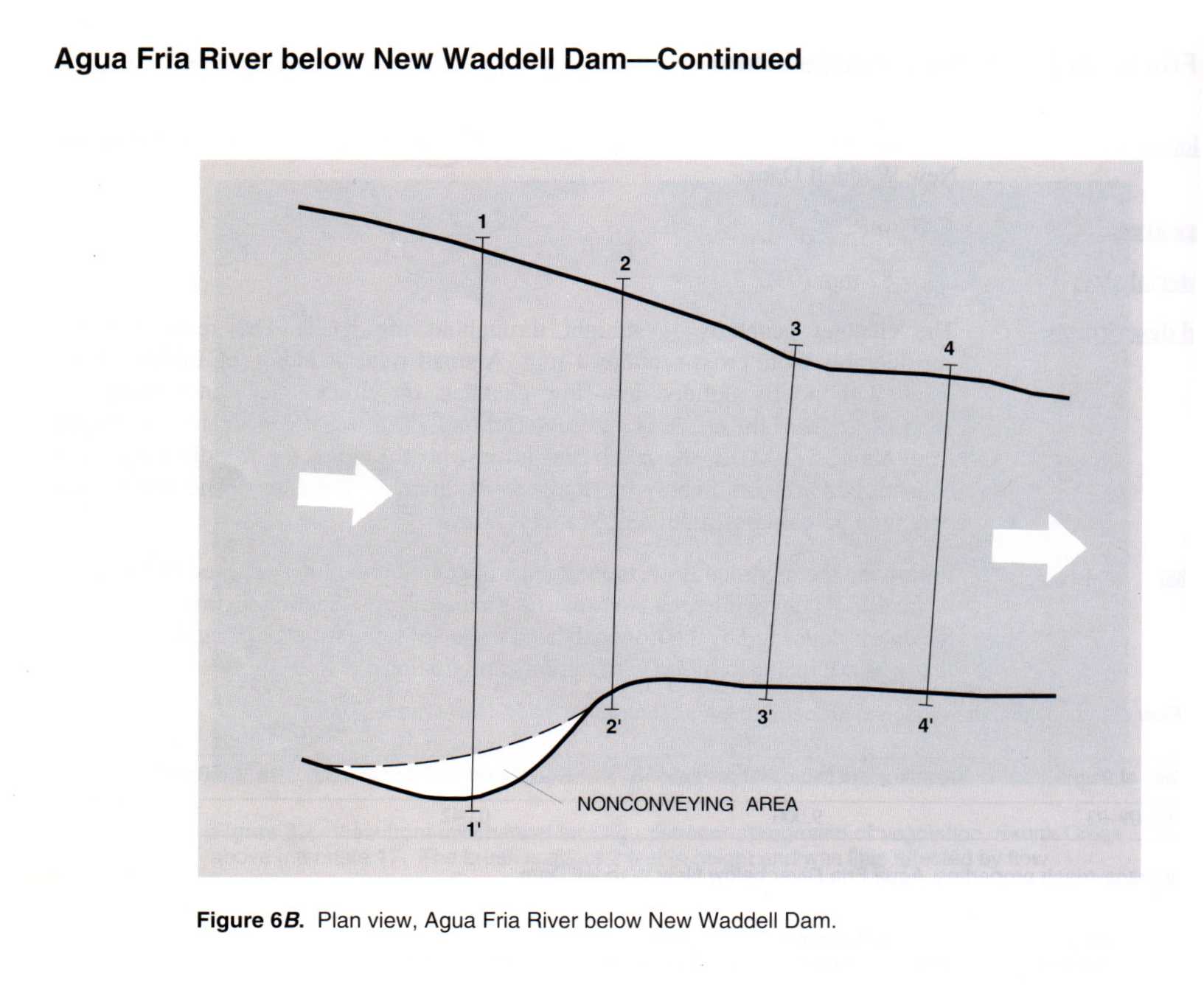
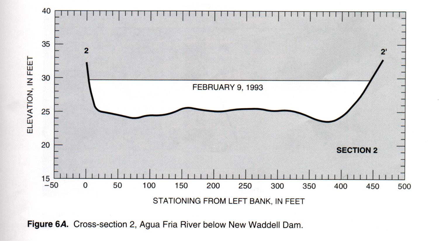
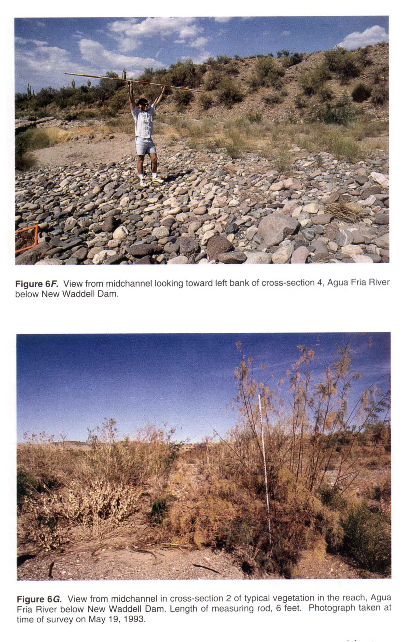
________ Agua Fria River below New Waddell Dam, Ariz.
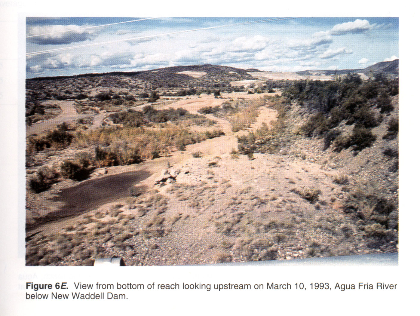
 Location
.-- Lat 33°50'03", long 112°16'33", near New Waddell Dam, Arizona.
Description of channel.--
d50 = 82 mm.
| Date of observation | Average depth (ft) | Average surface width (ft) | Discharge (ft3/s) | Average cross section area (ft2) | Hydraulic radius (ft) | Mean velocity (ft/s) | Slope | Coefficient of roughness n |
|---|
| Feb. 09, 1993 |
--- |
--- |
9000.0 |
1978.0 |
4.78 |
4.600 |
0.002500 |
0.042 |
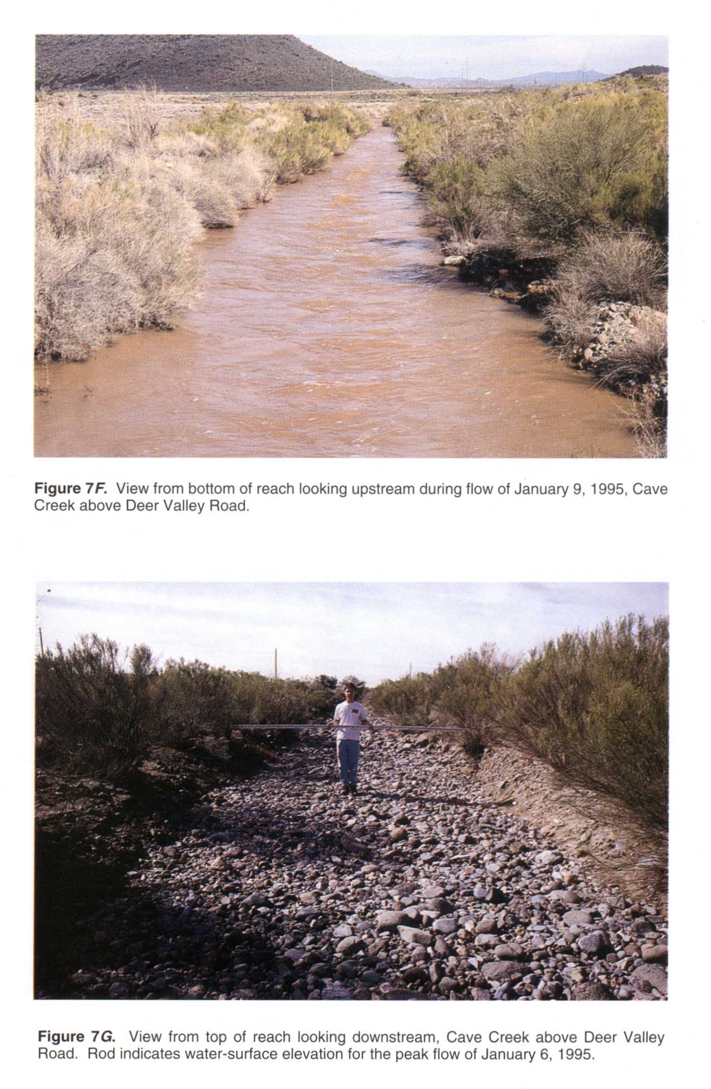
________ Cave Creek above Deer Valley Road, Ariz.
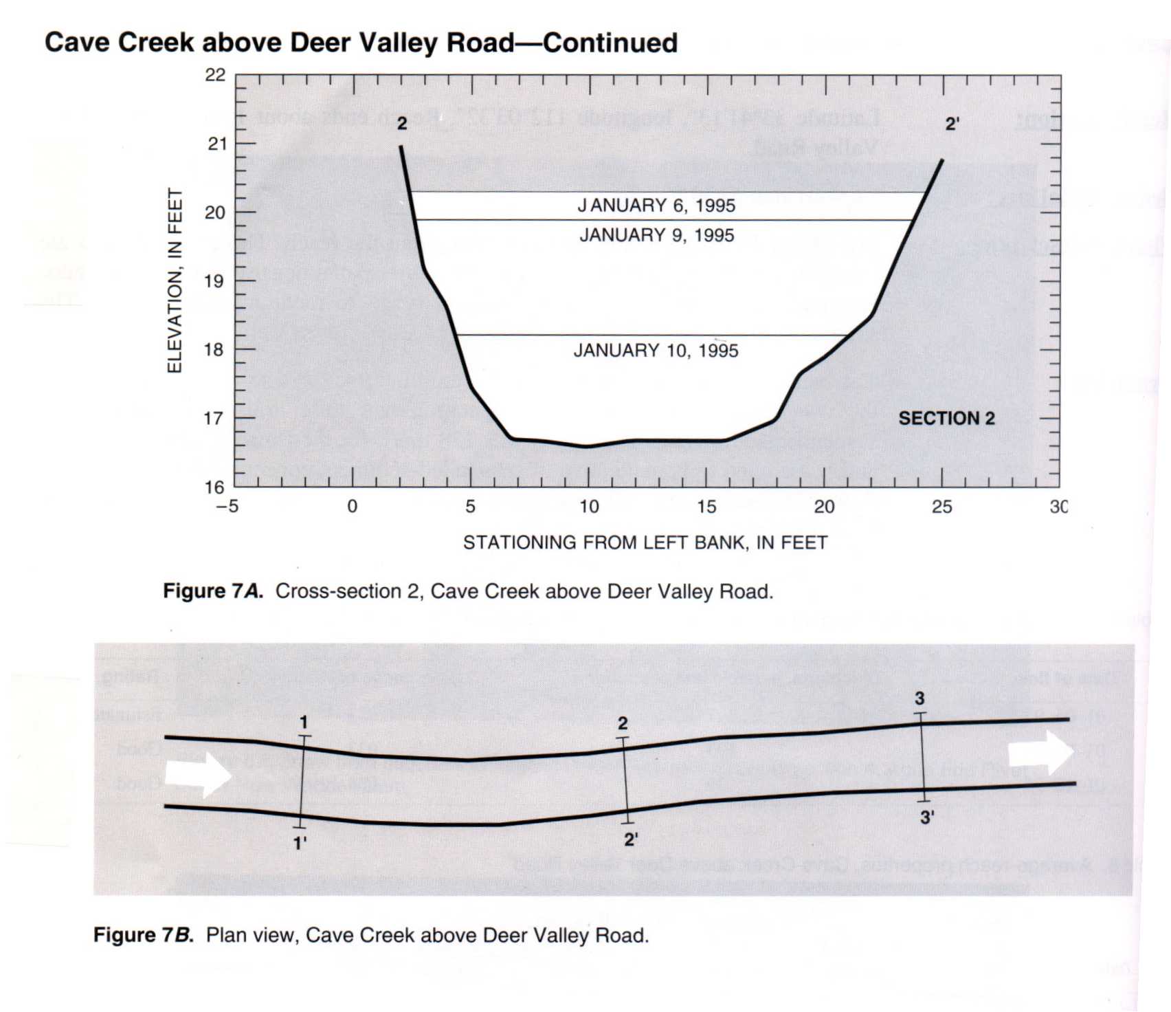
 Location
.-- Lat 33°41'13", long 112°03'32", near Deer Valley Road, Arizona.
Description of channel.--
d50 = 91 mm.
| Date of observation | Average depth (ft) | Average surface width (ft) | Discharge (ft3/s) | Average cross section area (ft2) | Hydraulic radius (ft) | Mean velocity (ft/s) | Slope | Coefficient of roughness n |
|---|
| Jan. 06, 1995 |
--- |
--- |
297.0 |
58.2 |
2.33 |
5.130 |
0.004600 |
0.033 |
| Jan. 09, 1995 |
--- |
--- |
193.0 |
48.9 |
2.07 |
3.960 |
0.002900 |
0.033 |
| Jan. 10, 1995 |
--- |
--- |
39.0 |
17.5 |
0.98 |
2.320 |
0.002400 |
0.034 |
________ Cave Creek below Cave Buttes Dam, Ariz.
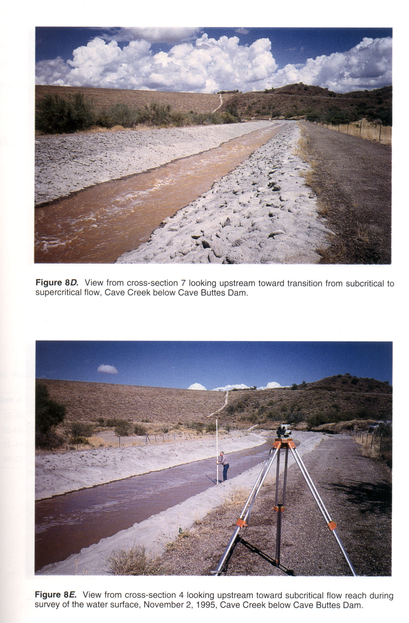
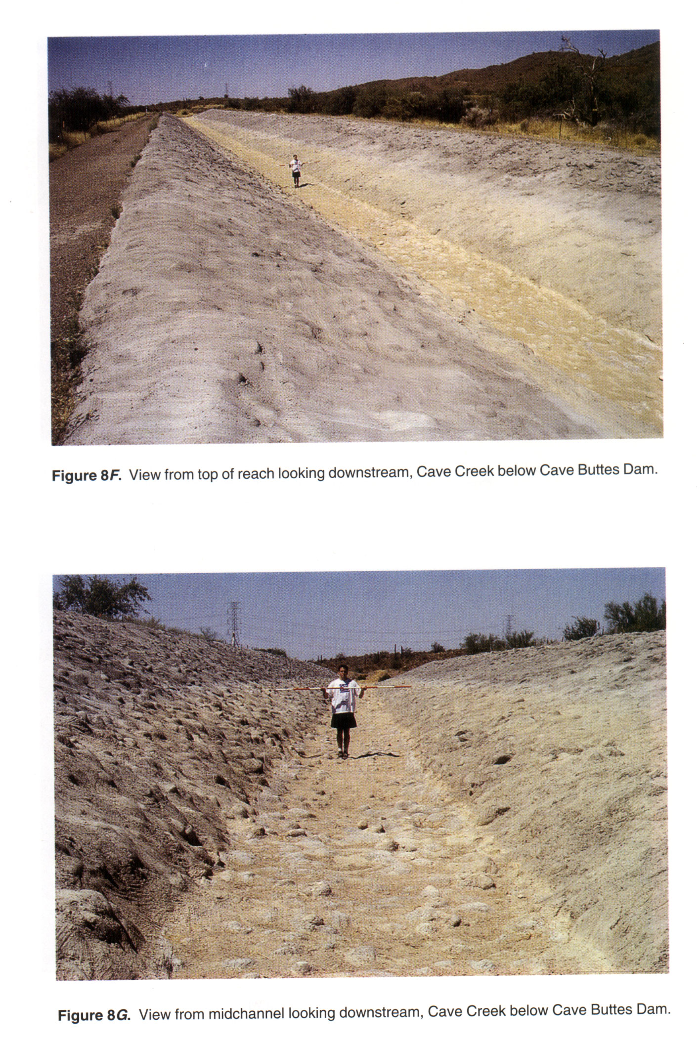
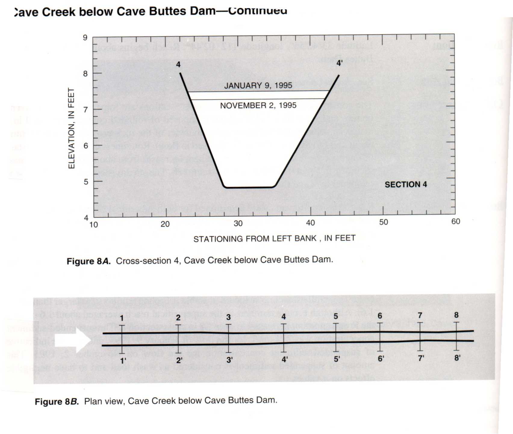 Location
.-- Lat 33°42'55", long 112°02'44", near Cave Buttes Dam, Arizona.
Description of channel.--
| Date of observation | Average depth (ft) | Average surface width (ft) | Discharge (ft3/s) | Average cross section area (ft2) | Hydraulic radius (ft) | Mean velocity (ft/s) | Slope | Coefficient of roughness n |
|---|
| Jan. 09, 1995 |
--- |
--- |
197.0 |
46.6 |
2.03 |
4.360 |
0.003000 |
0.025 |
| Jan. 09, 1995 |
1.00 |
--- |
197.0 |
21.9 |
1.12 |
9.210 |
0.014800 |
0.017 |
| Nov. 02, 1995 |
--- |
--- |
165.0 |
42.0 |
1.91 |
4.060 |
0.003100 |
0.025 |
| Nov. 02, 1995 |
--- |
--- |
165.0 |
18.1 |
0.99 |
9.160 |
0.013000 |
0.017 |
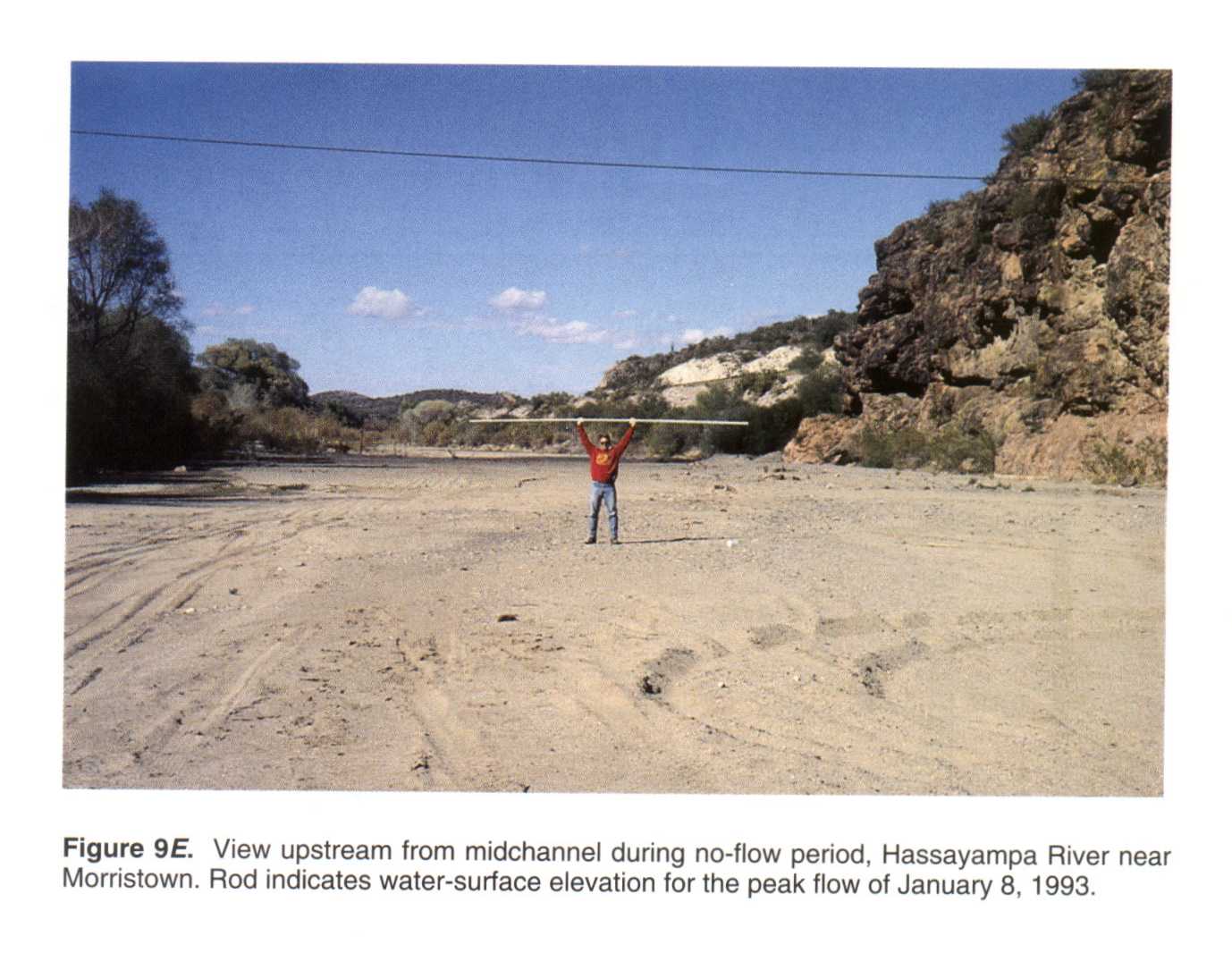
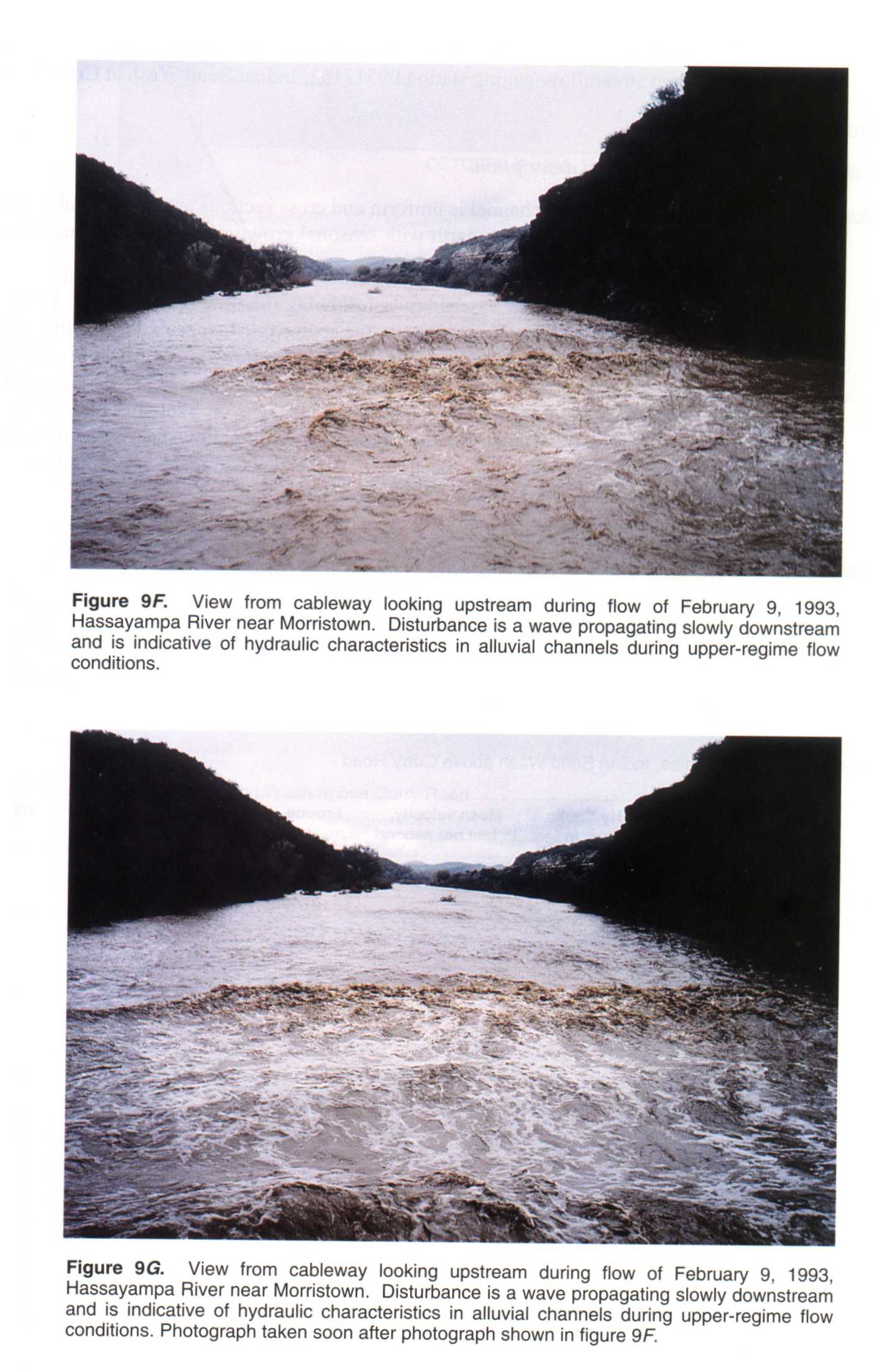
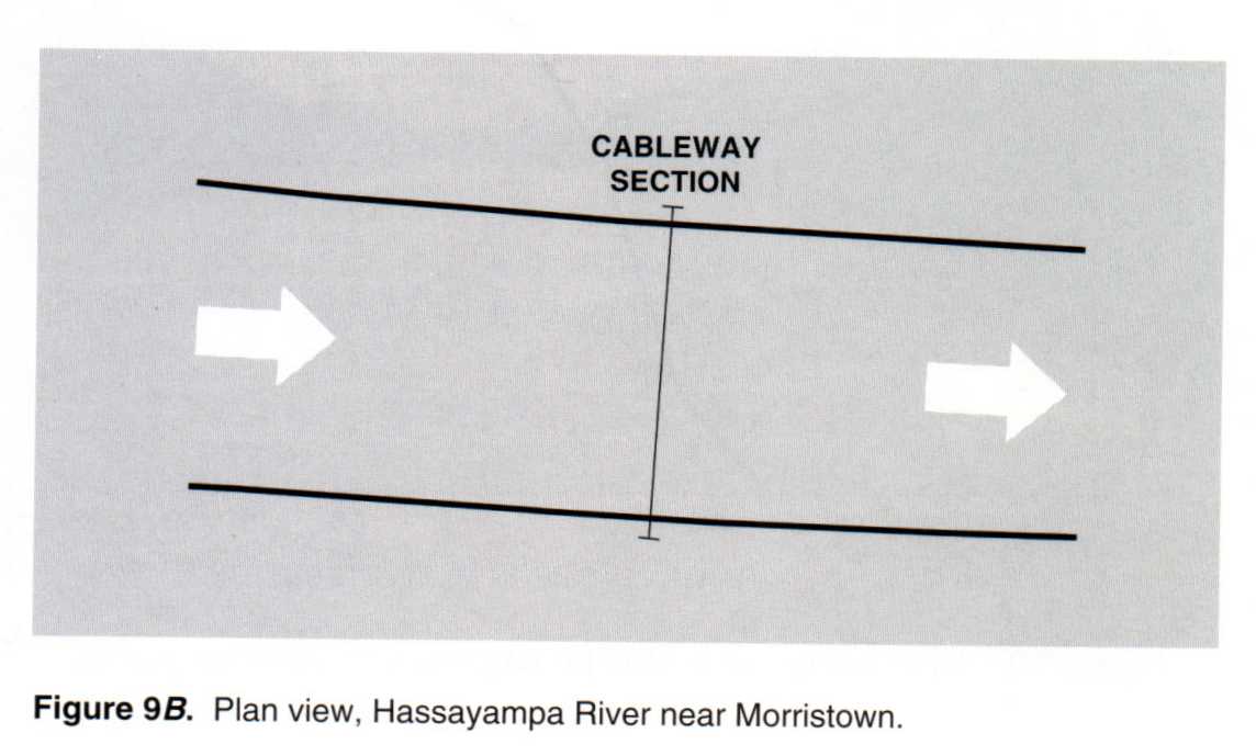
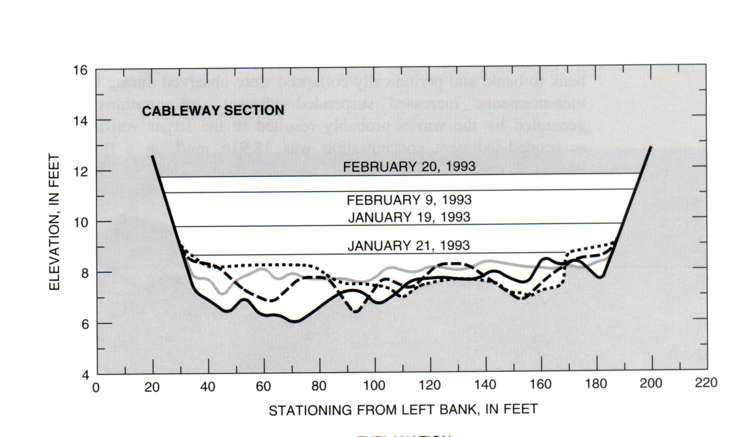
________ Hassayampa River near Morristown, Ariz.
Location.-- Lat 33°53'06", long 112°39'41", near Morristown, Arizona.
Description of channel.--
d50 = 0 mm.
| Date of observation | Average depth (ft) | Average surface width (ft) | Discharge (ft3/s) | Average cross section area (ft2) | Hydraulic radius (ft) | Mean velocity (ft/s) | Slope | Coefficient of roughness n |
|---|
| Feb. 09, 1993 |
--- |
--- |
6180.0 |
518.0 |
3.40 |
11.930 |
0.006200 |
0.026 |
| Jan. 19, 1993 |
--- |
--- |
2470.0 |
300.0 |
1.80 |
8.230 |
0.005000 |
0.019 |
| Jan. 21, 1993 |
--- |
--- |
787.0 |
155.0 |
0.90 |
5.080 |
0.004300 |
0.018 |
________ Salt River above Interstate 10, Ariz.
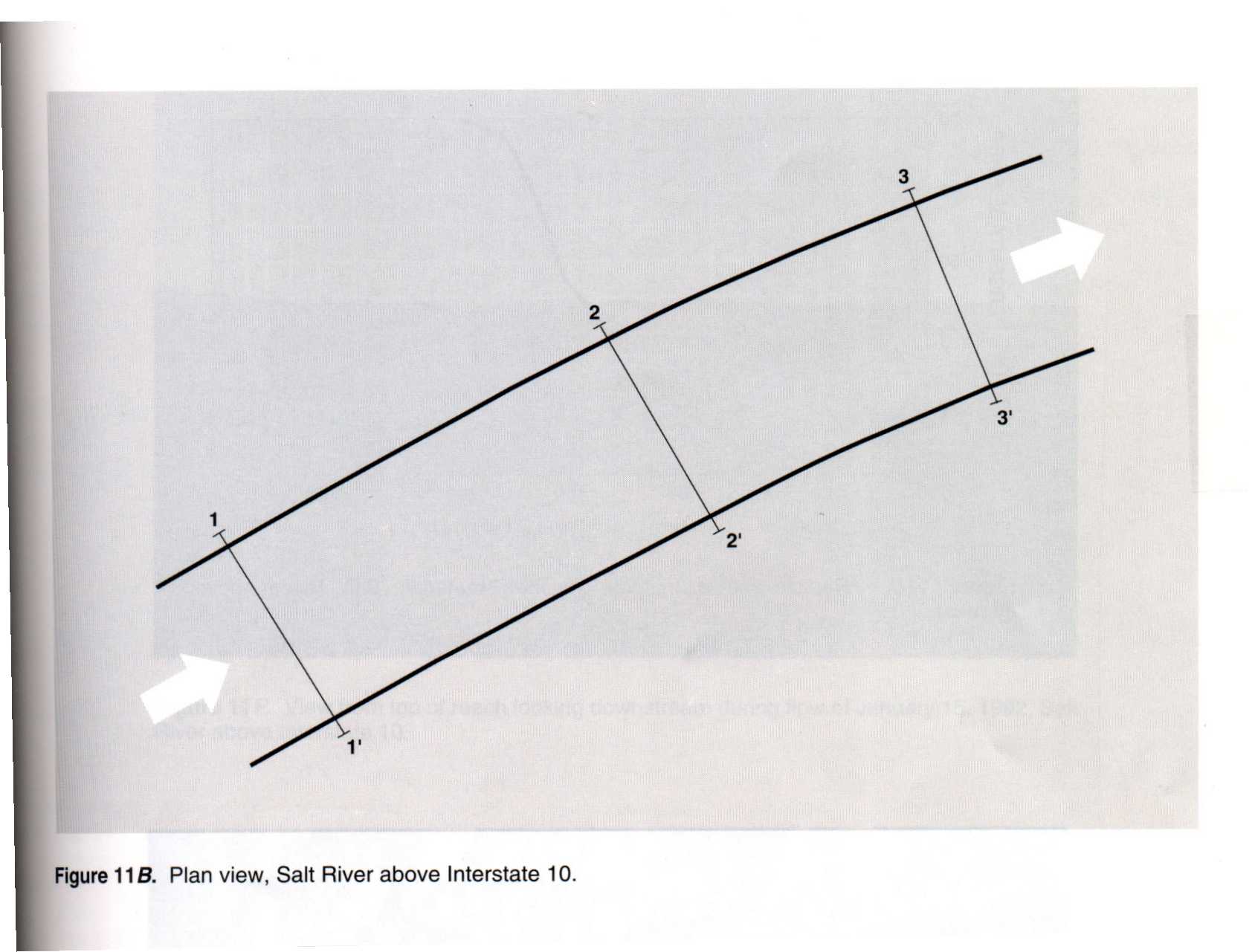

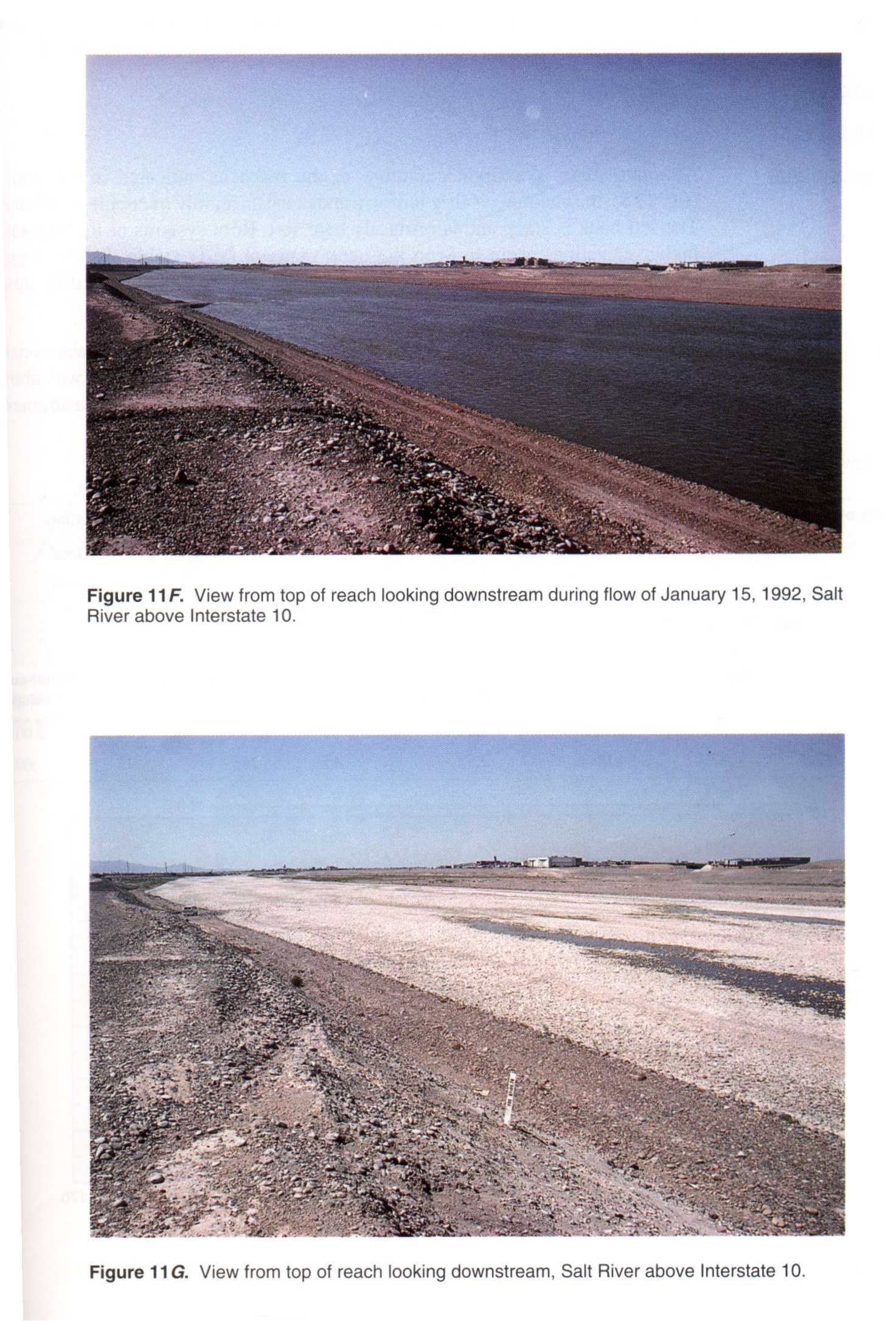 Location
.-- Lat 33°25'53", long 111°59'16", near Interstate 10, Arizona.
Description of channel.--
d50 = 94 mm.
| Date of observation | Average depth (ft) | Average surface width (ft) | Discharge (ft3/s) | Average cross section area (ft2) | Hydraulic radius (ft) | Mean velocity (ft/s) | Slope | Coefficient of roughness n |
|---|
| Feb. 18, 1992 |
--- |
--- |
4900.0 |
1090.0 |
2.61 |
4.500 |
0.002500 |
0.030 |
| Jan. 15, 1992 |
--- |
--- |
2070.0 |
665.0 |
1.64 |
3.130 |
0.002700 |
0.034 |
| Jan. 09, 1992 |
--- |
--- |
1000.0 |
462.0 |
1.16 |
2.180 |
0.002600 |
0.038 |


