

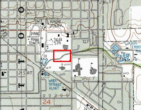
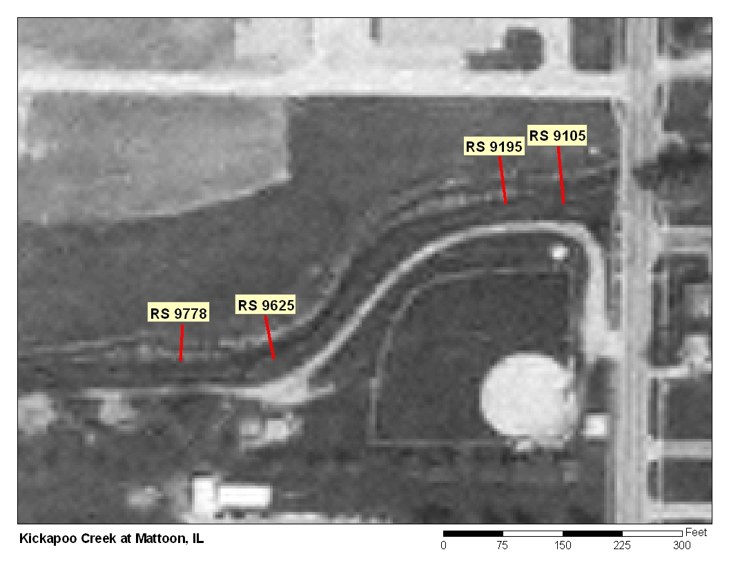

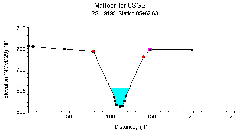
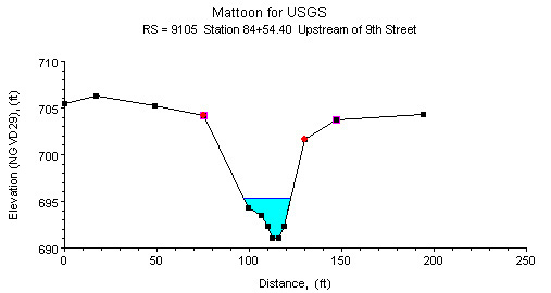
Study Reach.--The channel reach is a dredged ditch in an urban area. The study reach extends from the upstream side of the South 9th Street bridge to about 650 ft upstream of the bridge. The channel reach and the study reach are presented in the quadrangle map on the top left. Four surveyed cross sections (surveyed by the Illinois Department of Natural Resources, in February 2003) are available in the study reach (see plots above). The channel alignment, approximate channel width and bank conditions, and locations of the cross sections are shown in the aerial photograph on the top right. Channel geometries are illustrated with cross-sectional plots at river stations (RS) 9625, 9195, and 9105.
Gage Location.--There is no USGS streamflow gage at this location. The study reach is upstream of South 9th Street in Mattoon; Coles County, Hydrologic Unit 05120112, Illinois. The site can be can be reached by driving about 5 mi west off Interstate 57 from the Mattoon Exit, then turning south on 9th Street in Mattoon. The USGS streamgage station number is 03343800.
Drainage Area.--Unknown
Gage Datum and Elevations of Reference Points.--The base reference mark RM-1 is a chiseled square on the upstream side of the 9th Street left bridge abutment; elevation = 705.280 ft; obtained from a previous IDNR survey. Three reference points (RP-N) were established for the n-value study. RP-N1 is two file marks on the upstream side of the 9th Street bridge between the 5th and 6th vertical slats from the right edge of water, elevation = 707.942 ft. RP-N2 is two file marks on top of a pounded-in fence post at left edge of the water, about 135 ft upstream of the bridge, elevation = 693.195ft. RP-N3 is two file marks on the second collar of a 6 in diameter iron pipe, at the right bank approximately 400 ft upstream of the bridge face, elevation = 699.050ft. All elevations are referenced to NGVD29.
Stage, Discharge Measurements, and Computed n-Values.--The water-surface elevations were measured at the three RP-Ns before, during, and after a discharge measurement. Discharge measurements were made using the conventional current-meter method. When stage rose or fell quickly during an event, a shortened discharge method was used and multiple discharge measurements were made. Water-surface elevations were recorded consecutively covering the full range of discharge measurements.
| Date of Observation | Discharge (ft3/s) | Average Cross Section Area (ft2) | Hydraulic Radius (ft) | Mean Velocity (ft/s) | Slope (ft/ft) | Coefficient of Roughness n |
|---|---|---|---|---|---|---|
| 1/5/2005 | 148.0 | 60.6 | 2.12 | 2.45 | 0.000954 | 0.032 |
| 1/5/2005 | 152.0 | 61.0 | 2.13 | 2.49 | 0.000886 | 0.031 |
| 1/5/2005 | 154.0 | 60.7 | 2.12 | 2.54 | 0.000927 | 0.030 |
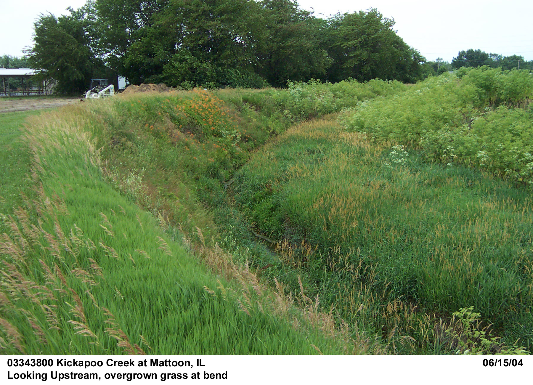
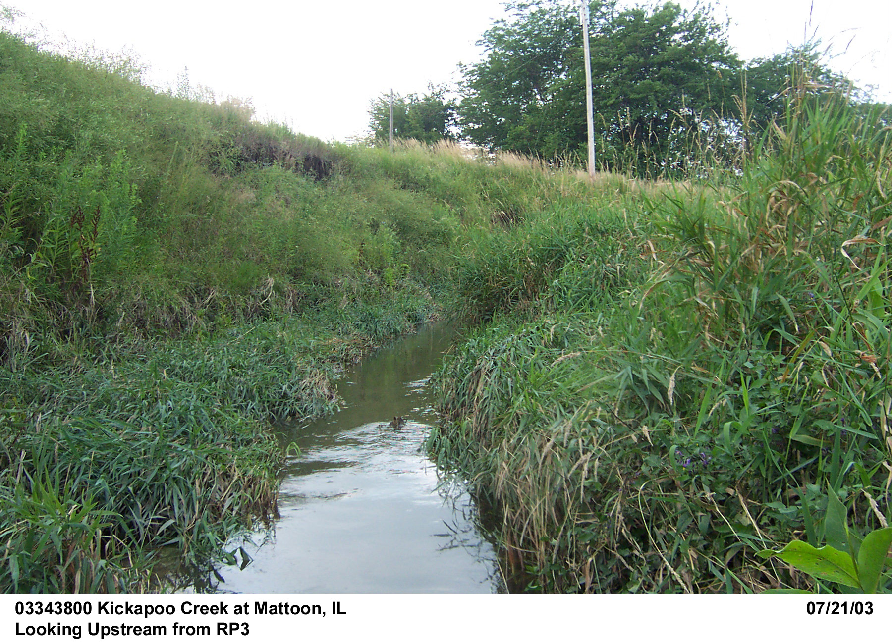
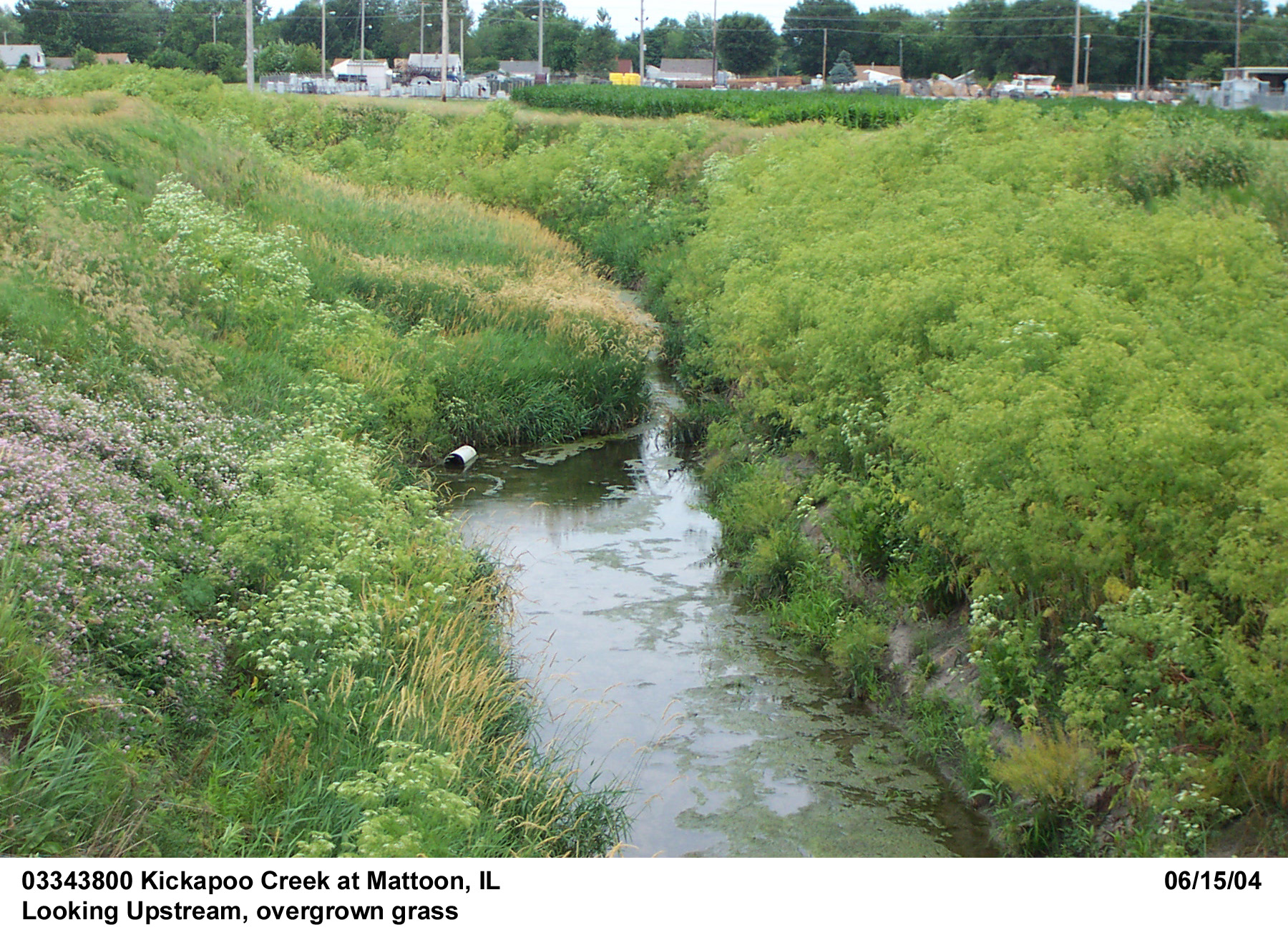
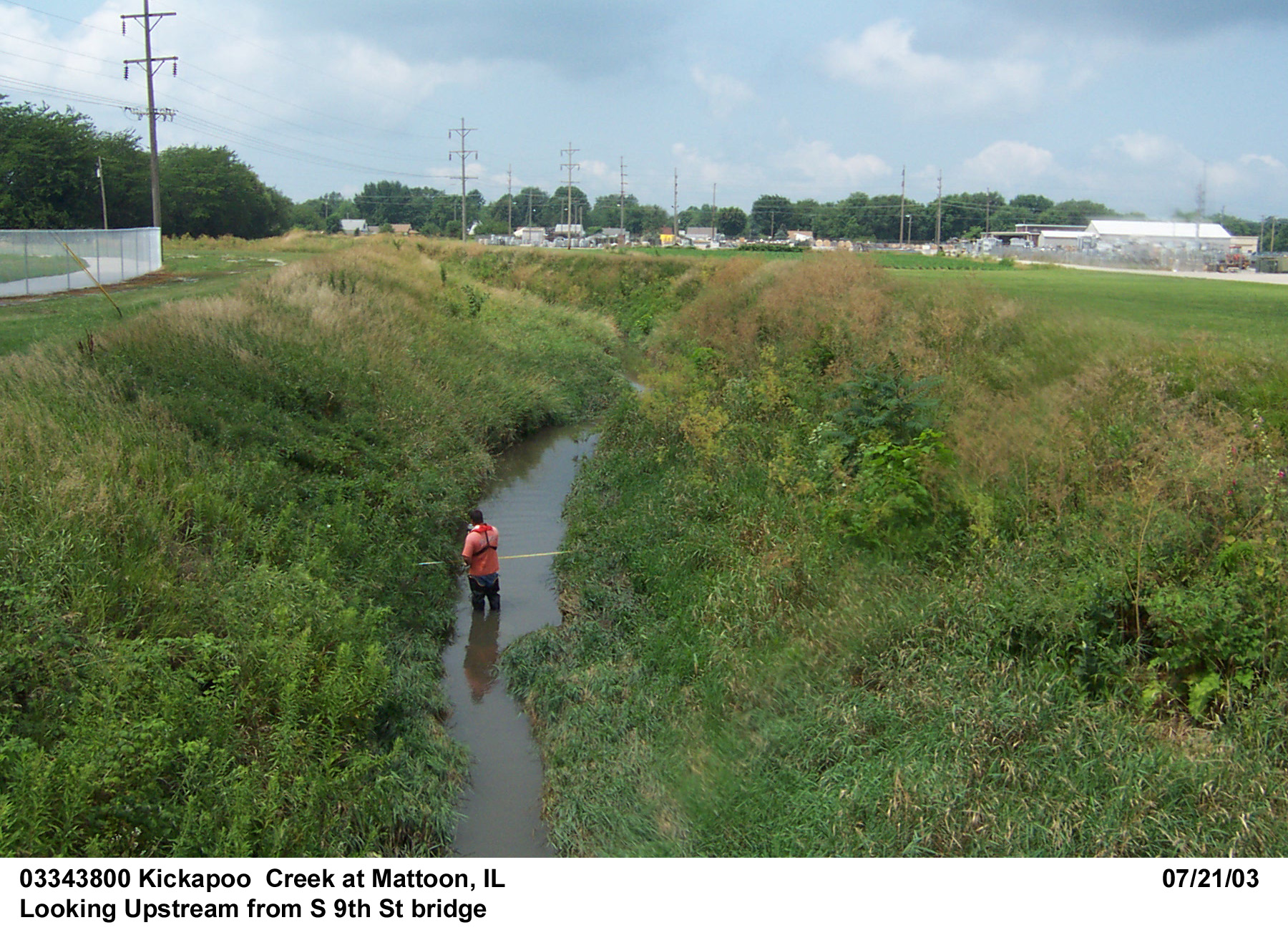
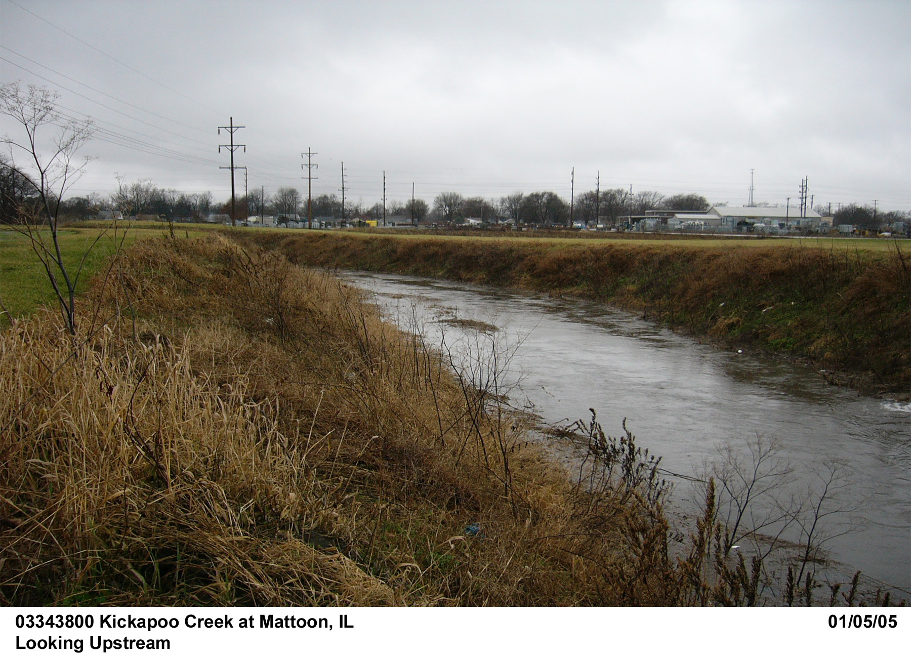
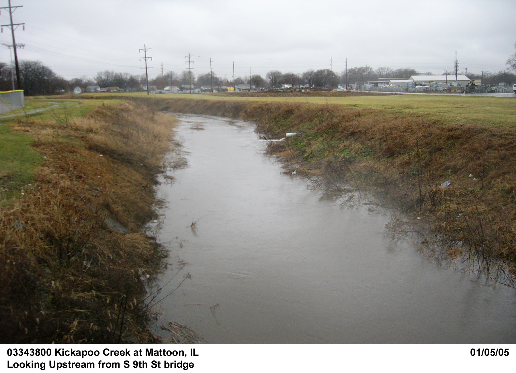
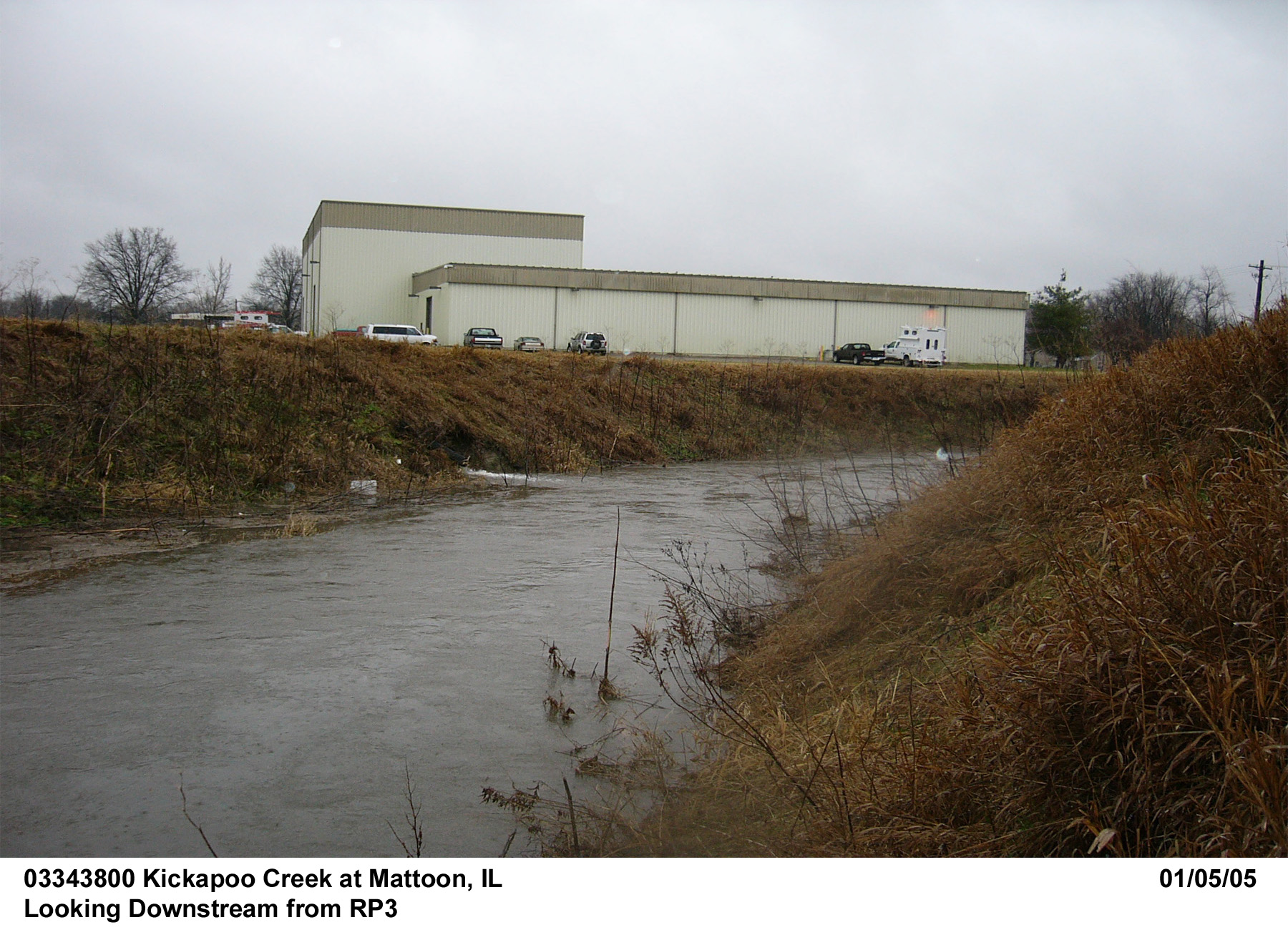
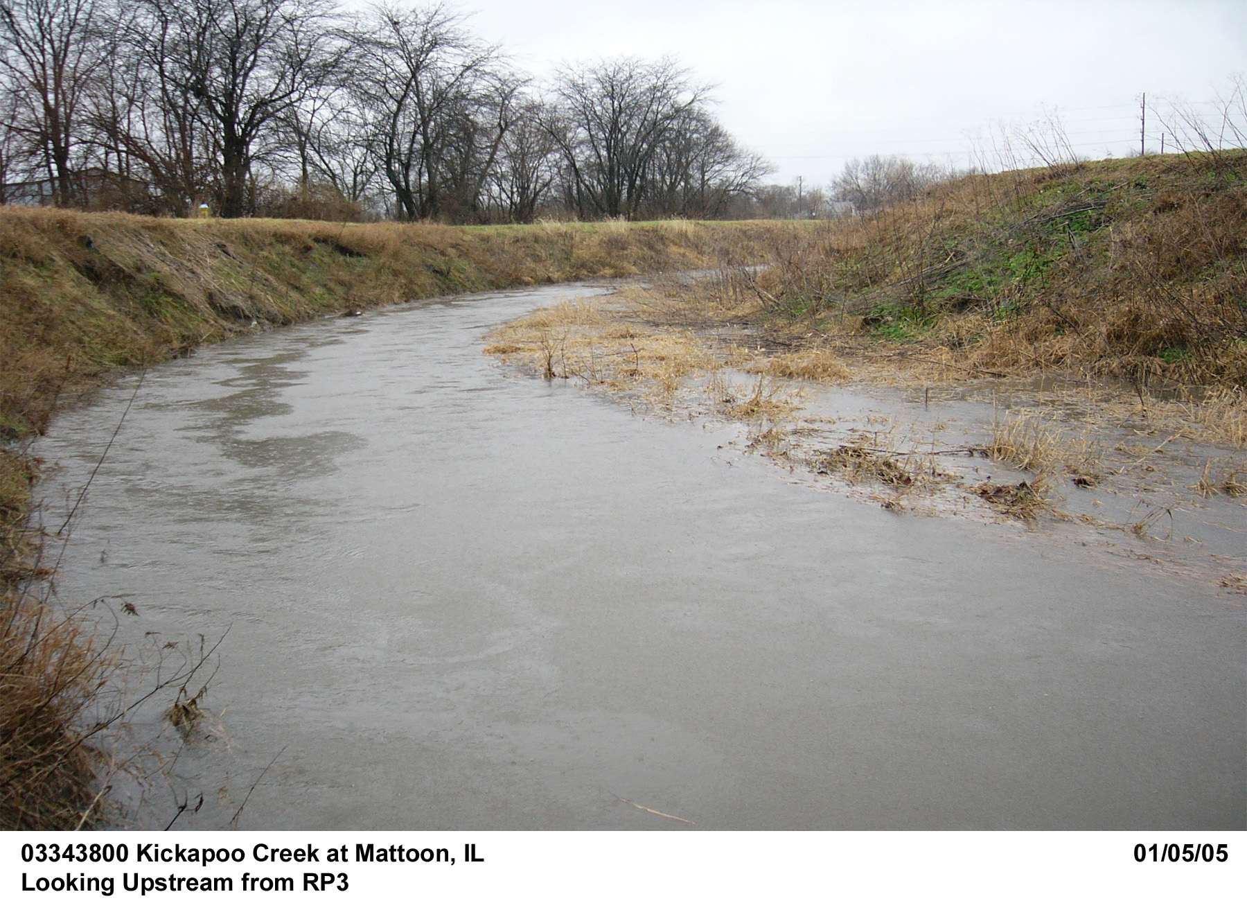
Description of Channel.--This channel is constructed grass with trapezoidal cross sections. Overall, the study reach covers a meandering reach of the channel. Portions of the bank have collapsed and the waste has been deposited as berms at the toe of the bank. With berms formed at different locations, a small meandering channel is shaped within the bottom to convey base flow during dry seasons. The streambed consists of sands (medium to coarse sizes) in the center and loose silt/clay at submerged border areas at both banks. Above the main channel, the banks and bed are covered with dense tall grasses. The top width of the excavated channel is around 40 ft and bottom width from around 15 to 20 ft. Banks are around 15 ft high.
Floods.--Not determined, not a regular USGS streamgage station

![]() U.S. Department of the Interior |
U.S. Geological Survey
U.S. Department of the Interior |
U.S. Geological Survey
URL: http://il.water.usgs.gov/proj/nvalues/db/sites/03343800.shtml[an error occurred while processing this directive]?
Page Contact Information: David Soong
Page Last Modified: February 4, 2013
