

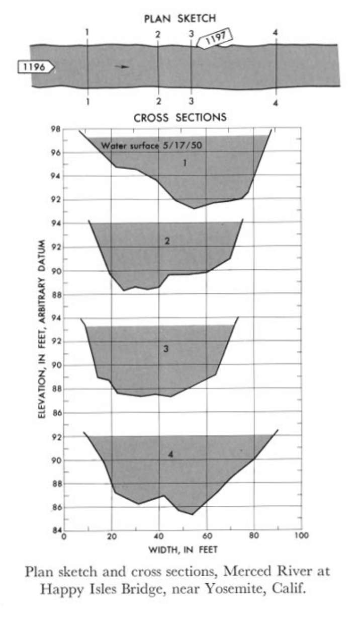
Study Reach.--Section 1 is about 1,000 ft downstream from gage.
Gage Location.--Lat 37°43'54", long 119°33'28", on right bank 10 ft downstream from Happy Isles Bridge, 0.4 mile down stream from Illilouette Creek, and 2 miles southeast of Yosemite National Park Headquarters, Mariposa County.
Drainage Area.--181 sq mi.
Gage Datum and Elevations of Reference Points.--Not available.
Stage, Discharge Measurements and Computed n-Values.--Gage heights were 6.06 ft at gage; 97.40 ft (different datum) at section 1. Peak discharges was 1,950 cfs on May 17, 1950.
| Date of Observation | Discharge (ft3/s) | Average Cross Section Area (ft2) | Hydraulic Radius (ft) | Mean Velocity (ft/s) | Slope | Coefficient of Roughness n |
|---|---|---|---|---|---|---|
| 5/17/1950 | 1969.7 | 301.8 | 3.41 | 6.53 | 0.012976 | 0.065 |
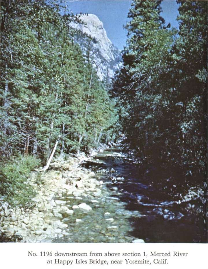
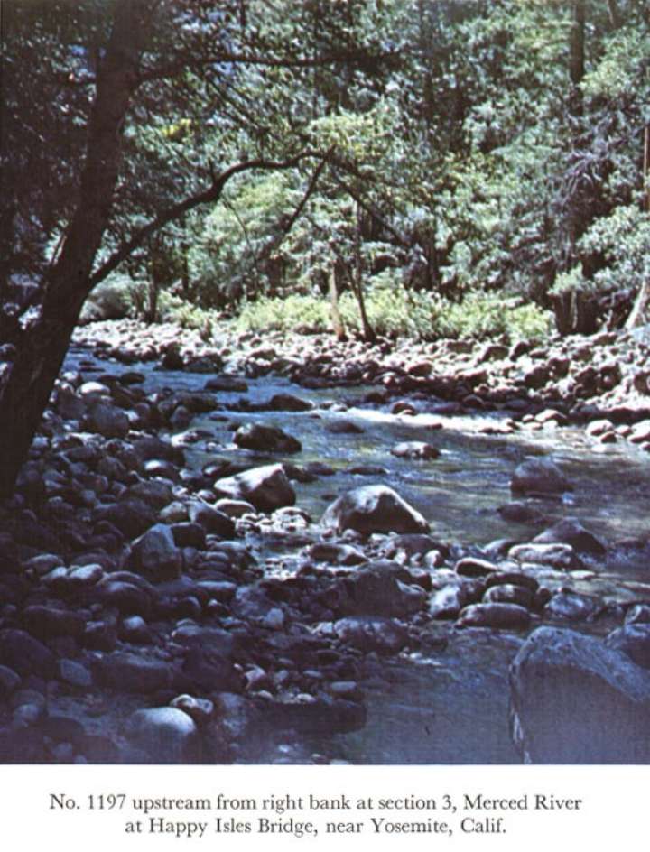
Description of Channel.--Fairly straight channel is composed of boulders with trees along top of banks; d50 = 253 mm, d84 = 550 mm.

![]() U.S. Department of the Interior |
U.S. Geological Survey
U.S. Department of the Interior |
U.S. Geological Survey
URL: http://il.water.usgs.gov/proj/nvalues/db_barnes/sites/11264500.shtml[an error occurred while processing this directive]?
Page Contact Information: David Soong
Page Last Modified: December 19, 2012
